Clean Up the Historic Deadman’s Curve in Bethpage on Saturday, June 22, 2013
With the approval of the Town of Oyster Bay, come join the Long Island Motor Parkway Preservation Society and the Bethpage community for a "Clean Up the Historic Deadman's Curve" Day at 9:00 AM Saturday, June 22, 2013. Cars should park on Sophia Street, N.Windhorst Avenue and N. Hermann Avenue. Please bring plastic bags, hand saws, gloves, brooms, shovels and rakes.
Early risers will meet for breakfast at the Plainview Diner, 1094 Old Country Road, at 8:00 AM.
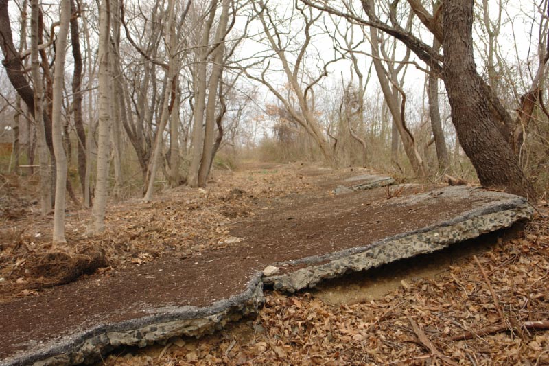
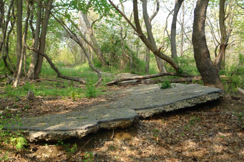
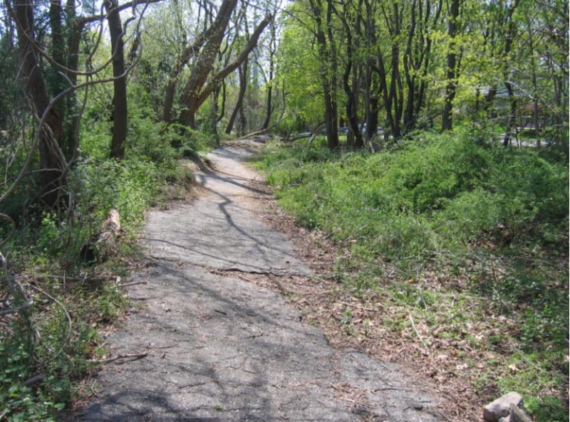
The most dramatic curve in the very curvy 44-mile Long Island Motor Parkway was the almost 90-degree turn south of Hermann Street in Bethpage. Remnants of the "Deadman's Curve" can still be found today as seen in these "Then & Now" images.
Enjoy,
Howard Kroplick
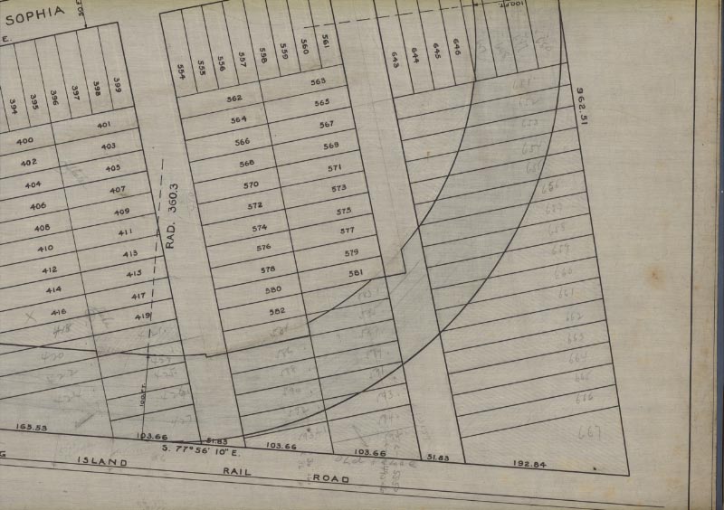
This is the September 1907 survey of the curve in Bethpage. The property was purchased from Hermann Windhorst. The two nearby streets were named for the original owner; Hermann Avenue and Windhorst Avenue.
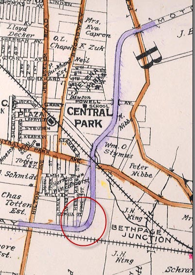
This 1914 Belcher-Hyde map showed the location of the first Deadman's Curve in Bethpage. As previously posted on VanderbiltCupRaces.com, the turn above Central Avenue was also called a "Deadman's Curve".
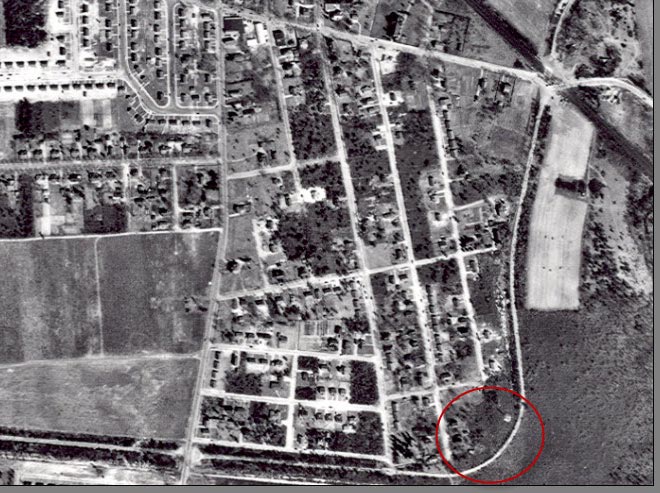
A aerial view showed the Motor Parkway in Bethpage was very much intact in 1950.
View Looking South
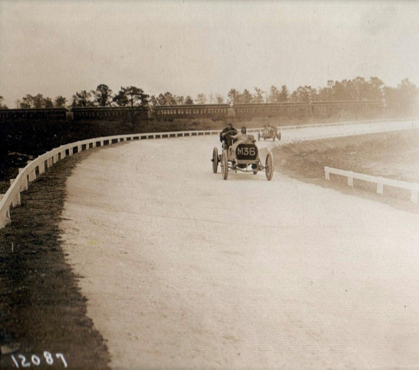
Then: 1908 During the Motor Parkway Sweepstakes, Axel Peterson's #M36 Rainer battled William Haupt's #P41 at the Deadman's Curve. A Long Island Rail Road train can be seen in the background acting as a spectator stand or to bring spectators to the Hempstead Plains grandstand.
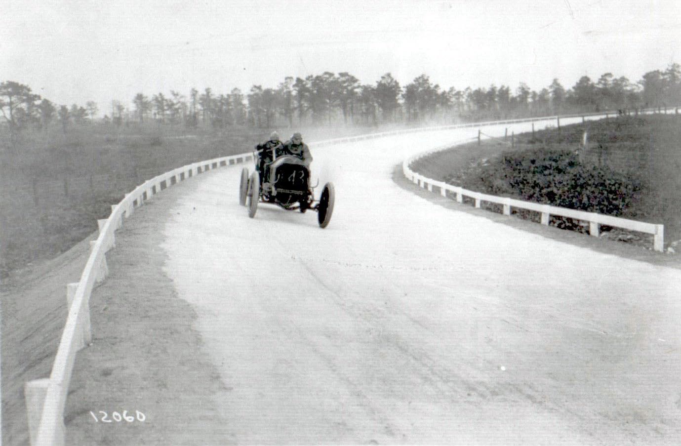
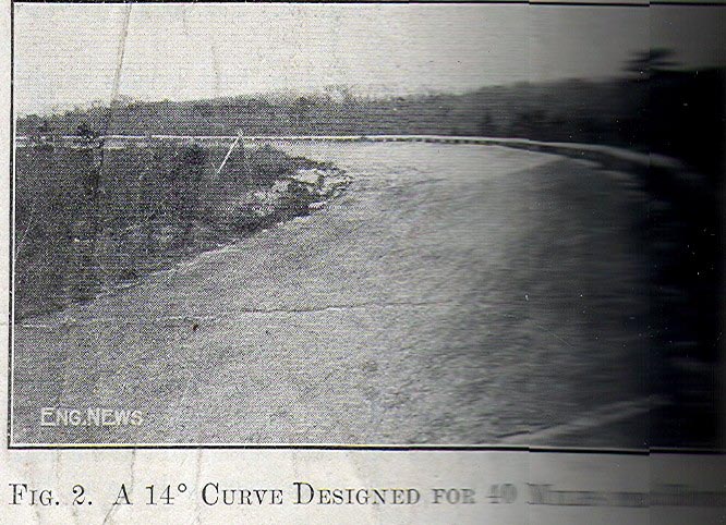
Then: 1908 Deadman's Curve was part of the courses for the1908 Motor Parkway Sweepstakes and the 1908 Vanderbilt Cup Race. Note: The banking of the curve and guard rails- pioneering road features for the period.
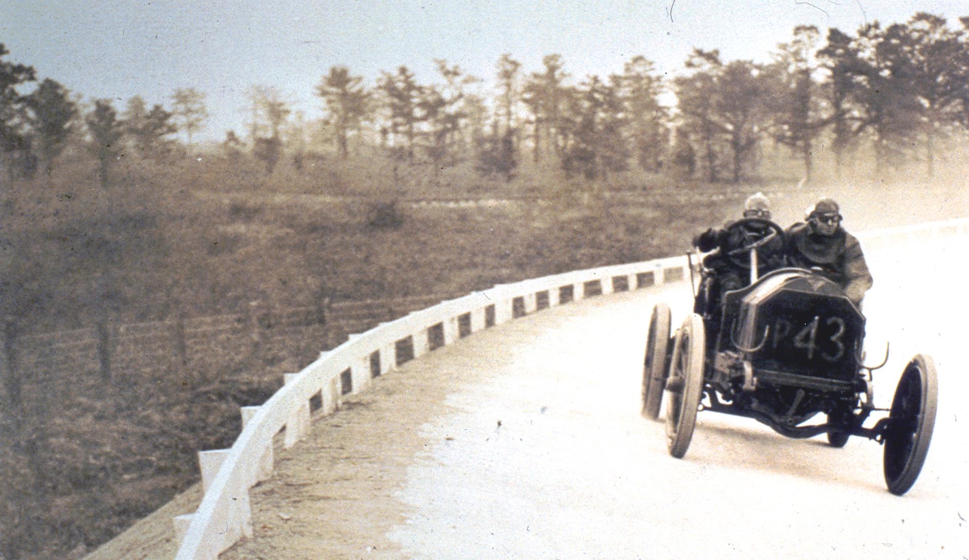
Then: 1908 The P43 Simplex driven by Frank Lescault at the Bethpage "Deadman's Curve" during the 1908 Motor Parkway Sweepstakes.
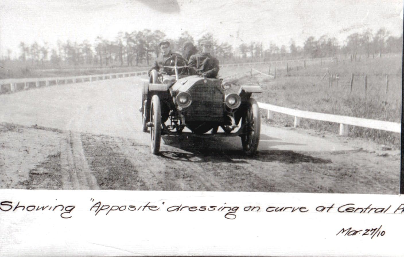
Then: 1910 A rare view of an early touring car on the Motor Parkway.
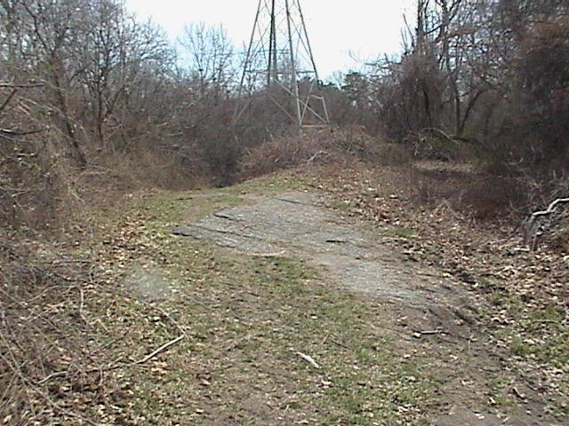
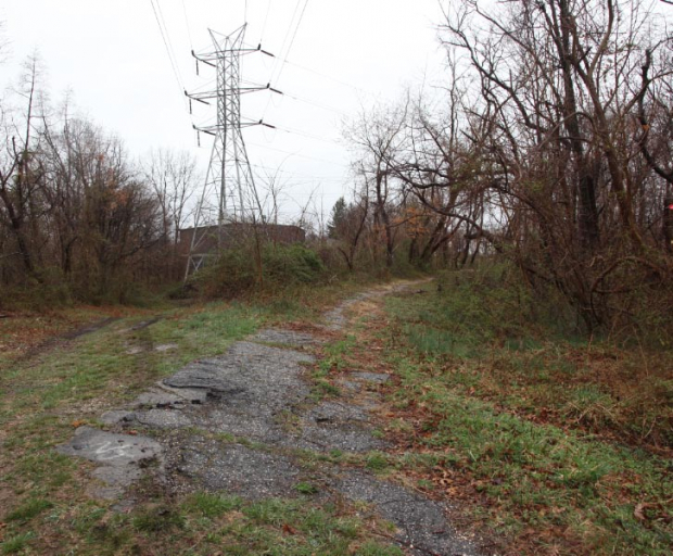
Now: 2003 Amazingly much of the banked curve survives today.
Now: 2008
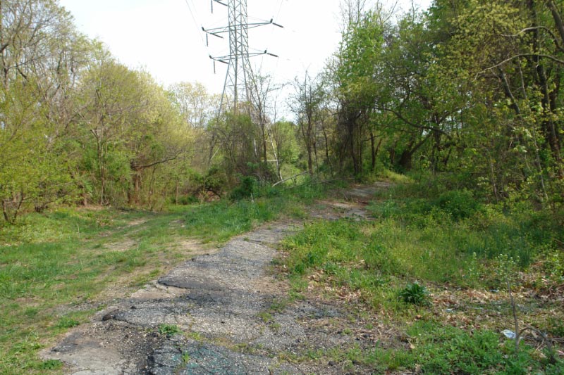
Now: 2010
View Looking East
Then: 1911
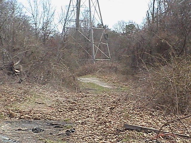
Now: 2006
Now:2008
2012 Google Map
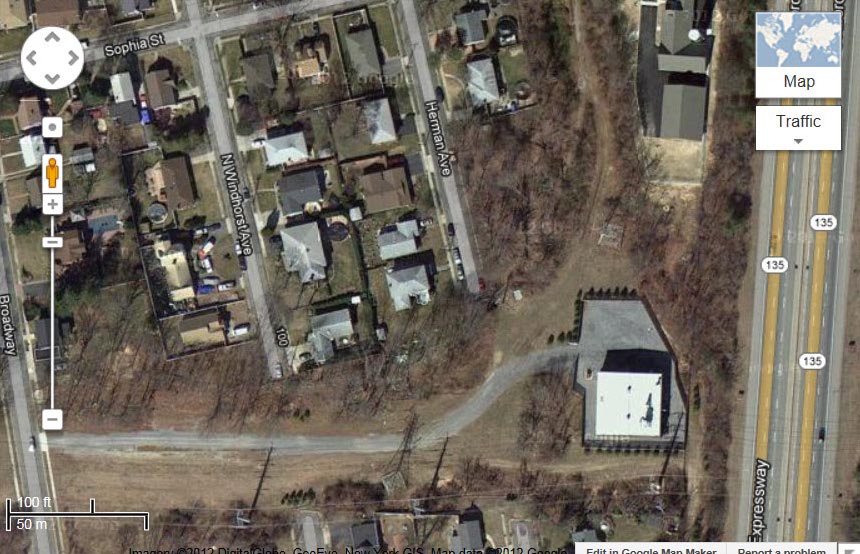
A 2012 Google Map view of the Deadman's Curve.
Update: June 15, 2013 Links to Deadman's Curve website pages
Link to Art's Motor Parkway Deadman's Curve I page.
Link to Sam Berliner III's Deadman's Curve page.
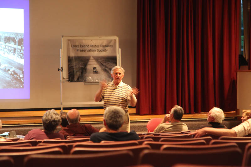
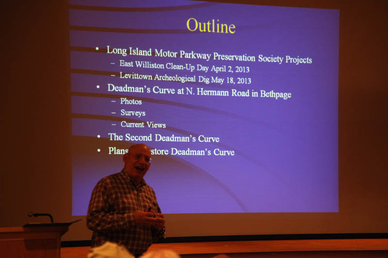
Long Island Motor Parkway Preservation Society Meeting, May 23, 2013
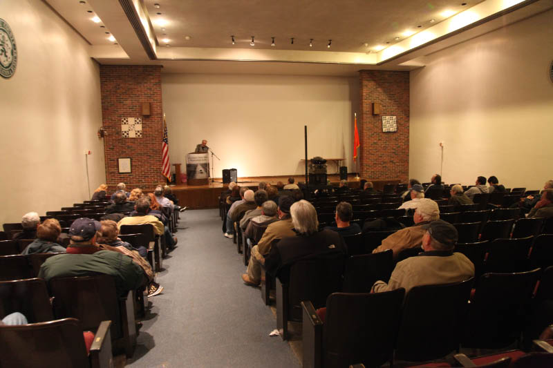
The Long Island Motor Parkway Preservation Society met on Thursday, May 23, 2013. A special presentation was made by Howard Kroplick and Al Velocci on Deadman's Curve and plans to restore it. Over 35 people enjoyed the program.


Comments
Nearly certain my dear grandfather worked on the parkway in this area…he bought a small parcel of property a few hundred feet from the roadway, just off Central, and eventually built a wonderful brick house there.
When growing up in New Hyde Park in the 50’s we used to play & ride bikes on a long stretch of the old parkway, between NHP Rd. and Shelter Rock Rd., including an overpass. Don’t know if anything is left now.
Howard - hope all is well. I went by Dead Man’s Curve 1 a few weeks back and noticed that the home on Broadway and the one on Windhorst that butt up against the Parkway are both for sale. Those are the properties with posts still intact and which I’ve documented on my website. Hopefully any new owners will appreciate the significance of the posts and the historic value of their property. I’ll keep a watch on the situation.
For the record, the touring car on the 1910 photo surely must be a Chalmers-Detroit of 1910, probably a model Fourty. From Kimes’ Standard Catalog I understand, that the Vanderbilts had Chalmer-Detroits in the garage. So the question now is: who’s at the wheel?
Ariejan, good question!
The photo was from a Motor Parkway article in a road engineering magazine.
Howard
Howard,what’s that website that you can find all the limp locatoins on current maps,that was mentioned at the meeting ? Thanks.I hope you have it.
Ted, Steve Lucas provided this link: http://www.openstreetmap.org/ .
Move the cursor to Long Island .Click on any Motor Parkway location and the entire 44-mile path can be found from Fresh Meadows, Queens to Lake Ronkonkoma, Suffolk County.
Thanks a whole lot Howard. I’m going to get on it right now,it’s a good day to do it.