Then & Now: Massapequa Road During the 1908-1910 Vanderbilt Cup Races
The intersection of Massapequa-Hicksville Road and the Long Island Motor Parkway was a favorite location for watching for watching the 1908, 1909 and 1910 Vanderbilt Cup Races. Hard to believe this quiet Bethpage/Plainedge neighborhood (at the edge of the Hempstead Plains) was packed with racing fans over 100 years ago.
Enjoy,
Howard Kroplick
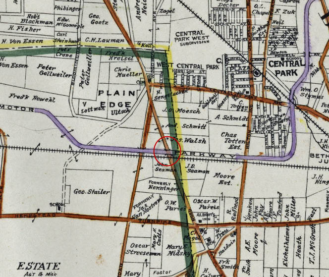 1923 Belcher-Hyde map shows the location of the Motor Parkway bridge over Massapequa-Hicksville Road..
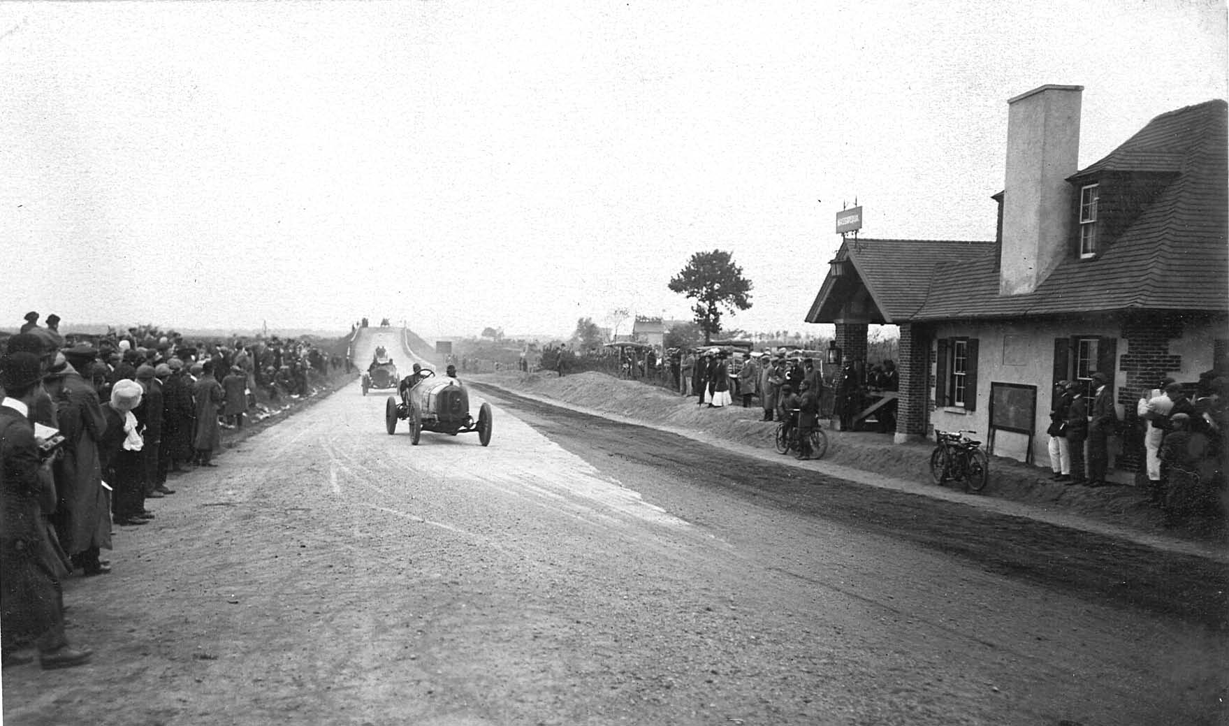
Then: 1908 Vanderbilt Cup Race
 This section of the race was a straight-away challenge between the two Motor Parkway bridges.
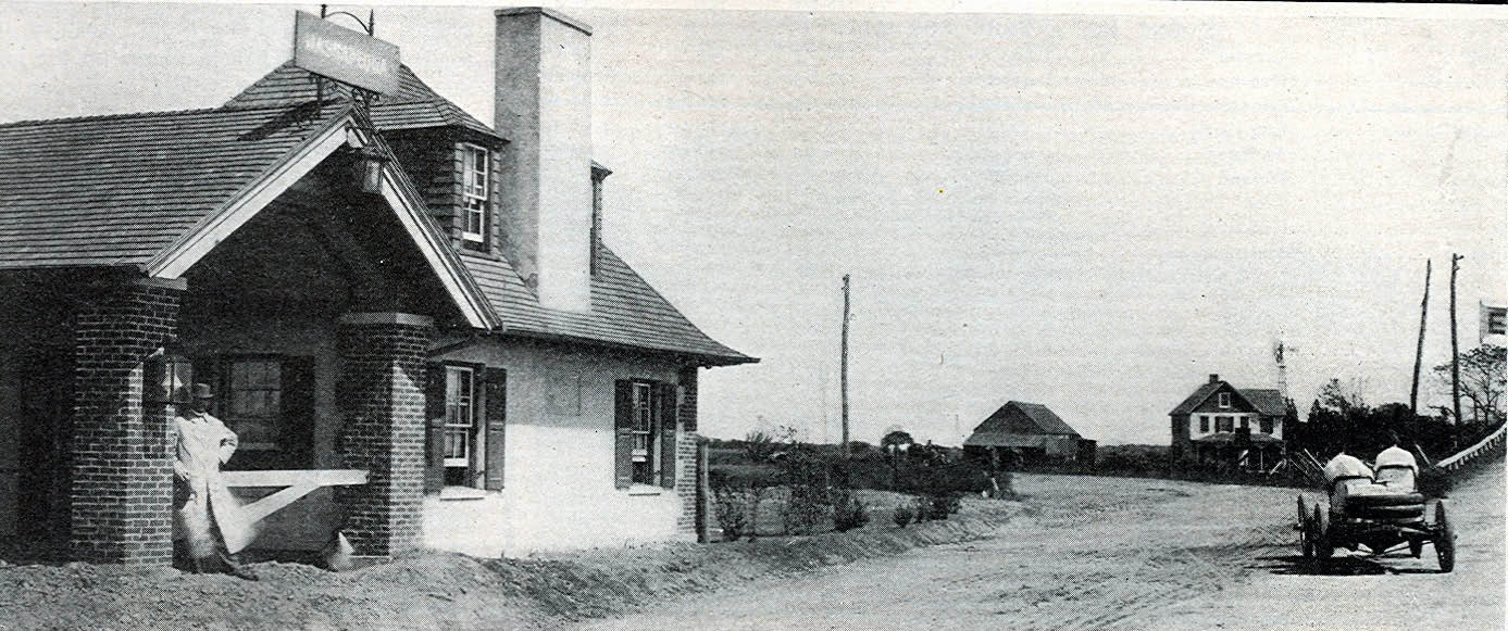
 Looking west, the Wantagh Avenue Motor Parkway Bridge can be seen in the background and the Massapequa Lodge on the right.
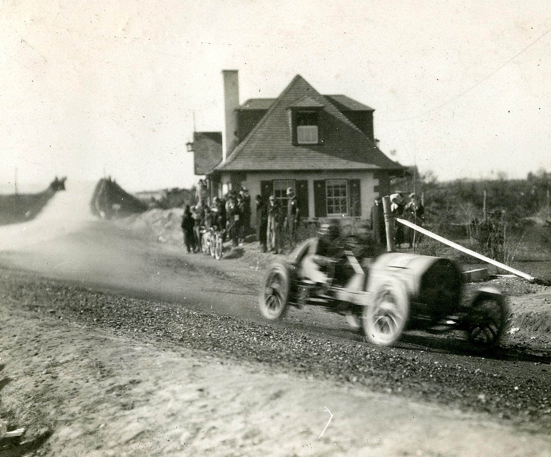
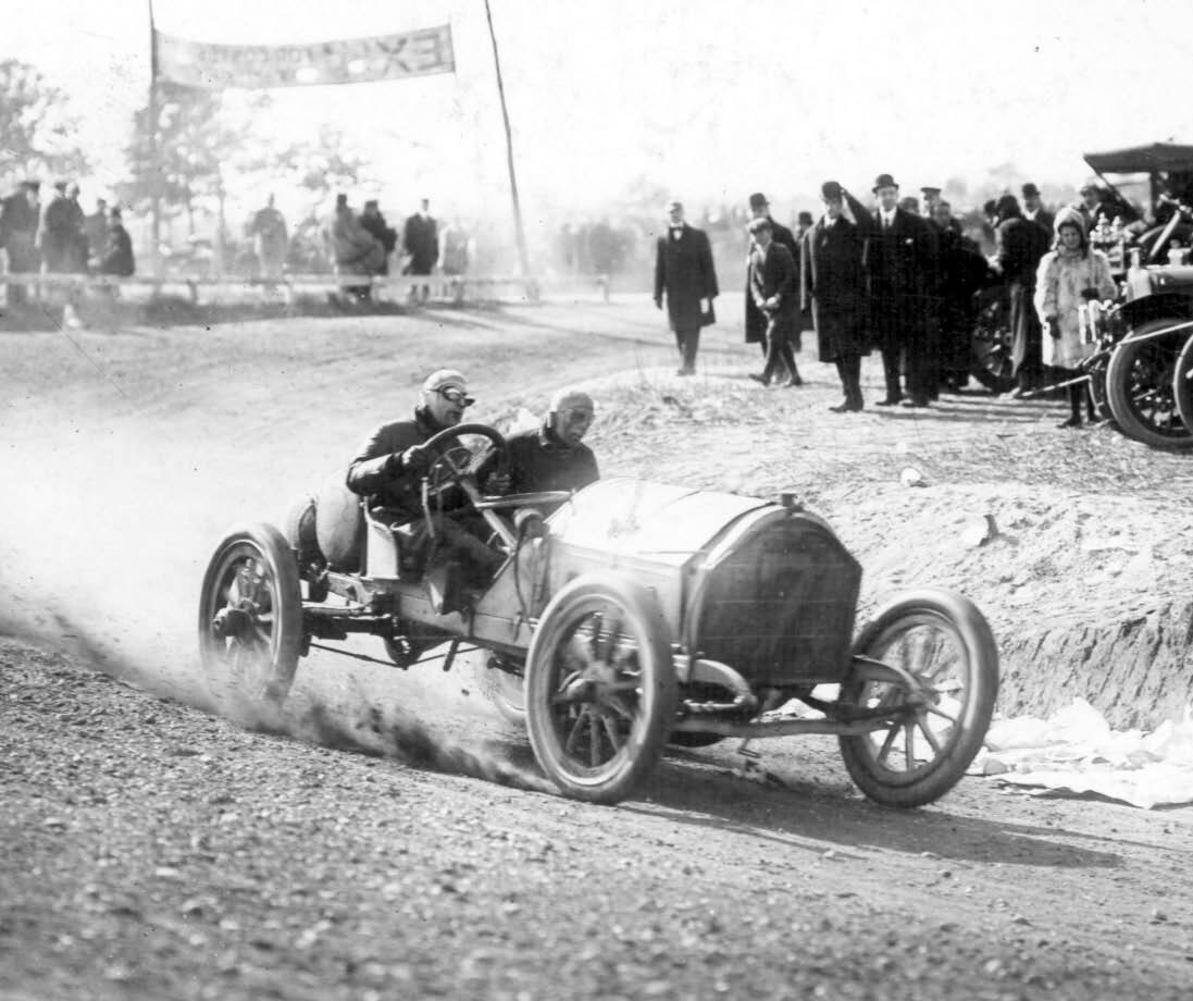
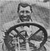
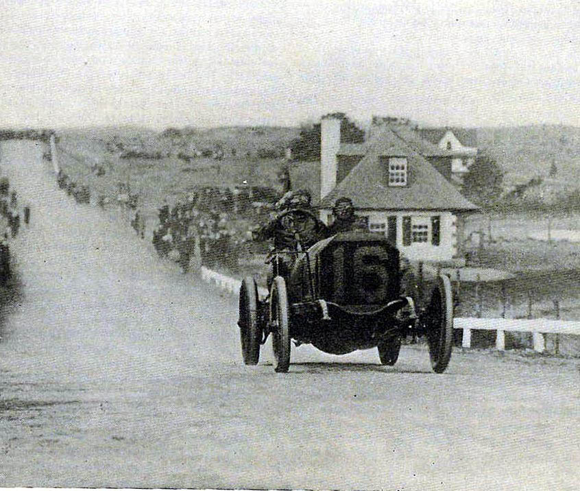 "Old 16" on it way to winning the race making the climb on to the Massapequa-Hicksville Bridge.
Then: 1909 Vanderbilt Cup Race
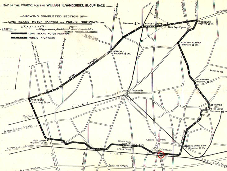
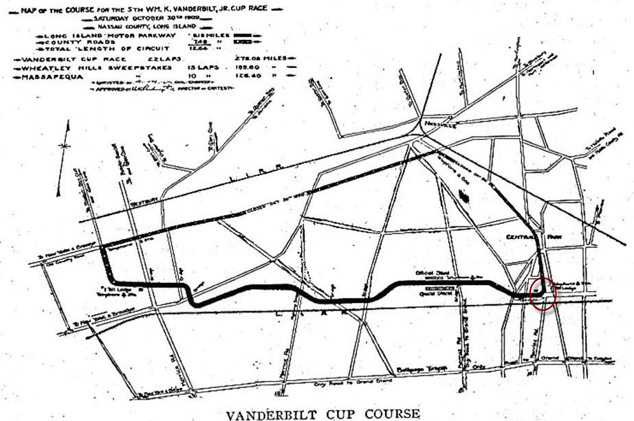 At 12.64 miles, the course for the 1909 and 1910 races was shorter than those for any previous Vanderbilt Cup Race and for the first time did not cross railroad tracks. Organizers believed the shorter course would decrease the intervals of time between appearances of cars and also provide more exciting entertainment for spectators.
 An eighth of a mile past the Wantagh Avenue Bridge, the drivers came to the eastern end of the Motor Parkway section of the course at the Massapequa Lodge. During the race, the racers transitioned from the concrete Motor Parkway onto a temporary crushed stone road just south of the lodge. The temporary banked road curved north to connect to Massapequa-Hicksville Road.
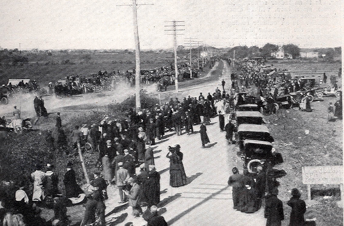
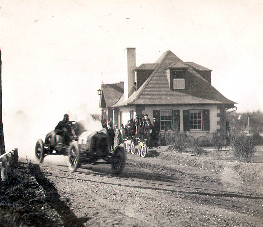 A great view of the Massapequa Lodge during the 1909 race.
 Harry Grant and Frank Lee taking the turn in the Alco Black Beast.
 Another view of the Black Beast looking north with Massapequa-Hicksville Road in the background.
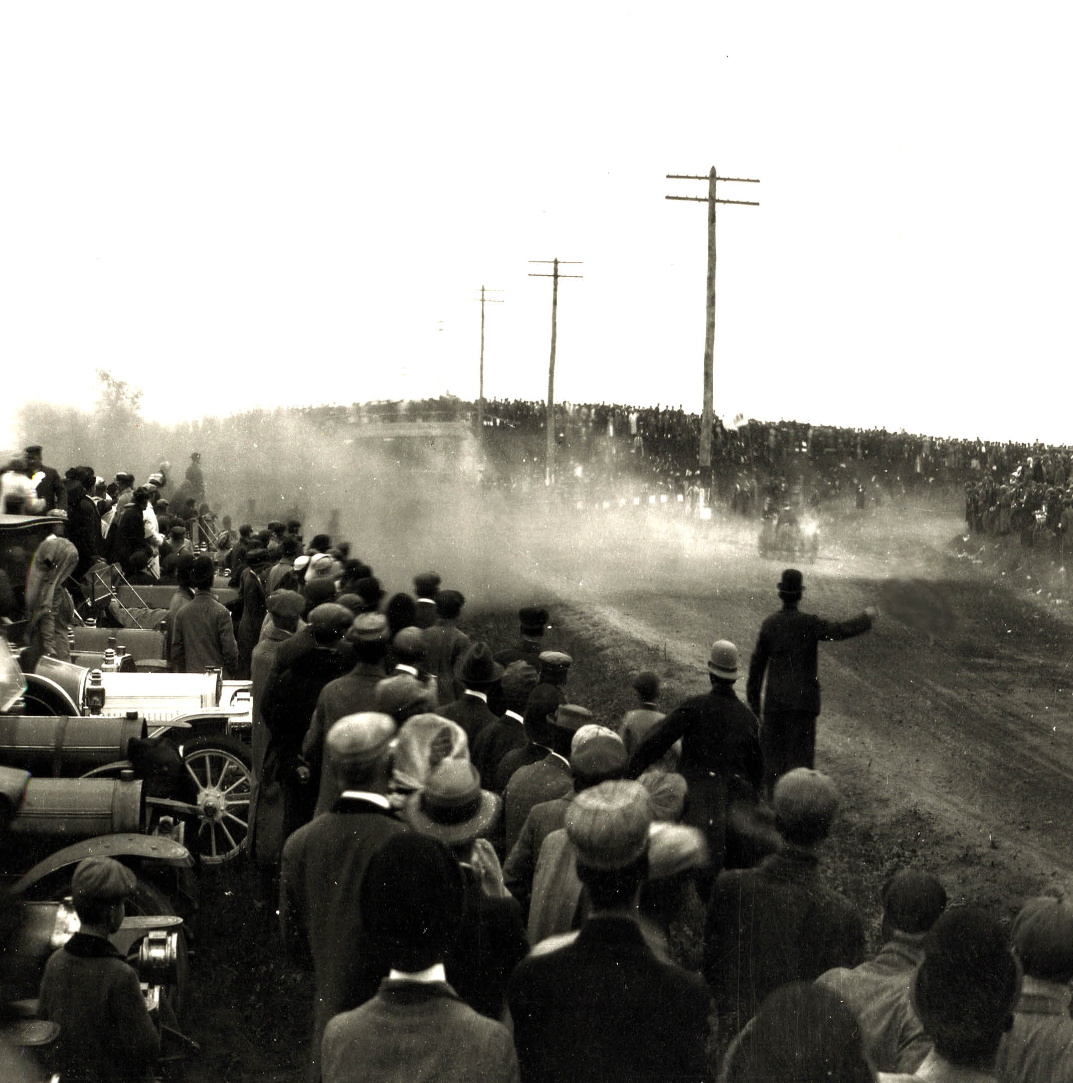
 The race as seen from atop the bridge. Look closely and you can see one car racing on the turn and another stalled on the shoulder of the banked curve.
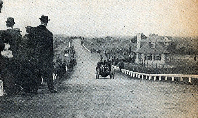
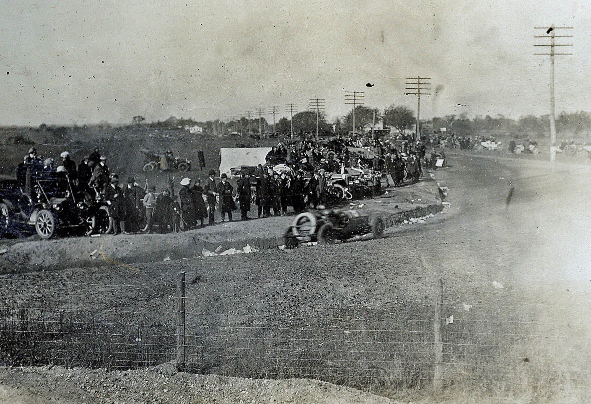
 Looking south at the crowd on the Massapequa-Hicksville Motor Parkway Bridge and the turn. Over 2,000 spectators watched the race here.
 The #7 Chalmers driven by Bill Knipper taking the turn. Note the banner in the background across the Motor Parkway.
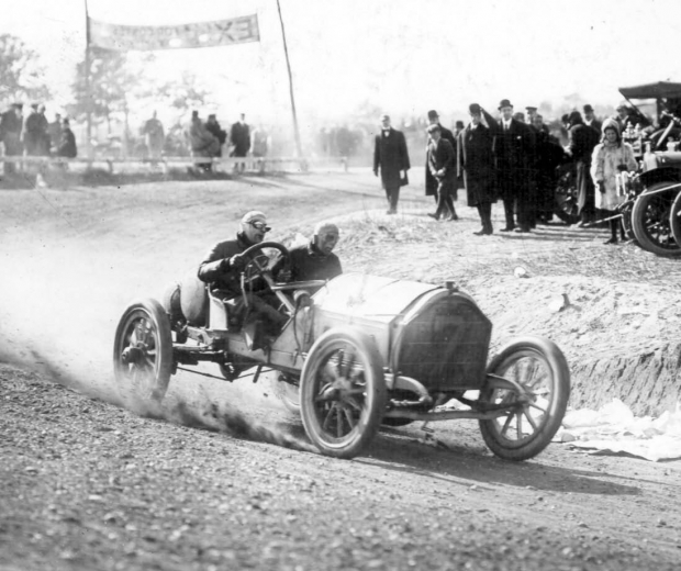
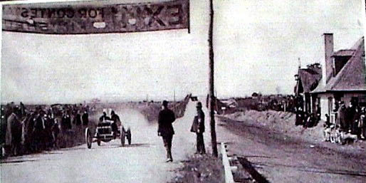 . This racer is leaving the course and continuing on to the Motor Parkway. This image use to be a mystery for me. Why did this car not take the turn?
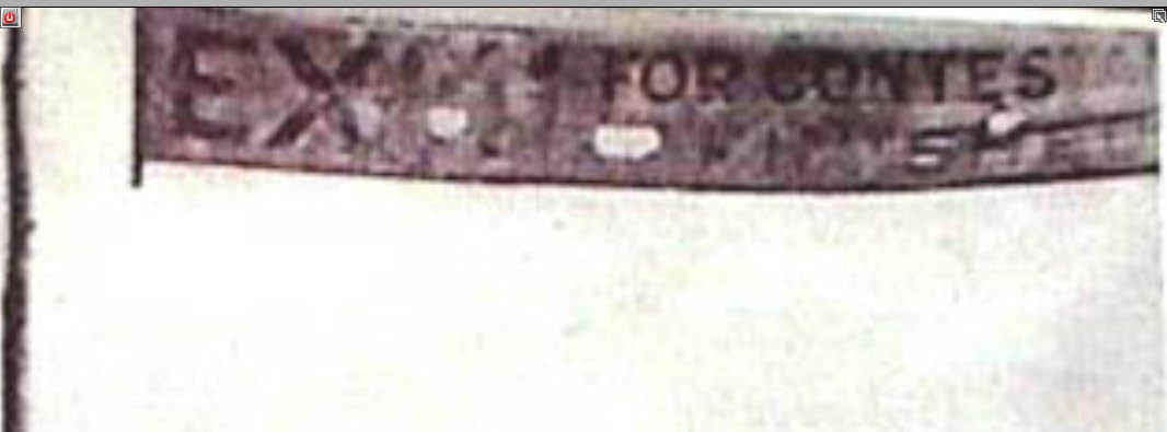 Reversing the copy on the banner reveals "Exit For Contestants" and the answer. After the racers finished their laps, they were required to continue on the Motor Parkway to the Bethpage Lodge for an inspection.
Then: 1910 Vanderbilt Cup Race
 The same course with the Massapequa Turn was used for the 1910 race.
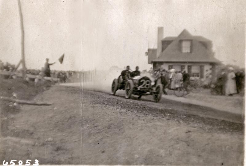
 Four racers can be seen in this photo. The smaller course was successful in making the race more exciting, but also making it more dangerous with crowds spread out over a smaller area.
Then: 1959
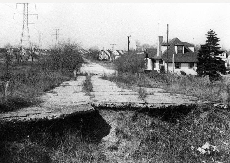 By1959. the bridge had been taken down and the lodge abandoned. Photo courtesy of Ron Ridolph.
Today
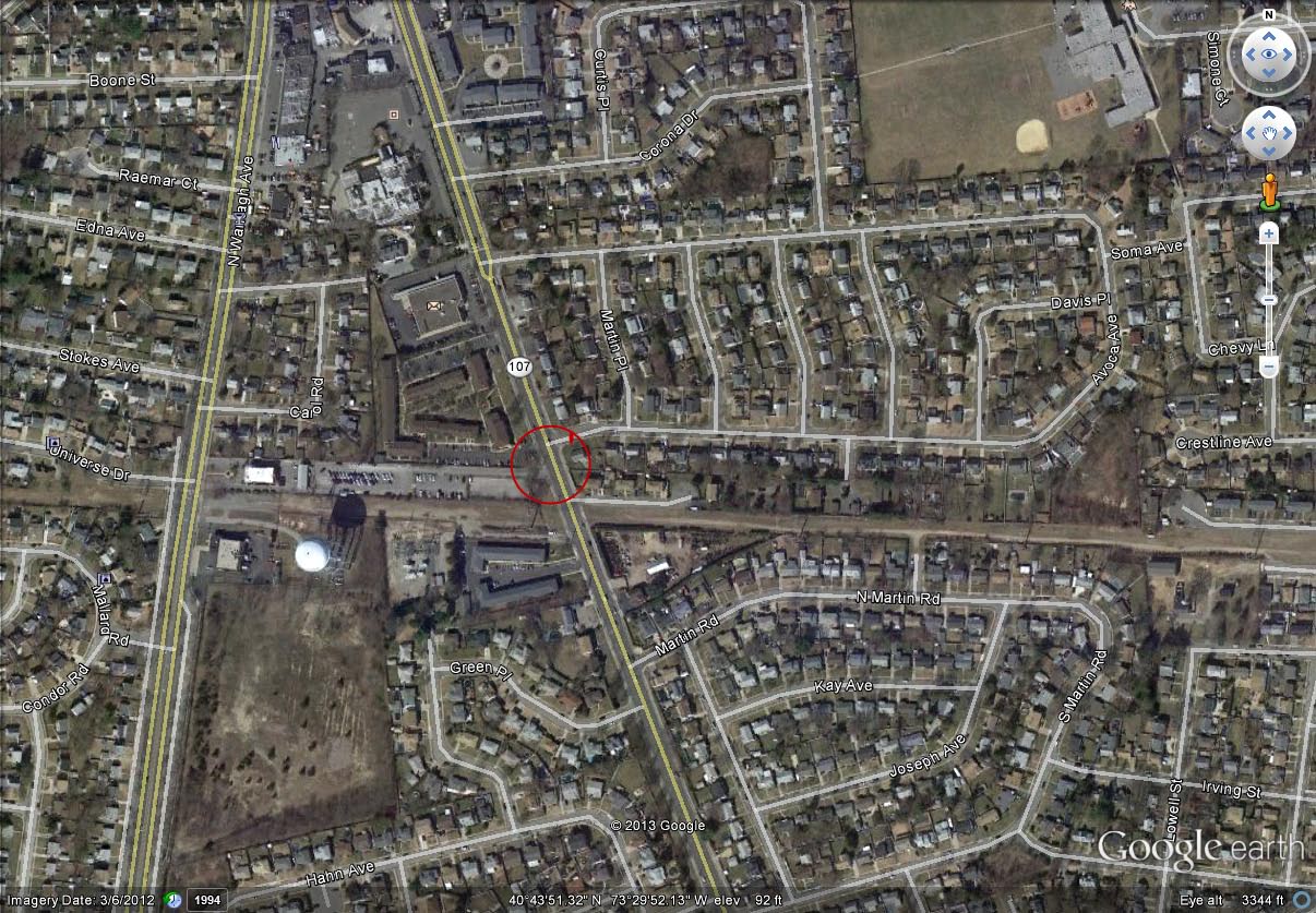
Google Earth View
Latitude: 40°43'57.13"N
Longitude: 73°29'33.90"W
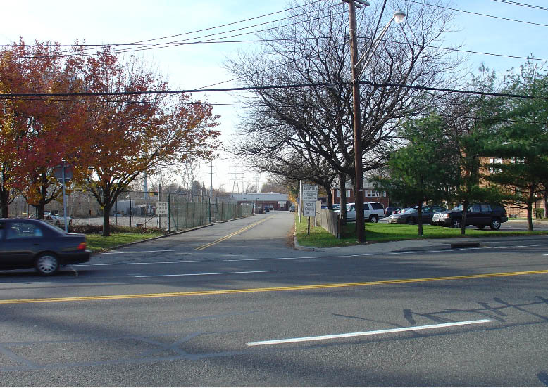
The lodge was demolished in the early 1960s and the site became part of a garden apartment complex. The right-of-way of the Long Island Parkway has been repaved and now leads to the Nassau County Eighth Precint police station.


Comments
Here’s a puzzler for you folks; if you follow the LIMP RoW east/north/ward from Deadman’s Curve on the 1923 Belcher-Hyde map, the RoW crosses Central Park Avenue and the LIRR with no delineation of the major bridges there BUT then crosses what appears to be an extension of today’s Schneider Lane on a carefully inked bridge to the Wm. O. Stymus property! If this bridge is on your bridges of the Vanderbilt Cup Races page http://www.vanderbiltcupraces.com/blog/article/tuesday_december_8_2009_the_bridges_of_the_vanderbilt_cup_races , I can’t find it (but, as you wrote, you can’t trust maps”). Sam, III
Hi Sam III, I believe you are referring to the Nibbe Farmway Bridge, the next bridge after the Central Ave/LIRR Bridge:
http://www.vanderbiltcupraces.com/blog/article/sunday_december_19_2010
Howard I
Very nice presentation. The Belcher-Hyde map lets me see the part of the parkway that I used to hike on when I was a kid in the early 1950’s, living in Plainedge/North Massapequa. Thanks!
Ken
Nibbe’s Hollow was north of the Stymus property. The bridge to which I refer is shown as instantly above/north of (adjacent to) the CPAve/LIRR bridge. Here, I marked up a smitch of the map:
http://sbiii.com/limppix/stymusbr.jpg
to be most specific. Is THAT the Nibbe bridge?
Sam, III
Sam III, you are pointing to the Central Avenue Bridge that went over both the road and the LIRR. The Nibbe Farmway Bridge was located near the bottom of the “M” on the map. The map did not indicate the bridge. These posts may be helpful: http://www.vanderbiltcupraces.com/blog/tag/tag/stymus+farm
http://www.vanderbiltcupraces.com/blog/article/from_the_noel_gish_collection_postcards_from_the_vanderbilt_cup_races_long_
Howard I
These pictures are not all the same lodge and the map locations are not the Massapeque lodge.
Toll lodge # 2 is the Bethpage toll not Massapeque
I lived there it was my Grandparents’ home and they worked for Vanderbilt until his death.
The Bethpage lodge is shown correctly in the photo THEN 1959 and TODAY as garden apartments complex
___________________________________________________________________________
From Howard Kroplick:
I spoke to Athur today and we agree the photos are of the Massapequa Lodge.