The 1944 Proposal for “A Nassau County Park at Salisbury” in East Meadow
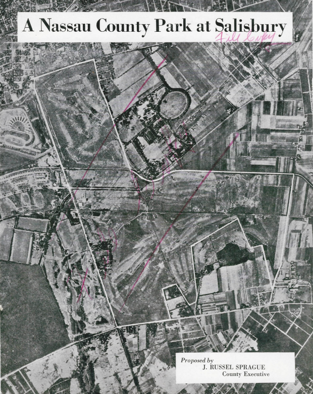
Gary Hammond has forwarded a copy of a rare historic document "A Nassau County Park at Salisbury" proposed by Nassau County Executive J. Russel Sprague in 1944. The aerial and map in the document provide insight into the Motor Parkway and East Meadow.
Enjoy,
Howard Kroplick
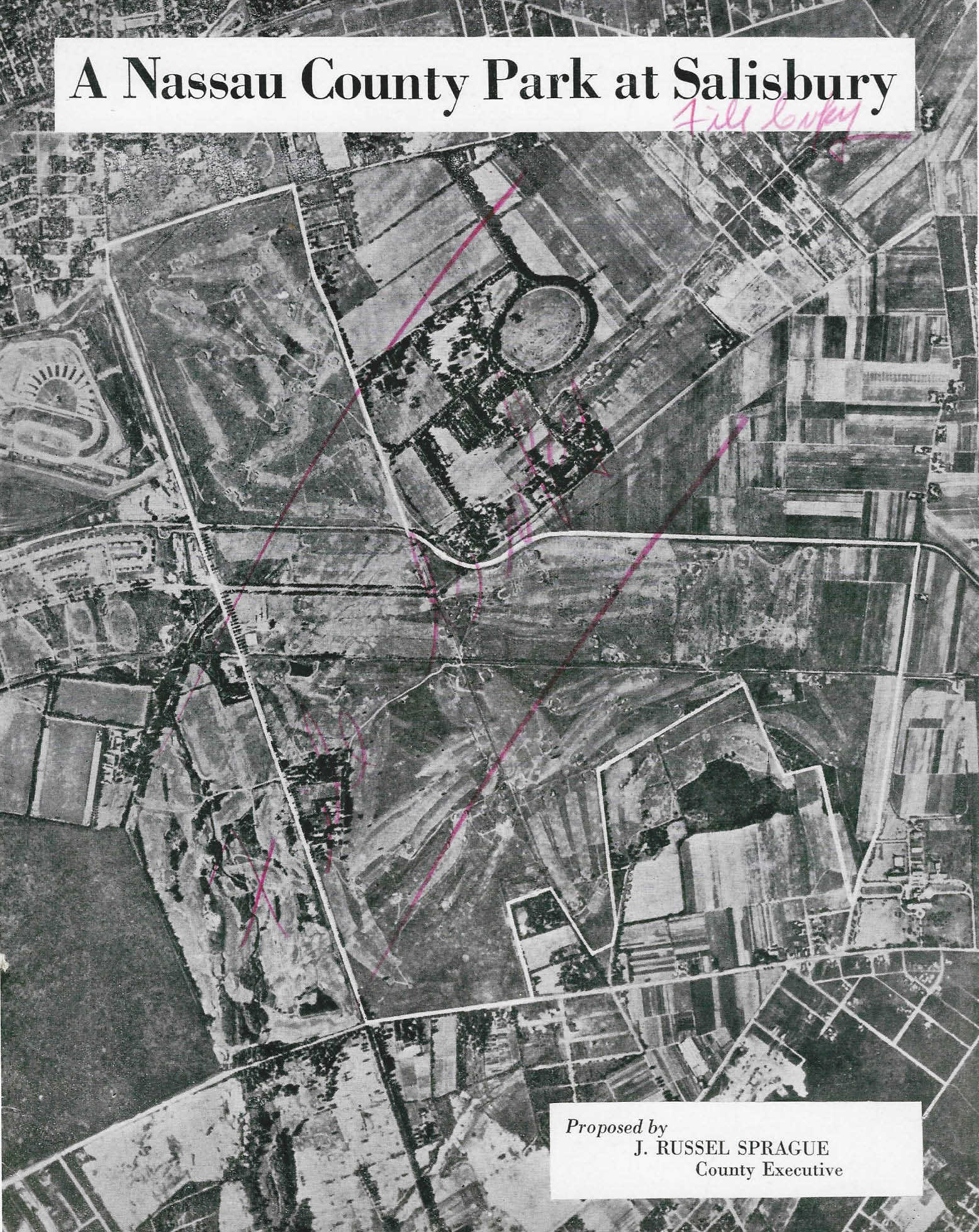
1944 Aerial
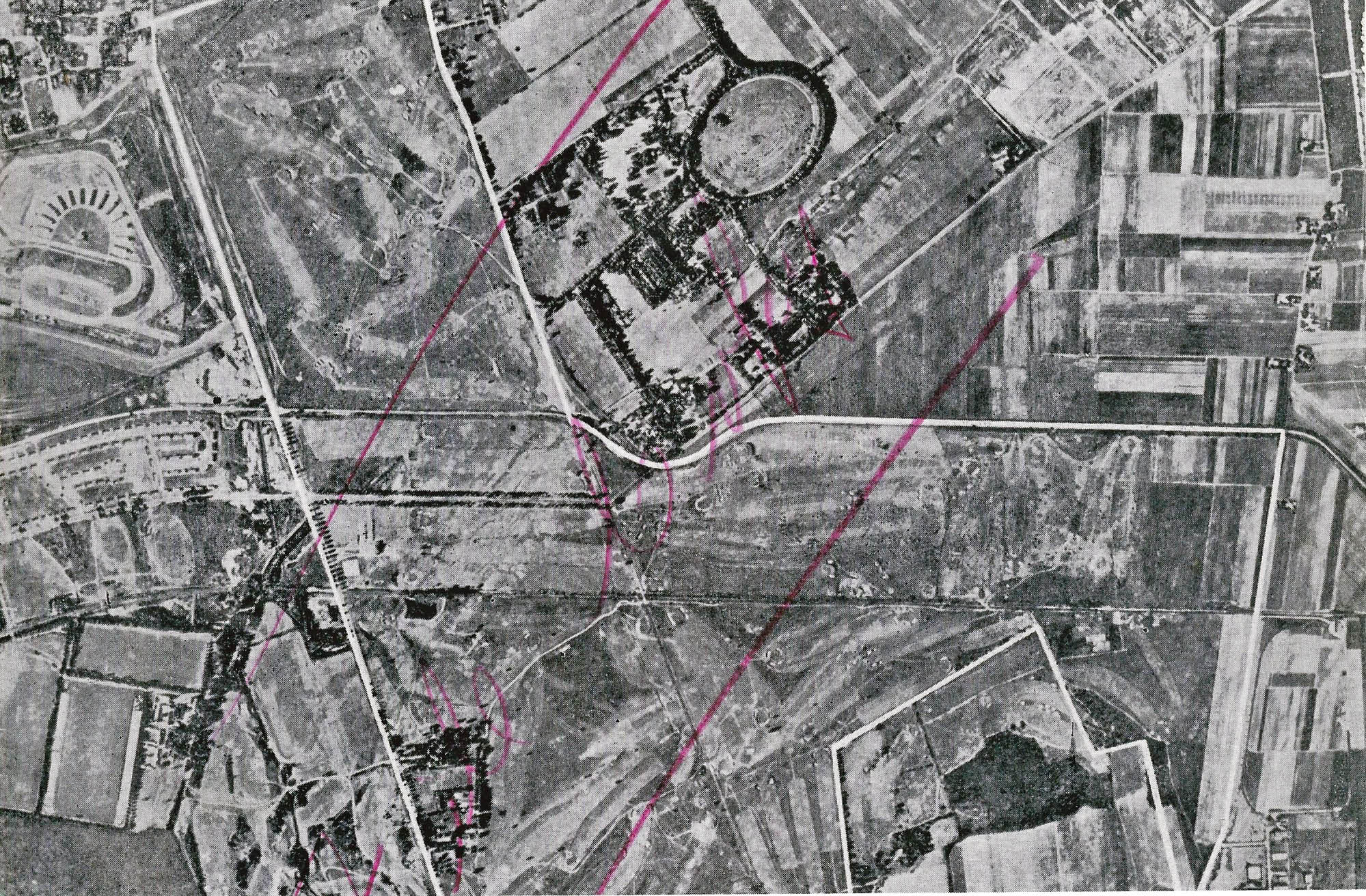
The northeast section of the proposed park (now Salisbury Park Drive) bordered on the Motor Parkway right-of-way. The circular track on the Ladenburg property could still be clearly seen.
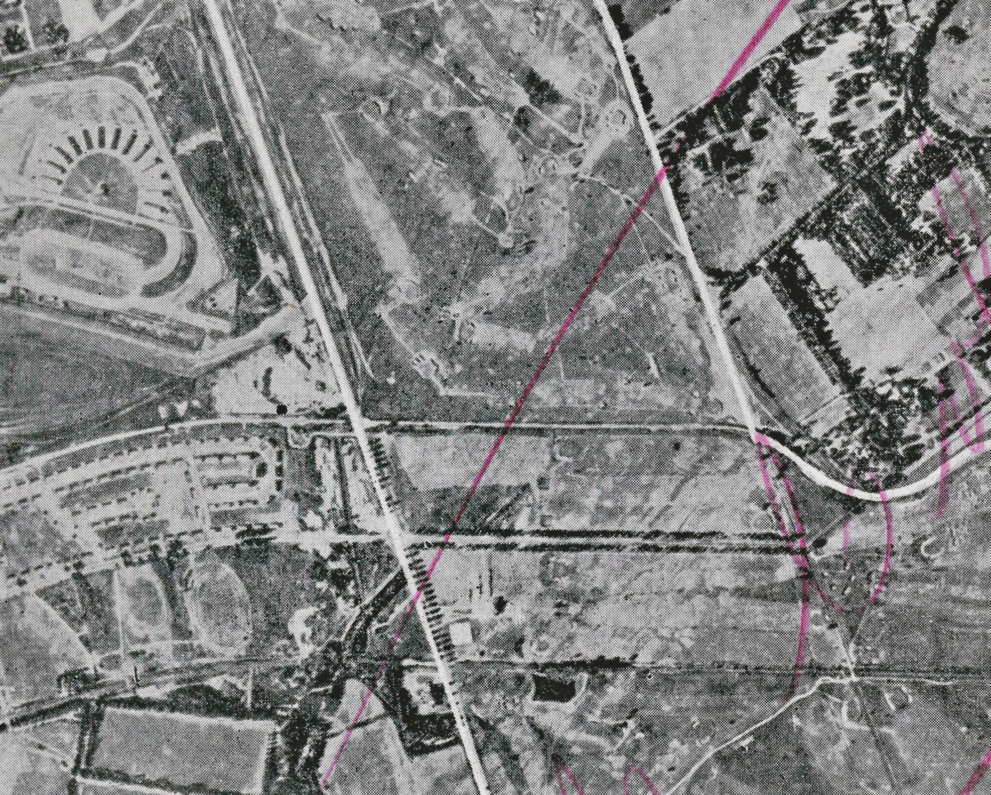
Note how the Motor Parkway paralled Stewart Avenue and the Central Railroad track. The former keyhole entrance to the Motor Parkway at the Meadow Brook Lodge can be seen west of Merrick Avenue. Roosevelt Raceway (top left) was being used for harness racing.
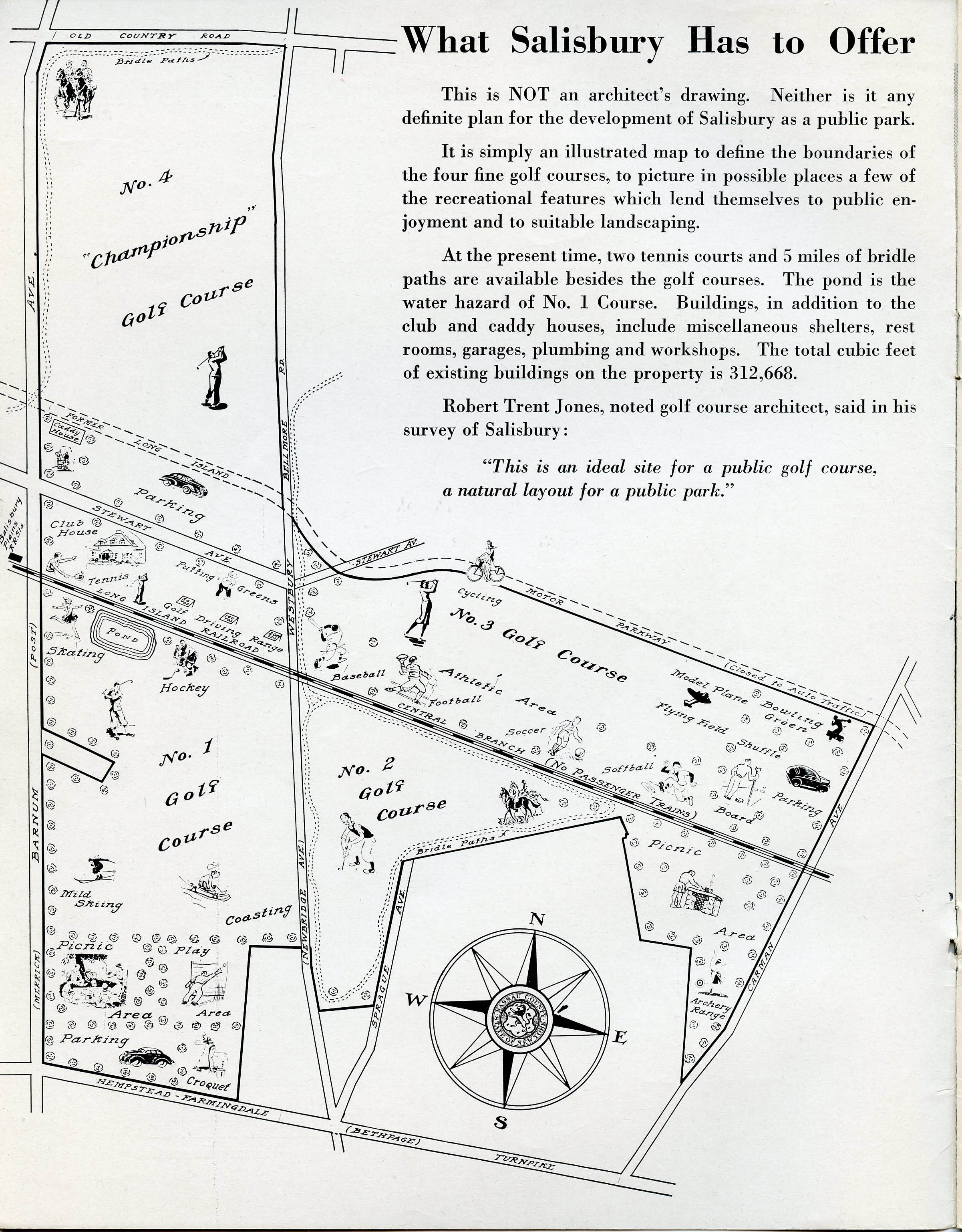
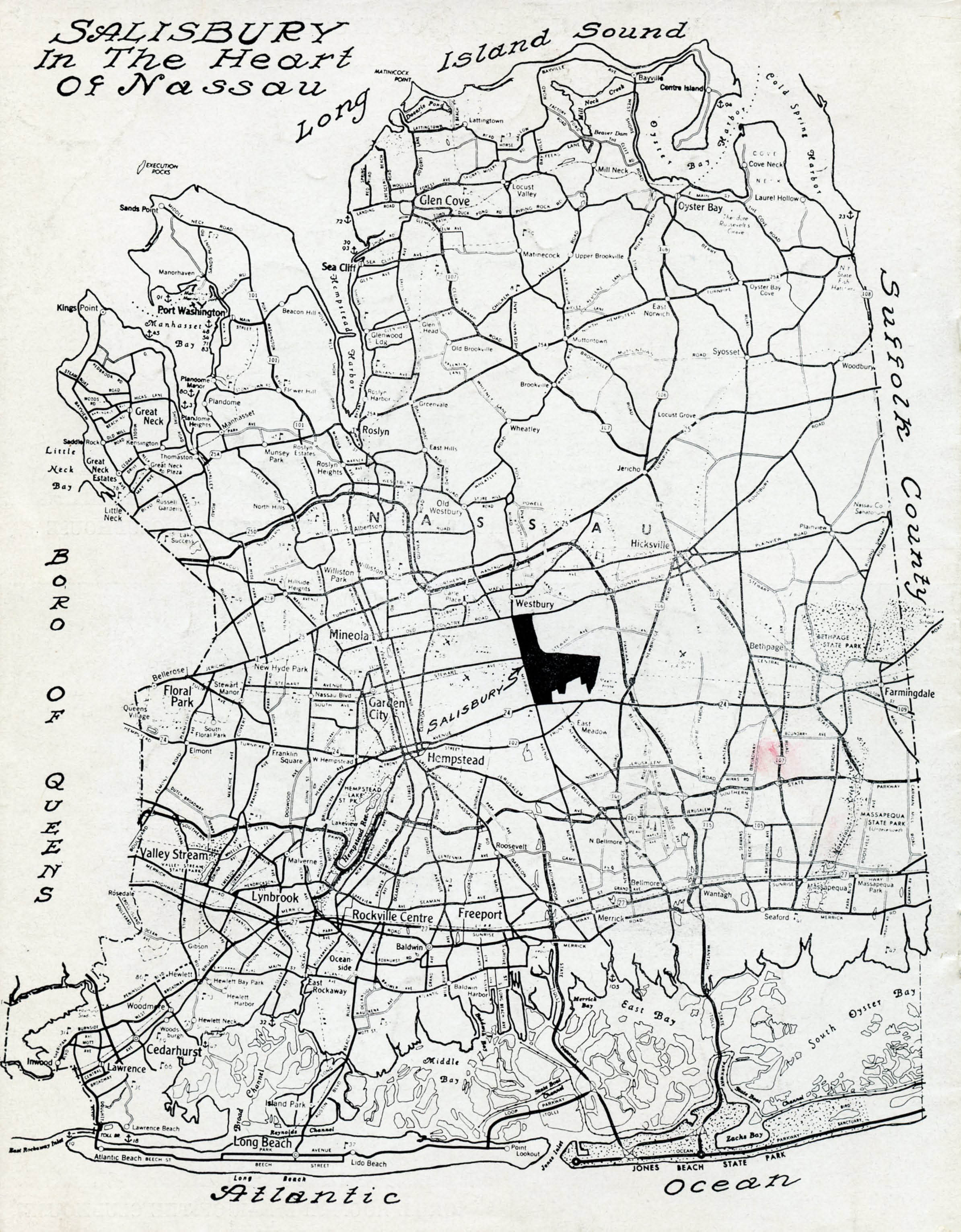
Illustrated Map
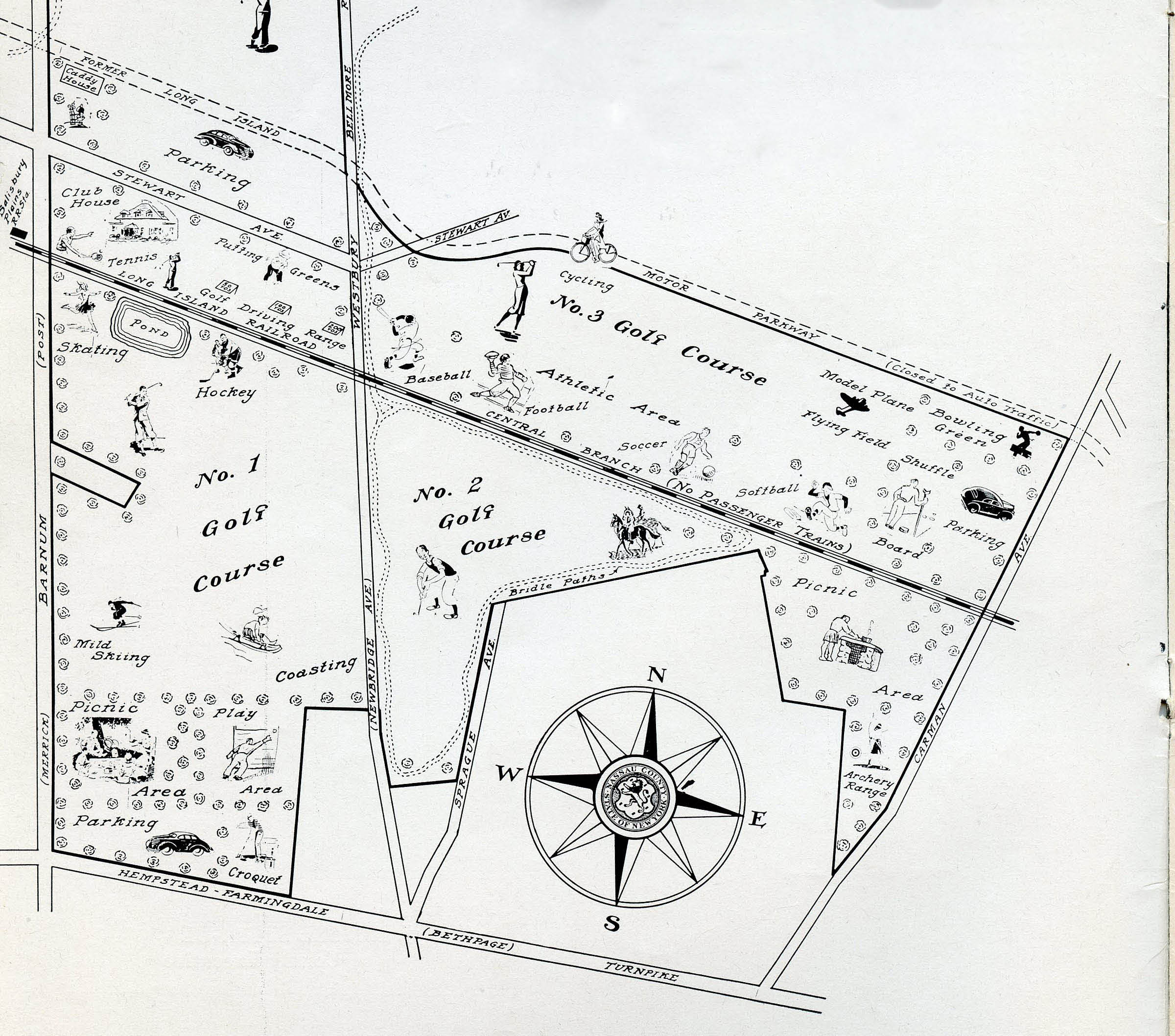
Note the "Former Long Island Motor Parkway" on the top of this section of the map.
Proposal " A Nassau County Park at Salisbury"
This proposal was written by Nassau County Executive J. Russel Sprague on April 24, 1944. Nassau County owned the 820 acres since 1940 and operating the four Salisbury golf courses. Sprague wanted to develop and expand the property as "a public county park which one day will be to Nassau County what Central Park is today to New York City."
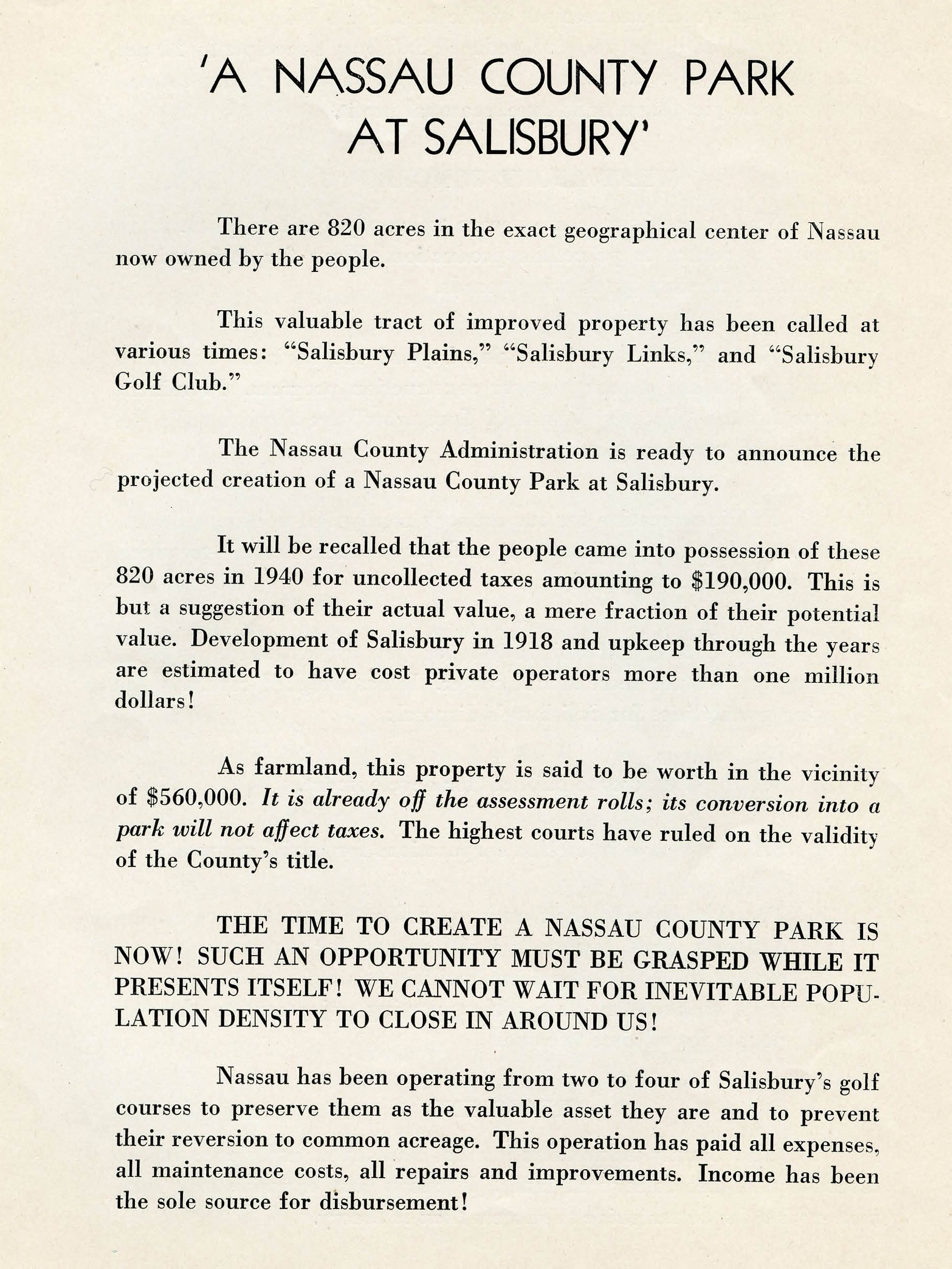
Nassau County had obtained the property in 1940 for uncollected taxes totalling $190,000. In 1944, they valued the property at $560,000.
The options in the document were a no-brainer:
-Sell the property for development
-Sell the property for use as a cemetery
-Develop a county park that will be a "self-supporting enjoyment to the people for all time to come."
Nassau County built a clubhouse for the Salisbury golf courses for $45,000.
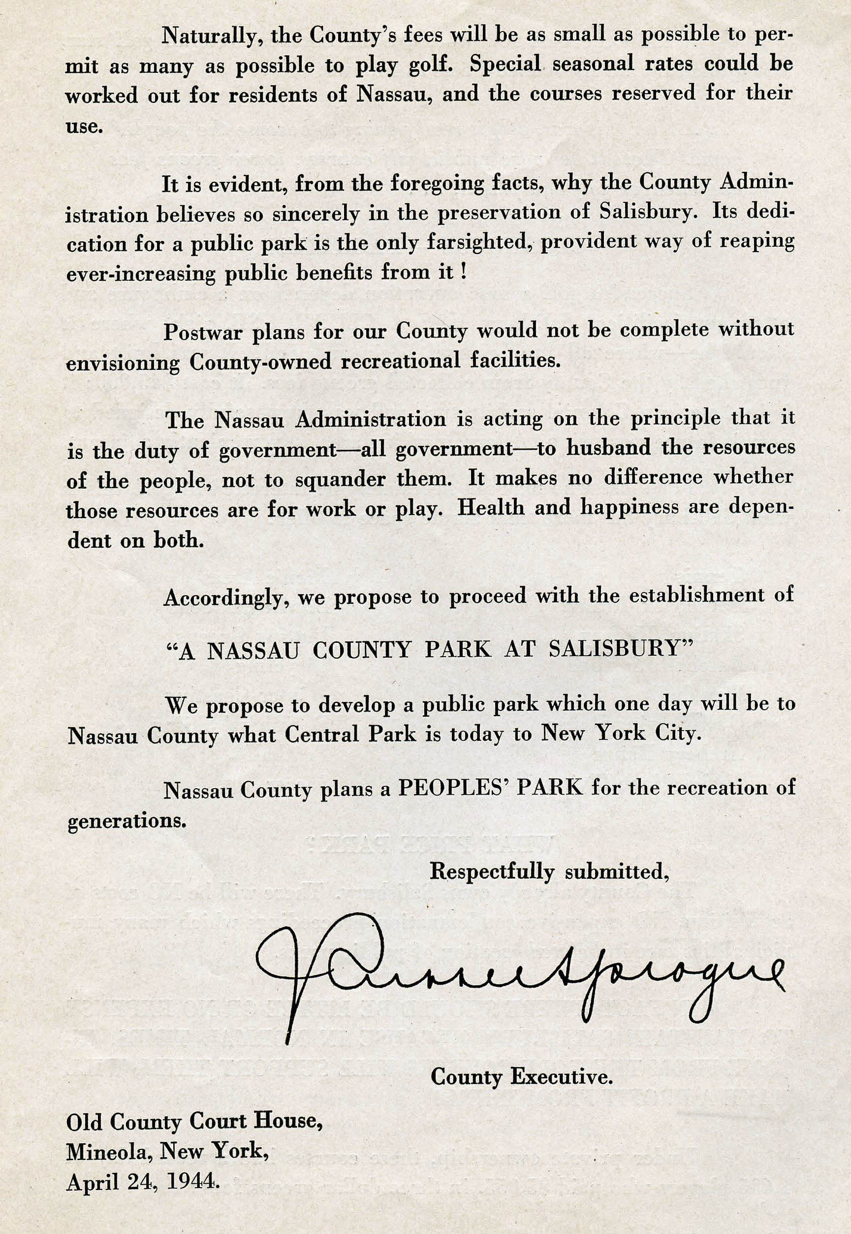
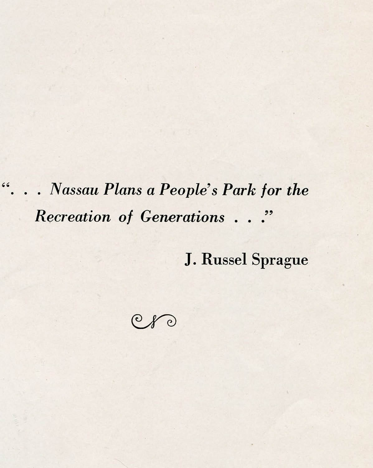
"Nassau County plans a PEOPLE'S PARK for the recreation of generations."
Salisbury Clubhouse Built by Nassau County
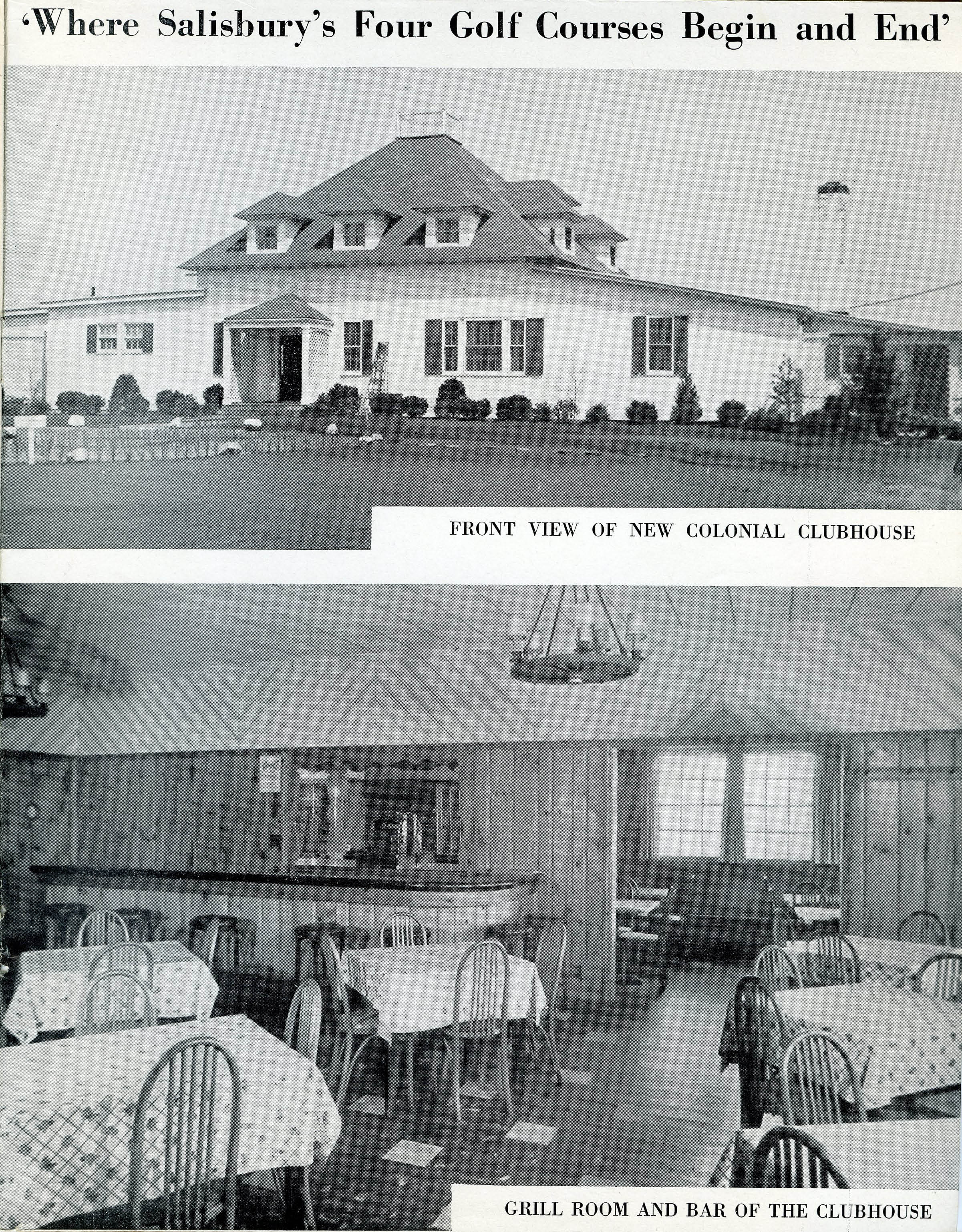
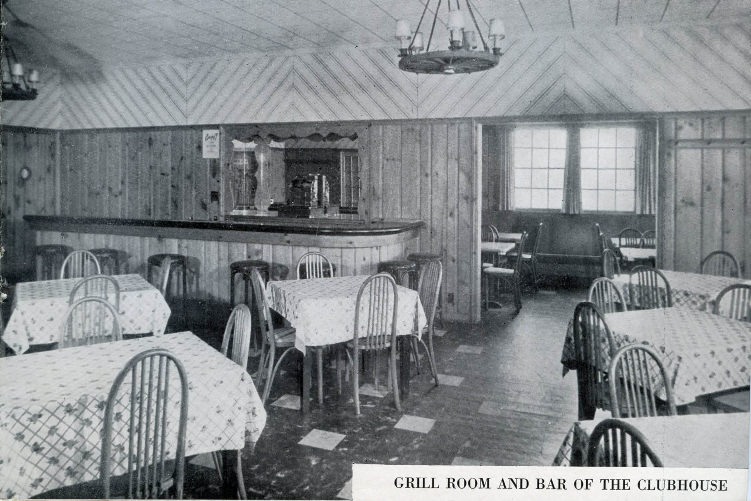
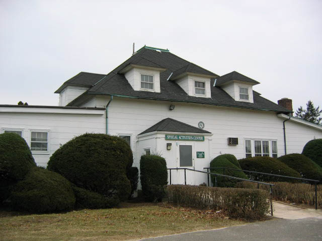
The former Salisbury Clubhouse is still standing and used as a Special Activities Center.


Comments
Great find, Gary.
Just for comparison, the Nassau County 1926/1950/2000 aerial photos are at http://sbiii.com/limpnaer.html and my original 2005 proposal for the LIMP Row trail is at http://sbiii.com/limpncpk.html . Sprague had it easy! Sam, III