Sam & Dave’s “Excellent 2019 Vanderbilt Day”- #4 Albertson
Our favorite Motor Parkway father and son team Dave and Sammy Russo journeyed once again on their bikes to explore our favorite parkway from Lake Success to Melville. In the fourth post of the series, Sammy and Dave explored the Albertson section of the Motor Parkway.
The Russo father/son series helps to document the current condition of the Motor Parkway, while uncovering several new surprises.
Enjoy,
Howard Kroplick
2019 Vanderbilt Day
March 30, 2019
Dave Russo :
So we did it yesterday. After a one year hiatus, Sam and I resumed our annual Vanderbilt Day tradition.
What better starting point than the Deepdale Mansion in Lake Success, William K. Vanderbilt, Jr.'s residence in the early 1900s. The home is still standing, just steps off of the Motor Parkway. I'm sure not by coincidence.
Moving west to east as always, we traveled 18 miles by bike from Lake Success to the Maxess Road Bridge in Melville We had a great time!
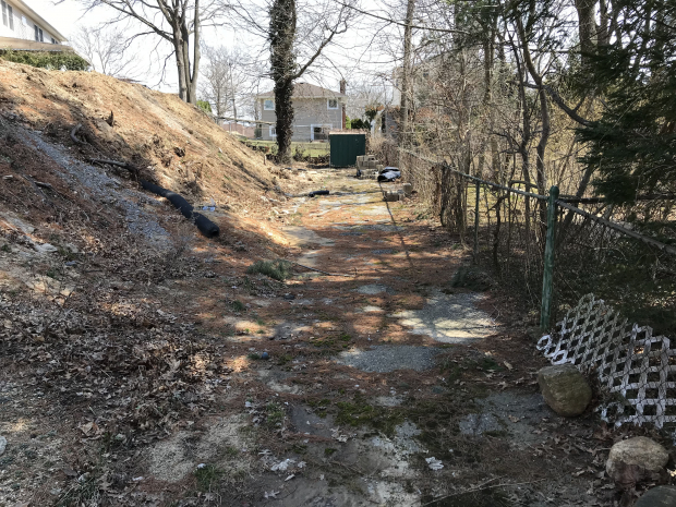
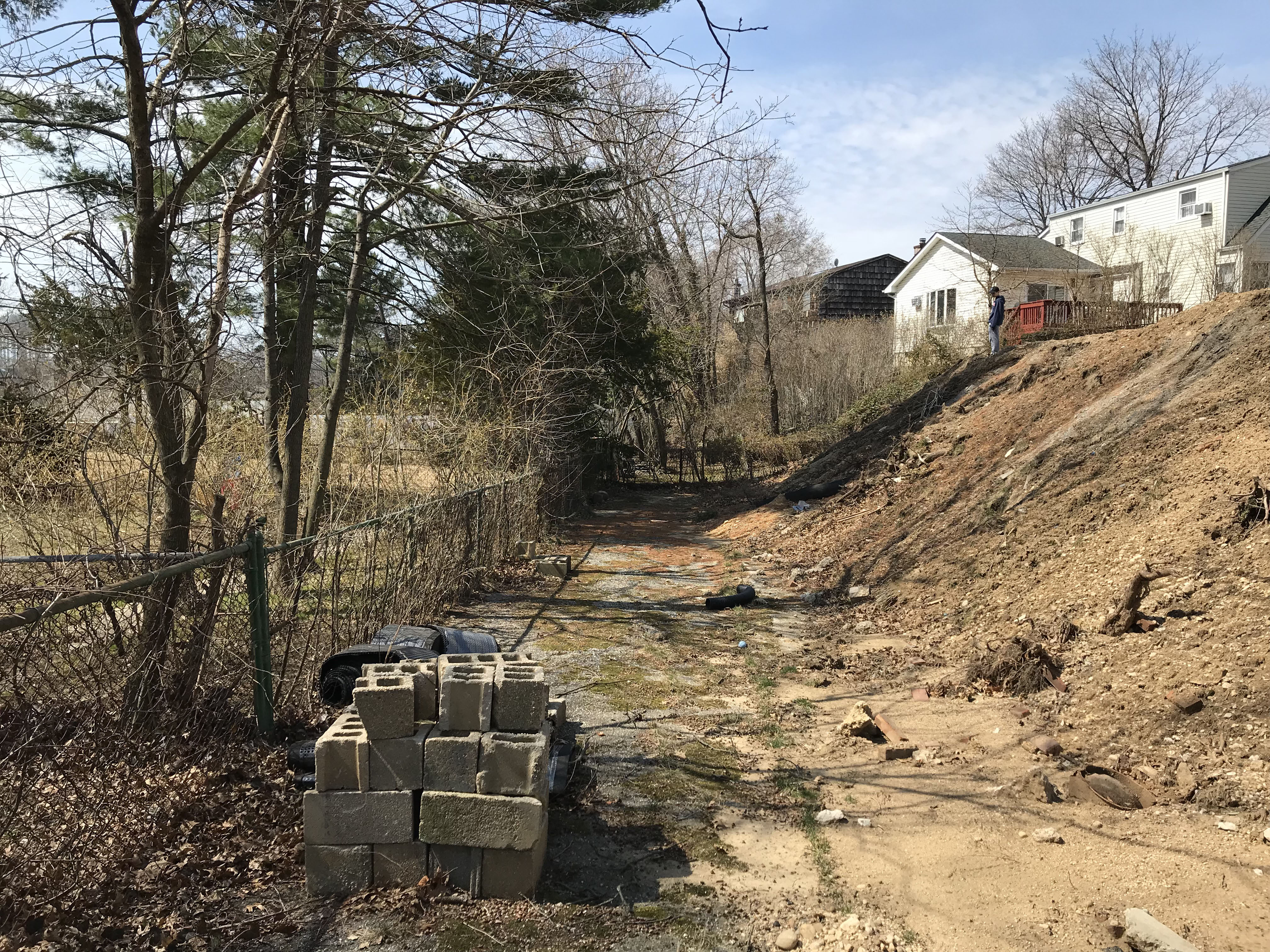
East of Searingtown Road we come to the house on Sigsbee Ave that has the LIMP in the backyard -- amazingly, and not for much longer I believe..

As you can see there is work going on at this location now, hard to believe this will survive.
None of this was here last time
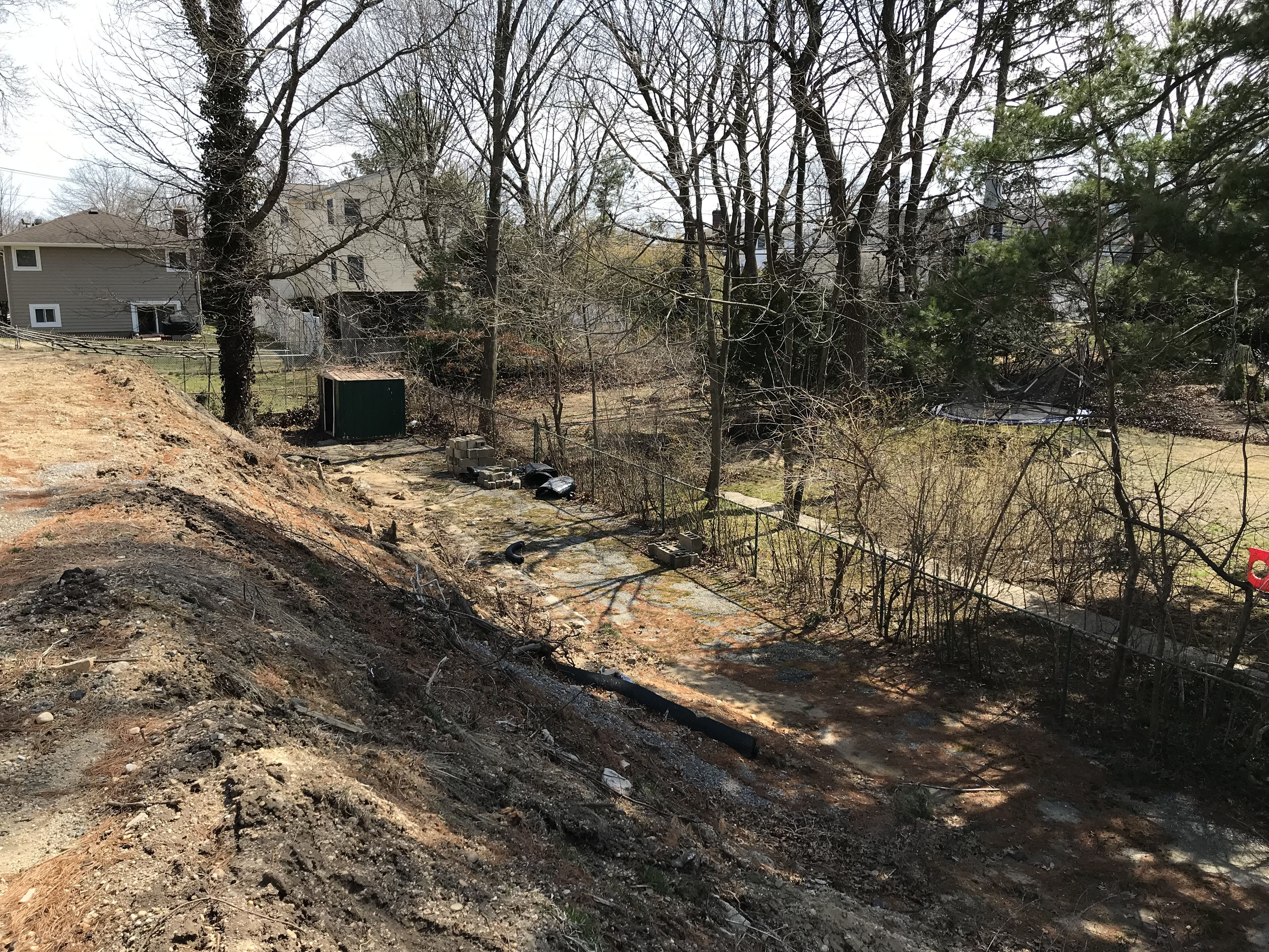
Concrete extension piece in backyard just south of this house.
Looking east to west -- you can see concrete ext piece to your left.
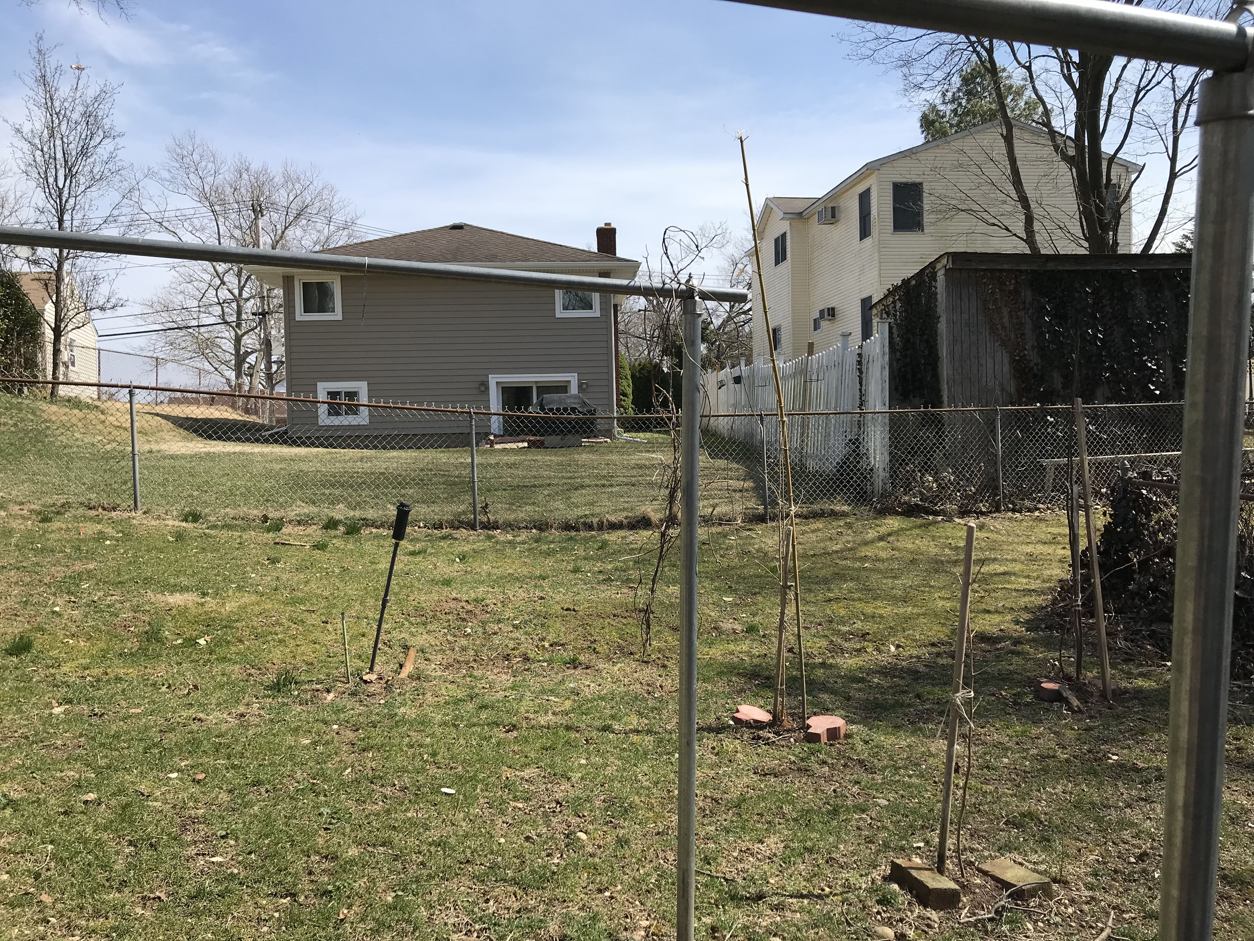
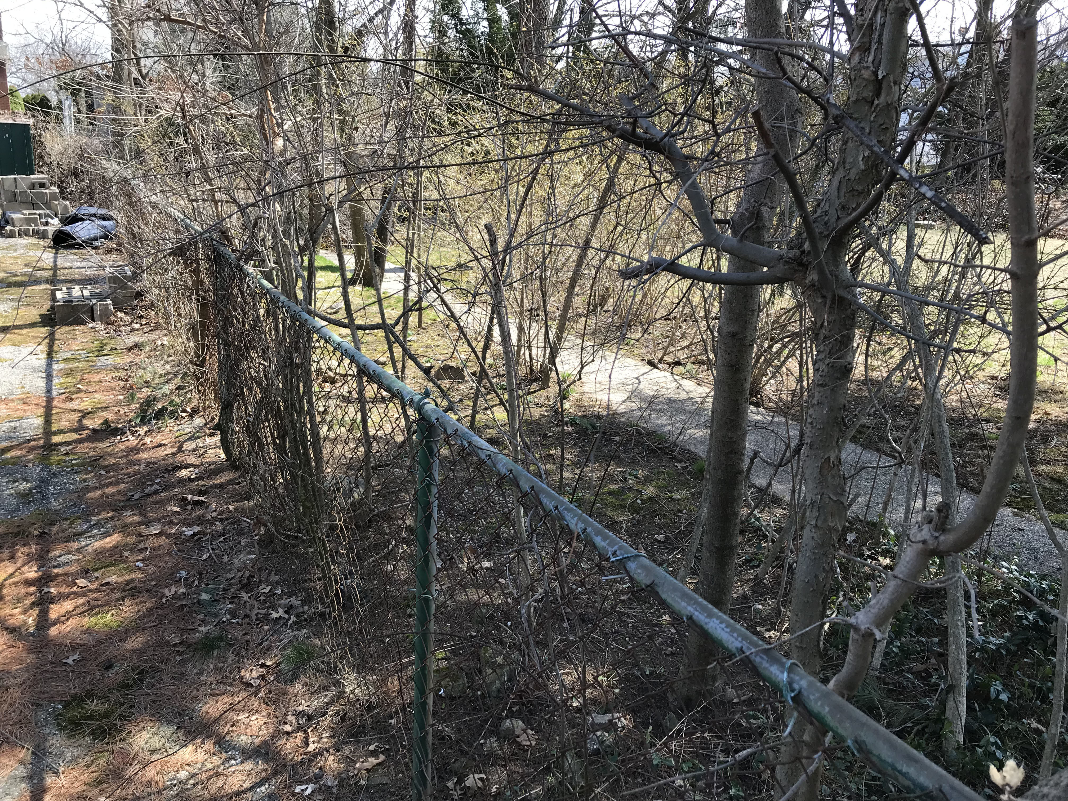
Looking east right next to the end of this Sigsbee Ave LIMP -- this is the ROW continued.
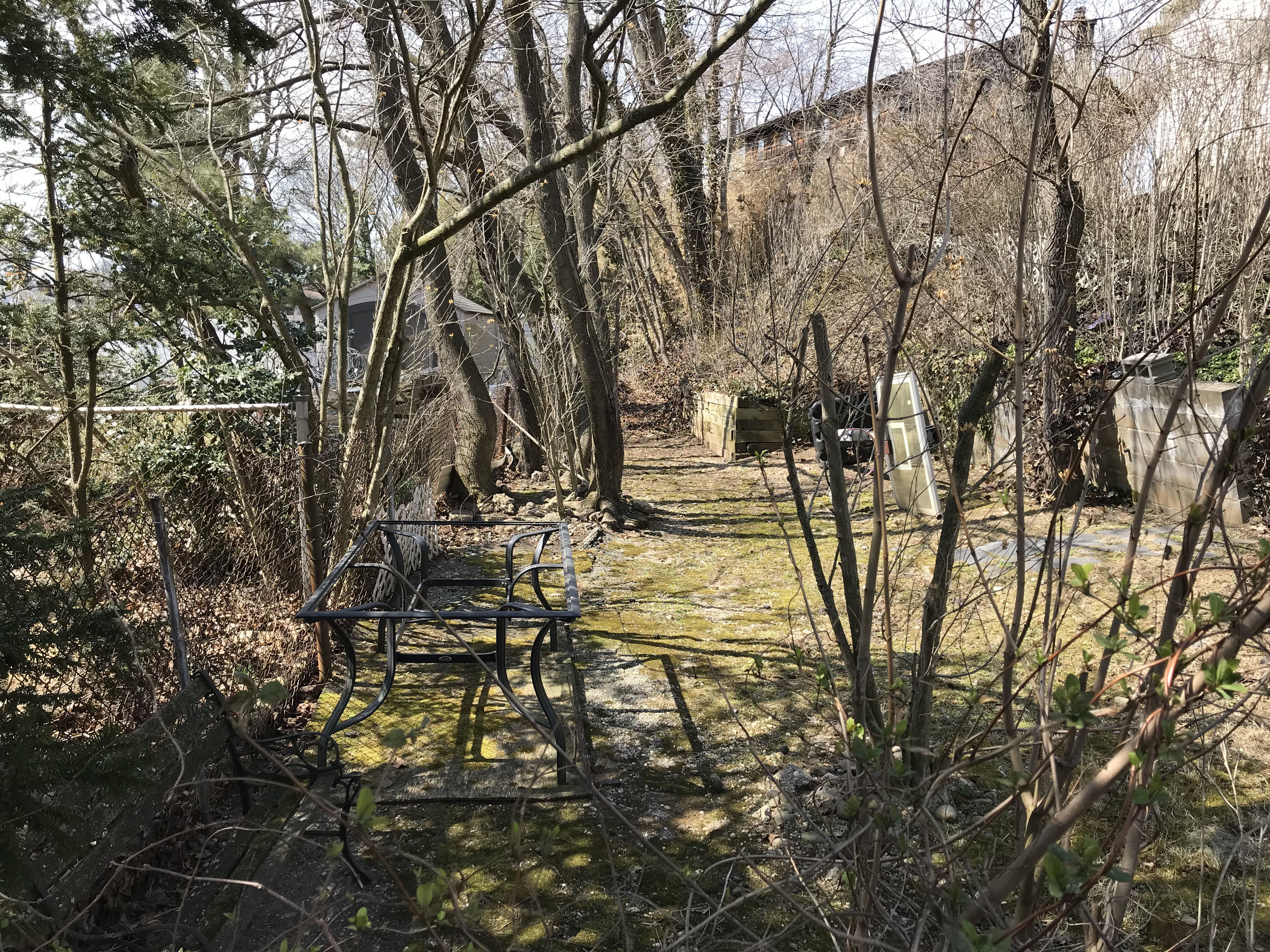
Looking at the backyard just west of the Sigsbee Ave house - fragments remain.


Comments
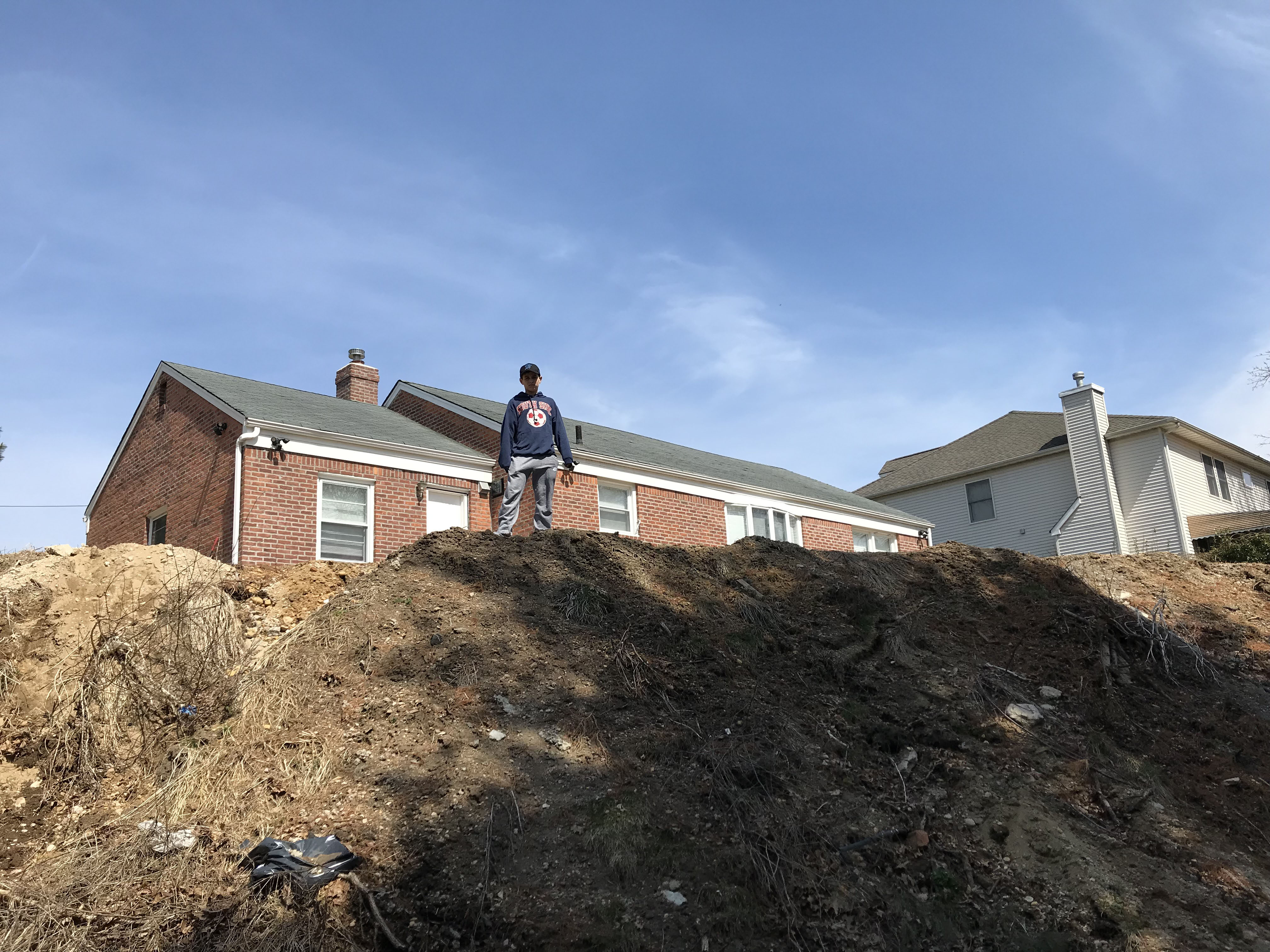
The rear property of the brick house looks to be elevated, then sloping down to the flat LIMP ROW on the past images, too. The additional dirt mound where Sam is had to come from somewhere. Maybe the house foundation is being expanded? Probably just spread the dirt down towards the LIMP.
Look at the pics from two years ago. I don’t know what they are doing here, but it seems inevitable that this stretch of LIMP is on it’s last leg.
the govts. on long island only want to get more tax revenue as possible by allowing all the building of houses especially on the old motor parkway route. i laughed when the proposed “greenway” trail was talked about around 2010. Follow the money. i blame it all on our greedy tax and spend local and county government. They don’t care about overbuilding and the historical (greenway) motorparkway that could be in the planned developments for the people of long island.
To second Paul’s comment, when I moved to Mineola ca. 1960, I used to bike the LIMP between Searingtown and Roslyn Roads (lotsa glass - lotsa punctures) and was deeply distressed when the house on the west side of Collins (actually 178 Wentworth, I theenk) was plonked down right on the RoW. Wonder where my pix are? Sam, III
In 1959 my family moved to a new house in Manhasset Hills.The development was built by the Scarpinatto Bros. My father,James DeNicola did the site work and excavating.Our house was on Lords way.The development was between Old Courthouse Rd. and the Old Motor Pkwy.I was 11 at the time.Lords way was 1 block south of the LIMP.Walked it many times,didn’t realize its significance then! The Links development on Shelter Rock Rd. was a golf course back then.Across Shelter Rock was Harkness Boy Scout Camp,what a wonderful place to grow up!
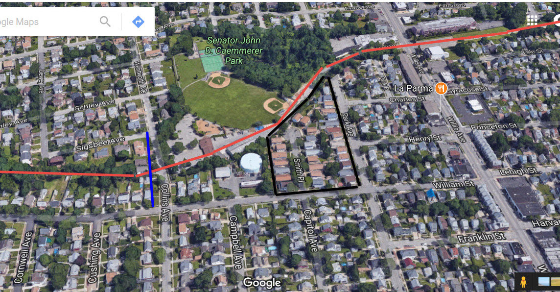
Does anyone have any past pictures of Caemmerer Park. There was supposedly a lake next to motor parkway where the park is. I heard a child drowned in the lake back around 1943. Looking for more pictures and info on this.
Thanks
Billy - The wooded area within the park ( see it on the last aerial image above ) was a Gravel Pit. Pond was created due to the mining. I haven’t been in there, but aerials & street maps still show a depression & water. Guess this area is fenced in, maybe it became a drainage basin?
Just west of the park, next to Searingtown Rd, is Herricks Pond ( St George’s Lake )
Unless someone knows of the this off hand, think we could find out more about a drowning with a newspaper search. On the web, there’s NYS Historic Newspapers & Newsday Archives, both free.
Billy & Blog Viewers - I believe the Newsday articles below from 1941 is the drowning that Billy asked about. This whole event had a happy outcome. 2 - First Grade children - David Clarke and Helen Herte, walking home ( Fordham St Williston Park ) from school. They encountered the Sand Pit. Helen decided to slide down the pit towards the water, she dropped in. David pulled her out, rescued her from drowning. Maybe I’ll search them again to see if they married later in life : ) The first 2 articles describe this happening, 3rd article tells of the dangers due to no fencing around various Sand Pits.
Wow, great info. I was asking because there is a dedication plaque at the park specifying a death of a child drowning at the sand pit. There is a sign on one of the fences of the town park saying property of Nassau county so the county must have put up the fence around it before the town took over the property. The wooded area behind the park is a storm basin. Would love more info on this and St George Lake. Also I can’t find any info on Theodore Brown who owned the 16 acres sold to Long Island motor parkway. Was the land just used for farming prior to being a sand and gravel pit? Thanks!
Billy. Re St. Georges lake…. known previously as Herrick Pond, at least back to 1873. Was much larger at one time with the western shore at today’s Old Searingtown Rd. and the northern end pretty much at the Shelter Rock Library parking field. The new Searingtown Rd. was built right thru the center of the lake ( in the early 1960’s I believe), dramatically reducing the size of that body of water Around 1890 starting referring to the lake as Herricks Pond. What I would like to know how the Library got it’s name, Shelter Rock is located on Shelter Rock Rd.
fairly close to Northern Blvd.