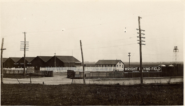
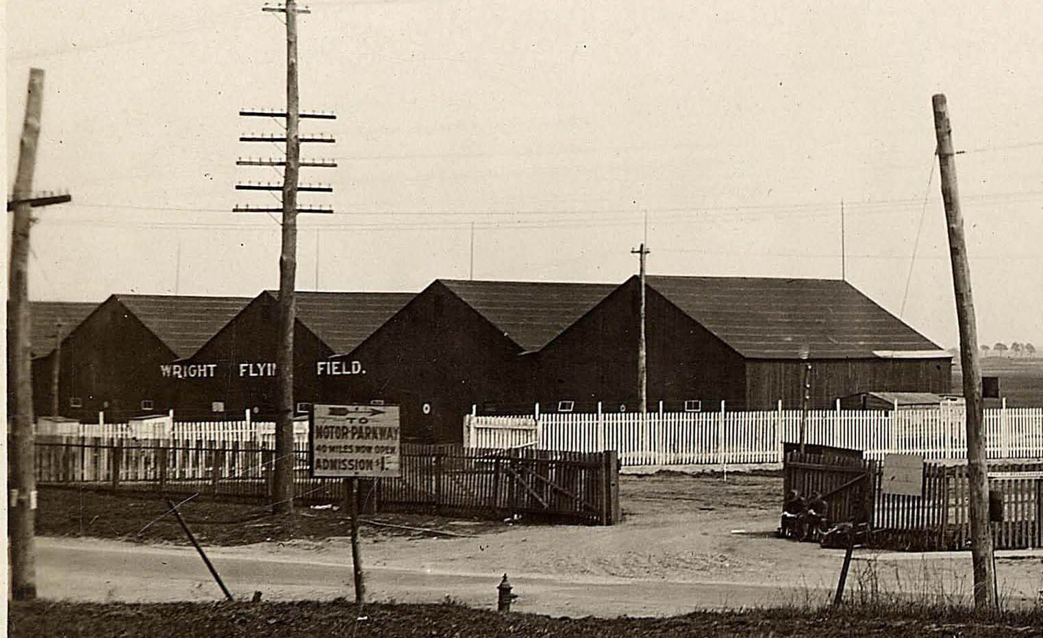
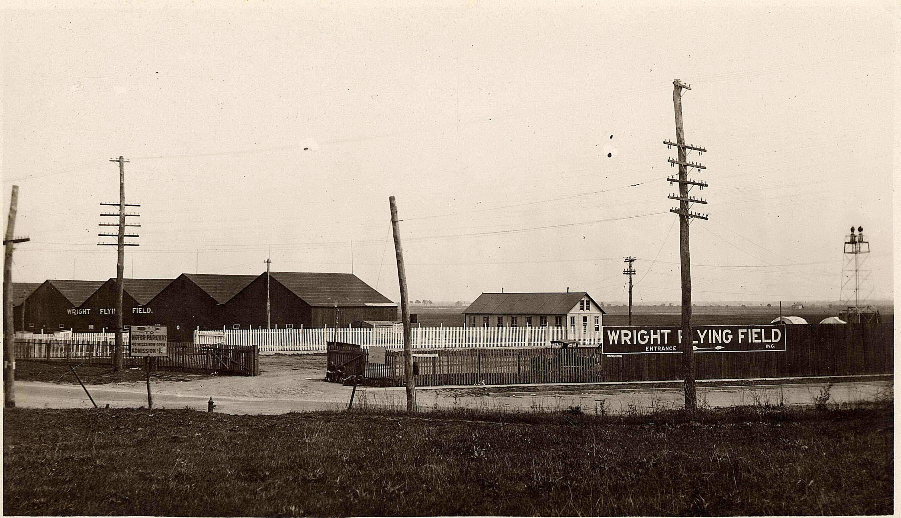
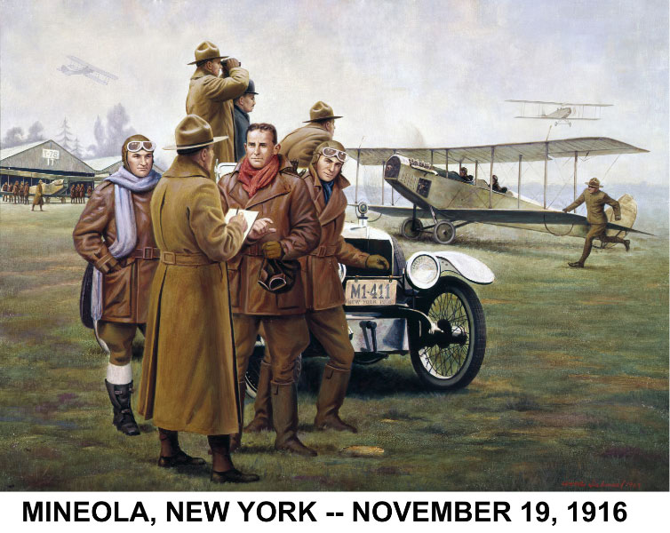
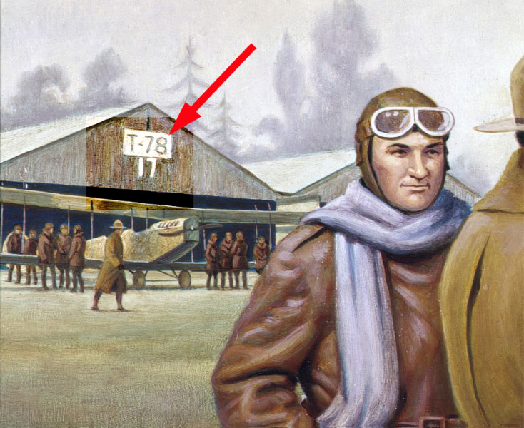
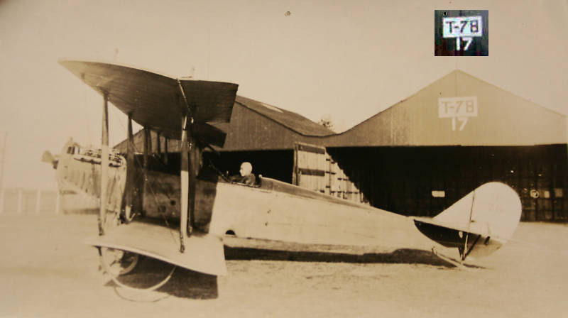
Mystery Foto #99: The Wright Flying Field in Mineola Circa 1916/1917
Allan Routt of Fairborn, Ohio forwarded this never-before-published photo of a Long Island Motor Parkway sign as this weekend's Mystery Foto.
Answers to the Mystery Foto questions:
- Where was this Motor Parkway sign located?
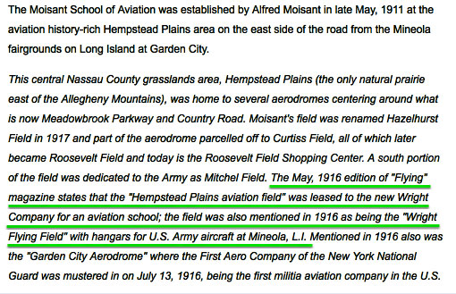
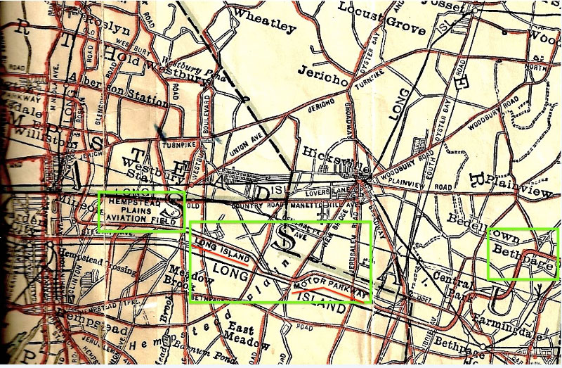
South west corner of the intersection of Clinton Road and Old Country Road in Mineola. The Wright Flying Field was located in Mineola (now East Garden City).
-Where was the arrow on the sign pointing to?
Garden City Lodge located off of Clinton Road.
-What is the likely year of the photo?
The photo was taken from 1916 to April 1917.This section of the Hemptead Plains Aviation Field was leased to the Wright Company in 1916. When the United States entered the war in April 1917, the entire field was taken over and renamed Hazelhurst Field after Leighton Hazelhurst, Jr., the third US Army officer to die in an aviation accident (1912).
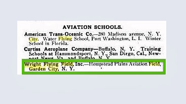
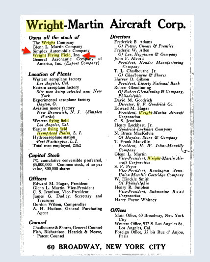
-What was the Wright Flying Field and who owned it?
The Wright-Martin Company.
The Wright-Martin Company was a merger of the Wright Company and the Glenn L. Martin Company in 1916. The company later merged into the Curtiss-Wright Company on July 5, 1929.
-What automobile company was owned by the parent company of the flying field?
In 1916, the Wright Company purchased the Simplex Automobile Company. One year later, the Simplex Automobile was shut down and the company switched to the production of aircraft engines for the war effort.
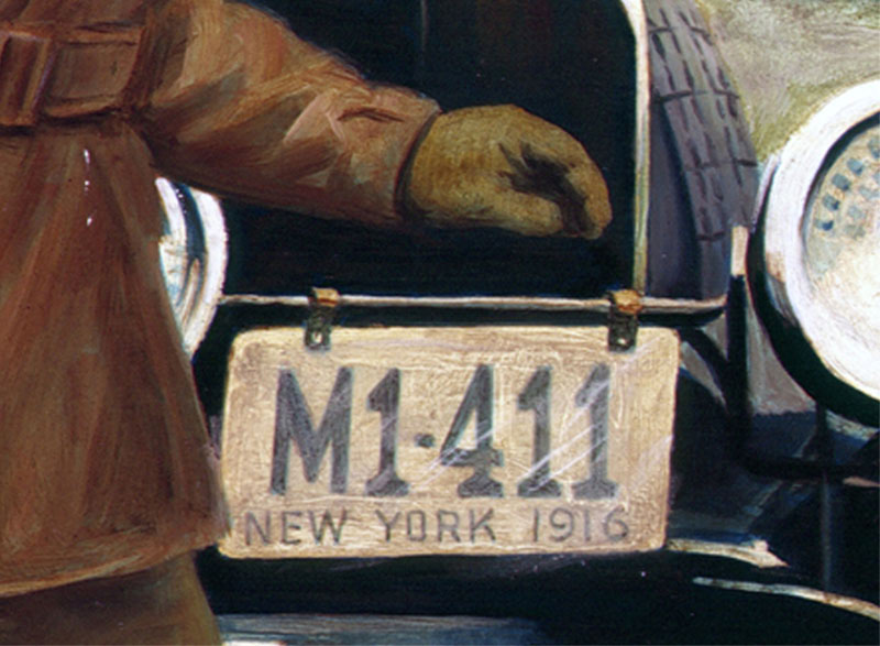
-How was this automobile company linked to the Vanderbilt Cup Races?
Simplex racers ran in the 1904, 1909, and 1910 Vanderbilt Cup Races, Frank Femenias (see below Femenias' Findings), Art Kleiner (see below Kleiner's Korner), Tim Ivers, and Greg O. for correctly identifying the location of Old Country Road and Clinton Road.
Congrats to Michael LaBarbera, Frank Femenias (see below Femenias' Findings), Art Kleiner (see below Kleiner's Korner), Tim Ivers, and Greg O. for correctly identifying the Motor Parkway sign location as Old Country Road and Clinto Road. Kudos to Art Kleiner for correctly answering all the Mystery Foto questions.
Enjoy,
Howard Kroplick
Closeups
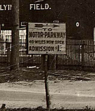
The sign reads:
To
MOTOR PARKWAY
40 Miles Now Open
Admission $1.
Note: The dollar amount was revised from $1.50.
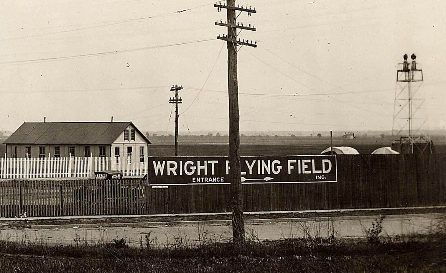
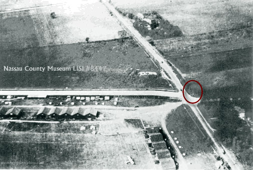
The likely location of the Long Island Motor Parkway sign .
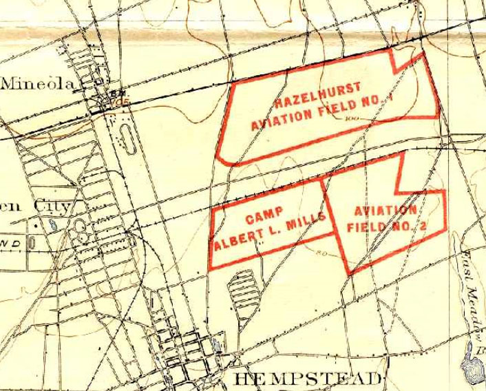
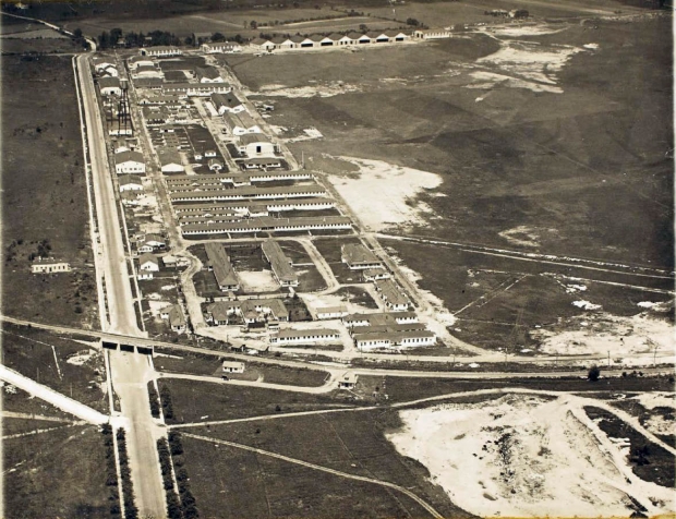
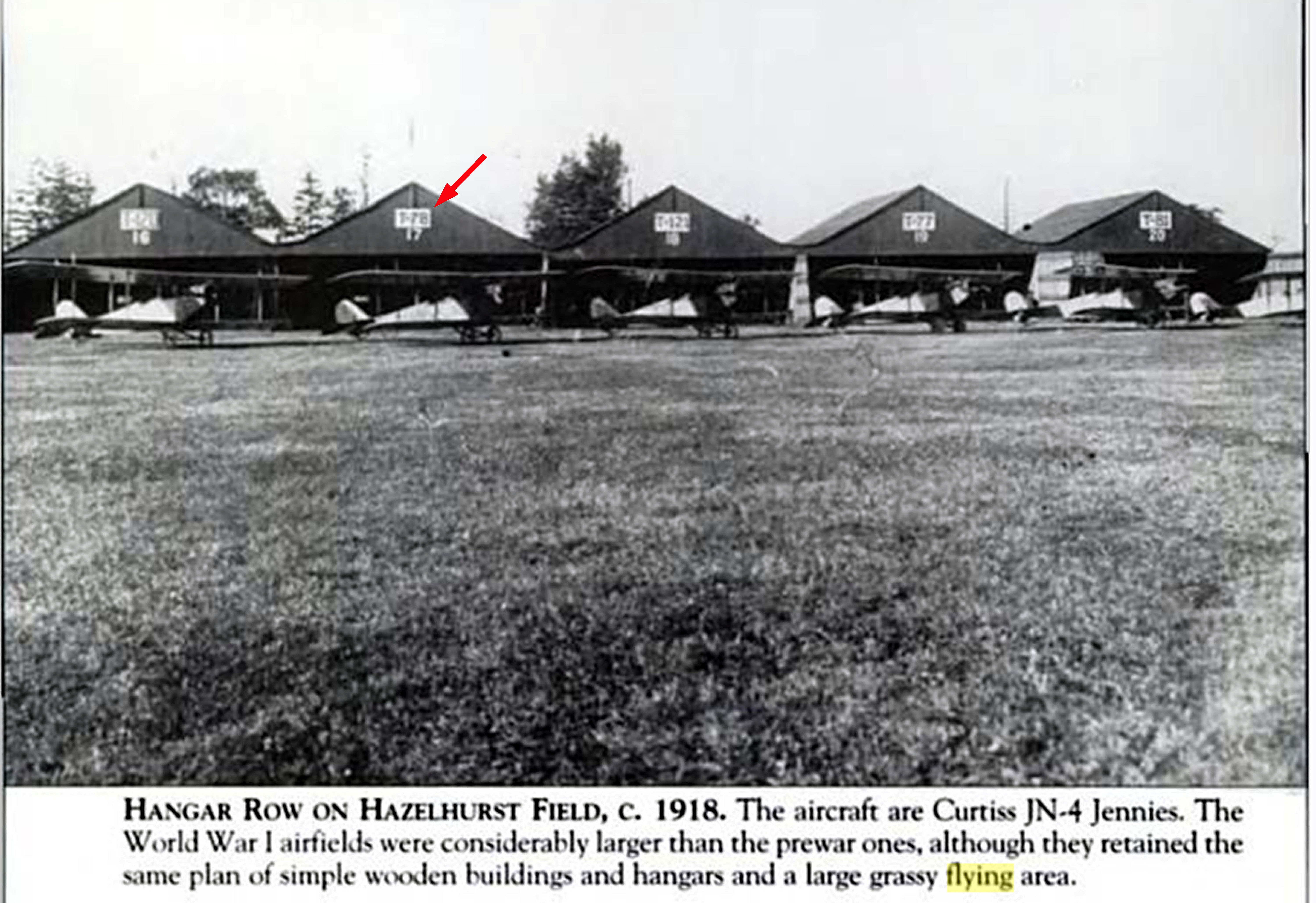
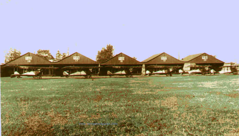
1918 map of Hazelhurst Aviation Field No. 1.
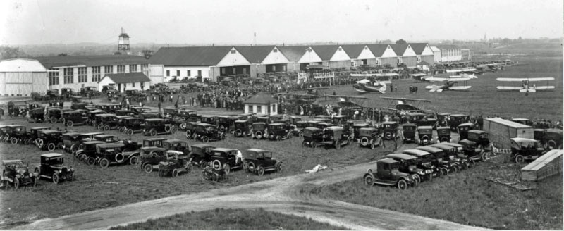
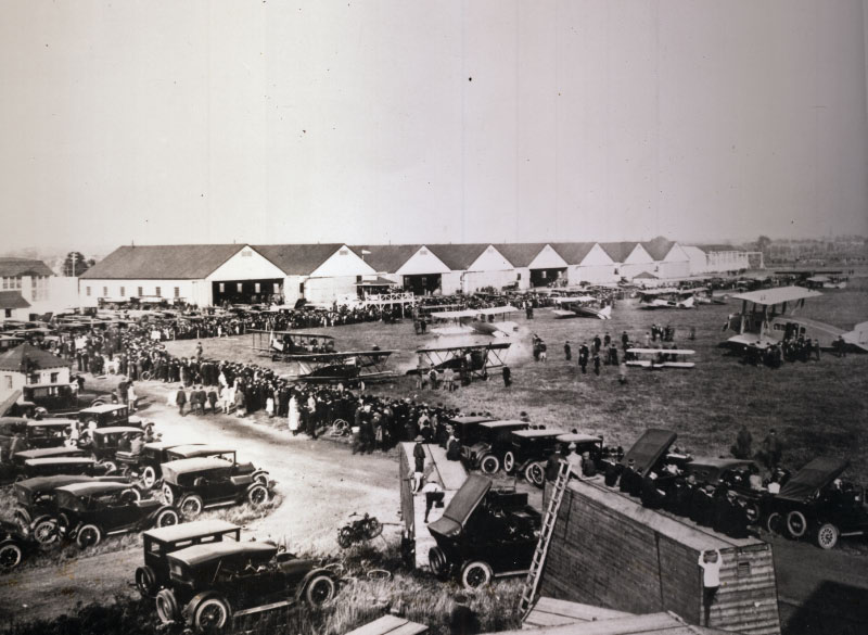
Opening day of the Curtiss Flying Field on May 15, 1921.
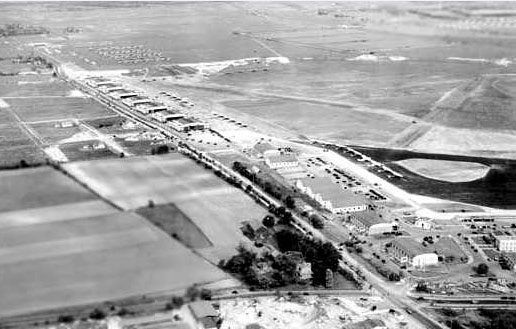
Clinton Road, Old Country Road, Curtiss Field and the Motor Parkway in Garden City . Circa 1926.
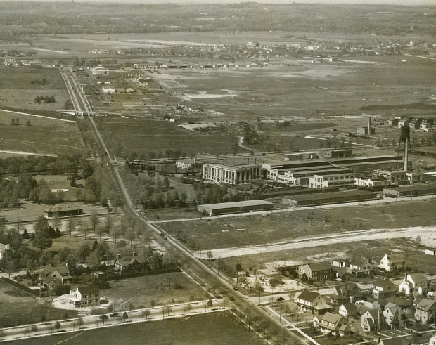
This aerial is looking north towards Curtiss Engineering Corporation and Curtiss Field in Garden City and East Garden City in 1927. Clinton Road is running north and south highlighted by the Motor Parkway Bridge and the Garden City Lodge- the target of the Motor Parkway sign.
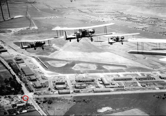
Keystone bombers flying over Roosevelt Field in 1931. The circle indicates the likely location of the sign. Photo courtesy of the Cradle of Aviation.
The "Now" view of the Mystery Foto as it looks today- one of the busiest interesctions on Long Island. The Roosevelt Field shopping center can be seen in the background.
Submitted by Allan Routt
Allan Routt: "I ran across these items while researching the Wright Flying Field photo."
Kleiner's Korner (Submitted by Art Kleiner)
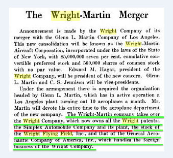
Aviation & Aeronautical Engineering, August 15, 1916
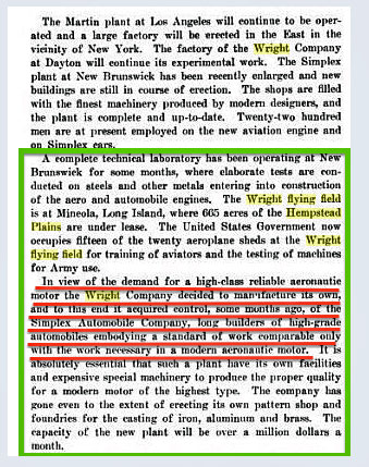
Aviation & Aeronautical Engineering, August 15, 1916
Flying, December 1916
1916 Hammond Map
Aviation Week, January 1917
Femenias' Findings (Submitted by Frank Femenias)
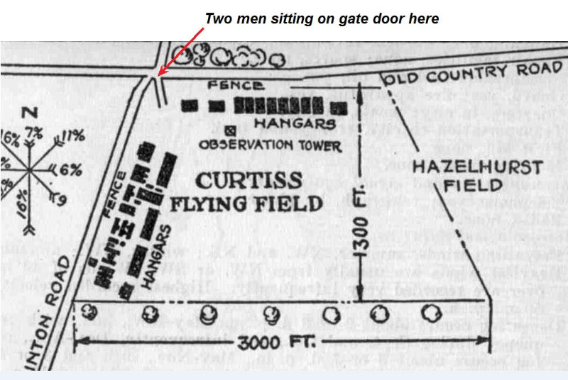
Location of two men sitting on the gate door of the Mystery Foto.


Comments
My uneducated best guess is that this is the entrance to Roosevelt Field (Curtiss Field) at the corner of Old Country Road and Clinton Avenue. The Motor Parkway sign would be pointing south toward the toll gate entrance further south on Clinton Ave. Couldn’t guess the car affiliation, but the year is probably in the late teens to early 20s when the price of toll went down from 2 bucks to $1.50, now $1.00.
This is a wild guess, but I’ll take a crack at it. The minute I saw he picture. I said to myself . that has to be Route 109 in Farmingdale by Republic Airport, it’s a straight road and there’s an open field, perfect for a airport. What’s with the sign? it’s not facing the road, It’s pointing to the Motor Parkway, I’m assuming. I also see 1 or 2 early 1900 cars that were involved in a Vanderbilt Cup Race, but don’t remember which one
1920, intersection of Clinton Rd and Old Country Road looking SE, pre Curtiss Flying Field, Motor Pkwy sign is pointing south at Clinton Rd, towards the Garden City Lodge entrance on Vanderbilt Court. God bless us all, everyone!
Kleiner’s Korner documentation to be sent to Howard separately.
- Where was this Motor Parkway sign located?
I believe it was near Clinton Road and/or Old Country Road in Garden City adjacent to the Hempstead Plains Aviation Field (i.e., Moisant Field, Curtiss Field, Hazelhurst Field, Roosevelt Field).
-Where was the arrow on the sign pointing to?
The Garden City Toll Lodge and the Motor Parkway entrance.
-What is the likely year of the photo?
The toll was reduced to $1 in 1917 so anywhere around that time. Probably no later than 1920.
-What was the Wright Flying Field and who owned it?
The Wright Flying Field was 665 acres of the Hempstead Plains leased from I believe the above mentioned Hempstead Plains Avaition Field. Among other users, the US Govt. used it for training of aviators and testing of Army machines. It was originally owned by the Wright Company (i.e., Wright Brothers) of Dayton, Ohio but when that company merged with The Glenn L. Martin Company it fell under new leadership. The connection (at least one I’ve found) between the Wright Company and the Motor Parkway/Vanderbilt Cup Race is found with Harry Payne Whitney being a director of the Wright Company (and later the merged company), a 1st VP of the Motor Parkway and a judge of the 1909 Cup Race.
-What automobile company was owned by the parent company of the flying field?
The Wright Company bought the Simplex Automobile Company in order to control the manufacture of a high quality aeronautic motor, which it believes was similarly accomplished in the Simplex’ manufacture of automobile engines.
-How was this automobile company linked to the Vanderbilt Cup Races?
Simplex autos raced in the 1904, 1909 and 1910 races (two in 1910). Unfortunately none finished high in the results.
My guess is Old Country Road at Clinton Road. Curtiss/Wright Field later renamed Roosevelt Field. About 1918. A portion of the LIMP was used for testing of a “flying bomb” atop a Marmon automobile.
I have seen only 1 or 2 vague references to this ever having been called ‘Wright’ Field. It was certainly never official. We have a letter from an army pilot dated 1917 that refers to the ‘Old Wright hangers’ there, so I suspect it was only called that sometime during the 1912 - 1917 period.
Looks like I’m getting this one wrong since I didn’t have time this week to research and figure this one out, so I’ll just give some quick off the cuff guesses…
- Where was this Motor Parkway sign located?
Old Country Road. (although closer to the Nassau Boulevard airfield in Garden City wouldn’t be a bad guess either)
-Where was the arrow on the sign pointing to?
Clinton Rd towards the Garden City Lodge
-What is the likely year of the photo?
The toll on the LIMP was $1 from 1917-1932. My guess is the early 1920’s.
-What was the Wright Flying Field and who owned it?
Curtiss-Wright
-What automobile company was owned by the parent company of the flying field?
-How was this automobile company linked to the Vanderbilt Cup Races?
Looking forward to the correct answers!
This was a very good one this week and thanks for all the extra info Frank and Art, the photos were great. What guess work Greg, expecting to be wrong with no research and me expecting to be right with no research was wrong
Check out those old utility poles, that really looks like an old country road. I’d give 10 schillings just to spend a day there with my modern auto and a fully charged camera.
From Tim G:
Thanks for posting the block about the Wright Flying Field photo. I see it was posted more than a year ago, but I just stumbled across it while searching for information about the field. I’m working on an article about someone who learned to fly there, but I’ve only had a vague sense of where the school was located and what it looked like. It’s interesting that this photo has been in my own backyard all along (Fairborn is close to Miamisburg). I’m now trying to contact Allan Routt through the Fairborn Historical Society.
Tim
Taken from a 20 page pamphlet put out by the The Wright Flying Field in 1916. Classes cost $400 paid upfront.