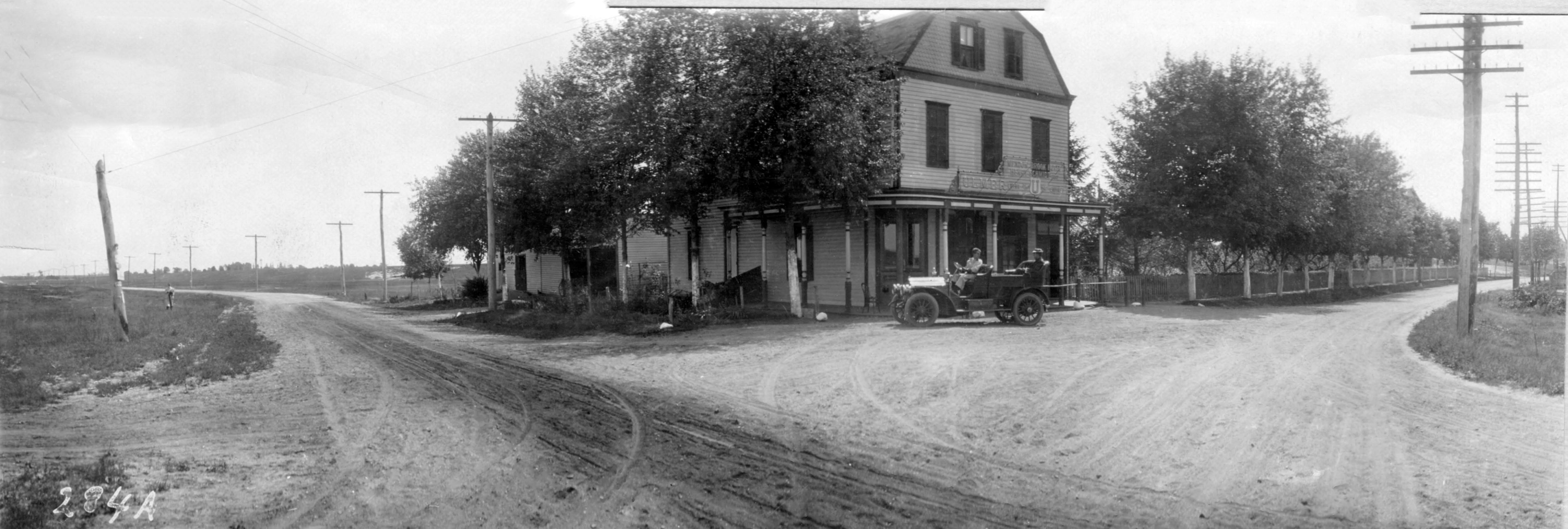
Mystery Foto #7 Solved:The Intersection of Old Country Road & Post Avenue in Westbury (1908 & 2020)

The Garden City Archives challenged you to identify this Mystery Foto of a section of the planned original section of the 1908 Vanderbilt Cup Race course.
Answers to the Mystery Foto questions:
- Identify the location of the Mystery Foto. What is the orientation of the photographer? Hint: This intersection today is one of the busiest on Long Island.
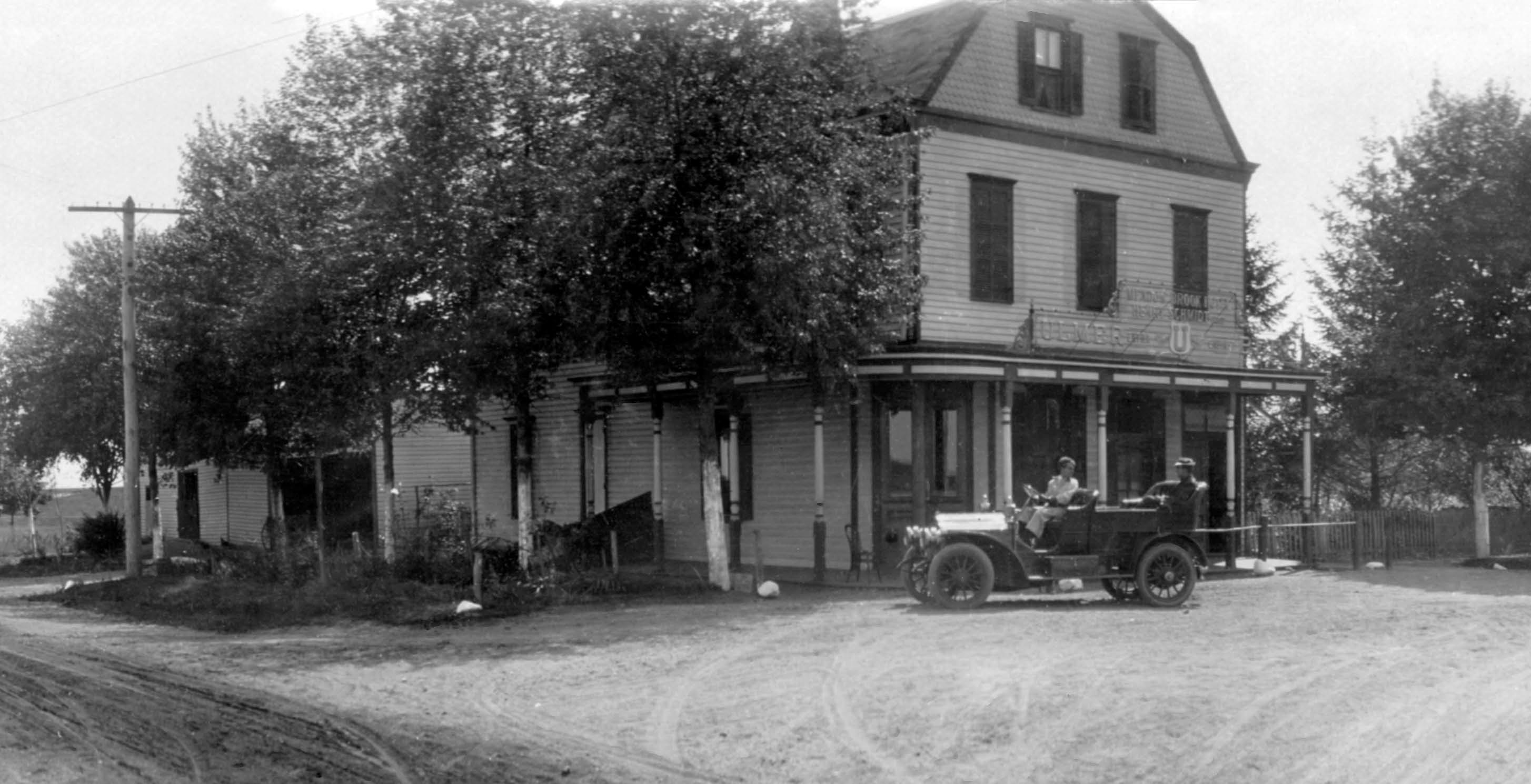
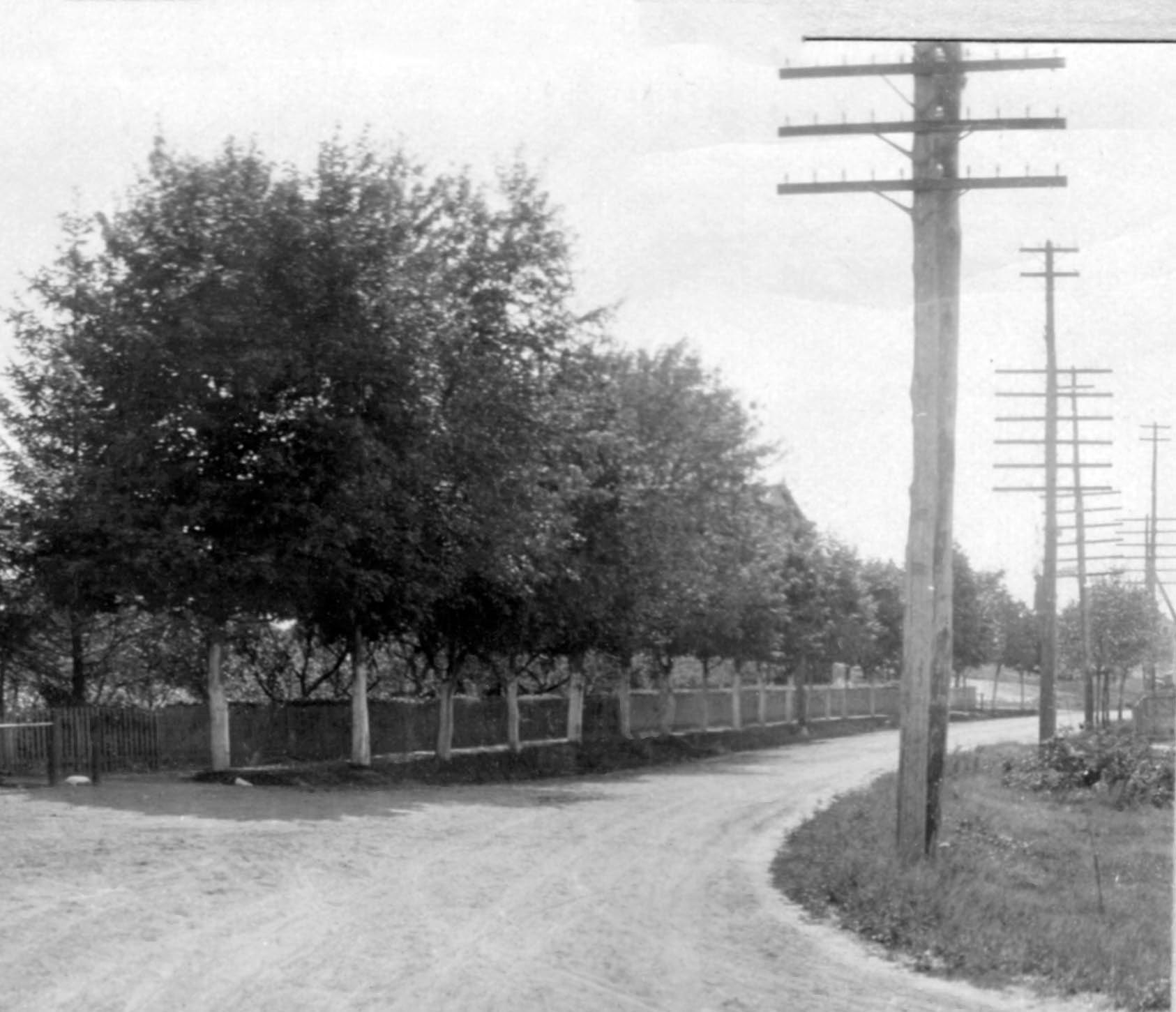
The intersection of Post Avenue (AKA Merrick Avenue, Barnun Avenue and Whaleneck Avenue) and Old Country Road in Westbury. Looking south down Merrick Avenue. East Meadow is on the left and Westbury is on the right.
- Identify the building in the Mystery Foto? Name one or more restaurants that were located in this corner over the last 112 years?
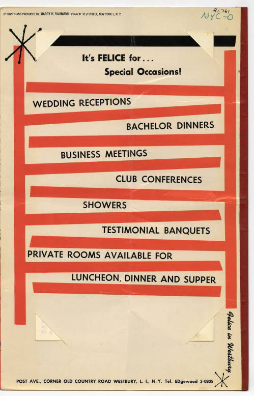
Henry Schmidt's Meadowbrook Hotel. The building was still standing when it became the restaurant Felice in Westbury. It must have still be standing in the early 1960s since I remember eating there when I lived in East Meadow. Later the building was torn down. In 1995, it became the location for Cafe Baci.
- Kudos question: Why was the 1908 course changed to a different location? Where was it changed to?
In September 1908, the course for the 1908 Vanderbilt Cup Race was changed to a location further west utilizing Ellison Road and a temporary road linked to the Motor Parkway. It was likely the course was changed to promote the new Motor Parkway entrance at the Meadow Brook Lodge and Merrick Avenue Bridge. This part of the course was used for the 1908, 1909 and 1910 Races.
Comments (8)
Congrats to Art Kleiner, my favorite co-author Al Velocci and Tim Ivers for correctly identifying the Old Country Road location in Westbury.
Kudos to Art Kleiner for documenting the reason the course was changed.
Shout out to Frank Femenias who discovered a Motor Parkway Bridge in the Mystery Foto!
Enjoy,
Howard Kroplick
Close-Ups
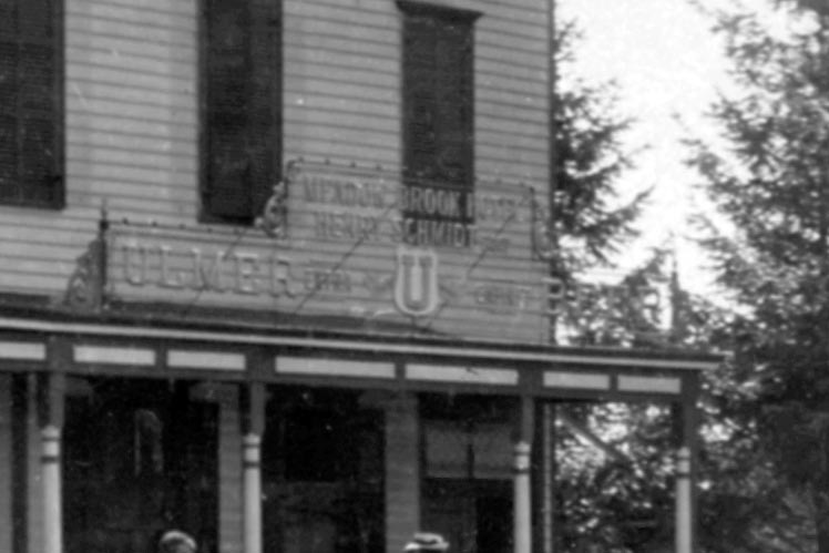
Meadow Brook Hotel
Henry Schmidt Prop.
Frank Femenias zoomed into this section of the Mystery Foto and likely discovered a Motor Parkway Bridge -Over Merrick Avenue.
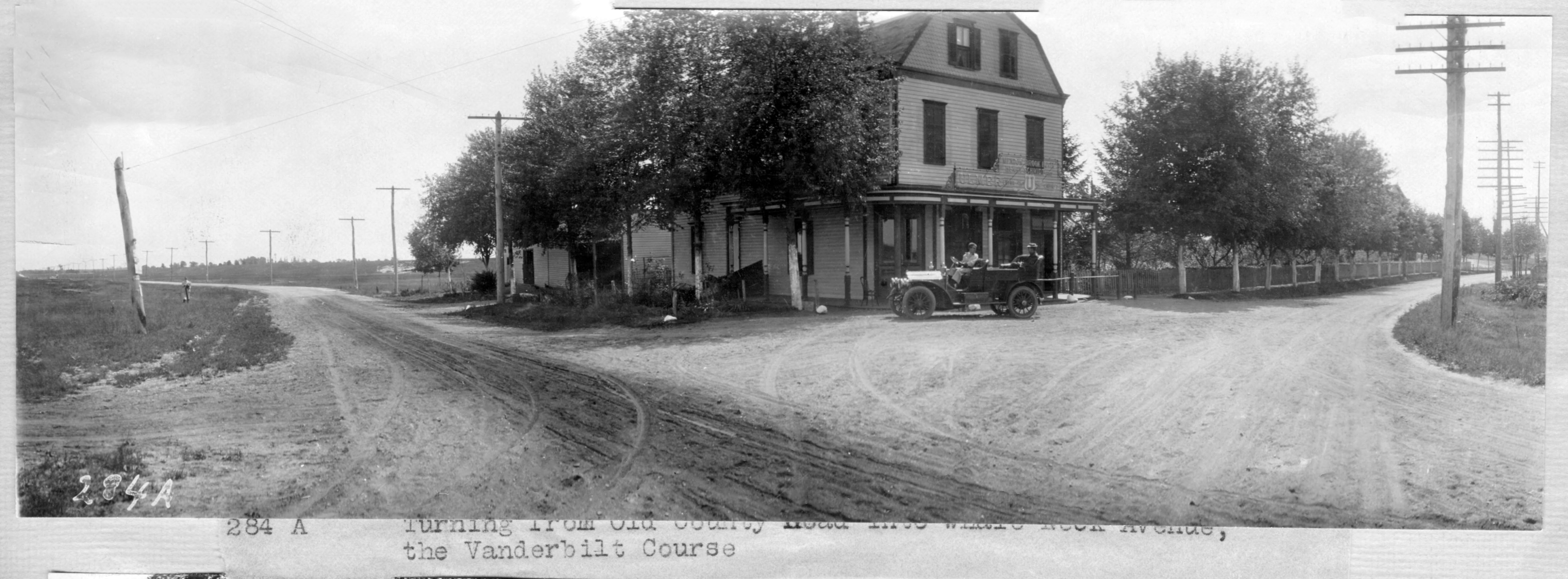
Caption: Turning from Old Country Road into Whale Neck Avenue, the Vanderbilt Course.
1926 Aerial
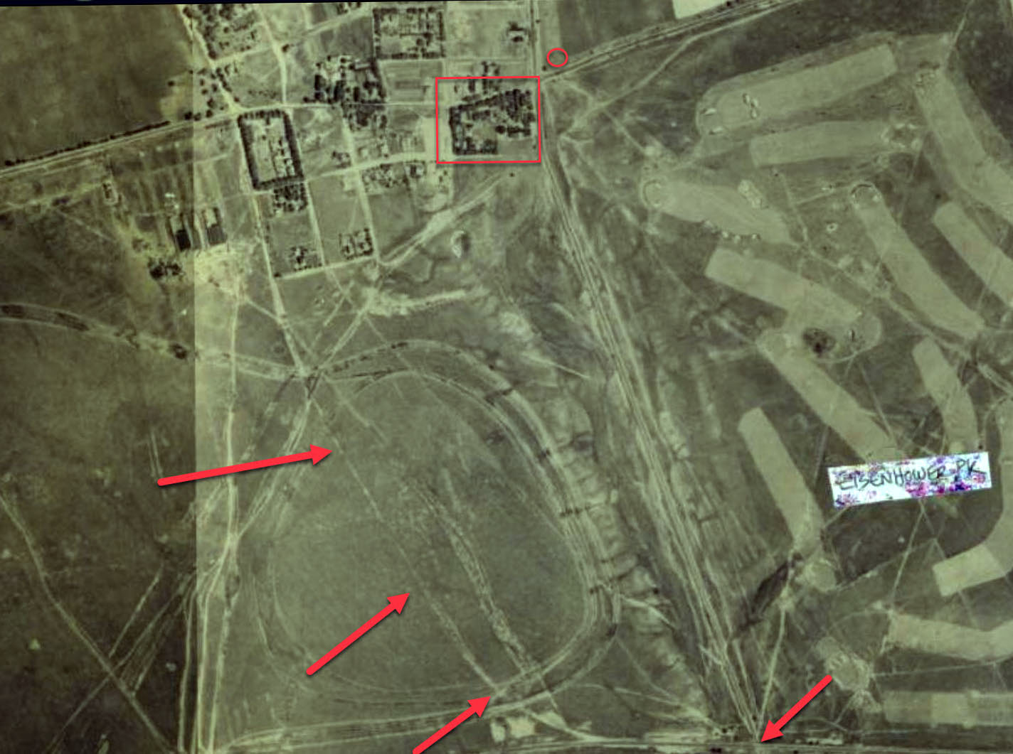
This aerial shows the relationship among the intersection, the Merrick Avenue Motor Parkway Bridge and the temporary road (arrows to the right) that connected the courses to the Motor Parkway could still be seen in this 1926 aerial.
1937 Aerial
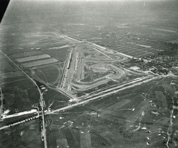
Merrick Avenue can be seen across the diagonal.
Kleiner's Kolumn (Submitted by Art Kleiner)
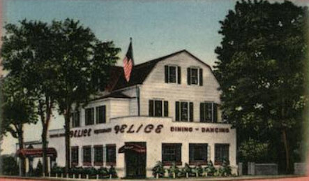
I actually remember the restaurant Felice when growing up in East Meadow. Note the building seen in the Mystery Foto was part of the restaurant.
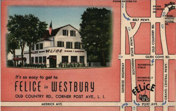
A Felice postcard
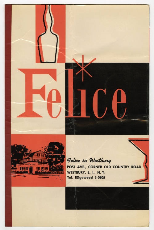
Felice Menu
Then (1908 ) and Now (2020)
1908
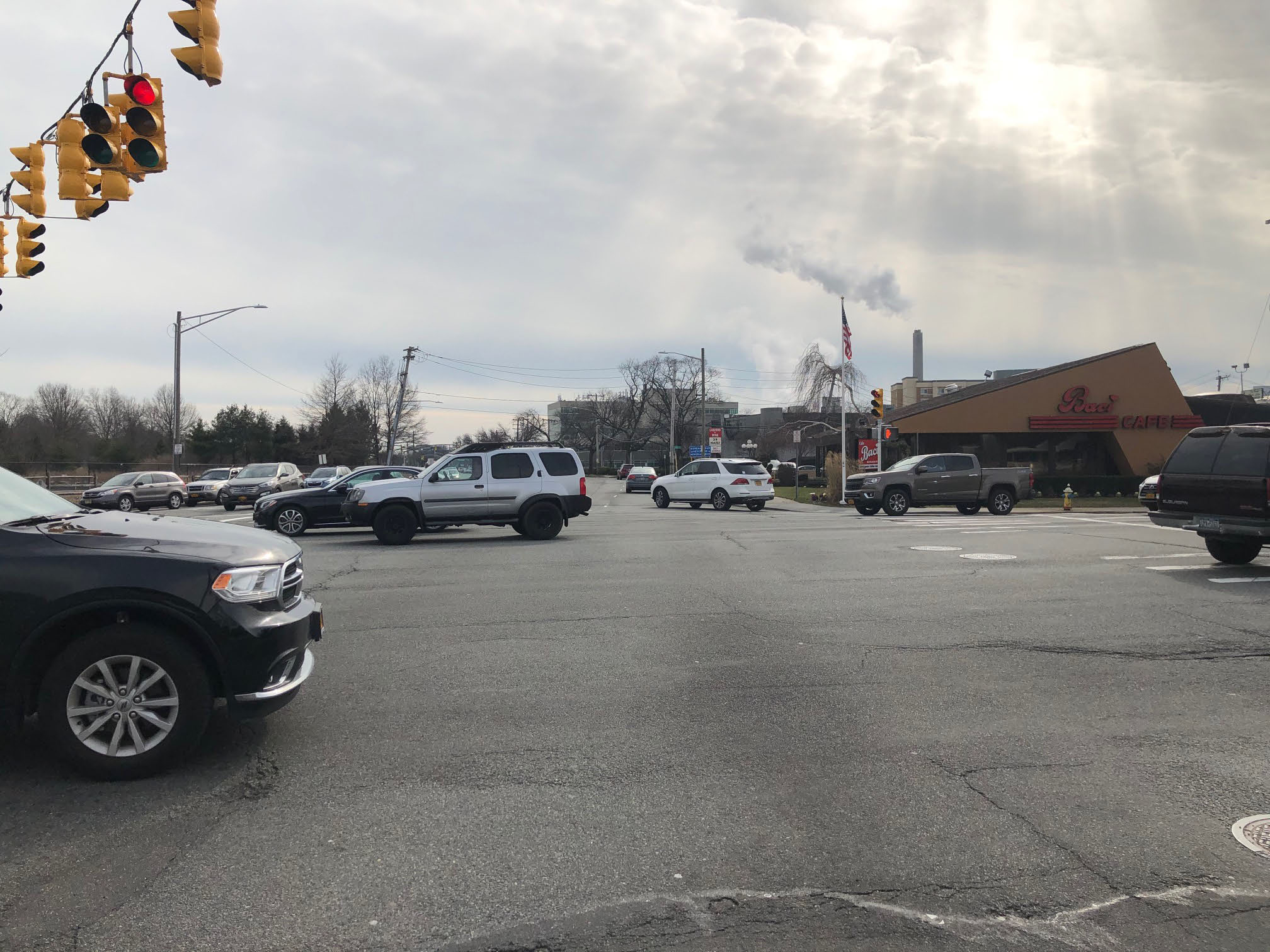
2020: How Long Island has changed in 112 years!


Comments
Intersection of Old Country Road and Barnum (Whaleneck, Merrick) Avenues in Westbury. Looking west down OCR on the right side, south looking down Barnum Ave. on the left.
Identify the building in the Mystery Foto? Name one or more restaurants that were located in this corner over the last 112 years?
Schmidt’s Meadow Brook Hotel (Henry and then Carl prop.); Baci. There was another Meadowbrook Hotel in Hempstead near the Belmont estate (Front Street) in the 20s.
The course was changed so that racers would not have to use Whaleneck Avenue to get to the Motor Parkway part of the course. It was moved a little west to Ellison Avenue. Is that a Motor Parkway bridge further to the south behind the hotel?
Three more docs.
those were the days !!!!!
I’m aware of 3 eating establishments that previously occupied this corner. Schmidt’s Meadowbrook Hotel/restaurant was there during the VCR races time frame, Felice’s restaurant late 1930’s-mid 1960’s ( basically same building) and presently Baci’s .
Looking southwest at Felice’s Restaurant Old Country Rd at Merrick (on left) Avenue and Old Country west to the right. The building looks similar to the match cover picture.
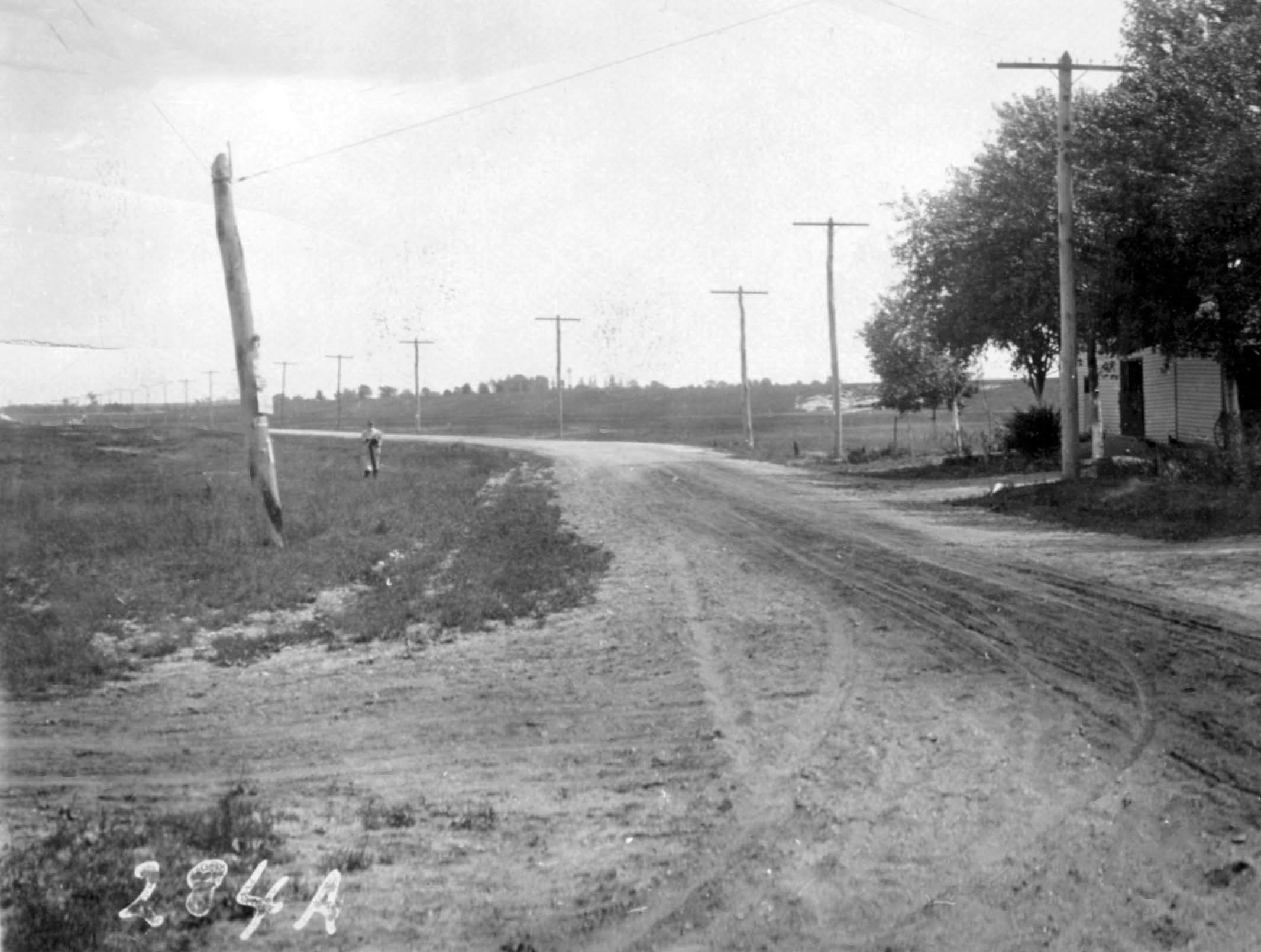
Admiring all the open spaces in this early 20th century Long Island photo. Henry Schmidt’s Meadow Brook Hotel. I believe photo is looking NW but where in Meadow Brook? -This location could be intersection of Old Country Rd and Glen Cove Rd looking NW, with Roosevelt Airfield directly behind photographer. The bend in OCR westbound could be a match to the present day thoroughfare, though much wider today and loaded with red light cameras. Cannot locate any hints of the LIMP underpass just 1/4 mi down the OCR road. Also any sign of LIRR RoW just to the north cannot be seen as well. Wish I could spend just a day here. Take me back, please. Looking forward to this weeks answers!
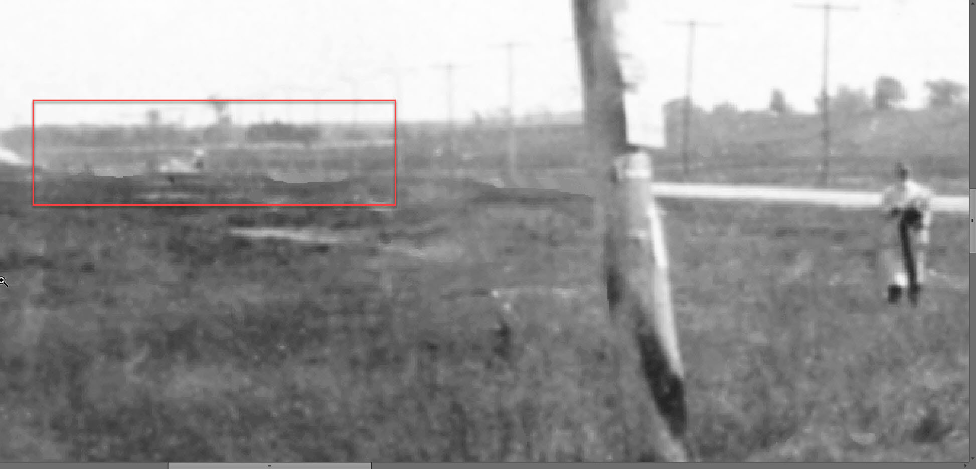
If I’m correct, I may have spotted both the LIMP OCR underpass walls, and LIRR RoW, after opening the last zoomed photo in the Microsoft Paint application. Photo below
Zoom photo cropped below
Pre-Baci’s restaurant! And excellent sleuthing Art. Great information relating to the hotel’s original location and related incidences. Always learning something new here. On the left, part of the original Salisbury Plains still intact, now home to Eisenhower Park’s golf course, just south of Old Country Rd., the same area Dave mentioned just last week. An amazing shot Howard. Thank you Al, Howard, and Garden City Archives for sharing these photos of old Long Island to all.
I’m embarrassed that I didn’t have a clue about any of the questions, because I traveled the Merrick Ave./Post Ave. route many times as a youngster, from our home in Merrick to relatives in Locust Valley, and have eaten in the Baci restaurant.
Now that I see the pictures, I recognize the Felice restaurant, where I never ate. The area has changed extensively even in my lifetime. One thing that did not change from my youth to today, I always remember the intersection as being busy. But not in 1908!
Facebook Page: People who grew up in East Meadow
Howard Kroplick: Does anyone remember the restaurant Felice on the corner of Merrick Avenue and Old Country Road?
_______________________________________________________________
Jacqueline Rubin: I had dinner there in the early 60’s. Nice place.
Adam Schaefer: Cafe Bacci on the corner of Merrick Ave and Old Country Rd, used to be a quick serve Chinese place called Rickshaw.
Myk Mäyo: Adam Schaefer my dad used to take us there all the time in the mid 80’s. The Baci sign in front still has a decidedly Asian look to it.
Richie Shor I remember it as a young kid going with my parents for dinner.
Gene Scheinberg: Sure my dad’s favorite…garlic bread knots in little paper bags
Julie Standish Mangano: My parents favorite when they were flush with cash, which wasn’t often.
One more pic from a 1927 map of Westbury.
Excellent observation Howard. That looks like the LIMP approach to the Merrick Av bridge, most definitely. I missed it.
Felice’s? OMG! I’d forgotten all about it. Wonder if the Greentree, up Post Avenue, wasn’t also used by the sporting set? Seems to me that Whaleneck Road and Merrick Avenue were two different roads, with WR just west of MA, as shown on my Central Nassau page <http://sbiii.com/limpcns1.html>. See also George Thane’s aerial on my VCR page <http://sbiii.com/limpvcup.html> (where I conflated them in the text). Other images are lost so HELP, please! Sam, III
Let’s spend a few days at the Meadow Brook Hotel, I hear they have good rates.