Mystery Friday Foto #53 Solved: The #8 FIAT driven by Felice Nazzaro practicing at the 1906 Hairpin Turn in Old Westbury

Paul Mateyunas challenged you to identify the last Mystery Foto of 2022.
Answers to the Mystery Foto questions:
Identify:
- The location of the racer and orientation of the photographer/artist.
The Hairpin Turn located at the intersection of the Wheatley Road and Old Westbury Road in Old Westbury. The building on the right was 1 Wheatley Road which was sadly demolished in 2017. The photographer is looking northwest.
- The racer and its driver
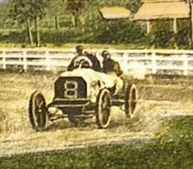
This is the #8 FIAT driving by Felice Nazzaro.
- The approximate date of the Mystery Foto. Provide a rationale.
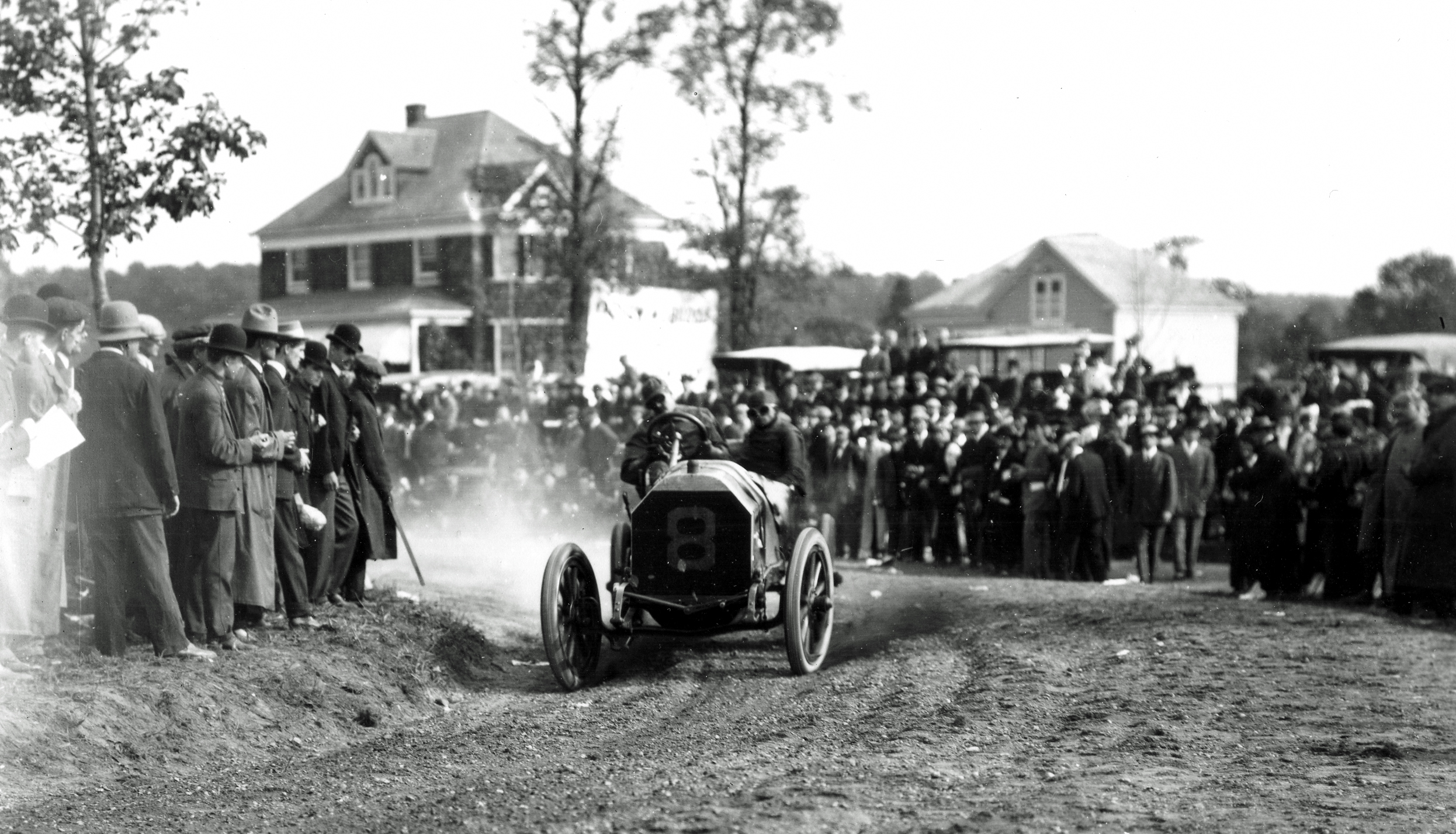
Based on the absence of spectators, Nazzaro is practicing for the 1906 Vanderbilt Cup Race which was held on October 6, 1906. The date is likely the first week of October 1906.
Comments (5)
Congrats to David Miller, Joseph Oesterle, Steve Lucas, Mark Lanase, and Art Kleiner for identifying the #8 FIAT driven by Felice Nazzaro at the Hairpin Turn.
Kudos to David Miller, Steve Lucas and Mark Lanase for recognizing the Mystery Foto was a practice run.
Enjoy,
Howard Kroplick
Close-Ups
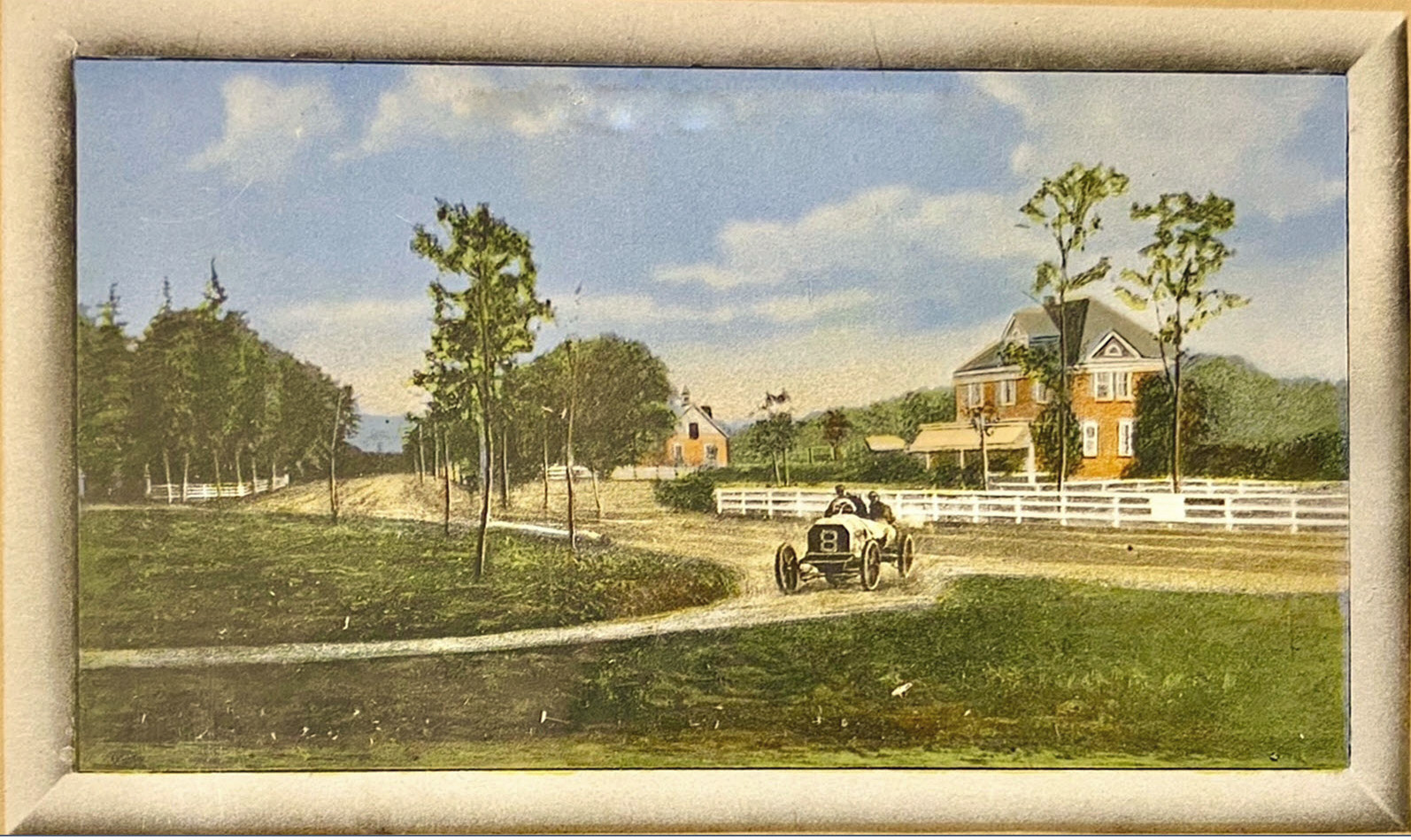
Original Postcard

The Mystery photo was a colorized postcard of the below photograph. Note the caption.
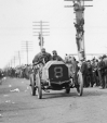
Original Photograph
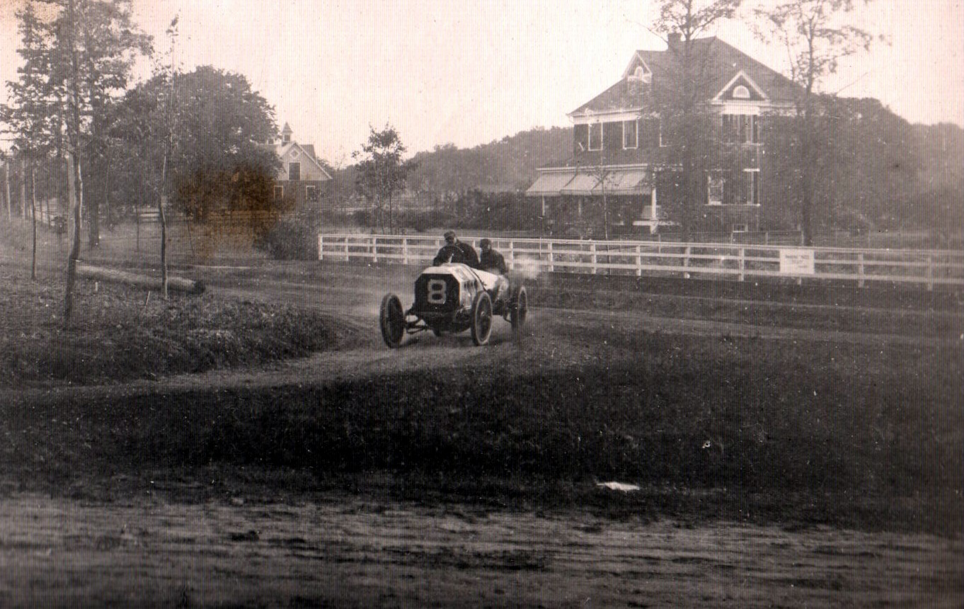
The #8 FIAT driven by Nazzaro at the Hairpin Turn during the 1908 Vanderbilt Cup Race on October 6, 1906.
Felice Nazzaro
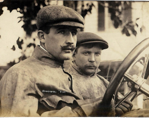
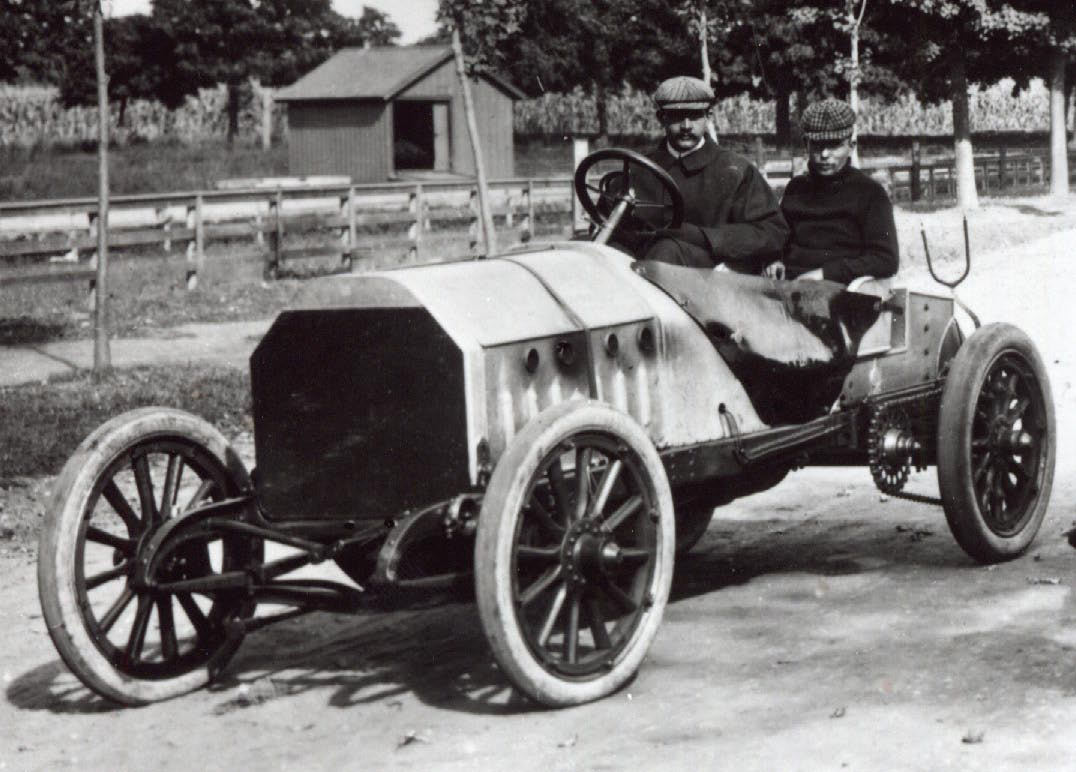
Felice Nazzaro and his mechanician in the #8 FIAT.
The 1906 Vanderbilt Cup Race. Felice Nazzaro driving the #8 FIAT at the Hairpin Turn can be seen at the 0.53 second mark.
The 1906 Hairpin Turn Americarna nterview with Howard Kroplick.


Comments
This is Felice Nazzaro driving the #8 Fiat during a practice run before the 1906 Vanderbilt cup race. The photographer/artist is facing north as the racer is headed southbound on Wheatley rd making a right at the “hairpin turn” to go northwest onto Old Westbury rd. The photo was take sometime shortly before the October 6th 1906 VCR. I do not know when the artist’s rendition of it was created. The fact that this was a right turn really narrowed the search down for me. A November 18th, 2017 vanderbiltcupraces.com entry shows corroborating information about this “hairpin turn”.
1906. Wheatly Rd turn west onto Old Westbury Rd.
Photo facing North East.
Absolutely love this picture.
I think we might be looking at an artist’s rendering of the #8 Fiat driven by Felice Nazzaro. We are looking north up Glen Cove Road in Old Westbury as Nazzaro enters the hairpin turn onto Old Westbury Road. Since there are no spectators, this is probably a test run for the 1906 Vanderbilt Cup Race sometime around the first week of October, 1906.
The photographer is looking north up Wheatley Road in Old Westbury. The driver is Felice Nazzaro in his #8 Fiat. He is having a practice run before the 1906 Vanderbilt Cup Race turning from Wheatley Road onto Old Westbury Road.
This would be the Hairpin Curve at the intersection of Old Wheatley Road and Old Westbury Roads in Old Westbury. The artist appears to be looking at the point at which the racers turn right going west (slightly north). Car is the FIAT driven by Felix Nazzaro. Date would be approx. the last week of October, 1906 as the date of the race was October 30. No spectators would indicate the racer doing a practice run on the course prior to the race.
Happy new year everyone.
You guys always mess this up! This is the intersection of Wheatley and Post Road. Not Old Westbury road, which is not close to this location.
Wheatley road was basically the former driveway of “Wheatley” which was the estate of E.D. Morgan, portions of which still remain.
Yeah unfortunately this house was torn down a few years ago. I hate when historical houses are ripped down to be replaced with McMansions. Old Westbury still has plenty of amazing spots though.
Dave. Are you saying that this section of what we now know as Wheatley Road between the North Service Road of the LIE and Post Road (roughly 1 mile north) was a private road that was used for the race?
No it wasn’t a private road but I’ve read several articles about Old Westbury and it talked about this basically being the driveway. The Wheatly estate was built between 1890-1900 btw.
This is from the Old Long Island web site:
There is a great story somewhere on the ‘Lost Village of Wheatly’. It talks about how there used to be this very tiny little enclave between Old Westbury and Brookville called Wheatly from a term the Natives had used. ED Morgan and WC Whitney wound up buying the vast majority of the little village when they built their estates.
The current configuration of Post Road as it is with it’s S curve as it ascends the hill is that way because the original Post Road ran right through what became Morgan’s estate. He and Whitney paid to have the road moved between their estates and had it planted (which is why it is one of the nicer stretches of road through Old Westbury). I think current day Morgan Drive is roughly the route the original Post Road would have taken you.
Wanted to leave these “marked maps” that show the 1906 course, this course on a 1926 aerial and a today map. Trying to show all the roads described in the comments : )
I can see that the race course turned south onto Glen Cove Road then branched onto Red Ground Road and somehow weaved through Old Westbury towards the hairpin turn. Anyone know if there was a connecting road that is long gone now?
Mark - I became creative with the course southeast of Red Ground Rd. Here’s a couple of maps from 1914 and 1939. 1914 map shows Red Ground Rd extending southeast towards Wheatley and Old Westbury Rd. That seems to be the course route. 1939 map shows Red Ground as it’s today. Hastings La connects with Wheatley Rd, unofficially on the map.
Brian. Interesting how many roads got reconfigured through the years because of LIE ect. The 1939 map shows Hastings merging into Wheatley Rd. Do you have these actual maps or is this off a website?
From Greg O.
Brian- you are correct. Tonight’s post should clear it up.
Sounds good, Greg. Looking forward to the blog : )
Mark - I screenshot those maps from websites - Course Maps are here on the site, of course. NassauCounty.gov website - LRV ( Land Record Viewer ) has 1926 & 1950 aerials, as well current property maps. HistoricMapWorks website - has Atlases for just about everywhere. I also like SuffolkCounty.gov - GIS Aerial maps from 1947 till now, also shows property data. Tried looking at GIS maps yesterday, but it looks the website is reconfigured. Look again soon.
I have no idea what the 1906 course route was, but I do know Old Westbury and I always thought from the pics of the hairpin turn that spot seemed to be exactly at the location of present dayWheatley and Post Road.
And the house that was in all the old pics, that was there until a few years ago right at that spot.
Dave. If the house in the picture is indeed the one that was torn down and we know that it was a few hundred feet from the intersection of Wheatley and Old Westbury Roads, how could it have been at the intersection of Wheatley and Post.
That’s the whole point Mark. I thought the picture/house was at the intersection of Post and Wheatley. I think the location you are talking about is not correct. The house that looked exactly like the house in the pics was at the intersection of Post and Wheatley.
From Greg O.
Dave- The house in the 1906 photos is at #1 Wheatley at Wheatley Rd &Old; Westbury Rd., torn down on 2017. There may have been a similar house at the location you’re asserting, but it is not the hairpin landmark. Hopefully my post tonight clears it up when Howard makes it live later.
Greg. All clear now.
Brian. Thanks for the info on online maps.