Mystery Foto #49 Solved:Hazelhurst Field, Garden City Lodge,Curtiss Engineering & Camp Mills in 1918
Author Richard Panchyk challenged you again to identify another amazing previously unpublished Mystery Foto.
Mystery Foto Questions:
- What is the location and orientation of the photographer?
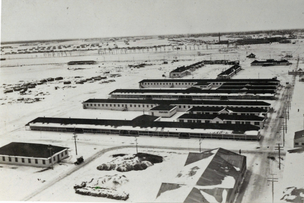
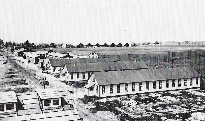
Looking south over Hazelhurst Field towards Stewart Avenue in Garden City.
- Identify the four historic sites/buildings in the Mystery Foto.
-The barracks of Hazelhurst Field, a military airfield built for World War I. The barracks were built in 1917 and taken down for a golf course in the late 1920s.
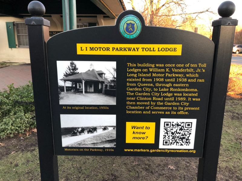
-The Garden City Lodge and General Manager's first office building of the Long Island Motor Parkway
-The Curtiss Engineering Headquarters and factory complex
-Camp Mills
- Which buildings still exist today?
-The Curtiss Engineering headquartes and factories
-The Garden City Lodge moved to Seventh Street in Garden City.
- Which Motor Parkway structure(s) are in the photo?
The Garden City Lodge, the embankment to the Clinton Avenue Motor Parkway Bridge and the General Manager's first office.
- .Identify the road surrounded by the array of trees seen across the top of the photo?
Stewart Avenue
- What month and year was this photo taken? Provide a rationale.
January 1918. Rationale: The Hazelhurst barracks, the General Manager's first office building and snow on the ground
- Kudos question: How was the photographer able to take this photo?
The photographer was standing atop a water tower in Hazelhurst Field.
Comments (17)
Congrats to Art Kleiner, Lee Chambers, Andy, George Philippides, Greg O., Steve Lucas, Tim Ivers, Joe Oesterle, Brian McCarthy and Frank Femenias for recognizing the Garden City locations.
Kudos to Art Kleiner, Greg O., Brian McCarthy and Steve Lucas for identifying the water tower as the photographer's shooting location.
Enjoy,
Howard Kroplick
Close-Ups
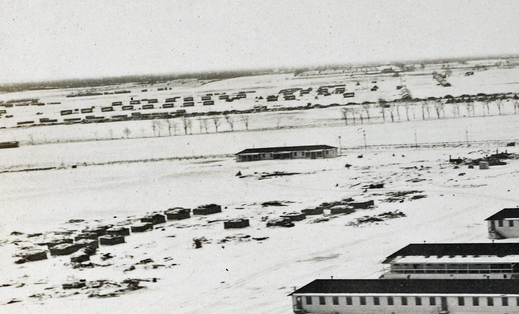
The array of trees along Stewart Avenue in Garden City
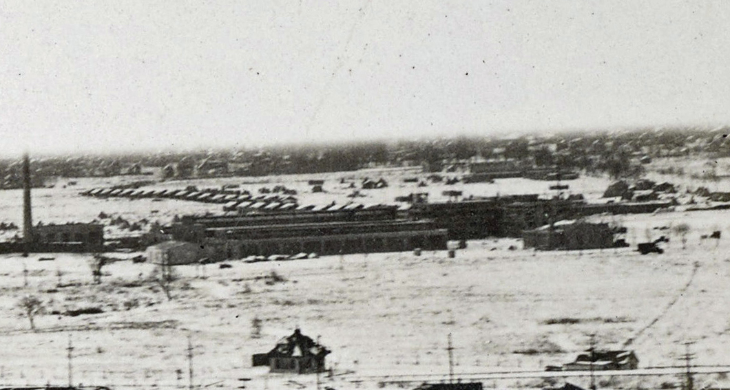
Curtiss Engineering headquarters and factories with Camp Mills buildings in the background.
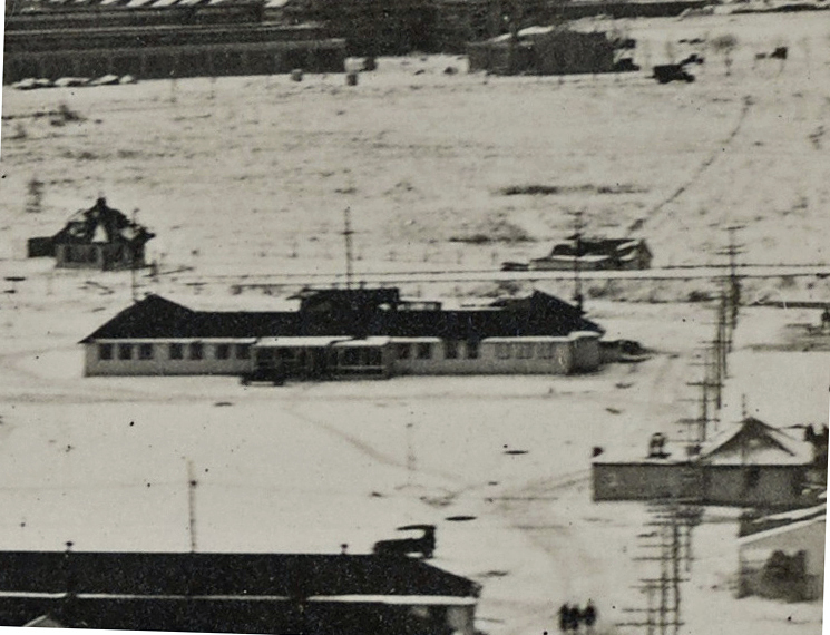
The Garden City Lodge (left), the embankment to the Clinton Avenue Motor Parkway Bridge and the General Manager's first office building.
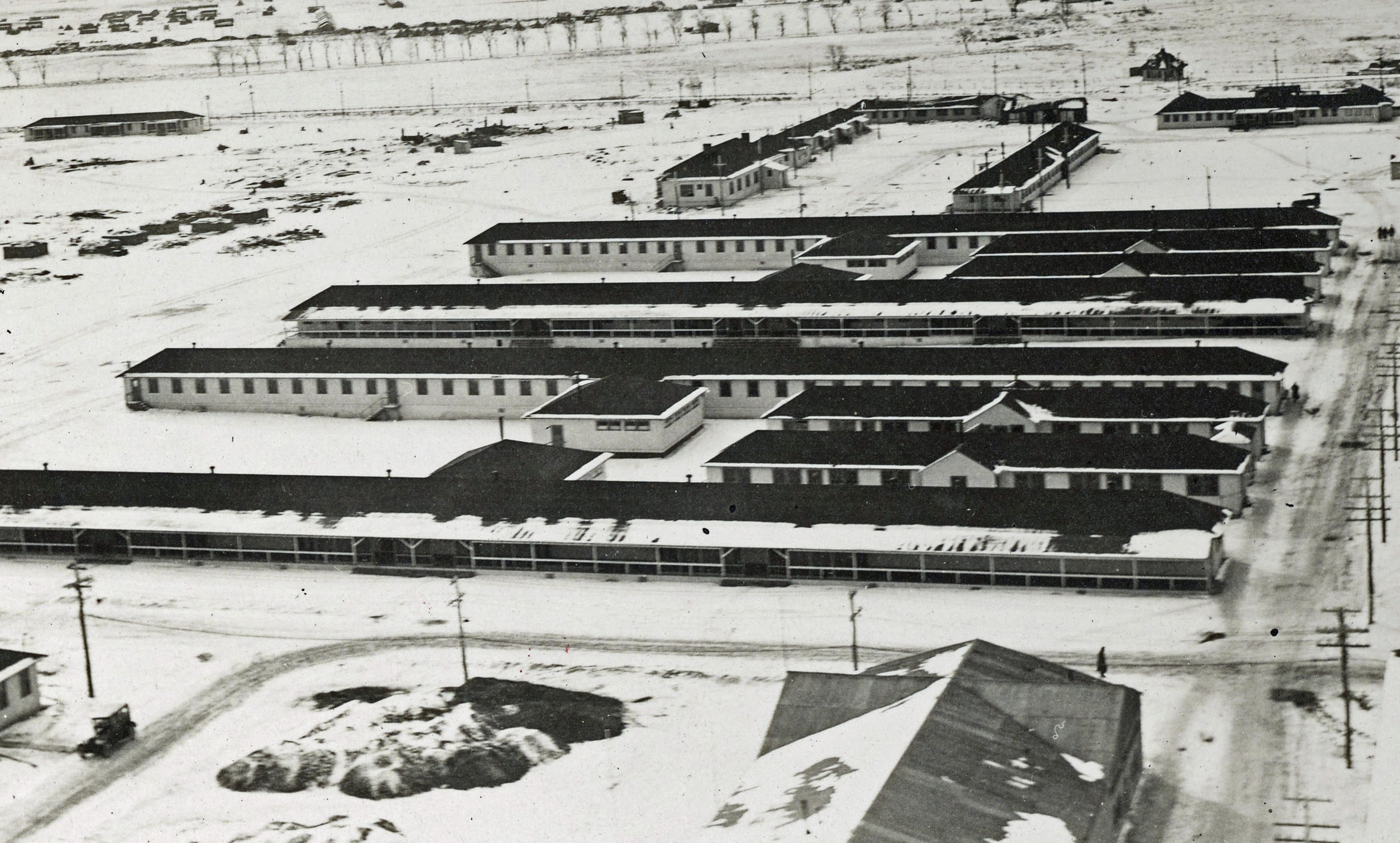
The barracks of Hazelhurst Field.
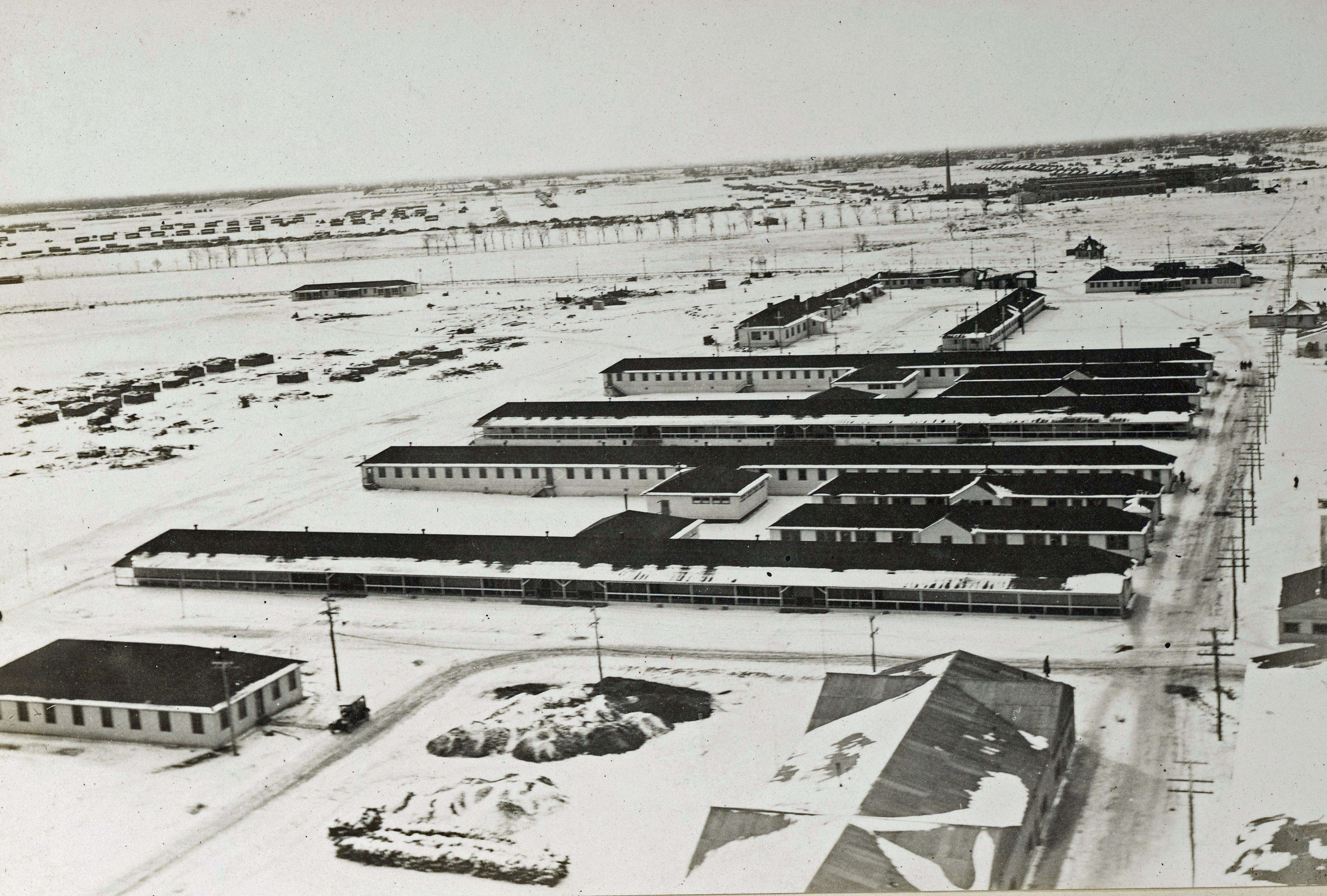
1926 Aerial Looking North
2014 Mystery Foto #53 showed the same area looking north.
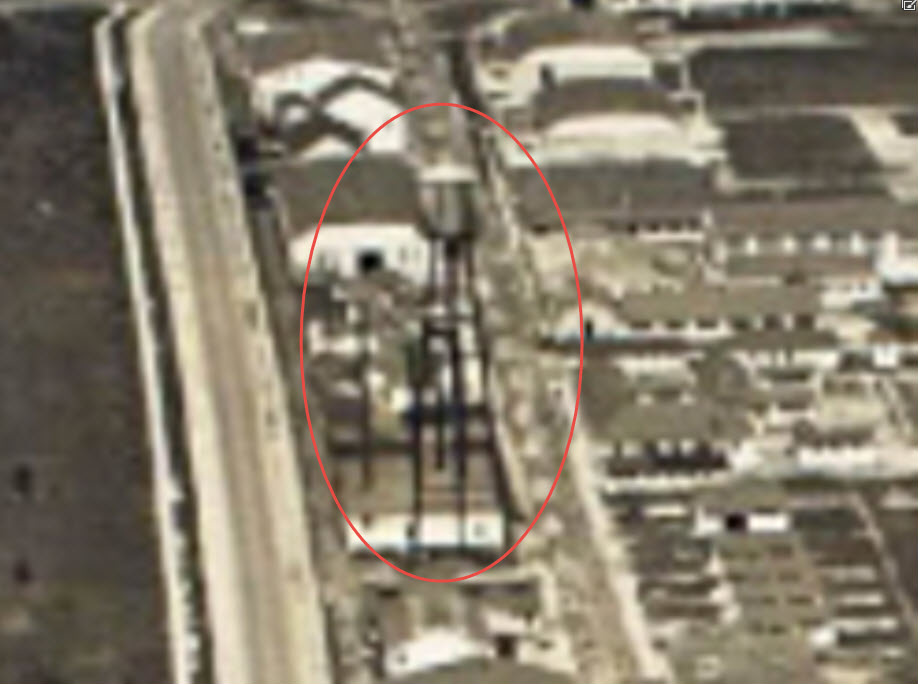
The water tower where the photographer shot the Mystery Foto.
Hazelhurst Field
In preparing for World War I, the army took over the Hempstead Plains Airfield in 1916. This view looking north show the new barracks also seen in the Mystery Foto. The original Hempstead Plains hangars can be seen in the background.
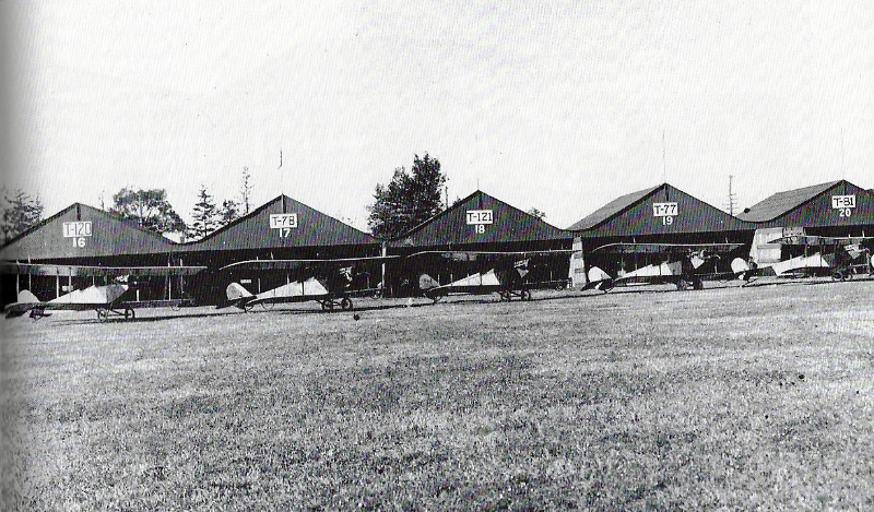
Army fliers flight training with Curtiss JN-4s at Hazelhurst Field.
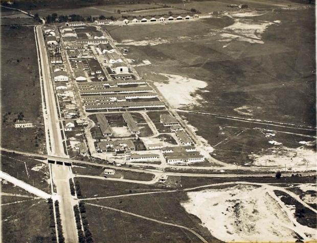
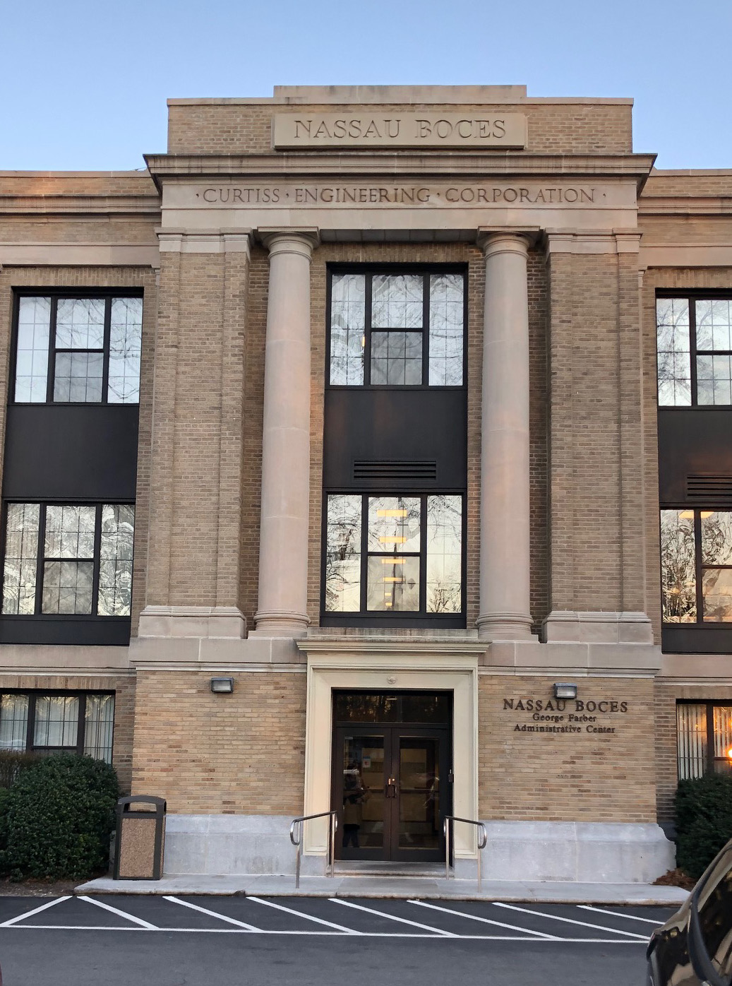
Curtiss Engineering Complex
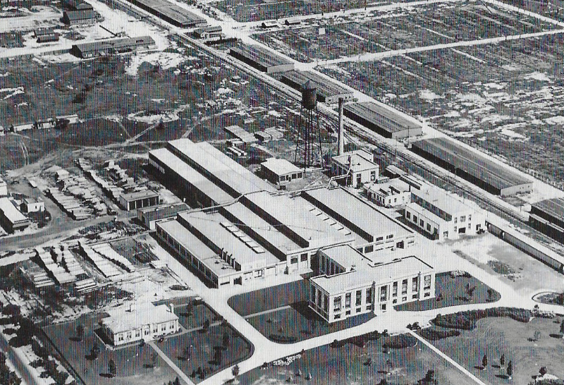
The complex as seen circa 1925.
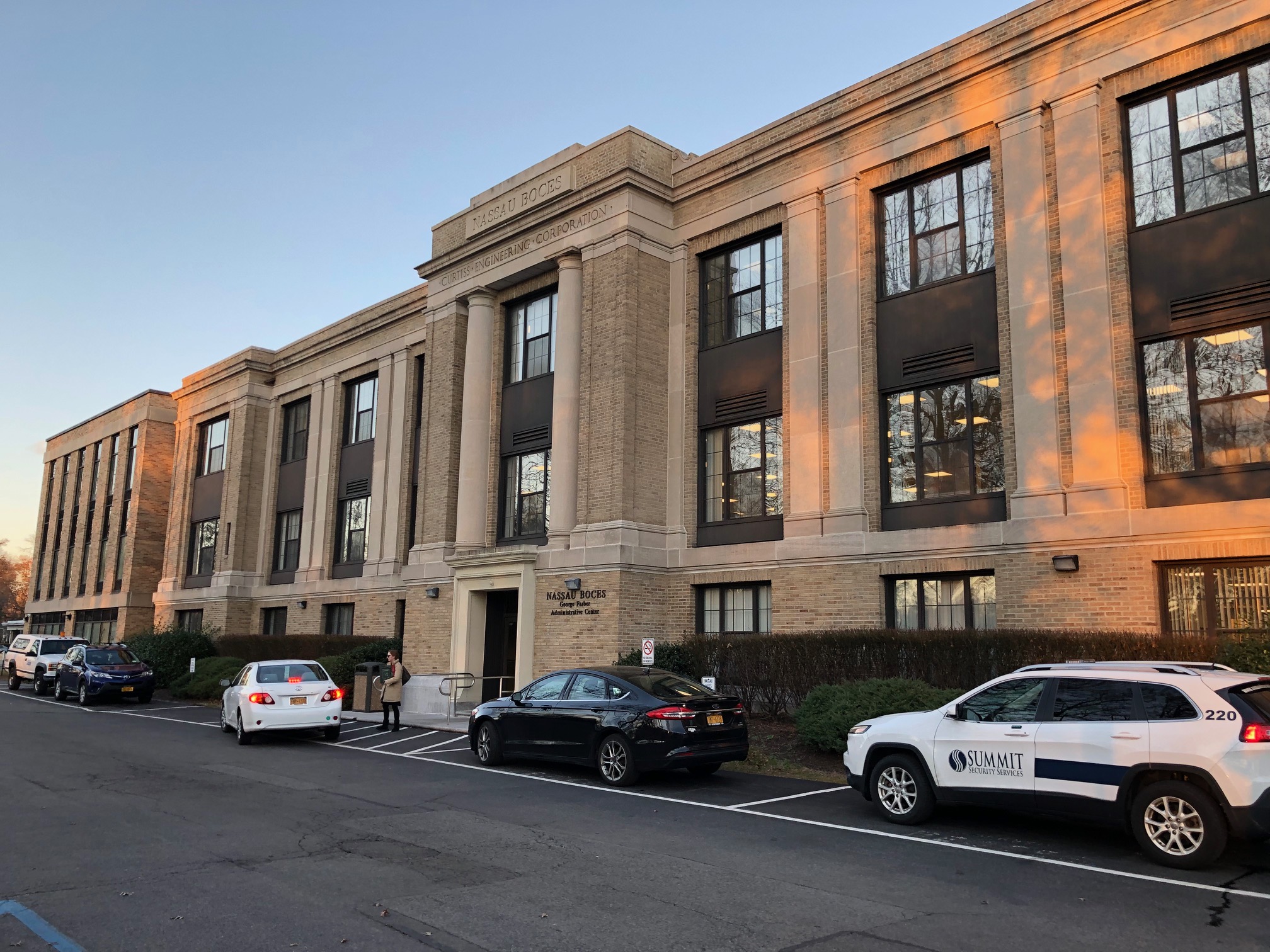
The Curtiss Engineering Headquarters building today.
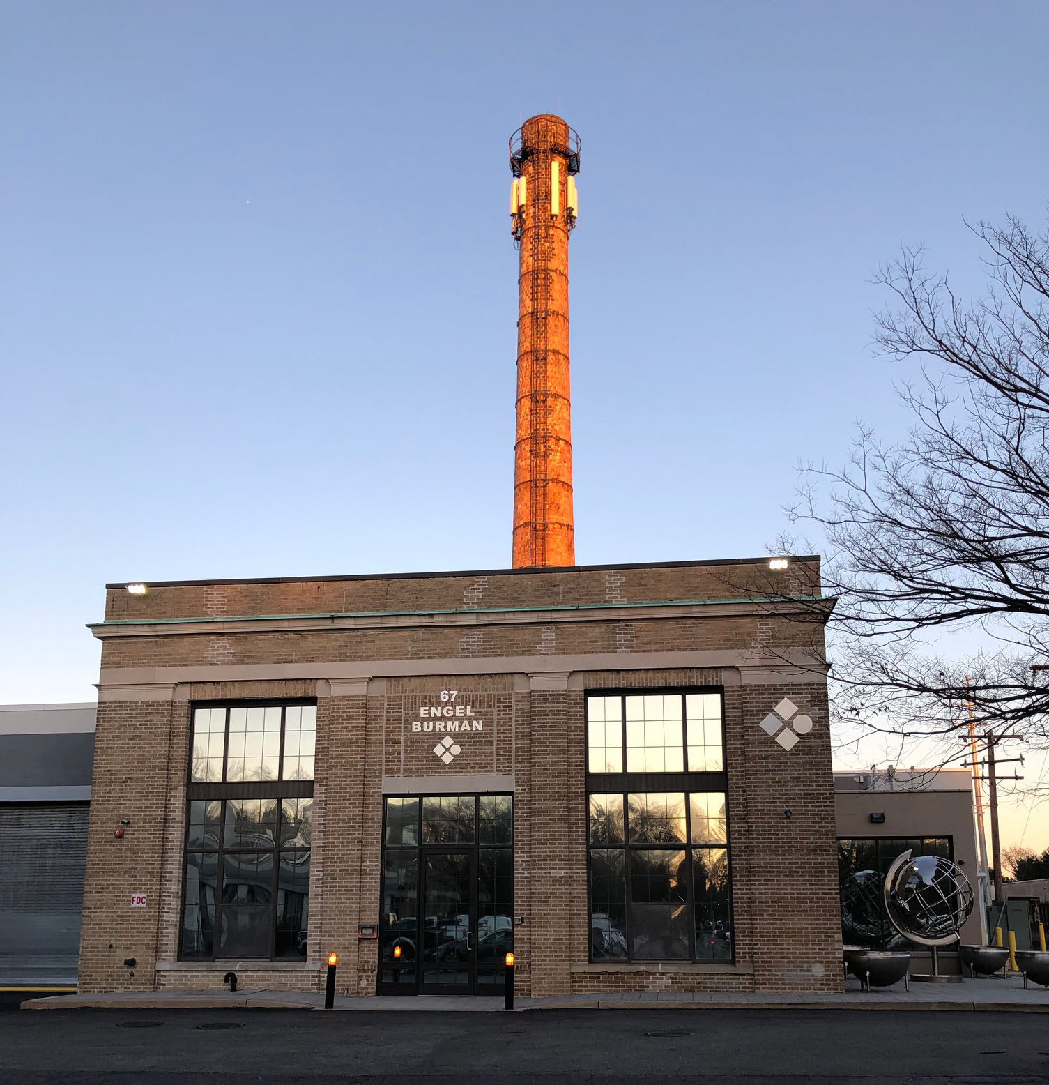
The Curtiss Power Plant. Look carefully and you can read C-U-R-T-I-S-S on the smokestack.
Stewart Avenue
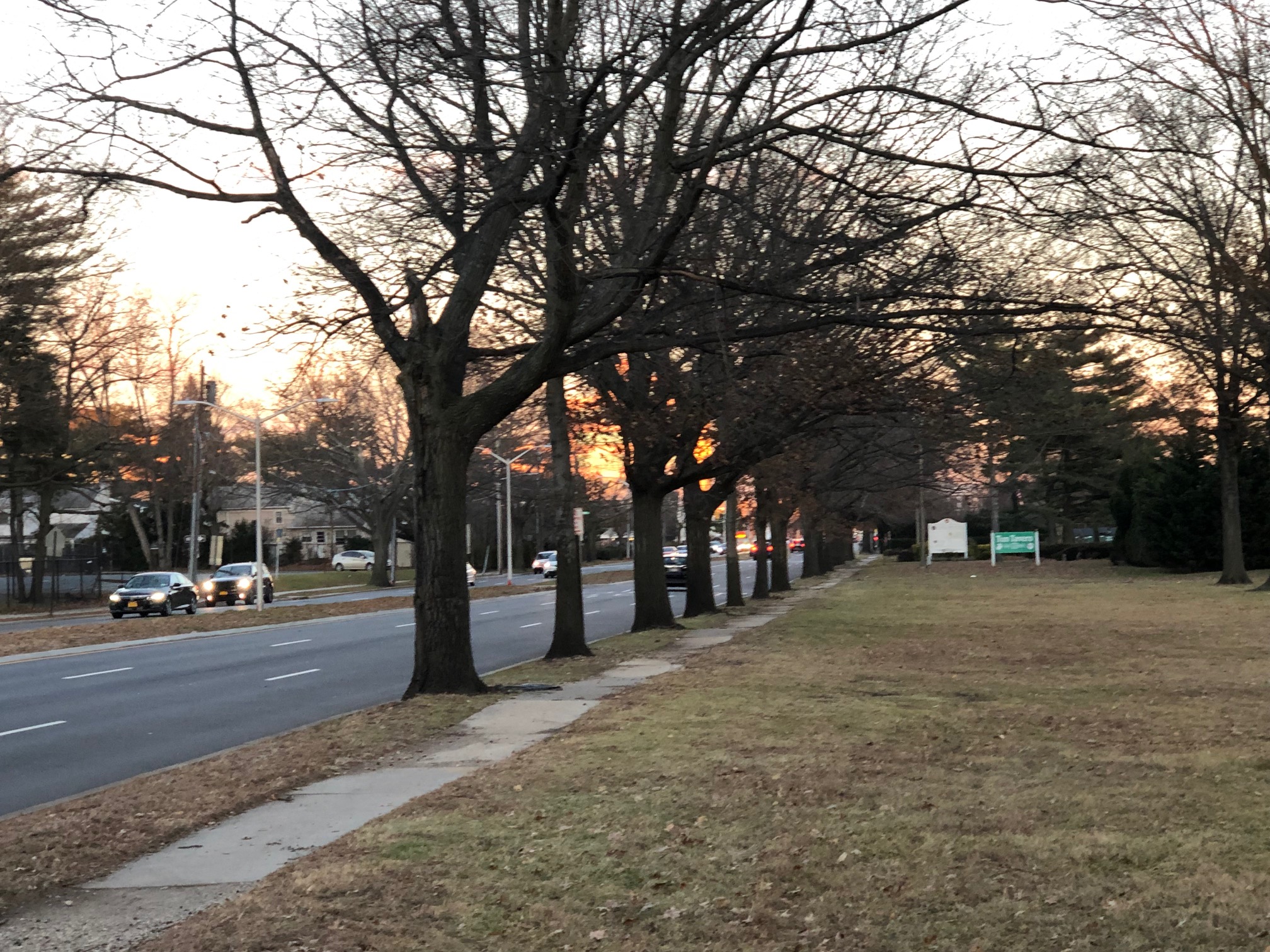
An array of trees still exist along Stewart Avenue in this section of Garden City.
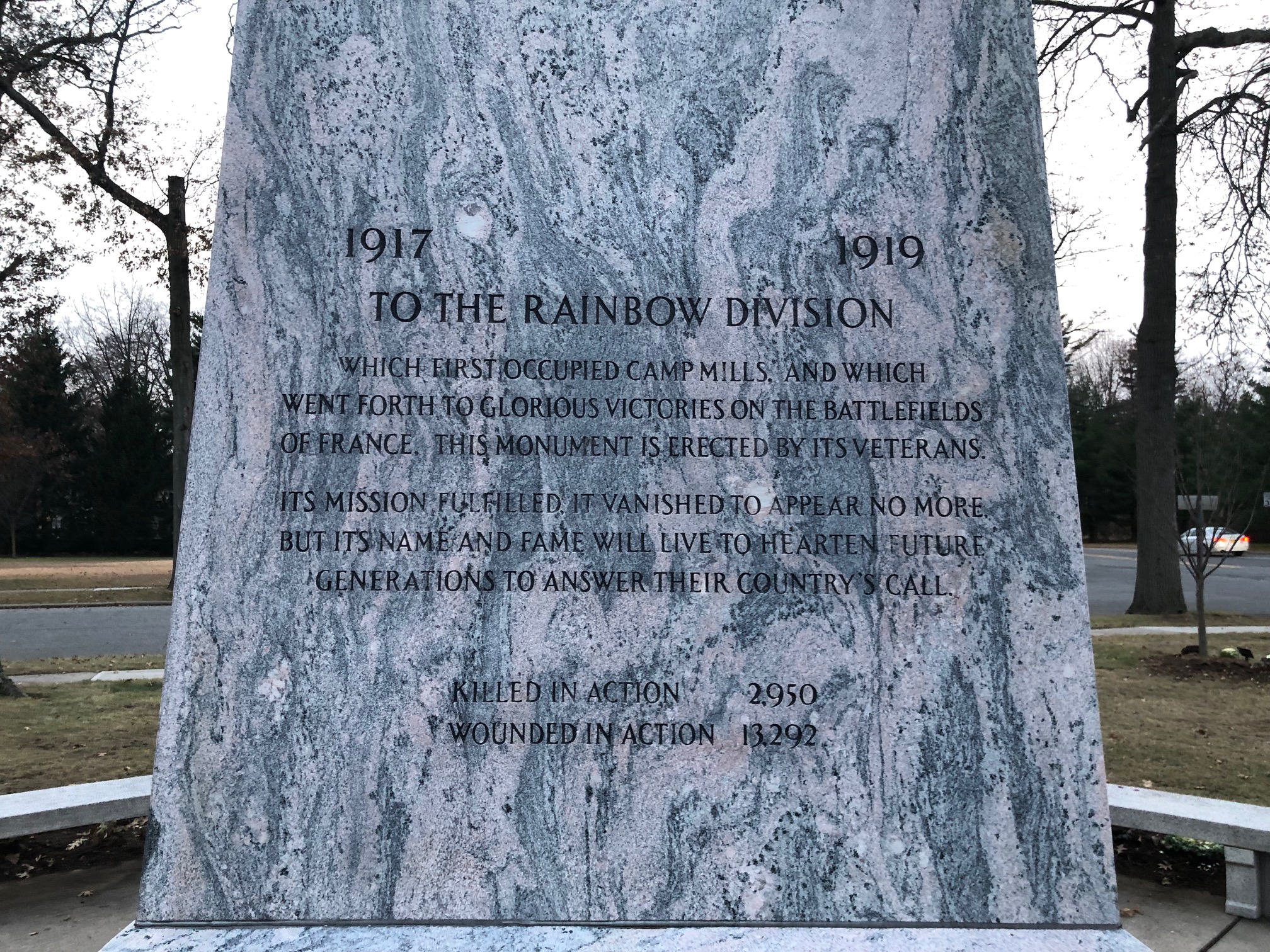
Camp Mills Monument
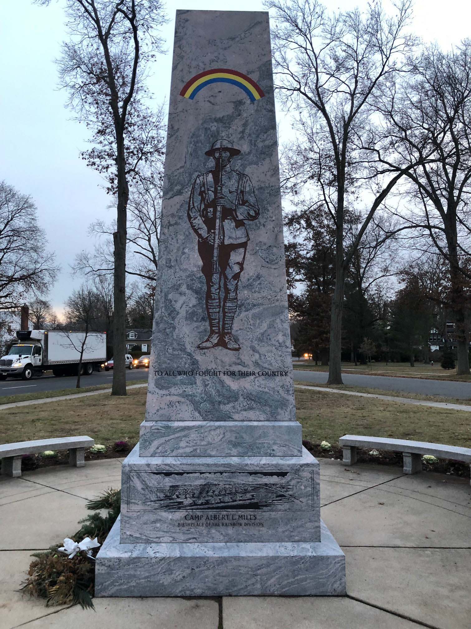
The Camp Mills monument on Clinton Road and Saint James Street in Garden City.
Garden City Village Historian Bill Bellmer has provided this link to 160 images of Camp Mills.
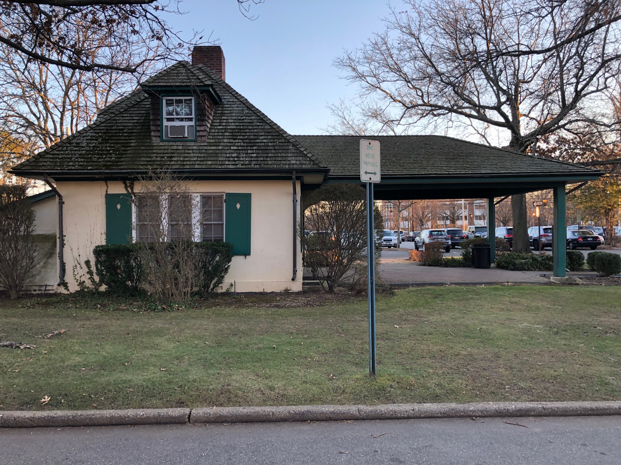
Garden City Lodge
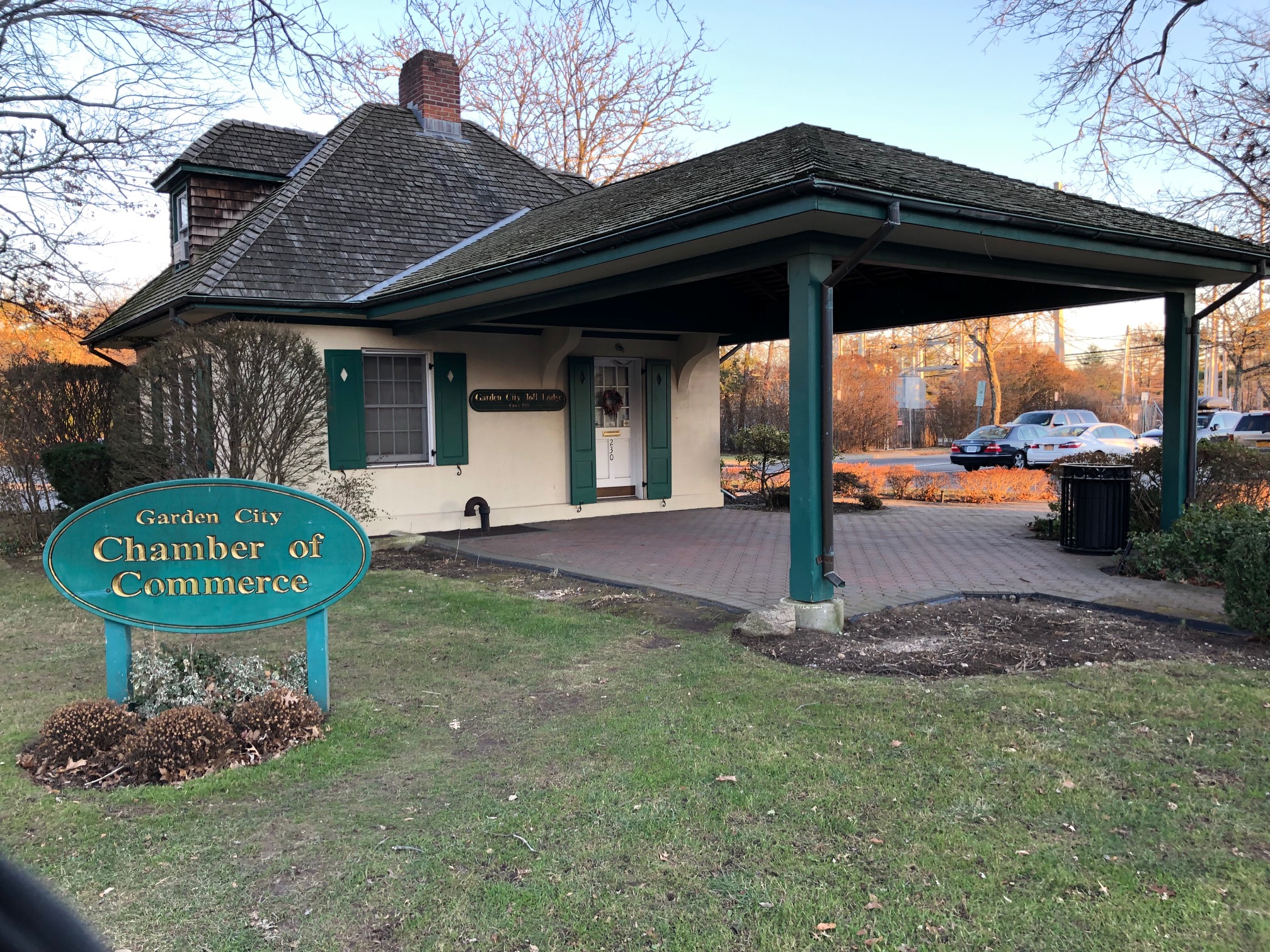
Now the headquarters for the Garden City Chamber of Commerce.
Femenias' Findings (Courtesy of Frank Femenias)
1927 Department of Commerce Airway Bulletin


Comments
Let’s see.
Garden City, looking east
Camp Mills, Curtis Engineering Plant (with smokestack) - building still standing, Curtis Field
Clinton Road Motor Parkway Bridge, General Manager’s Office, Lodge
Clinton Road
Looks kind of cold - How about January, 1919
Photographer standing on a water tower ?
Possibly wooden structures at Camp Mills related to the Base Hospital? Photo may have been taken at low altitude from a biplane from Mineola Aviation Field #1 (Roosevelt Field) or Mineola Aviation Field #2 (Mitchel Field). Orientation would be slightly to the Southeast.
Building with the smokestack may have been the Camp Mills Power Building. Buildings off in the distance may have been associated with the Curtis plant in Garden City.
Row of trees may be the LIMP or could be Stewart Ave with the LIMP running parallel to it. Central RR branch appears to be in the foreground parallel to it.
Small brick structure may be the Garden City toll/entrance to the LIMP which still stands today further south as the Chamber of Commerce in downtown GC.
Camp Mills was decommissioned in 1919. Photo is likely from that approximate period.
Is that the Durea Starch factory on glen cove Creek with the li tungsten factory tower in the background ??
Photo Number Two.
Long Building in background next to smoke-stack, Look like Liberty Aircraft.
Was on Motor Ave, Farmingdale N Y
The photograph is oriented to south facing over Clinton Ave in Garden City. Some historic buildings include Roosevelt Field airfield buildings, Vanderbilt Toll House GC Clinton Ave and Lodge. The Curtis manufacturering building and smoke stack. The tree lined street is Stewart Ave. EST date 1938.
Hmmm As always , a great photo…I,m guessing , but I suspect ,it may be Mitchell Field, The Elevated photo suggests it may have been taken from the Control tower! A hsort story! i was born in 1941, So i have some very early recollections of Mitchell field as a kid! .. I recall on a shopping trip to Hempstead, ( in my parents car,) Spotting a parachute on our return trip to Farmingdale…( in levittown area, ) The mystery was solved the next day, when the Paper revealed a Pilot had ejected from an early jet, After he aimed it ,out over the Atlantic ocean! ( to crash?) Long Island, A great place to grow up ,in WW2 ! I recall much, regarding all the history of aircraft factories here, Republic, and Grumman… My father never quite understood my love of Flying? How could I not love airplanes…...they were always over my head as a kid!
A complete guess. South/southeast from a vantage point north of the Motor Pkwy, Stewart Ave. and the Central RR tracks.
Location/Orientation: Over Roosevelt field near intersection of Clinton and Old Country Road ( I grew up one block from that intersection) looking south.
4 historic sites include the Clinton st bridge (gone), Curtiss Engineering building (there), Garden City Lodge(moved to 7th street GC) and General Managers office (still there)
Tree lined road on top of photo is Stewart Avenue.
Month and year- guessing a winter month, say December, some time in late 1920s early 1930s judging from building development.
Usually these photos are aerial photos, but this one looks a bit low.
Might have been taken from the water tower that used to be on Clinton, near the Old Country road intersection.
-What is the location and orientation of the photographer?
Looking South over Hazelhurst/Roosevelt Field.
-Identify the four historic sites/buildings in the Mystery Foto.
Curtiss Engineering, Hazelhurst Field, Camp Mills, Mitchel Field
-Which buildings still exist today?
Most of Curtiss Engineering’s buildings, The Garden City Lodge exists as the Chamber of Commerce at a different location, and the LIMP managers office is still there.
-Which Motor Parkway structure(s) are in the photo?
Garden City Lodge and Manager’s office.
-Identify the road surrounded by the array of trees seen across the top of the photo?
Stewart Ave.
-What month and year was this photo taken? Provide a rationale.
Purely a guess, but I’d say winter of 1920ish judging by buildings and lone car.
-Kudos question: How was the photographer able to take this photo?
From the top of the Hazelhurst water tower.
We are looking south over East Garden City with Clinton Road just out of the frame to the right. In the foreground is Curtiss Field with the LIMP, Garden City Lodge, and General Manager’s office behind it. Slightly further south is the Curtiss Engineering complex of buildings. Some of the Curtiss buildings still exist today, along with the office (now a residence) and the lodge (moved to different site). The road at the top of the photo is Stewart Avenue. The date of the photo is probably November / December, 1929 since there’s snow on the ground, the larger General Manager’s office has been constructed but the porte-cochere has not yet been added to the lodge. The photographer probably climbed up the water tower at Curtiss Field for this amazing photo.
Another flat forehead moment! That factory and powerhouse sure look like the old Liberty Aircraft plant north of Conklin between Broadhollow/110 and New Highway, up against the LIRR in Pinelawn - except that Liberty may have been on Motor Avenue in Farmingdale (oh, HELP!), neither of which is particularly close to the LIMP. Sam, III
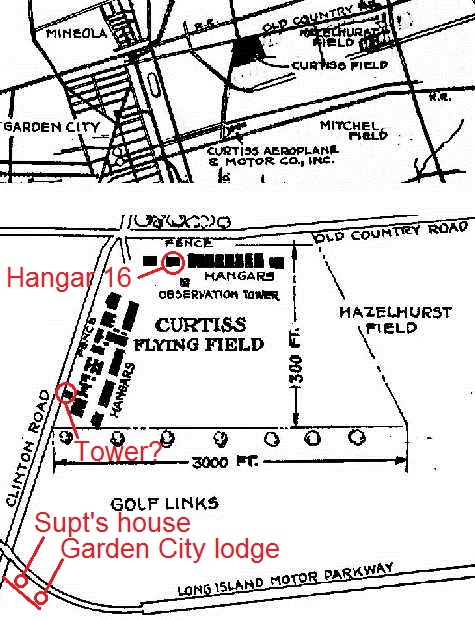
Curtiss Airfield (Roosevelt Airfield) looking south, East Garden City. This photo is about midway between Vanderbilt Court and Old Country Road. Clinton Rd just off to the right of photo. Clinton Road Motor Parkway bridge also just to the right. Motor Parkway roadway is beginning its ascent towards the bridge at ¾ top right. Historic sites/structures could be 1: Garden City Motor Parkway Lodge (Moved to 7th St, Garden City, now GC Chamber of Commerce building/museum), 2: Motor Parkway Supt’s house on Vanderbilt Court (Still there!), 3: Curtiss Engineering Corp/Smokestack (Both structures still there), 4: Future Roosevelt Airfield (still there today as Roosevelt Field, New York State’s largest shopping mall with 2,400,000 sq.ft. of retail floor area), also home of Hangar 16, Colonel Lindbergh’s “Spirit of St. Louis” airplane storage for his historic 1927 transatlantic solo flight. Hangar 16 in the photo would be located behind about 1900ft. (0.36 mi.), on the corner of Clinton Rd and Old Country Rd. I believe all the Curtiss Airfield buildings shown have been replaced.
Tree-lined Stewart Avenue in the distance (Still there!).
Photo date is approx Nov-Mar, about 1927, during this configuration of buildings at Curtiss.
Photographer could be on top of an observation tower. Attaching a 1927 Curtiss map with possible tower.
They look like WW1 Army Barrack’s
Looking south across Curtiss Field .
The Garden City Lodge visible in center.
Treed roadway is Stewart Avenue
Smokestack and adjacent buildings were the Curtiss Aircraft complex (buildings still exist)
Looks to be snow on rooftops; estimated date February 1931.
Photo may have been taken from observation tower south of Old Country Road.
The old WWI hospital, near Camp Mills in Garden City, south of Old Country Rd. Perhaps the picture was taken from a water tower?
-joe o
*Location/Orientation: East Garden City viewing basically south.
*Historic Sites/Structures: Curtiss Engineering Corp, Camp Mills, Garden City Toll Lodge, and Curtiss Field.
*Existing Structures of Significance: Curtiss Corp structures, Garden City Toll Lodge.
*LIMP structures: Garden City Toll Lodge ( no porte cochere ). Motor Parkway Office ( General Manager’s Office is yet to be ).
*Road w/array of trees: Stewart Ave.
*Month & Year of image/ Reasoning: Pre - 1929. Camp Mills 1917 thru 1921+, Curtiss Corp. est 1918, Field named Curtiss 1920 thru 1929. There’s a single building to the east of the cluster of buildings within Curtiss Field. This single building isn’t apparent in the 1925 and 1929 images of this location. Still have to guess: Winter of 1924 is my answer
*Location Of Photographer: Atop Water Tower within Curtiss Field.
My guess is Republic Aviation, route 110, from a small plane? Best I can do. Happy holidays Howard!
Fantastic responses here on the Motor Parkway! Amazing to find many still attached to this roadway. Please share your visions on this historic highway!
Was the date of this image considered part of the mystery? Or is the image captioned with a date?
January 1918 according to Richard
O.K., folks; I KNEW I’d be embarrassed but, if Liberty was on Motor Avenue, then what was the factory I describe on Conklin? It was there well into ca. 1960-70 and I always “:knew” it as Liberty. With all the aero and historical power amassed for this thread, SOMEONE must know! Looks like the ruins are still there; satellite view at <http://sbiii.com/histpix/libertyx.jpg>. New thread? Sam, III
Hi Sam, the factory by Conklin may still have existed in 1994. Sending Howard an aerial with buildings intact. Don’t know what was there.
Also, there is today a Liberty Industrial Finishing plant on Motor Ave.
Liberty Industrial Finishing
https://www.cerc.usgs.gov/orda_docs/CaseDetails?ID=141
P. S. - It occurred to me to look at Street View for the Conklin site, opposite Stew Leonard’s, <http://sbiii.com/histpix/l1bertyx.jpg> and that’s NOT the plant I remember at all, far too big, nor is this 1941 view of Liberty <http://sbiii.com/histpix/librty41.jpg>. The place was definitely at Conklin and New Highway, diagonally across the tracks from the Pinelawn L. I. Nat’l Cem., probably in the empty lot there now, and the building was a big simple rectangle parallel to the tracks and Conklin with dark (rusty?) sides and a peaked roof. C’mon, someone! This REALLY has me going, now! Sam, III
Sam, the factory you refer to is the old Fairchild Republic plant. Yes, there is still one building remaining. I was there a few weeks ago. It was badly damaged in a fire a few years ago.
Richard, thanks but I respectfully submit that the building at the far east end of the Conklin lot far predated Republic (perhaps even predating Seversky). When I first saw it, ca. 1960, it already was very old, appearing to be from WWI. I may well be manufacturing memories here but the longer I think about it, the more I think it had the name “Liberty” on it or on the stack. The extant foundation and ruined building on the lot are west of that, in the E/W center of the lot. Sam, III
‘Tis I, again! I just realized that the second Close-Up, “Curtiss Engineering headquarters and factories”, shows a small but substantial building just in front of the Engineering building, left (east) of the truck on Stewart. When I worked in the NW corner of the Engrg. building ca. 1958, that was the LI Nat’l Bank (my first adult account), later Franklin, now Chase. As a North-oriented person, I made up a ref. map to show this - <http://sbiii.com/histpix/curt_map.jpg>. B=Bank, E=Engrg., F1=orig. factory (with pass-through), F2=later factory, P=power plant, plus (approx.) T=toll lodge and S=super’s bldg. More fun; love this! Sam,III