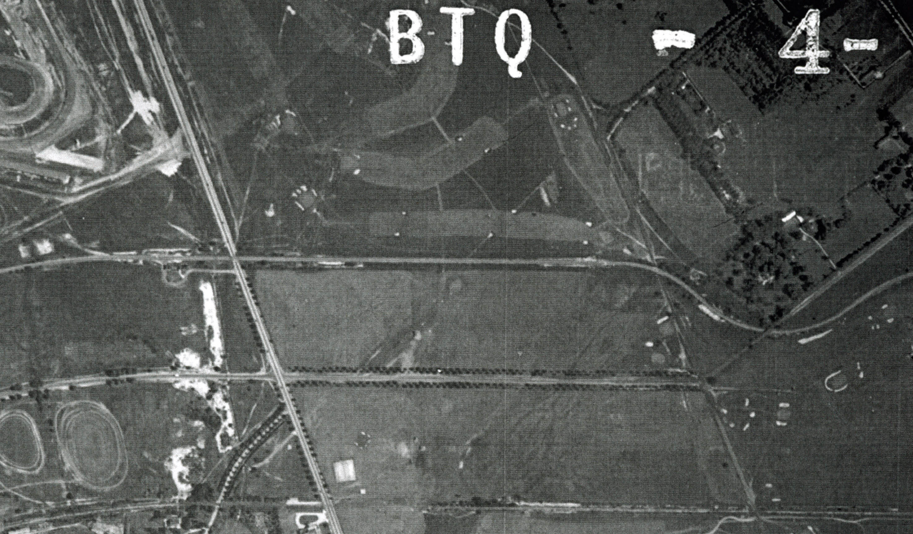
Mystery Foto #29 Solved: A 1966 Aerial of “Salisbury Park” in East Meadow and the Motor Parkway ROW

Author Richard Panchyck challenged you once again to solve a Mystery Foto.
Answers to the Mystery Foto questions:
- Identify the location, major roads and sporting areas
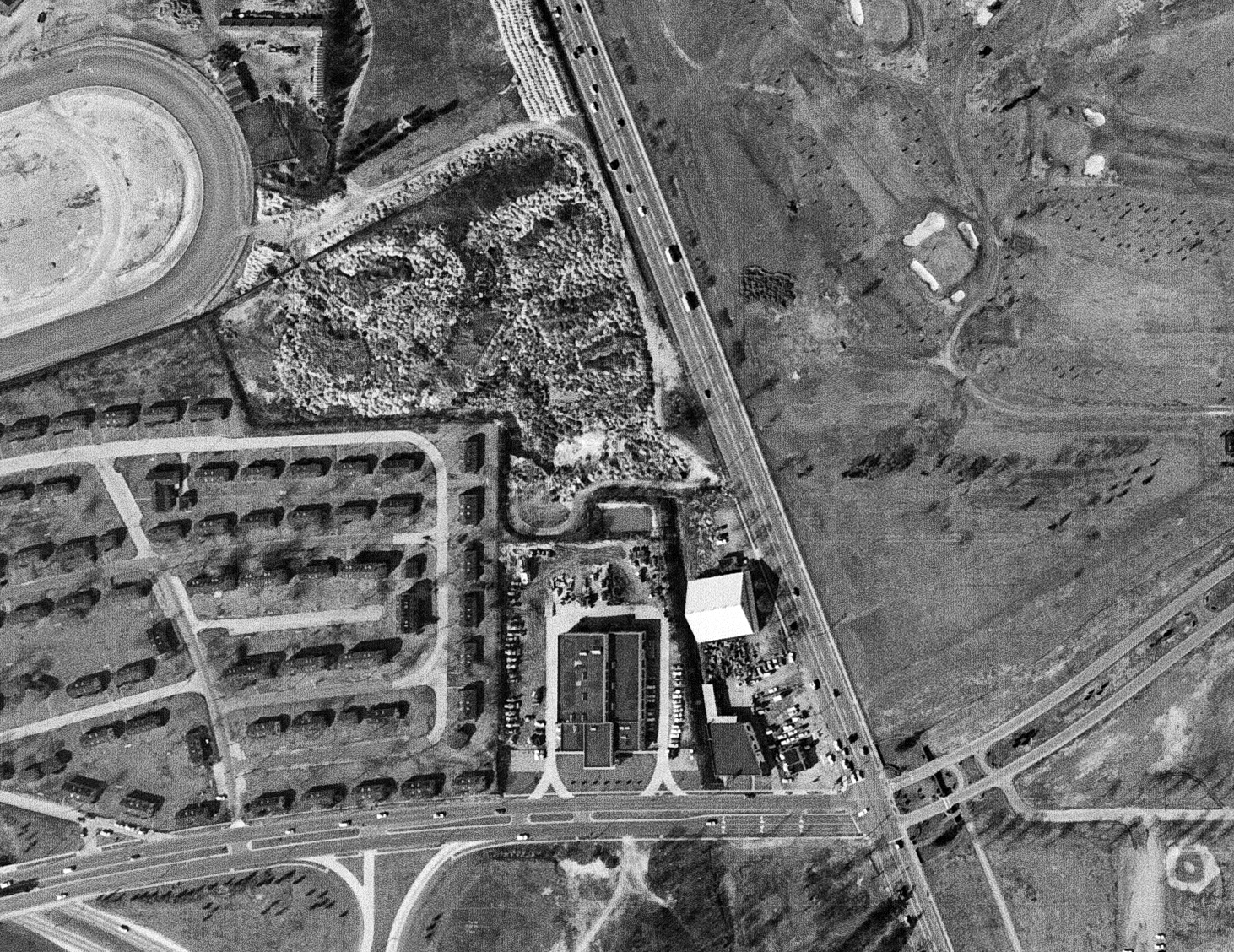
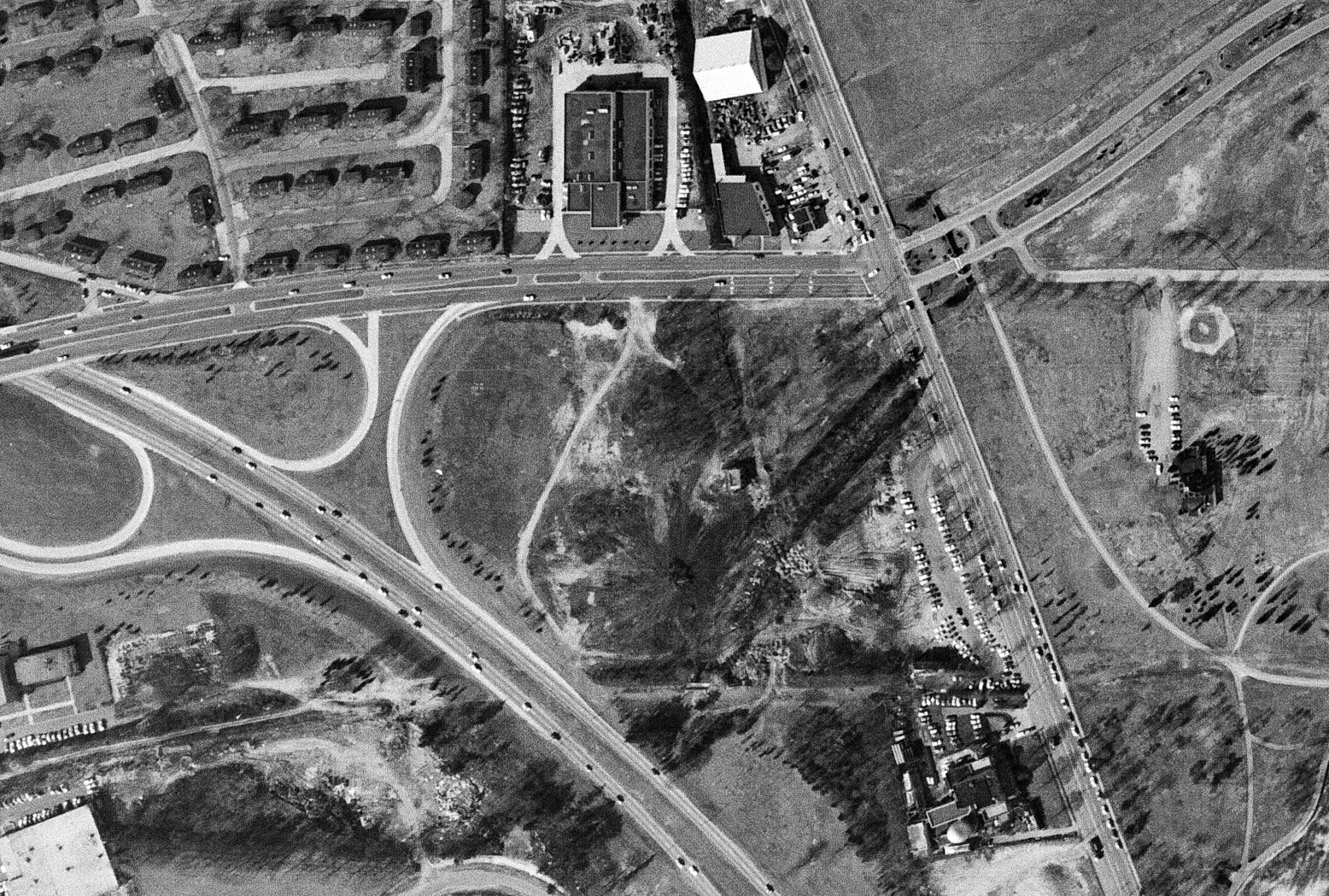
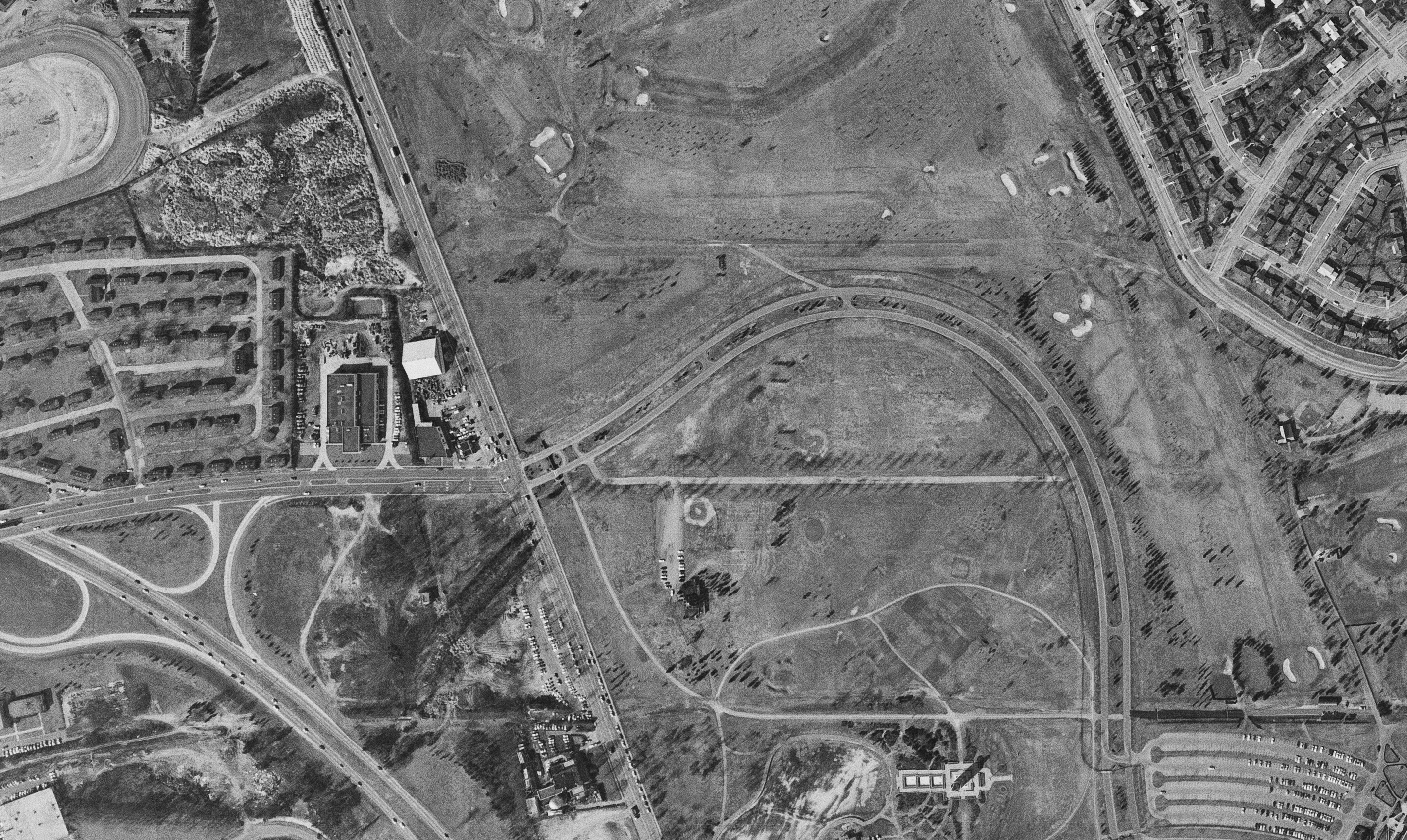
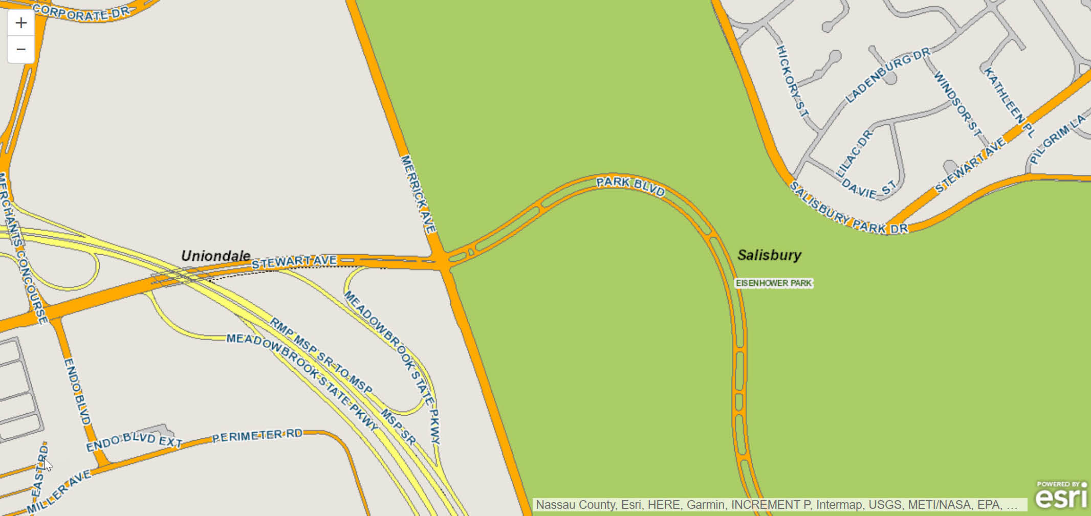
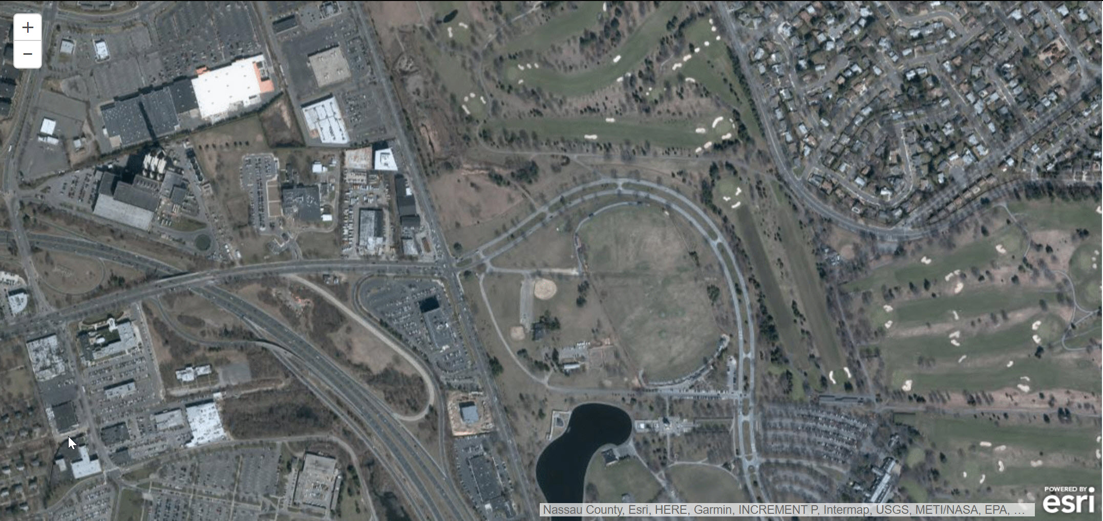
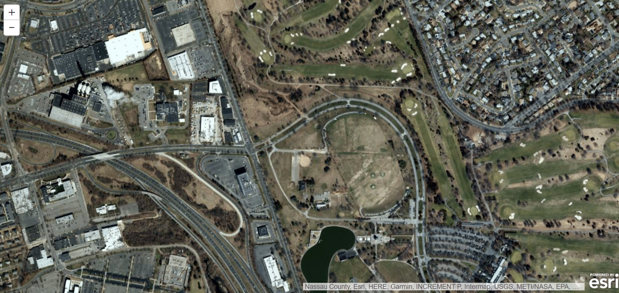
The Nassau County Park at Salisbury (Salisbury Park) in East Meadow, now Eisenhower Park. Major roads include: Stewart Avenue, Merrick Avenue, Salisbury Park Drive, and Meadowbrook Parkway (see Frank Femenias' Comment). Salisbury Links (golf) and section of Roosevelt Raceway (harness)
- Identify the residential communities
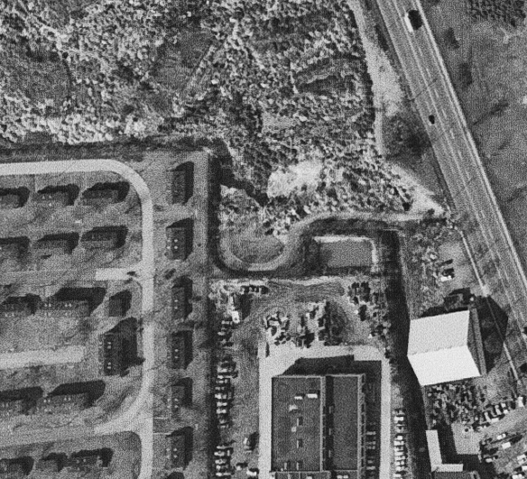
Mitchel Gardens on the left. Salisbury section on the right.
- Where is the Motor Parkway right-of-way?
Right above the loop of Park Boulevard.
- What major Motor Parkway remnant was still visible?
The keyhole entrance to the Meadow Brook Lodge and a section of the Motor Parkway in the park.
- What was surrounded by the array of trees in the middle of the Mystery?
The array of trees surrounded the old Stewart Avenue. I still remember the trees when I was a "slugger" playing baseball in the East Meadow Little League.
- Kudos question: Identify the date of the Mystery Foto. Provide as many rationales as possible.
1966. The missing Meadow Brook Lodge. The presence of Mitchel Gardens and Meadowbrook Parkway.
Comments (12)
Congrats to Mike Mehlrose, Joe Oesterle, Al Prete, Art Kleiner, Lee Chambers, George Philippides, Steve Lucas, Sam Berliner II, Frank Femenias, and Greg O.for identifying the East Meadow location.
Kudos to Art Kleiner, Lee Chambers, Steve Lucas and Frank Femenias for correctly guessing the date of the Mystery Foto (Circa 1966).
Enjoy,
Howard Kroplick
Close-Ups
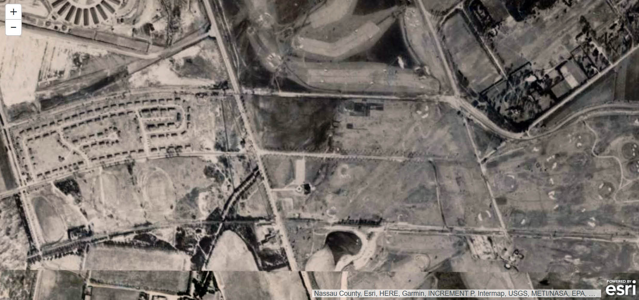
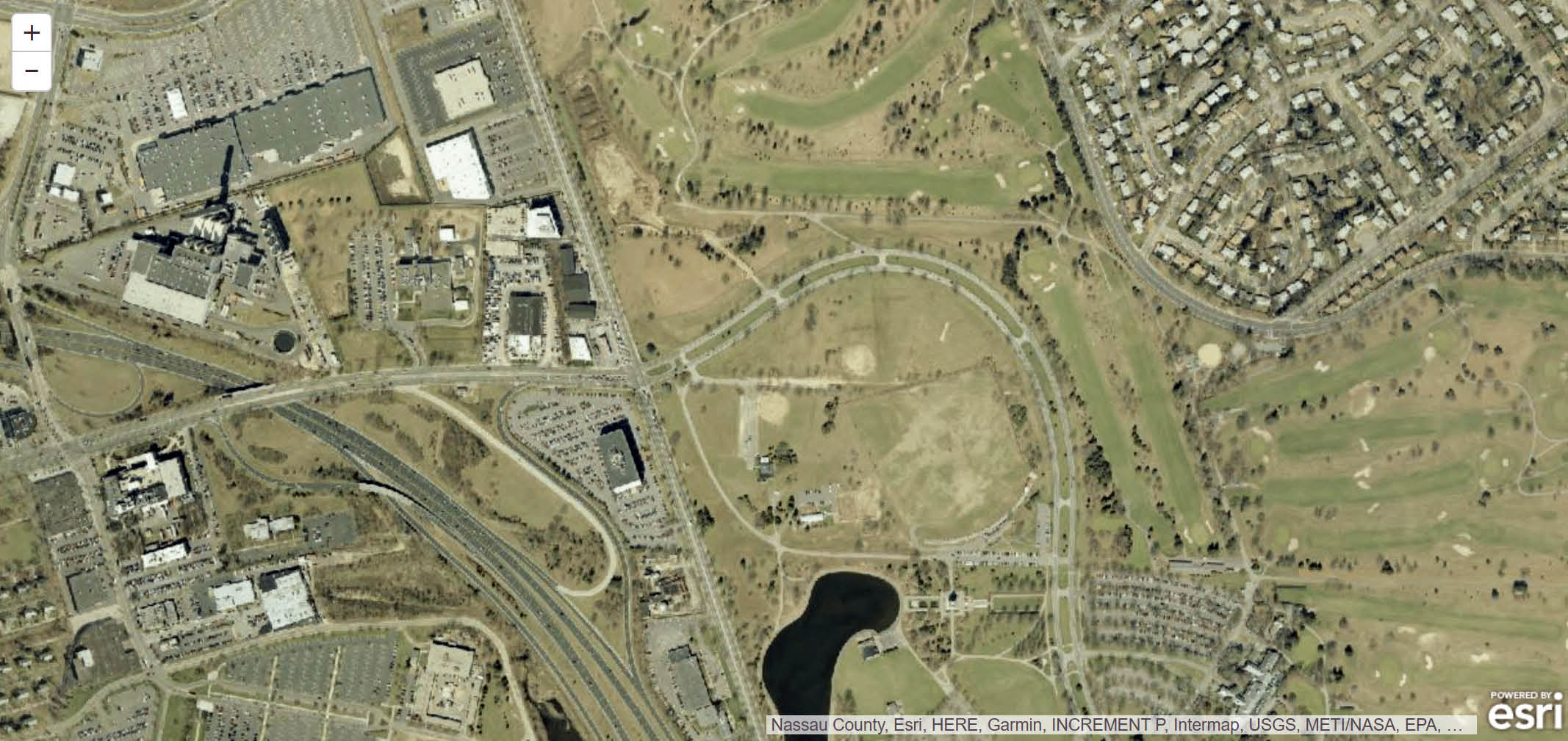
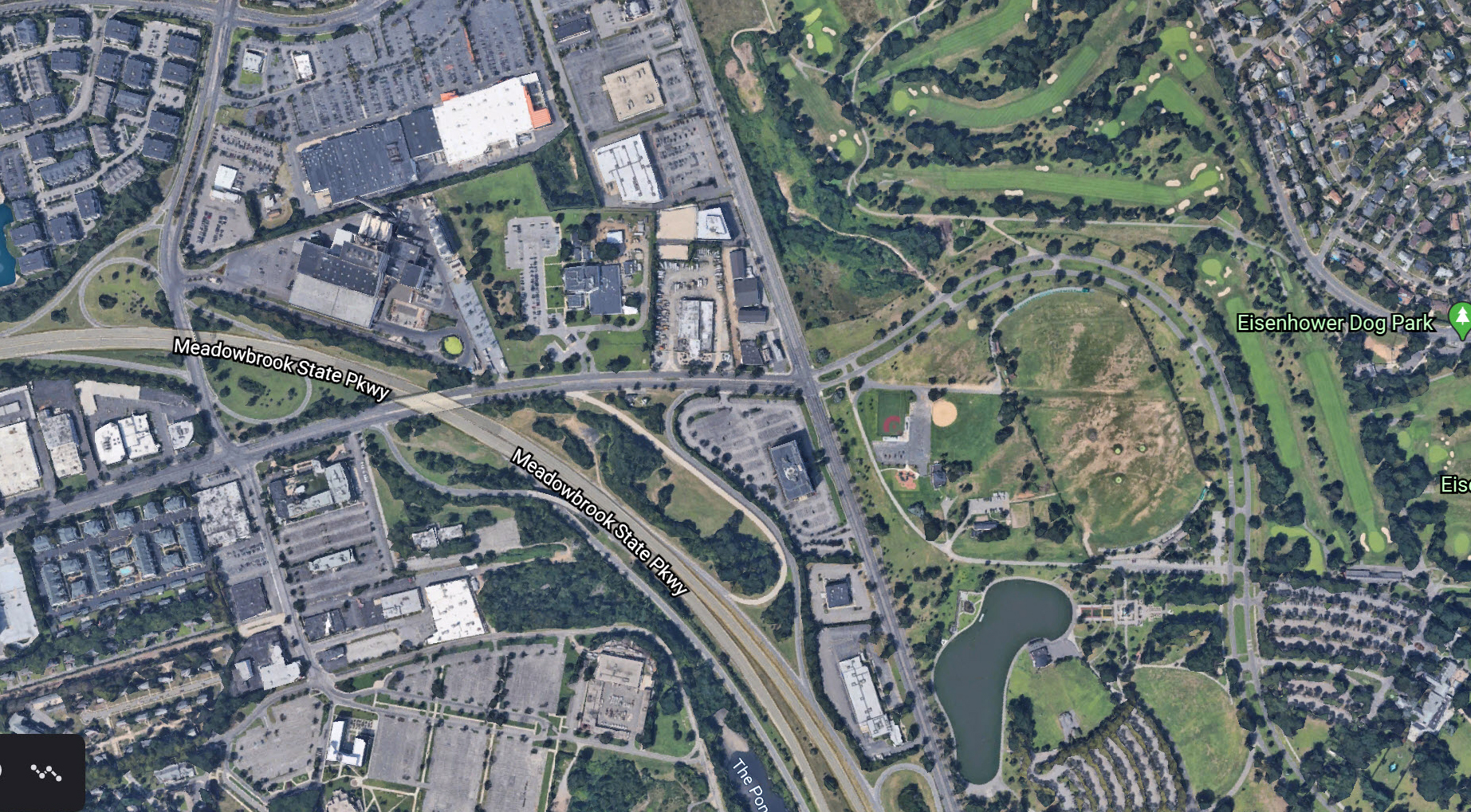
Current Map
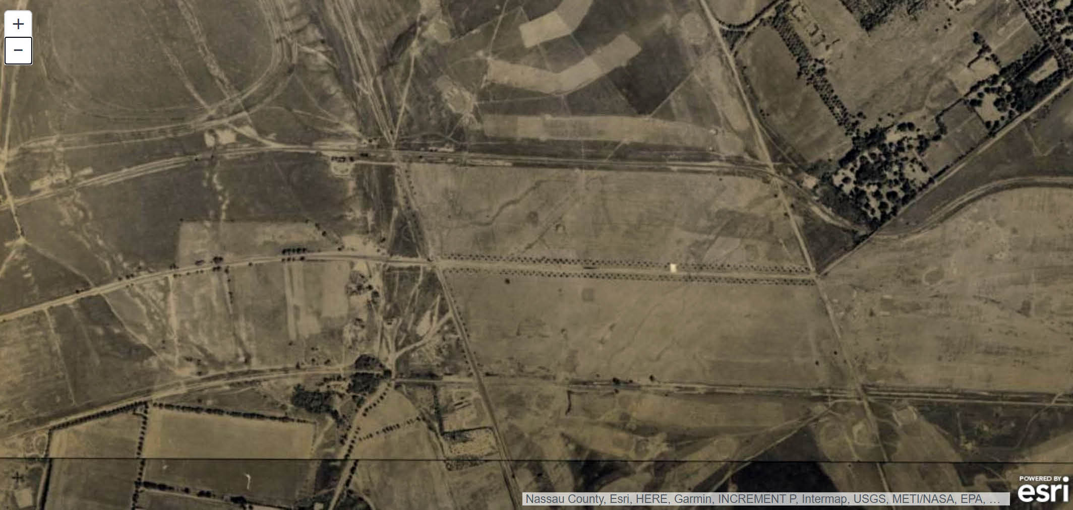
1926
Note:
-The array of trees surrounding Stewart Avenue in the middle of the aerial.
-The temporary road that connected Ellison Avenue with the Motor Parkway
-The central Railroad can be seen on the bottom of the aerial.
1938
1938 View looking northwest
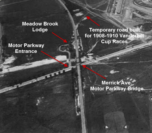
The keyhole entrance to the Meadow Brook Lodge
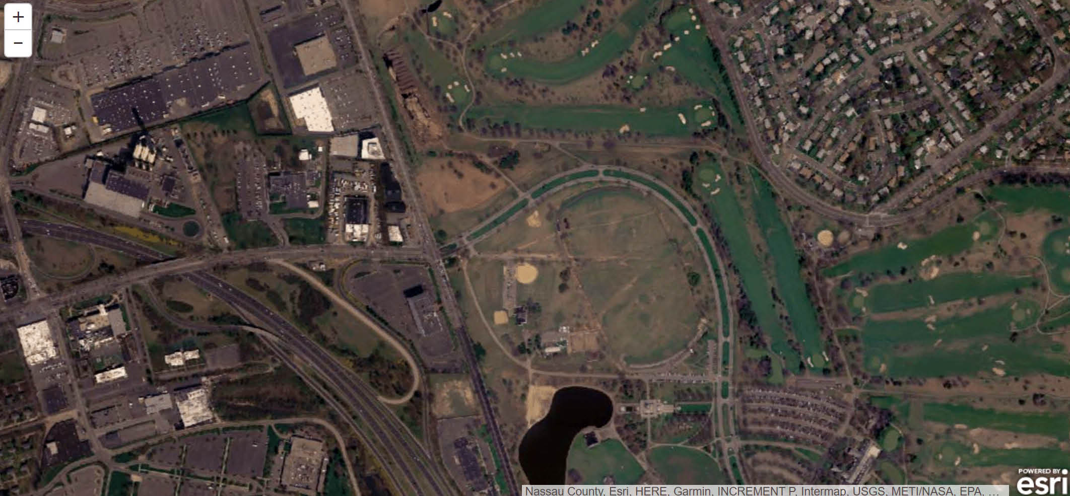
1950
1954
2000
2004
2007
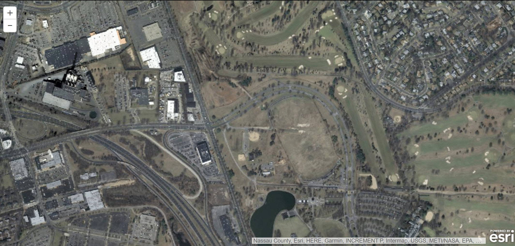
2010
2013
2020


Comments
merrick ave along Eisenhower park west side. lake on the.lower right side. Stewart ave into the Park. upper left was Roosevelt raceway. far right side is Salisbury park drive.
Eisenhower Park. We can still see the keyhole turn at the Meadowbrook Lodge. I would say 1955 ish.
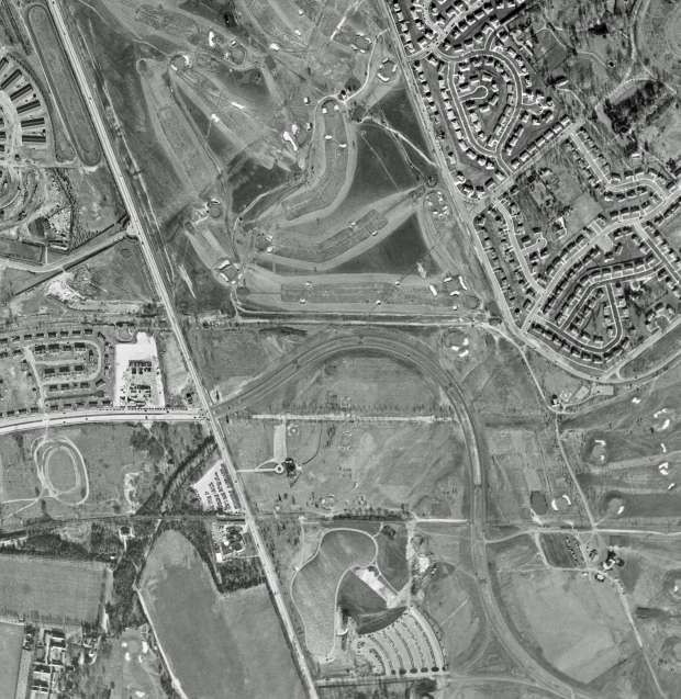
Location is Salisbury (Eisenhower) Park in East Meadow, where I spent many a day in my youth. North is at the top. Major roads: Stewart Avenue on the left, Park Blvd. across Merrick Ave. from Stewart, Meadowbrook Parkway, Salisbury Park Drive on the upper right. Sporting areas include Roosevelt Raceway on the upper left, and golf courses in the park.
Residential communities: Mitchel Gardens just north of Stewart Avenue, and the Salisbury section of East Meadow on the upper right.
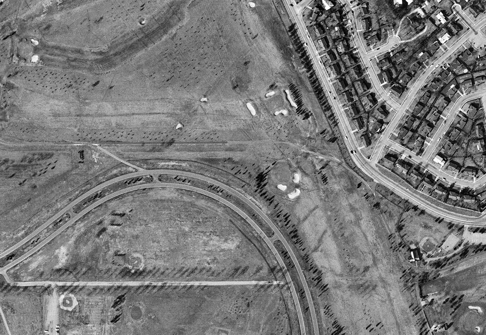
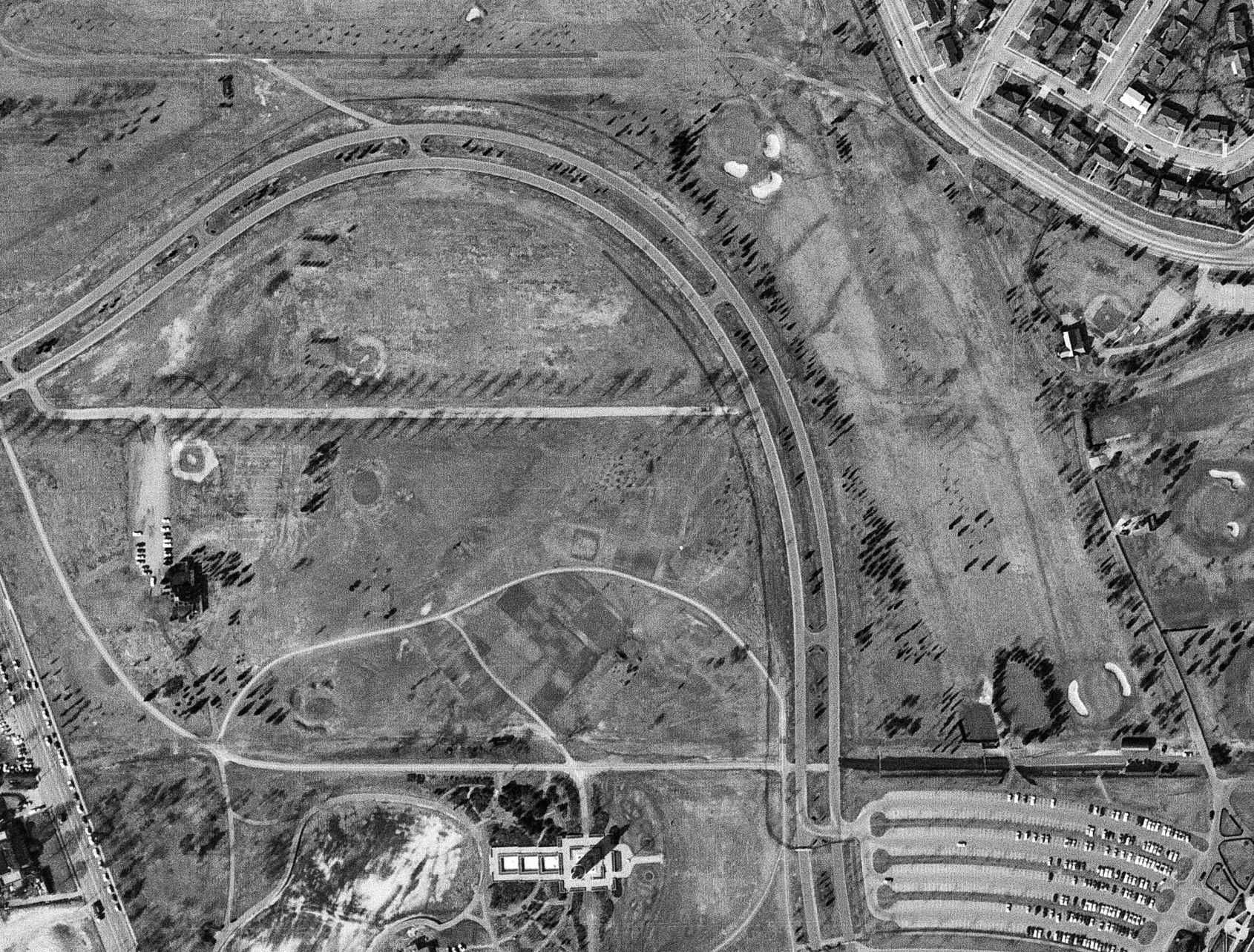
LIMP is the curved part of Salisbury Park Drive. Remnant can be seen just to the left of that (north of the northernmost curve of Park Blvd.), and continuing west to where it would meet the northern edge of Mitchel Gardens.
The only ring of trees that I see are on the right, and it just looks like they surround grass. A putting green?
Date of the Foto: I can only say between 1956 and 1962, because the Meadowbrook Parkway has cars on it and it opened in 1956, and Mitchel Gardens is still there.
Identify the location, major roads and sporting areas:
Salisbury (Eisenhower) Park, East Meadow/Westbury
Merrick Avenue, Park Avenue (in the park), Salisbury Park Drive, Stewart Avenue, Meadowbrook Parkway. Roosevelt Raceway, Golf Courses,
Identify the residential communities: Mitchell Gardens on center left, Salisbury (or South Westbury as it was called then) on the upper right
Where is the Motor Parkway right-of-way? Directly north of the curved road in the park going from west of Merrick Ave. to Salisbury Park Drive on the east (right of photo)
What major Motor Parkway remnant was still visible? Parkway driveway (the key shape)
What was surrounded by the array of trees in the middle of the Mystery?
Central Branch of the LIRR
Kudos question: Identify the date of the Mystery Foto. Provide as many rationales as possible. 1966 - picture from historicaerieals.com and possibly layout of the golf course. Lake (upper end shown at lower section of the photo) was not completed until after 1961.
Aerial photograph facing North over Salisbury Park.
Major roads included Meadowbrook Parkway and Merrick Ave. running top to bottom and Stewart Avenue, and remnants of the LIMP and LIRR Central line running laterally. The railroad trestle can be seen East of the Parkway in the woods. The Salisbury Plains RR station and the Salisbury Club can be seen West of Merrick Ave.
The original orientation of Stewart Avenue lined by the trees on either side is visible as is the key shaped entrance to the Meadow Brook Lodge to the West of Merrick Ave. To the East of that, a portion of the route of the LIMP used then by golf carts at the Park is seen.
Housing on the left of the photo is Mitchel Gardens. Housing to the right of the photos is the Salisbury area of East Meadow. Immediately adjacent to Mitchel Gardens, the LIMP approached the Lodge about to cross over Merrick Ave. The horse racing track is just above the LIMP. Nearby was the spot Lindbergh took off, not far from the location of a portion of the Vanderbilt Cup.
At the East end of the park can be seen the sites of the Stewart Ave. Bridge and nearby the Meadowbrook Bridge.
Parkway indicates it’s post 1956. Mitchel Gardens was gone by mid ‘70’s. Big silver tank at NYU building was put up in early ‘70’s. Could be from late ‘60’s - mid ‘70’s.
East Meadow/East Garden City
Stewart Avenue -East to West
Merrick Avenue- North to South
Park Blvd on the right
Meadowbrook Pkwy lower left
Sporting: Salisbury Links then Eisenhower Park Golf club to the right, Roosevelt Raceway upper left
Re motor parkway remnant, I think the keyhole entrance to the Meadowbrook Lodge is still visible
Motor Parkway ROW runs from just above keyhole, across Merrick avenue, thru golf course, to Stewart Avenue to the East.
Forgot to mention year.
Must be after 1956 since that is when meadowbrook parkway was built
We are directly over the East Meadow, Westbury, Salisbury, East Garden City area with Merrick Avenue running top to bottom in the center. Other roads include Stewart Avenue, Meadowbrook Parkway, Salisbury Park Drive and Park Blvd. inside Eisenhower Park. A portion of Roosevelt Raceway can be seen in the upper left corner. The LIMP R-O-W ran left to right about one third of the way down from the top between the raceway track and Mitchel Gardens and ending on the right at Salisbury Park Drive. You can still see the unique entrance driveway from Merrick Avenue to the Meadowbrook Lodge. I think the area surrounded by tress could be the house that Joseph Lannin built for his daughter Dorothy around 1928. I believe the date should be around 1964-1965 since the last section of Mitchel Gardens came down in 1966.
Another dead-easy location - Salisbury Links-cum-Eisenhower Park, after Meadowbrook Parkway (across lower left corner) was opened. RoW of Central Branch of the LIRR runs across bottom. LIMP RoW runs across top and curves down on to Salisbury Park Drive at upper right. The stretch along South Street is at left. The trace across the park is visible just above Park Blvd. Roosevelt Raceway at upper left. Stewart Avenue runs from middle left to Merrick Avenue (vertical) and then becomes Park Boulevard. Garden City East at upper left; East Meadow at upper right. Array hides a dog poop receptacle (softball field #6 there now). Dated by long-gone housing between Stewart and Raceway (i.e.: I dunno - ca. 1940?). Sam, III
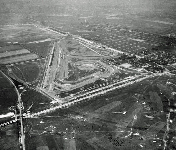
Lots of goodies in this Salisbury aerial with north up. Salisbury Links, then Nassau County Park (1949), and now Eisenhower Park’s (1969) Red Golf course in upper center. Roosevelt Harness Raceway in upper left. Ladenburg’s horse race track just off the photo in upper right, today it’s the East Meadow Public School District. Park Blvd is the curvy road in the center. Motor Parkway is just above it running horizontally. Meadow Brook State Pkwy in lower left, Merrick Ave diagonally on the left. Salisbury Drive diagonally on the right. Old tree-lined Stewart Ave still visible cutting horizontally through the park. Old Bellmore Road also visible cutting diagonally through the park. Mitchel Gardens Housing Complex below Roosevelt Raceway on the left. Salisbury housing community off Ladenburg Drive on upper right. LIMP’s Meadow Brook lodge entrance ramp still intact. The lodge, Merrick Ave bridge, Newbridge Ave (Bellmore Rd) bridge, and Stewart Ave bridge have all been removed. Photo date is after completion of MSP (1956), after demolition of the Meadow Brook lodge (early 1960s), and during Roosevelt Harness Racing (1966)
-Identify the location, major roads and sporting areas
The upper section of Eisenhower Park. ‘Whale Neck Ave’, Salisbury Park Drive. The Stewart Ave park (Park Blvd) entrance.
-Identify the residential communities
My old neighborhood of [Westbury]Salisbury on the East side of Stewart in the upper right!
Where is the Motor Parkway right-of-way?
Of the 3 ROW’s [remnants] visible, the uppermost.
-What major Motor Parkway remnant was still visible?
The keyhole driveway to the expansive McCamish estate
-What was surrounded by the array of trees in the middle of the Mystery?
Old Stewart Ave ROW
Kudos question: Identify the date of the Mystery Foto. Provide as many rationales as possible.
Judging by the state of Eisenhower and the Meadowbrook Pkwy, I’ll guess 1958ish
Mys 29 again
Frank, The photo you just posted, you describe an old roadway to Mitchel Field. ...Thru the Meadow Brook Club ?
thru the Meadow Brook Club ?
Al - Good catch. The private old road was access to the Meadow Brook Hunt Club. I often wonder if the road was shared with airport security in passenger vehicles, as it dead ended right up to Mitchel’s runway 23.
Al - Rushing to send the photo last night, I just realize another error. The former site of the Stewart Ave bridge is slightly west. Stewart Ave’s location is barely seen on the right edge in the photo . One shall not rush these things.
Frank, Got another one for you, only for the sake of accuracy. In that photo you also locate the former Stewart Ave. bridge. It wasn’t where you have it. O.K…, this might be tough to follow. The curved section of the Parkway,.... east of New Bridge Ave.,... originally dipped further south into in that area of Eisenhower Park where the dog run, the ball field and the office building are located today. In the mid- 1950’s Nassau County, opened today’s western potion of Salisbury Park Dr. in the bed of the Motor Parkway. At the same time the County renamed that portion of New Bridge Rd. north of the park to Salisbury Park Dr. connecting it to the east-west portion of Salisbury Park Dr. and eliminating the original intersection with Stewart Ave. The original Parkway curve was much more severe than today’s curve, so the county, in it’s wisdom, flattened it quite a bit. If you look at the 1954 photo that Howard has labeled, “an earlier mystery photo submitted by Richard Panchyk”, its possible to reconnect the two sections of the New Bridge Rd. and pickup the original Stewart Ave route east of New Bridge Ave. I believe Howard has a survey map showing the 1950’s re-alignment. Whew!
HA! An “array” can be linear. I thought you meant the dense clump to the south of that and was sorely puzzled. This pic is a winner in so many ways! Thanks, Richard and Howard. Sam, III
For the RR buffs amongst us, LIRR G5 steam loco #35 was on display for a while in the ‘50s-‘60s just east of Merrick Avenue on the CRR RoW, as shown on <http://sbiii.com/lirrcrr1.html>, just north of today’s 9-11 Memorial and just NE of the old puppet theater. A pic of the loco sitting there, facing west, is on <http://sbiii.com/lirr-etc.html#Loco35>. Of course, the Salisbury Plains Station is on the north side of the CRR RoW just west of Merrick Avenue, north of the Meadowbrook Club. See <http://sbiii.com/lirrcrr1.html#slsbrypl>. HEY! If it’s 1966, how come the NYU high pressure sphere is visible? As I recall, NYU didn’t take over the Club and erect that sphere until the ‘80s. Sam, III
Sam, I clearly remember a loco pointing west off Merrick Ave, just south of Stewart Av. I didn’t know at the time it was positioned on the CRR ROW, near the lake. Great stuff! I saw the loco positioned post 2000 AD. Was this the same loco still in place?
Al - You’re right on. Stewart Av bridge was more east as indicated by my map. Your detailed history of the area is always amazing to hear and learn from. Thanks as always, for sharing your knowledge of the LIMP
a
I’ve always been curious about the trees lining both sides of Stewart Ave. between Merrick Ave. and New Bridge Ave. Take a look at Frank’s 1938 photo, the trees are well defined and note that there are similar plantings on Merrick Ave. between the Parkway and Hempstead Tpke. and also lining the main entrance into the Meadow Brook Club. Who, why and when ?
Frank, thanks to LIRR historian Dave Morrison, I now have the dates for #35’s peregrinations. She was emplaced in Salisbury Park on 22 May 1956 and left for her Mitchel Field stay on 16 Jun 1978. So, no post-2000. You may have seen her sitting alongside the NCPD hangar at Mitchel. She left there for Oyster Bay on 02 Aug 2001. We slapped a coat of cosmetic paint on her ca. 1960. [For ref., Salisbury officially became Eisenhower on 13 Oct 1969.] Sam, III
Sam - Thank you and Dave for info on #35’s continuous journeys. I saw her sitting on the Eisenhower (Nassau County Park) lawn by herself, likely with tender, off Merrick Av and she was pointing west, and thought the display seemed odd at this particular location. Thanks to you, I’ve learned it was sitting on the former CRR RoW. A great display spot after all. I’m guessing at the time of her removal, it was due to vandalism, jeopardizing the machine. Painting a loco? I wish I knew you guys growing up
Corrected 1966 aerial
Al - Seems all roads between the Meadow Brook Club and Ladenburgh Racetrack are tree-lined, including old Newbridge Av between old Stewart Av and Ladenburgh Dr (1926 aerial). Access roads from the CRR and Motor Parkway also adorning trees. I have a hunch Ladenburgh began the tree-planting trend before Salisbury Links (1907) and Meadow Brook Club in the ‘20s.
Below, a completed puzzle with kid’s assistance, driving on old Stewart Av through Eisenhower Park in late autumn.
Driving? Virtually, I assume. Sam, III
Frank, Your puzzle,.... cant be Stewart Ave., Note that Stewart Ave. is the only tree-lined roadway with a double set of trees on both sides of the road. Its not the entrance to the Salisbury Links since it didn’t open until 1917. I think it’s the entrance way to the Meadow Brook Club, many clubs did that.
The puzzle might possibly be a shot of Meadow Brook Club Road looking North from the CRRLI trestle. Ahead, the roadway would curve to the Northeast where it would rendezvous with Merrick Ave., just South of the intersection of Stewart Ave. and Merrick Ave.
Could the blue area to the left of the trees been Meadow Brook Creek? I remember reading that the path of the creek had to be slightly realigned when construction of the Parkway occurred in 1955-56.
The majority of those trees near the trestle are still standing but for some further Northeast that were removed for roads and buildings. It would be very easy retracing the route of the road from the trestle Northward.
As to Frank’s observation of the road traveling in the opposite direction up to Runway 23 at Mitchel Field, was there any kind of bridge or overpass allowing Meadow Brook Club Road to pass over the creek?
Also, long before runways were constructed, I am under the impression the Meadow Brook Club Road extended farther than that, connecting with the numerous support buildings for the Polo Grounds in the 1900’s.
See photos of Meadow Brook Club Road from a previous Mystery Photo entry.
Folks, the puzzle box didn’t indicate location. It just resembles the roadways around the parks at the time.
Lee - Not sure how the Club road crossed the creek at the time. Today the creek seems contained in a pond south of the former roadway. The Club road did encroach the future airport, onto runway 23’s taxi way.
Frank, thanks for that superb map. Really helps is identifying historic structures with what’s there now.
As a child riding bikes along Perimeter Road, I recall a portion of the creek North of the Pond, though not very wide at all and literally just a few yards from the Parkway. I’m thinking perhaps a culvert was all that was needed underneath Meadow Brook Club Road to pass over the narrow part of the Creek and gain access to Mitchel Field and environs.
Interesting that the Meadow Brook Club Road extended as far as the taxiway for Runway 23, putting it within feet of the Godfather tollbooth scene, not far from the NCC baseball diamond left over from the Polo Grounds and virtually bisecting the location where the NCPD facility is currently under construction.
Lee - You are correct! I forgot all about poor Sonny Corleone. But in your second photo, I notice a circular culvert under the tracks on the east side of the bridge. Definitely water issues in this area.
Frank, yes I see the culvert to the East of the trestle now that you mention it.
I’ve never been clear on what exactly was located just to the North of the tracks. A junkyard or some kind of debri field? Looks like leftover concrete molds or wooden frames for something? Or the ruins from a massive structure fire of some kind?
Two thoughts. I don’t see a body of water to the left on the puzzle; I see a roadway. As to the Meadow Brook itself and related watercourses, there were many in the area and they show on many old maps and aerials, not one of which comes readily to hand when I need them (sorry ‘bout that). Sam, III
OMG; look what just turned up coincidentally; me helping clean-up/paint #35 (in chinos and a white polo, no less) at Salisbury in 1969 (NOT 1960 / picture from page 11, The Pennsylvania News, Summer 2010). Sam, III
Nuts! Keep forgetting to point out that the Salisbury Plains RR station is crystal clear at upper right in the lower of the two aerials just above. Sam, III
Awesome shot Sam! Immense clean up/paint job realizing her size. That must be Merrick Av on the left edge.
Below, locomotive 35 being trucked from the LIRR to Salisbury (Eisenhower) Park in May 1956, exact location not specified. Photo by Robert W. Gillespie
Wrong site to belabor #35 (I theenk) but do notice the tender beyond the loco (over the gooseneck) and then the tall structure behind that. That should tell some sharp-eyed buff just where it is. Billboards would indicate Hemp. Tpke. or some such. Many similar pix of #35 going in and out of Salisbury. Yes, Merrick at left in 1969 pic. Sam, III