Long Island Motor Parkway Bridge Series #41: The Bloomingdale Road Bridge in Hempstead Plains
The 41st bridge in the series documenting the 60 Long Island Motor Parkway bridges is the highway bridge built for the extension of Bloomingdale Road in the Hempstead Plains (now Levittown). It is classified as a "highway" bridge since the Motor Parkway went through the bridge under an extension of Blomingdale Road planned to be built after 1908.
One of the original 16 bridges built for the Vanderbilt Cup Races, it was part of the courses for the 1908, 1909 and 1910 races.
Enjoy,
Howard Kroplick
May 21, 1908 Survey
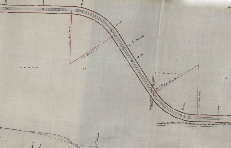
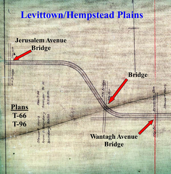
The property surrounding this bridge was pruchased from the heirs of A.T. Stewart. As part of the purchase, the Motor Parkway was required to built this bridge in anticipation of the extension of Bloomingdale Road to the north.
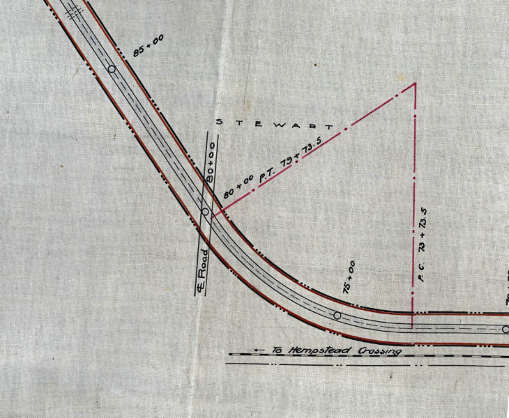
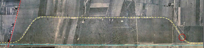
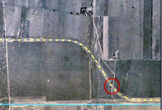
The bridge was identified as station 80.
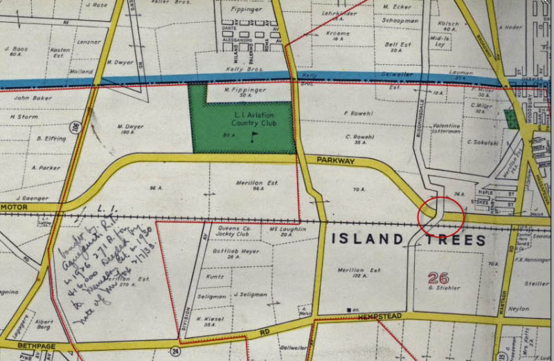
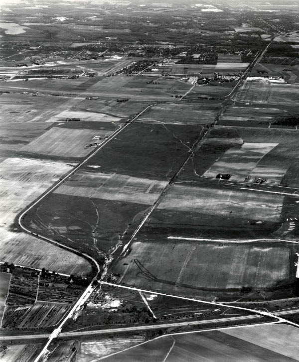
As shown in this map and the below 1924 aerial, Bloomingdale Road was eventually extended to the bridge.
1926 Aerial
1928 Motor Parkway Atlas
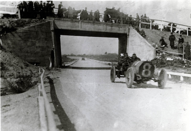
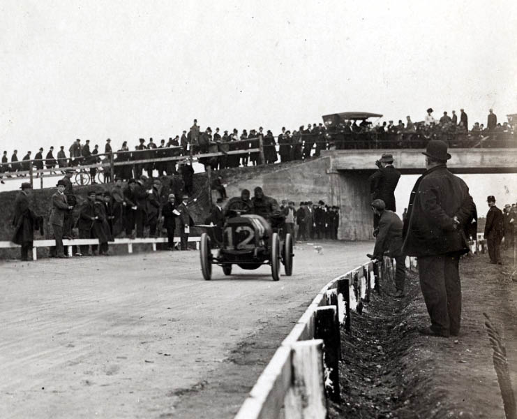
1908 Motor Parkway Sweepstakes- October 10, 1908
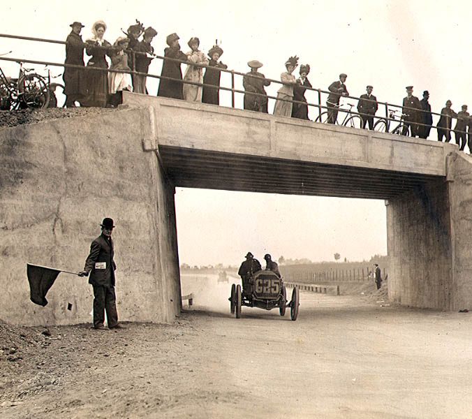
A wonderful view of the bridge on the opening day of the Long Island Motor Parkway. H. Tuttle was seen here driving the #G25 Stoddard-Dayton ahead of another racer.
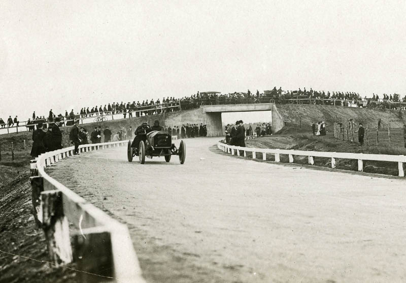
1908 Vanderbilt Cup Race- October 24, 1908
The #2 Knox driven by Al Denison.
#3 Mercedes driven by Emil Stricker.
#12 Thomas driven by George Saltzman.
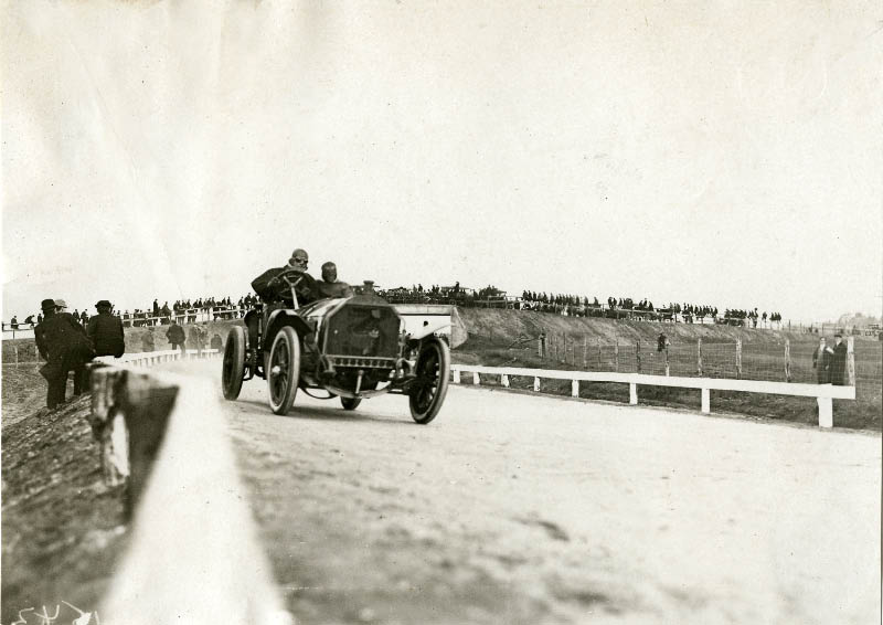
1909 Vanderbilt Cup Race- October 30, 1909

The Alco Black Beast driven by Harry Grant and Frank Lee. Grant's scarf was used to clean his goggles.
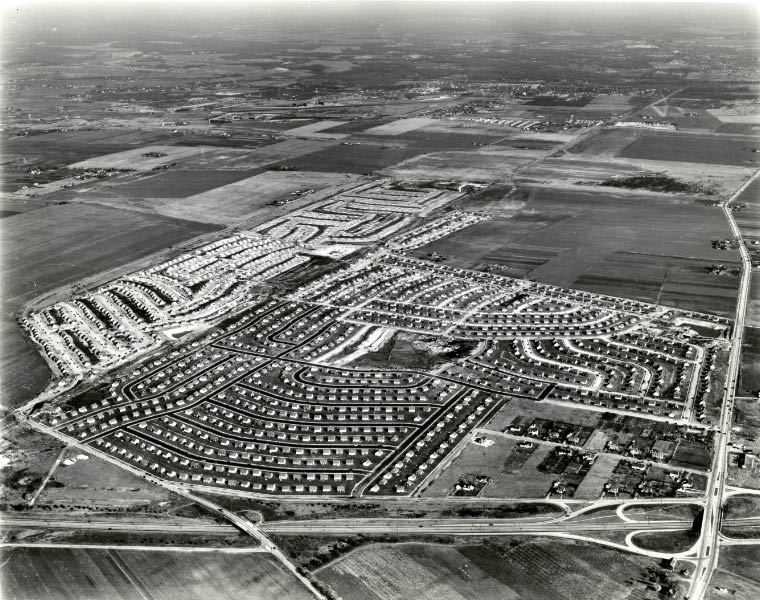
Levittown (May27,1947- December 24, 1949)
Watch the amazing transformation of the Hempstead Plains into Levittown over a 2 1/2 year period.
May 27, 1947
November 13, 1947
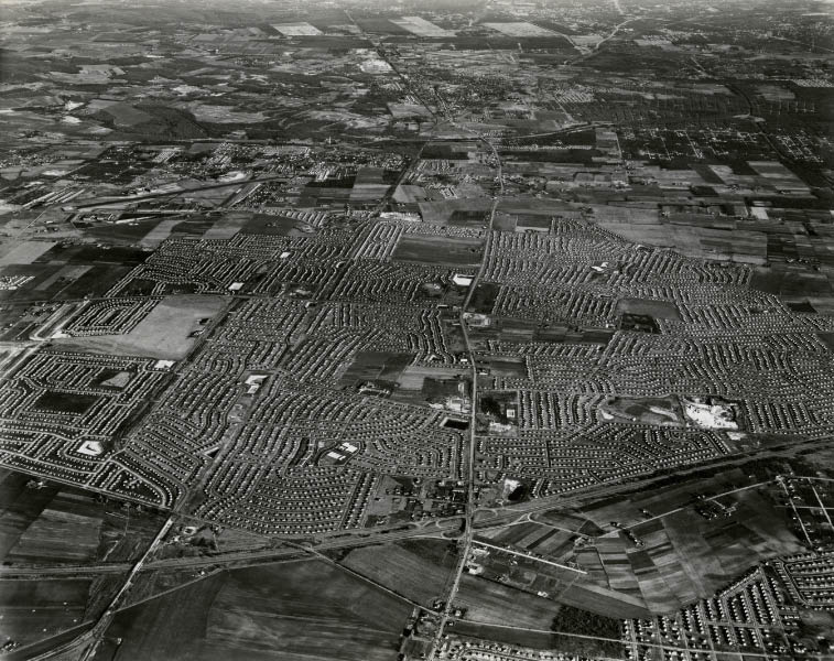
December 24, 1949
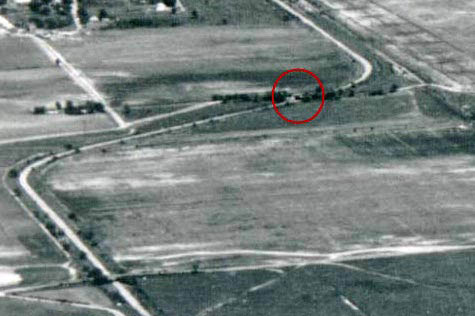
The Blomingdale Bridge was still standing in the 1947 aerials. It was taken down somtime before December 24, 1949 by Levitt & Sons
Now
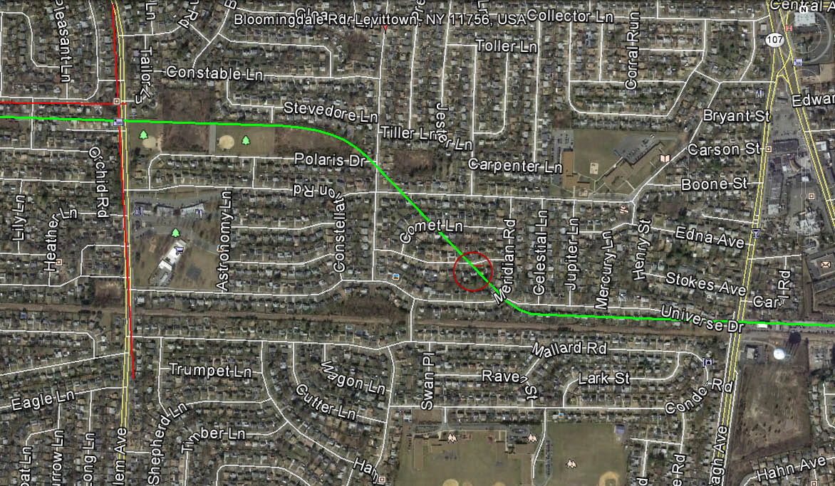
The location of the Bloomingdale Road Bridge is currently in someone's backyard. Check out Wayne Consolla's online Motor Parkway map to find the location of the bridge.


Comments
It would be interesting if there was remnants of this overpass in r/o Satelitte La? In the last 1947 aerial, there appears to be an uprise over the central lirr row. This uprise may have became Neptune La
After comparing 1926 aerials with current ones, it appears that this bridge extended between #19 and 20, or #23 and 24 Satellite La, Levittown. I won’t be offended if anyone believes differently.
According to the “NOW” map, the LIMP crossed Bloomingdale Road just east of where Polaris Drive presently ends.
“As shown in this map and the below 1924 aerial, Bloomingdale Road was eventually extended to the bridge.”
Which map or which Atlas was the source of this picture?
John, the 1926 aerial of Bloomingdale Rd is located here. https://lrv.nassaucountyny.gov/map/
The closest I could locate the bridge is here https://www.google.com/maps/d/u/0/viewer?mid=1396j0_672hYkvbcNFJInbc1mXNJspD9f&ll=40.73367555877808%2C-73.50545203004624&z=18
Howard, please delete my previous post. I am unable to link the LIMP online map on your website, after various tries.