Long Island Motor Parkway Bridge Series: #24 Robbins Lane Parkway Bridge Updated 3/14/2017

The 24th bridge in the series documenting the 65 bridges built by the Long Island Motor Parkway is the parkway bridge over Robbins Lane in East Williston.
Enjoy,
Howard Kroplick
Resources to Assist Recovering from Superstorm Sandy-Update: Letter from 27 LI Mayors to Gov. Cuomo
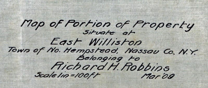
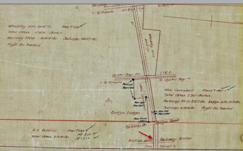
March 1909 Survey
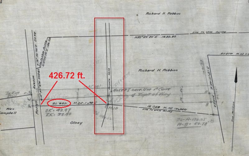
In 1909, the Motor Parkway purchased property east of Roslyn Road from Richard H. Robbins. As part of the sale, the Motor Parkway agreed to build a bridge over a "Private Lane" for the Motor Parkway. Notations provided by Frank Femenias and Wayne Consolla.
1911 List of Motor Parkway bridges
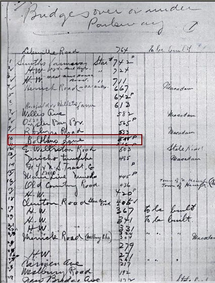
This early list of "bridges over or under the Parkway" included parkway bridge #548 over Robbins Lane.
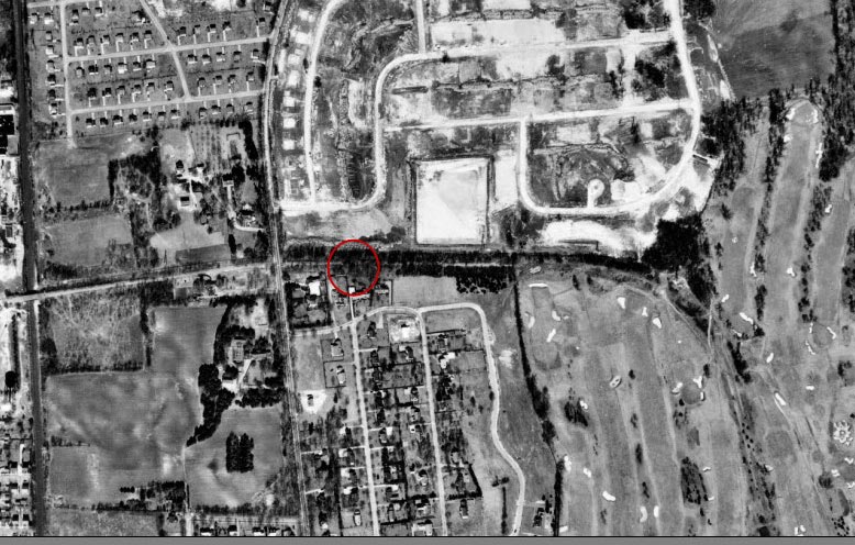
1926 Aerial
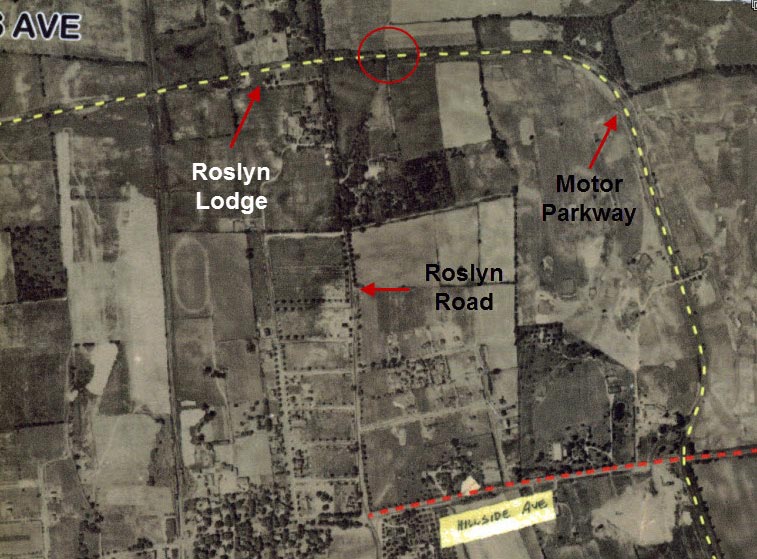
This aerial shows the location of Robbins Lane east of the Roslyn Lodge and Roslyn Road.
Provided by Frank Femenias and Wayne Consolla
Provided by Frank Femenias and Wayne Consolla
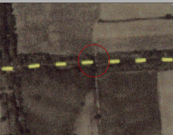
Unfortunately, this aerial closeup is currently the best image of the bridge.
1928 Motor Parkway Atlas
The Motor Parkway Atlas included the "Robbins Lane Parkway Bridge".
1950 Aerial
By 1950, the Motor Parkway was still visible but the bridge appears to have been taken down.
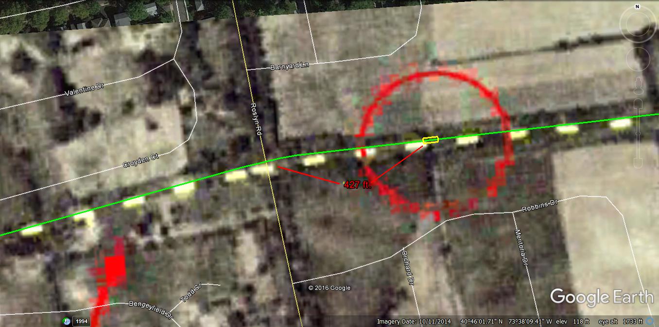
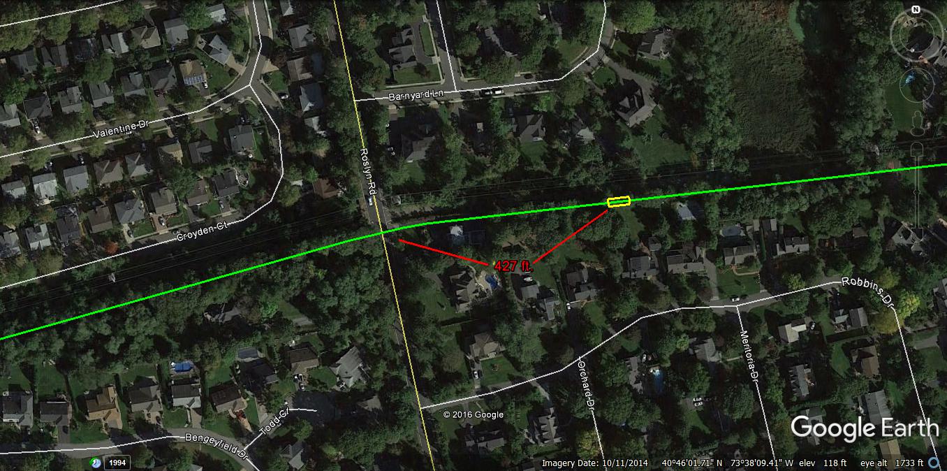
2012 Current Views
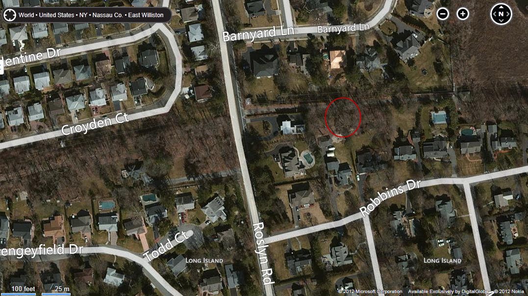
A Bing's Map "Bird's Eye" aerial of the bridge's approximate location. Note "Robbins Drive" to the south.
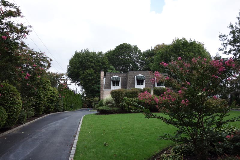
The right-of -way for the Motor Parkway heading east of Roslyn Road went right through this house.
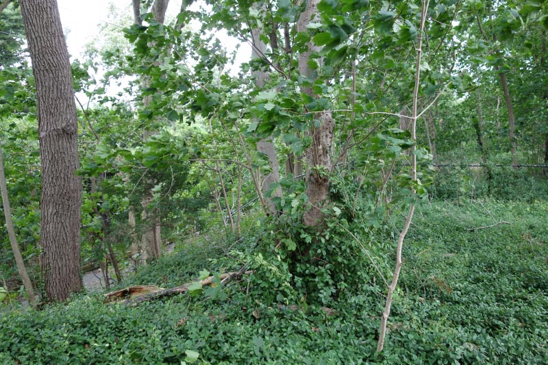
Mother Nature has taken over the road which is about 8 feet above grade level. There are no remnants left of the bridge.
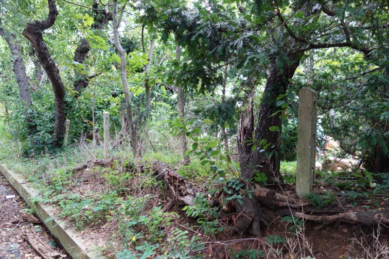
The ever-present concrete posts still mark the northern boundary of the Motor Parkway.


Comments
I remember back in the late 1970’s, before the house on Roslyn Rd was built, us kids would go up there on the right of way all the time. The LIMP definitely took a downward angle from it’s high point at Roslyn Road, sloping down east until the road was cut off, just before the built in swimming pool. I just don’t ever remember any signs of a bridge, or any sign of the right of way heading high again. Was this bridge under the motor parkway or over it?
If the 1928 Atlas Map is drawn to scale, my guess is the bridge was about 465 feet, roughly, from the eastern edge of Roslyn Rd.
Once again, thanks. I could never explain to people how much enjoyment I get from the posts on your website.
A sincere fan,
-joe o