Long Island Motor Parkway Bridge Series: #13 Marcus Avenue Motor Parkway Bridge in Lake Success

With the documentation of the 12 Motor Parkway Bridges in Queens completed (18% of the total 65 bridges built), it is time to cross the border into Nassau County. First up is the Marcus Avenue Motor Parkway Bridge located in Lake Success.
1914 Belcher Hyde Map
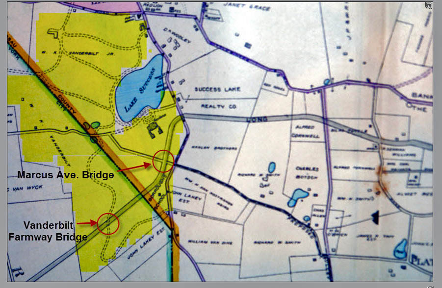
As shown here, the property for the Marcus Avenue Bridge (then called Hyde Park Road) was located on William K. Vanderbilt Jr.'s Deepdale Estate in Lake Success.
May 1911 Survey
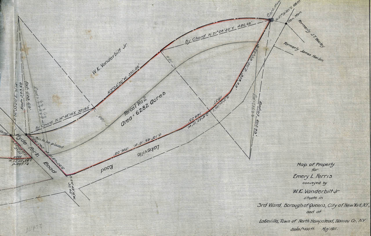 A total of 6.282 acres were purchased from Willie. K spanning the area from Marcus Avenue (Hyde Park Road) to Lakeville Road.
June 1911 Construction Photos
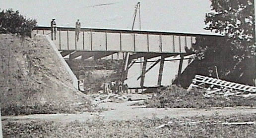
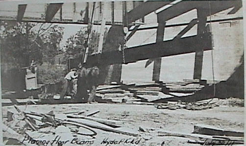
Similar to the Queens bridges over Little Neck Boulevard, Commonwealth Boulevard and Winchester Boulevard, the bridge construction was a steel trestle used for railroad bridges.
1924 Aerial- Queens
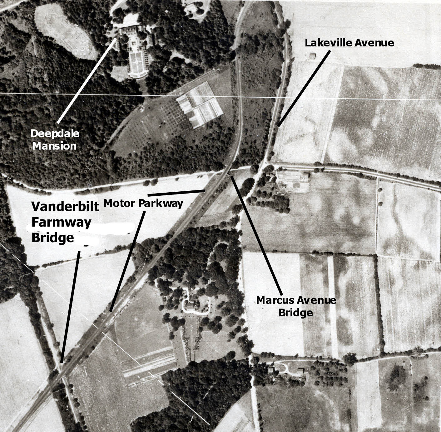
This aerial shows the relationship among the Marcus Avenue Bridge, the Deepdale Mansion and Lakeville Road.
1928 Motor Parkway Atlas Blueprint
 The Atlas Survey indicated the Motor Parkway right-of-way from Marcus Avenue (called New Hyde Park Road) to the next bridge over Lakeville Road.
1929 Aerial
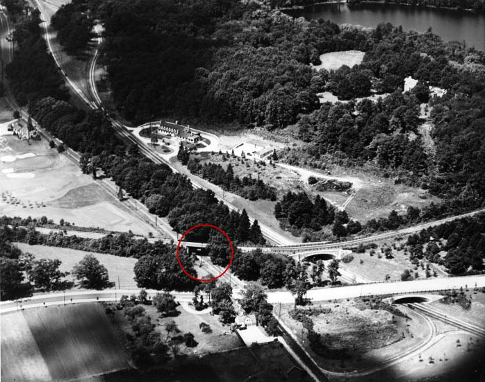
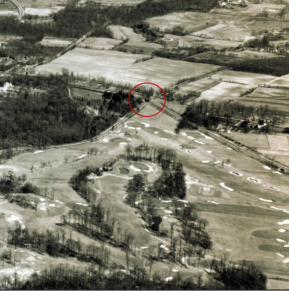 This 1929 aerial of Lake Success looking north east is one of my favorites from the book The Long Island Motor Parkway (page74). The golf course and club in the foreground was the old Glen Oaks Country Club, today the home of the North Shore Towers complex. The Marcus Avenue Motor Parkway Bridge was seen in the middle of the aerial.
 A close-up of the aerial highlights the north and south embankments.
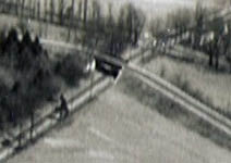
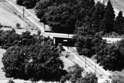
1930s Image
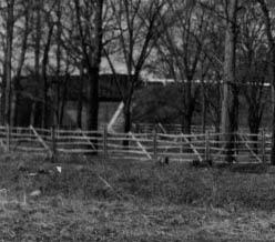
This recently found photo is the best known ground image of the bridge.
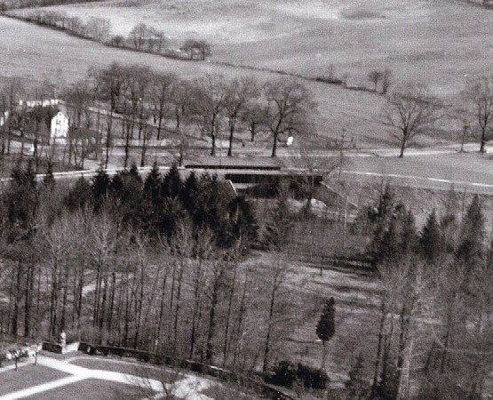
August 15, 1934 Aerial
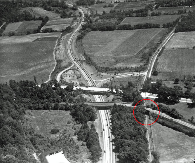
An early aerial of Lake Success Looking east.
August 17, 1934 Aerial
An aerial taken two days later looking west. The New York State Parkway Police barracks (formerly Willie K's guest house) can be seen in the background just above the bridge.
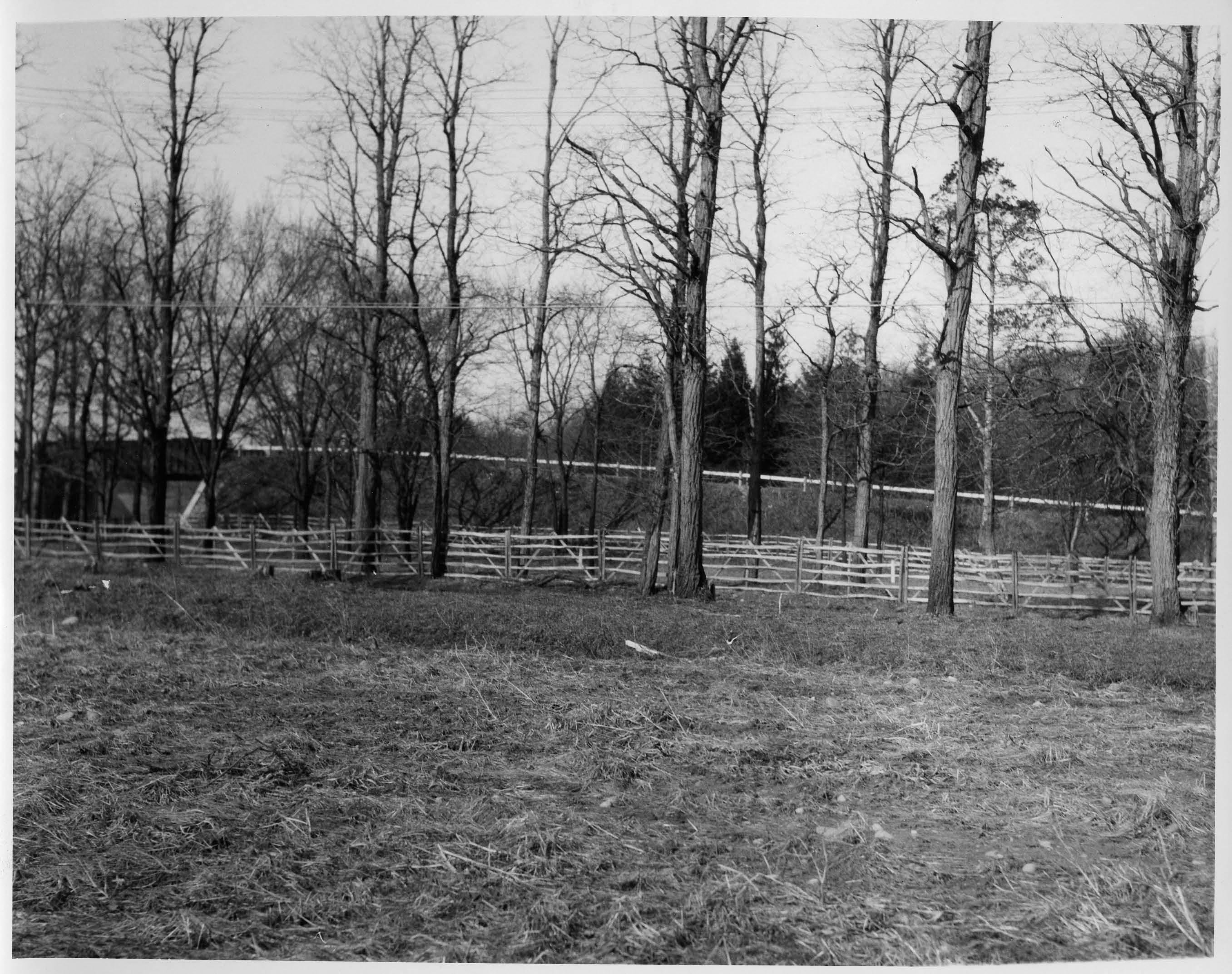
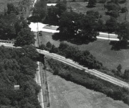
2011 Current Views
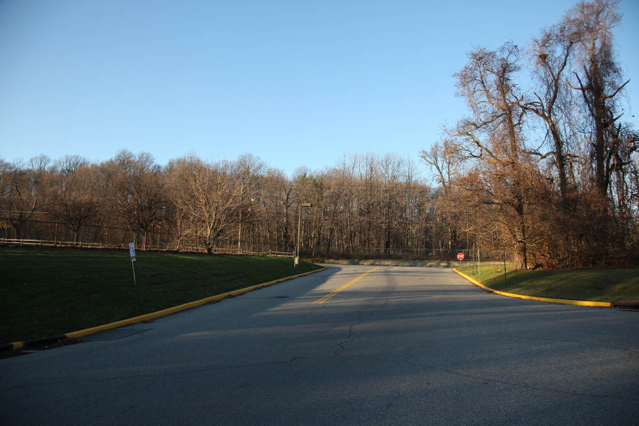
A view looking north on the Motor Parkway right-of way towards Marcus Avenue. The elevated area on the left.
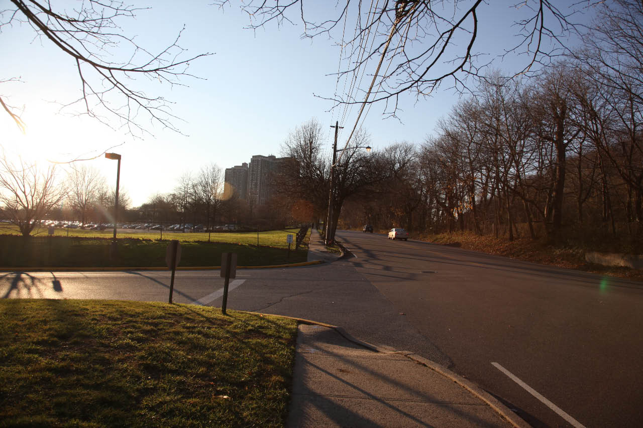
Marcus Avenue looking west. Note the elevated ground where the bridge embankment was located.
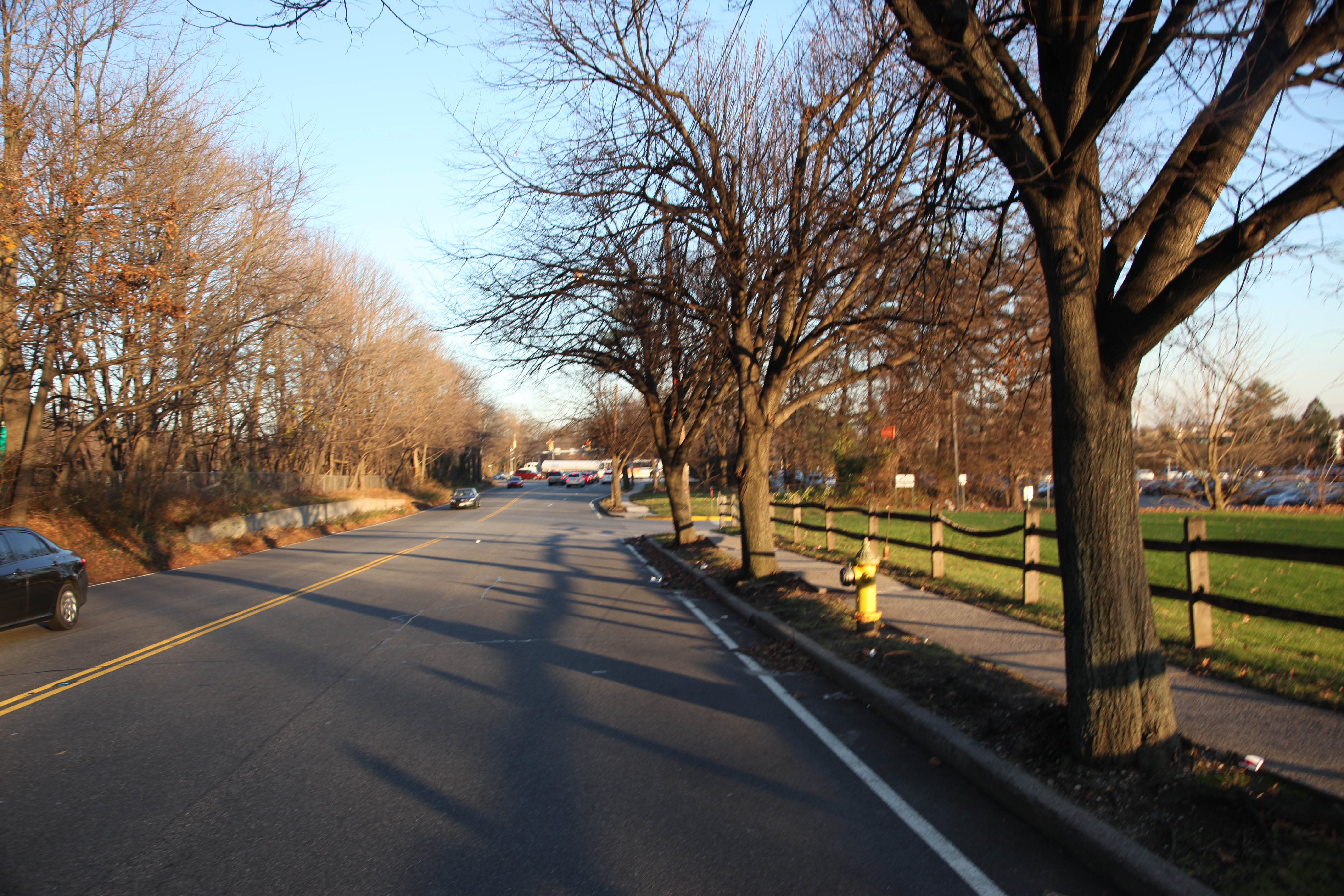
Marcus Aveue looking east towards Lakeville Road. The concrete retaining wall on the north side marks the location of the bridge's north embankment.
2011 Bing Maps
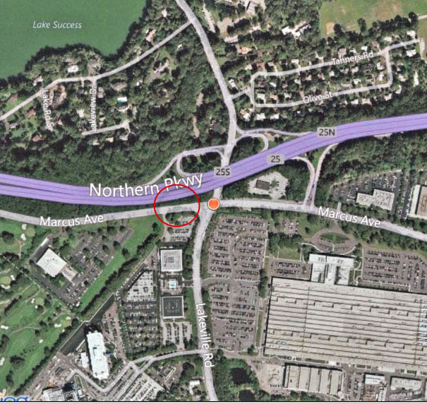 This Bing Map highlights the site of the Marcus Avenue Motor Parkway Bridge.
Links to related posts on VanderbiltCupRaces.com and the Internet:
Archives: Long Island Motor Parkway Bridge Series
The 1928 Long Island Motor Parkway Atlas
Archives: Long Island Motor Parkway- Bridges
Archives: Long Island Motor Parkway Bridges- Queens
Newly Discovered Photos of Motor Parkway Bridges and Willie K’s Guest Lodge in Lake Success
Google Maps: Marcus Avenue, Lake Success
Index: Archives on VanderbiltCupRaces.com
Archives: Monthly Highlights (2008-2011)
Update: June 19, 2012
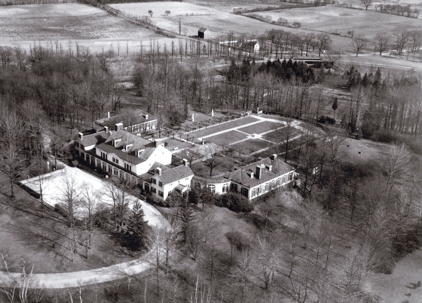 This 1927 aerial shows a spectacular view of the Deepdale Estate, former Lake Success home of William K. Vanderbilt, Jr., and the Marcus Avenue Motor Parkway Bridge.
 The Marcus Avenue Motor Parkway Bridge


Comments
From James S:
“Gram and I spent part of yesterday scrutinizing the wooded area sandwiched by the Grand Central and Marcus Ave where there was a bridge crossing just a few 100 feet west of what is now Lakeville Road as depicted in last week’s newsletter. Gram was excited to find a few small pieces of asphalt coating cement that I’m sure are final remnants of the parkway. He is endlessly fascinated by the road and we are plannng a hike over bits of the road from Bethpage the Christmas Holiday.”