Kleiner’s Tour of the Long Island Motor Parkway and a Mystery Triangle
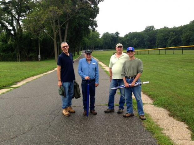
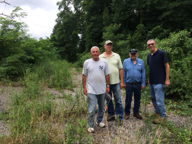
In early August, Art Kleiner of Kleiner's Korner fame led a tour of the Motor Parkway from Lake Success to Bethpage with three friends. Here is proof that exploring the Motor Parkway is indeed a lot of fun and a real bonding experience.
Enjoy,
Howard Kroplick
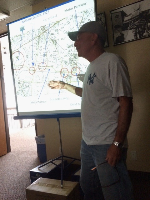
Art mapping out his Motor Parkway tour.
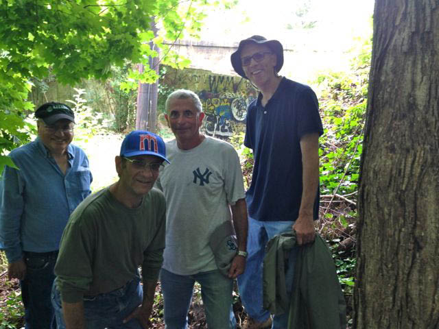
Lake Success
The tour became in Lake Success near the remnants of the Great Neck Lodge.

A great stretch of the Motor Parkway with the three-foot concrete extensions onn both sides of the road.
Old Courthouse Road Motor Parkway Bridge
On top of the newly cleaned up town landmark.
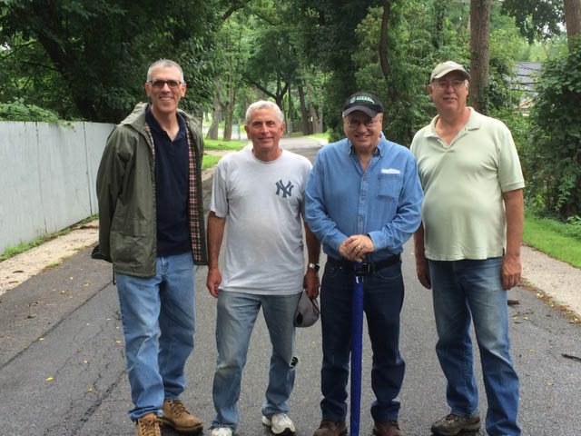
Williston Park
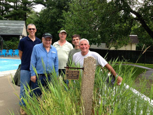
Art: I was finally able to see the Williston Park historical marker that I believe Al erected. It being not a swimming day, the staff (oldest was probably 25 or so) was very helpful and eager to learn more about the Parkway. Some new about it and the marker and some didn't.
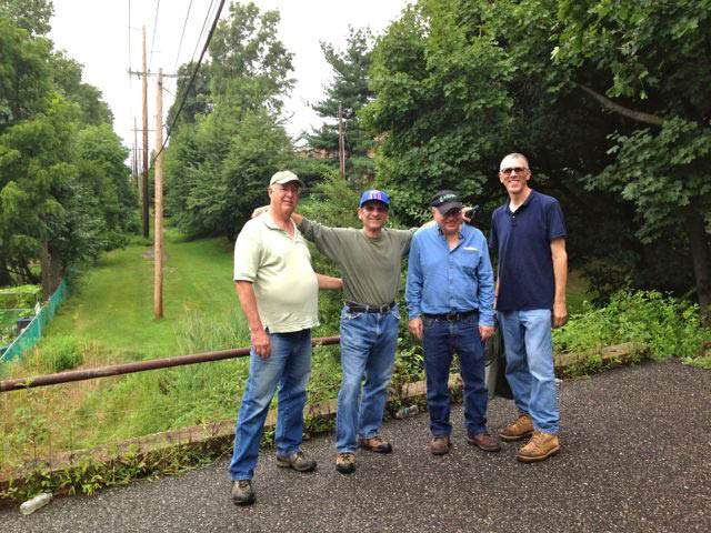
East Williston
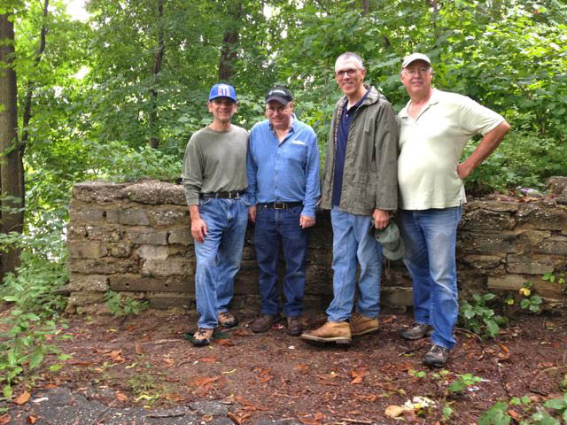
On top of the bridge embankment near Roslyn Road.
Bethpage
More pavement found near Stewart Avenue, very close to the 1908 ground-breaking ceremony.
At Deadman's Curve.
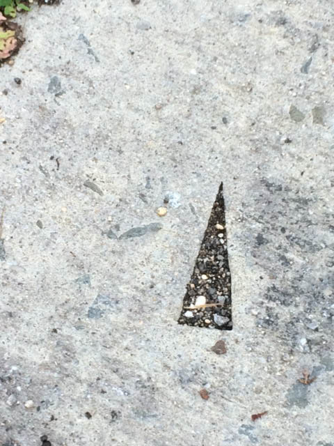
Art: This triangle was cut out in the Parkway roadway at Deadman's Curve. One of my buddies noticed it and was wondering about its significance. I couldn't answer, except that maybe it was post from a sign hung there at one time. Any ideas?


Comments
What an experience is right,you’ll never know what you’ll find,will you?you might be right about that triangle,nice find,have to do a little research on that.
Women go shopping, men explore! Great day Art.
ART—-What’s funny is you had to give them a pre-adventure map presentation? LOL. Didn’t the guys know where you were taking them?
No idea about that triangle. Maybe overthinking. Maybe something just chipped the pavement in a unique way? I’m still wondering about the Caroline Street posts!
Hi Art. I don’t know if it matters, but what direction is the triangle “pointing” towards. North, west etc. I think this area is going to be designated as a section of the LIMP trail? Such a fine cut, maybe done by a surveyor?
What direction is it pointing
Nice sleuthing. You guys did this on foot? That’s quite a distance. Interesting clean cut mark. Coincidental? Much head scratchin’ goin’ on here. I too was thinking a surveyor’s monument mark for equipment positioning. When working with surveyors it was typical to encounter small monuments engraved in concrete sidewalks, or a small metallic plaque with a center point, embedded into concrete to last many years. This would be a first for me where a triangle was used, usually an “X” or “+”. Unusual but still possible.
Art, were coordinates recorded where this was located? I’d like to take a look when I get a chance.
Dave, haven’t been able to think of a better theory than Rt 135 construction with uprooted LIMP posts, used by the homeowner as a retainer wall on the incline. Caroline posts seemed randomly positioned where some were even installed upside down. But I’m all ears for the solution. I love a good mystery
Let me add to the chorus. Exactly where was this aberration? What are its dimensions and how deeply was it cut? Cutting concrete that precisely is pretty well nigh impossible. The bottom appears freshly exposed; if ‘twere an old hole, say where a stick rotted out, the bottom would look as aged as the road surface - and it would be full of debris, especially in the inaccessible vertex. Aliens! Photoshop (and it’s not even 01 April!)? Sam, III
Oooh! I know, I know! It’s a Bermuda (Shorts) Triangle! Sam, III
Sorry for the delay in responding. Wow - I just opened this blog post and saw my tour! I usually always open the blog the day it comes out but must have missed it.
We did the tour by traveling by car to the 14 or so sites I had outlined ahead of time. More tours to come since time wouldn’t permit more and a few friends who had expressed interest couldn’t make it.
About the cutout, it was located soon after the Parkway curved north. I’ll be back there soon and get dimensions for Sam and more details. I’m at the location every few months and this was the first time seeing it so whatever it is was recently done. Thanks for your interest.
Hi Art, With regard to the Williston Park marker, I donated the stone post to the Village Historical Society. Looks like you had fun. Al