Kleiner’s Korner: Assorted Maps of the Motor Parkway
Following up on my previous post concerning maps showing the Motor Parkway produced by the NY Daily News here are numerous others by various publications.
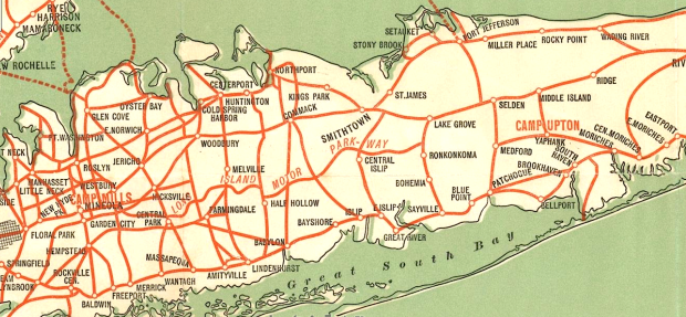
Take the time to look at each map and pick out what may be of interest to you. For instance, the cover map shows both Camp Mills and Camp Upton providing a clue as to the timeframe being between 1917 and 1920. Also its interesting that "Parkway" is hyphenated (e.g., "PARK-WAY").
I apologize upfront for the lack of clarity in some of the maps making it difficult to see the detail that would provide additional information. Either the original publication was not digitized clearly, the original itself was not clear, the software I use to touch up photos is limited, my ability to touch up is limited or my eye-sight at the wee hours of the morning when I usually construct posts is not the best (especially before my first cup of coffee!).
Art Kleiner
The Vanderbilt Cup Race Years
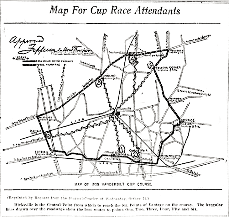
Map of the 1908 course showing approval by Jefferson Dumont Thompson. The hand drawn squigly lines indicate the best routes to six viewing points starting with the grandstand (#1). (The Morning Journal Courier Oct. 23, 1908)
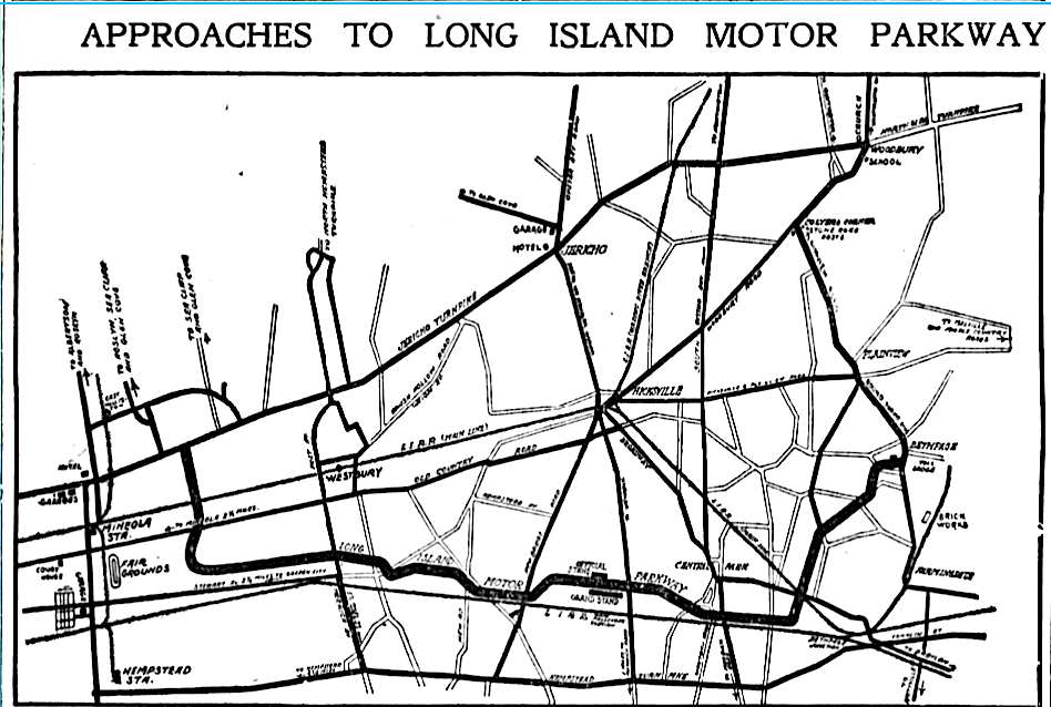
This map shows the Official Box and Grandstand and other non-race related locations such as the brick works factory (near Bethpage) the fairgrounds (Mineola) and schools. Hotels and garages are shown as well - can you find and identify them? (Brooklyn Daily Eagle Jun. 12, 1909)
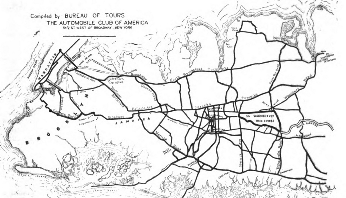
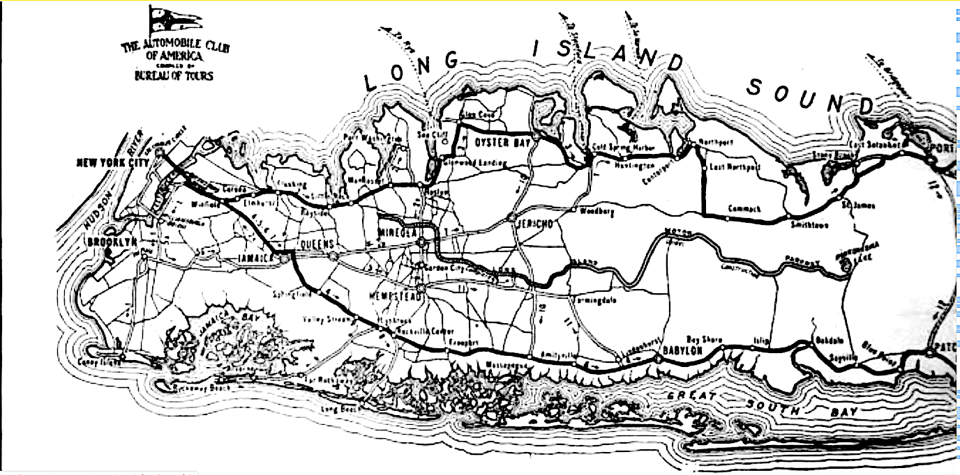
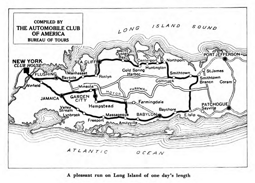
The "Bureau of Tours" of the Automobile Club of America compiled various touring routes on Long Island starting at its headquarters in Manhattan and traversing through Long Island. This 1909 map outlines in bold the course of the Vanderbilt Cup Race. (The Club Journal Oct. 30, 1909)
Another Club map in 1910 featured the Motor Parkway from its western terminus at the time, Great Neck, to its eastern terminus, Lake Ronkonkoma. (The Club Journal Jun. 11, 1910)
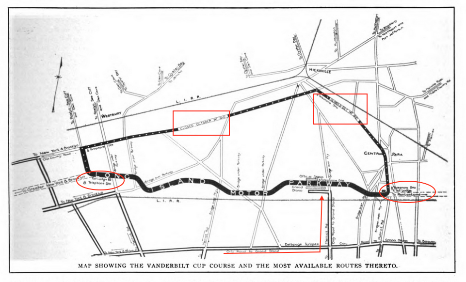
This 1910 map highlighted the "only road to the grandstand" (Bethpage Turnpike), notations of when the public roads would be closed and various toll lodges and telephone stations along the course. (The Motor World Sept. 22, 1910)
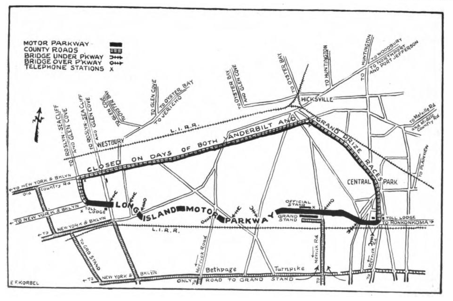
Two days later a similar map was produced however this one noted the bridges that went under and over the Motor Parkway. (Automobile Topics Sept. 24, 1910)
1915 - 1931
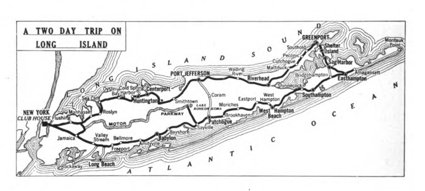
A two day trip through Long Island. Wonder what the road is connecting Lake Ronkonkoma and Sayville. (The Club Journal May, 1915)
And a one day trip. (The Club Journal Dec., 1915)
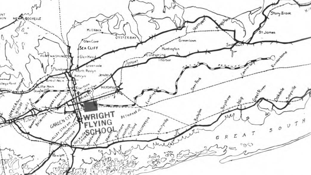
Produced by the Wright Flying School in 1916 this map prominently featured the Motor Parkway. (The Wright Flying School, 1916)
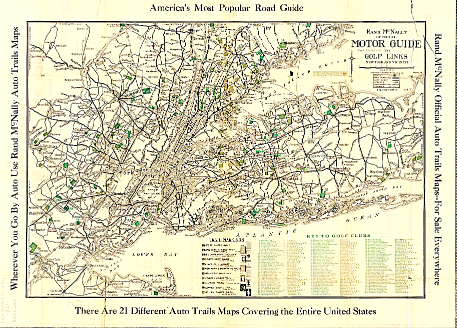
Here's a very detailed map of the metropolitan NY area created by Rand McNally showing the many golf courses (and the Motor Parkway). Interesting to me is the listing of the Lincoln Highway under "TRAIL MARKINGS". I hope to find a clearer picture of the map and will re-post if found allowing for a much more readable view. (Rand McNally, 1921)
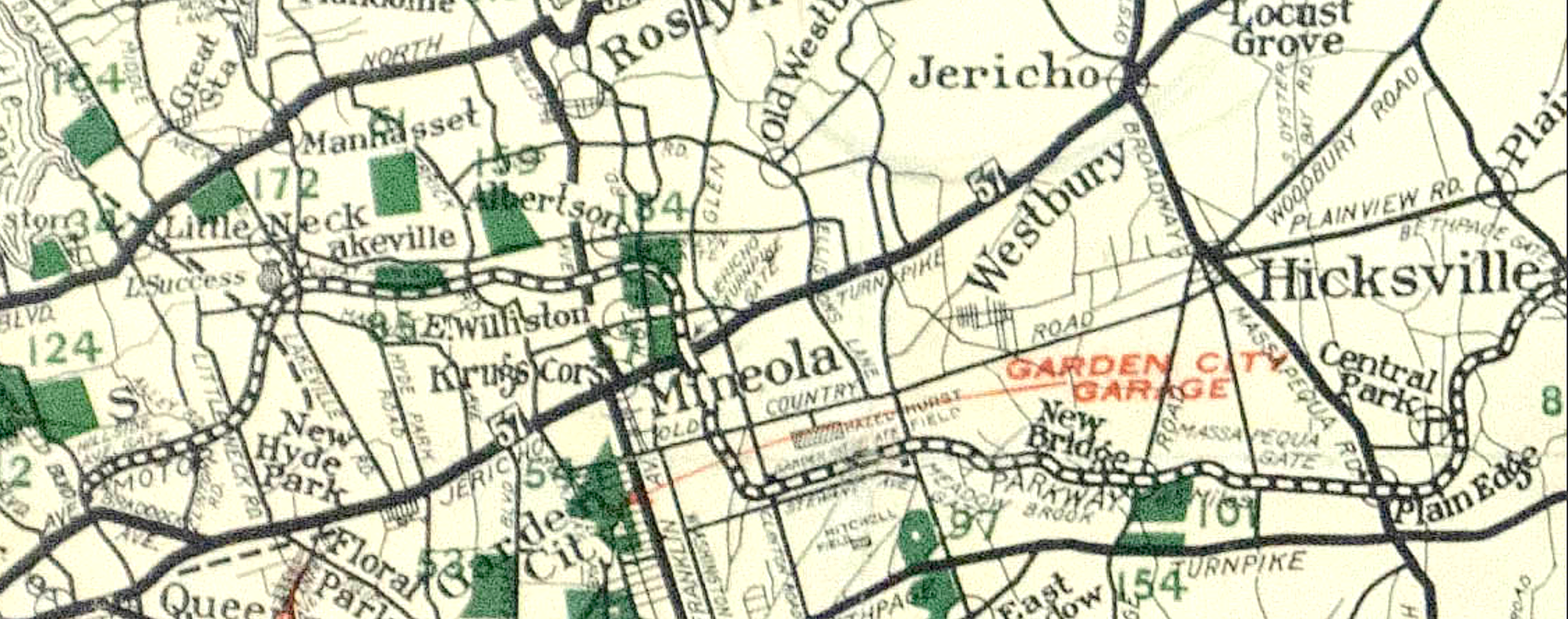
A clearer 1923 Rand McNally map showing a bit more information pertinent to our needs; The Motor Parkway, various toll gates, the Garden City Garage, Krugs Corner, Mitchell Field, Hazelhurst Field and the Garden City Airfield. The sites in green are golf courses. (Rand McNally, 1923)
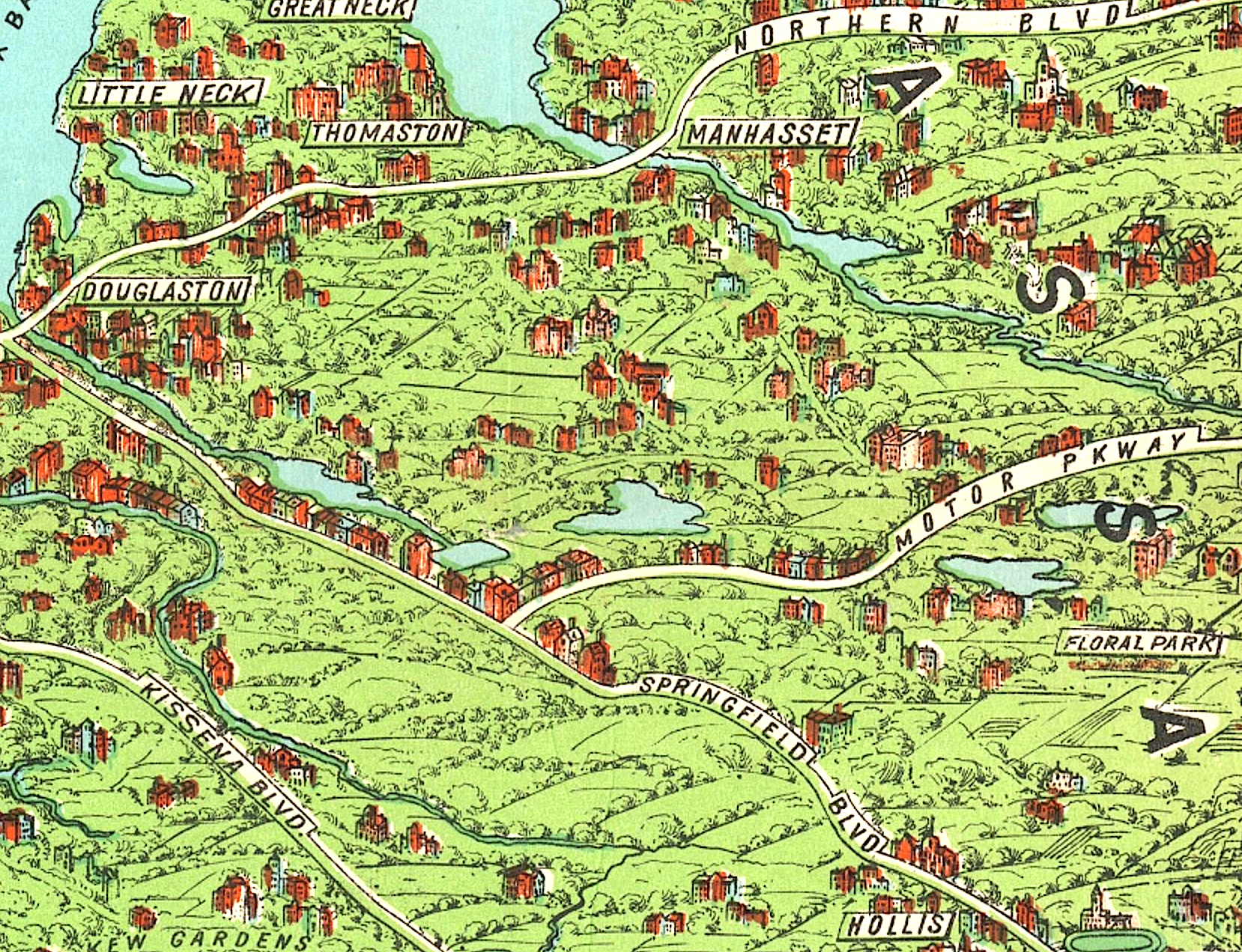
I'm not sure about the accuracy of this 1927 Nostrand map. Can anyone identify the track next to Hollis and Springfield Blvd.? (Nostrand Map Company, 1927)
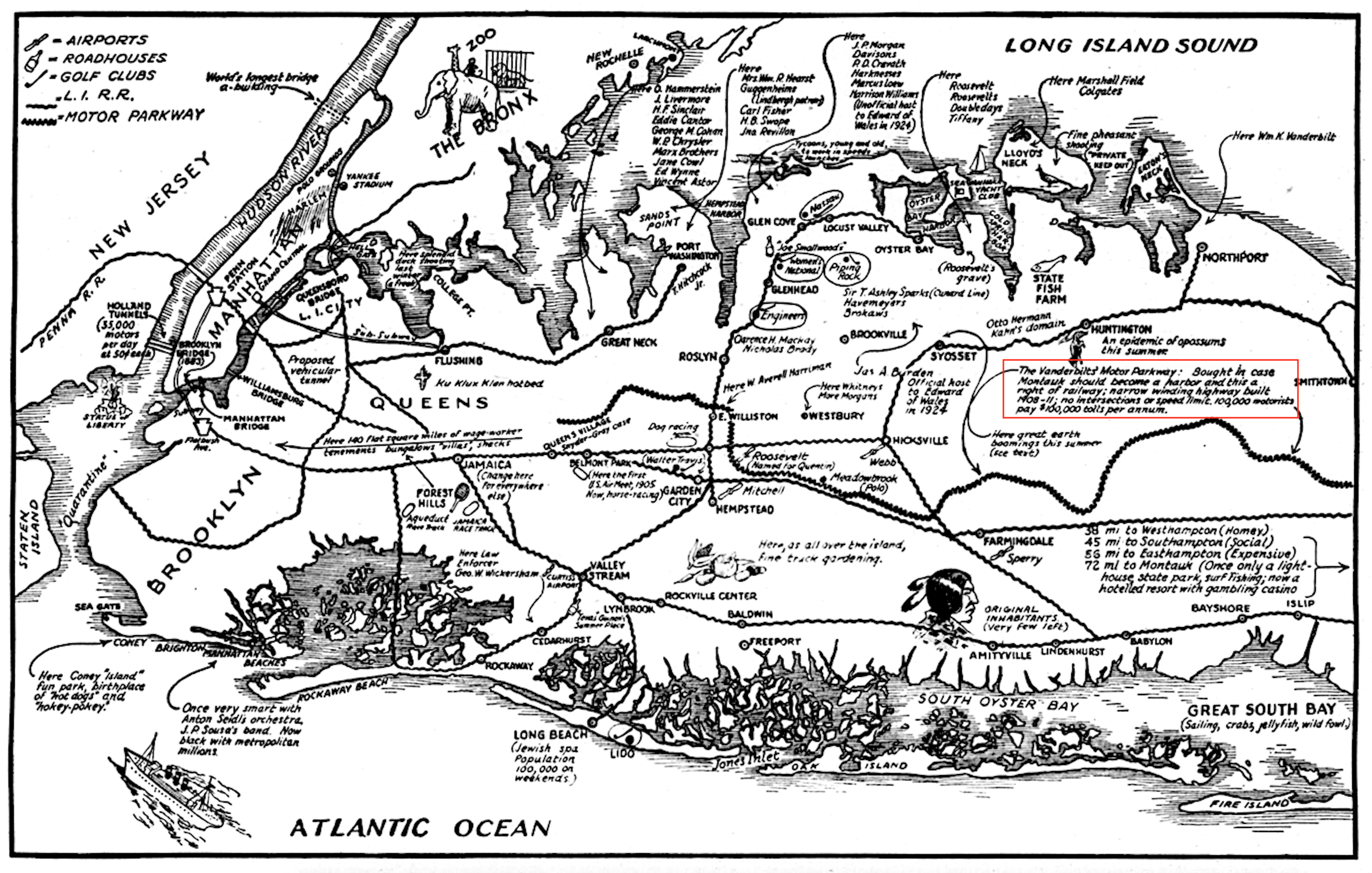
One of my favorite maps was in "Time" in 1929 that contains lots of historical references and information which might surprise you (take a look and see what I mean). Glad the Motor Parkway made it into the legend at the top left. (Time Sept. 16, 1929)
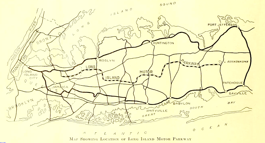
Not sure why the US Dept. of Agriculture would highlight the Motor Parkway in one of its publications but I'm sure there's a logical reason. (Public Roads - US Dept. of Agriculture Mar., 1931)
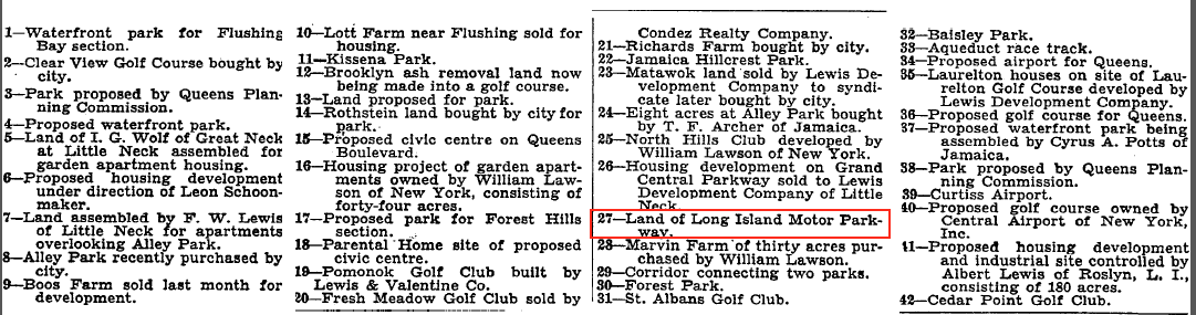
"The New York Times" in 1931 published a detailed list of real estate transactions and development proposals and an associated map. Wonder which listings came to fruition and what eventually happened with the proposals. (The New York Times May 3, 1931)
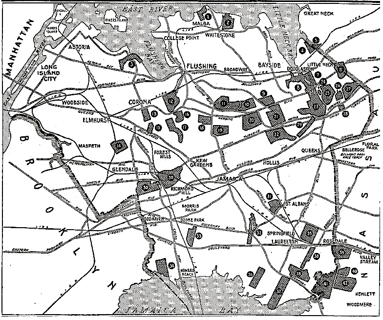
The Motor Parkway land is #27. (The New York Times May 3, 1931)
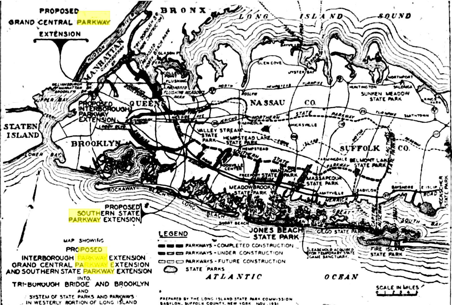
Published by the New York State Parks Commission (i.e., Robert Moses) in 1931 this map details the Commission's proposed highway extensions in Western Nassau. I believe including the Motor Parkway was meant to show how unnecessary it would be in conjunction with the other highways on or to be built on Long Island. (The Nassau Daily Review Dec. 8, 1931)
Apologies once again for the lack of clarity in many of the maps. Hopefully I'll find some of the same with much better readability.


Comments
Love that 1929 Time map as well!
Listing the estates/owners and the mention of building the ‘world’s longest bridge’ ie The Geo. Washington Br is very cool!
Hello Art,
Great posts with all of the maps. I love looking at old maps as much as you do. The answer to the road connecting Ronkonkoma and Sayville on the May, 1915 “The Club Journal” map is a combination of several roads starting with Rosevale Ave. then Pond Road, then Lakeland Ave. and finally Railroad Ave. in Sayville. There was a mystery photo back in September 2013 showing the Kensington Hotel on the N/E corner of Railroad Ave. & Main St. with a direction sign for the LIMP pointing north. When are you coming back to L. I. ?
Art, the 1927 Nostrand Map is approximating Belmont Race Track pre Cross Isl Pkwy. It’s been the only racetrack in that area since opening in 1905
Frank, In 1926 there were plans to build another horse racing track along the Motor Parkway. That year the Queens Jockey Club announced it had purchased some 270 acres for that purpose from the Stewart Heirs about 4 miles east of Hempstead Village. Newspapers of the day reported the acreage was bound by the Motor Parkway on the north and the Central Railroad on the south, Both Vanderbilt and the Railroad would have loved to seen that happen.
Here are some of the newspaper clippings Al mentioned. And a photograph of the proposed track during construction. Some infighting between the Brooklyn and Queens Jockey Clubs around the time and an eventual reorganization of the Queens club may have resulted in the proposed track’s demise. And possibly the realization that more money could be made by developing housing.
More documentation . . .