Kleiner’s Kolumn: The Carman Avenue Motor Parkway Bridge Removal
Next in the bridge removal series is the Carman Avenue Motor Parkway Bridge in East Meadow, location of many Vanderbilt Cup Races. All pictures are courtesy of the Nassau County Dept. of Public Works unless otherwise noted.
Art Kleiner
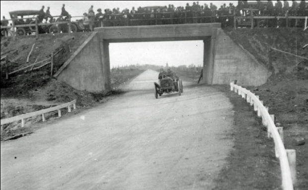
Opening Day of the Motor Parkway
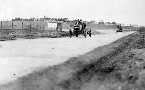
October 10, 1908
Initial Nassau County Plans
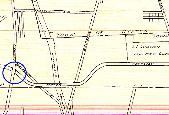
1938: The original Nassau County plans for the disposition of The Motor Parkway did not include the removal of the Carman Avenue bridge.
1939
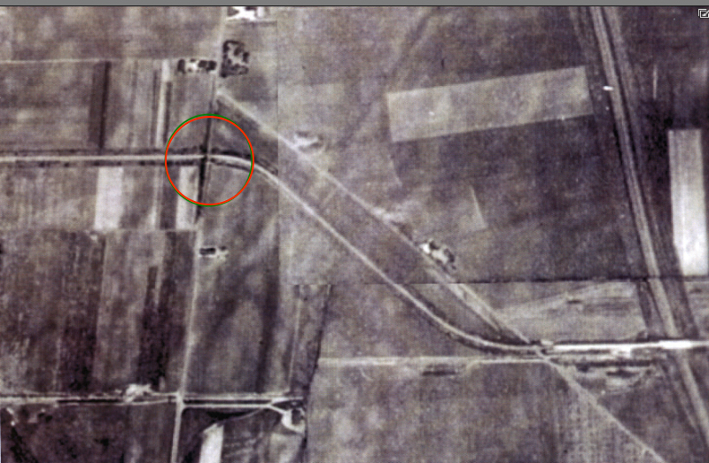
The bridge in 1942.
Removal Plans Begin
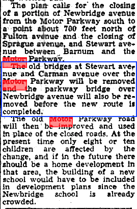
The Nassau Daily Review-Star, July 24, 1947
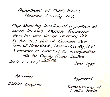
First the Motor Parkway had to be incorporated into the County Road System.
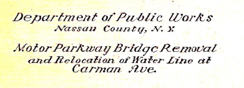
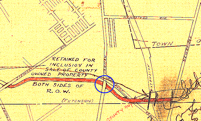
Plans in 1948 called for the removal of the bridge and relocation of water lines.
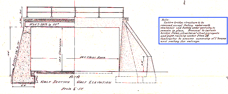
Instructions included removal of the entire bridge, except two bridge footings. I wonder why!
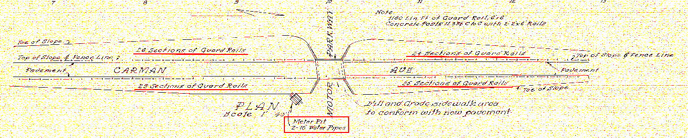
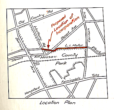
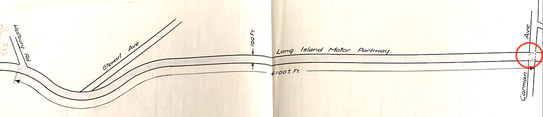
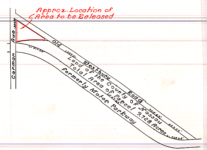
Note the orientation presented here is to give an easier view of the wording - Carman Avenue runs north and south in actuality so the location as shown is 90 degrees off.
Release of Real Property by Nassau County
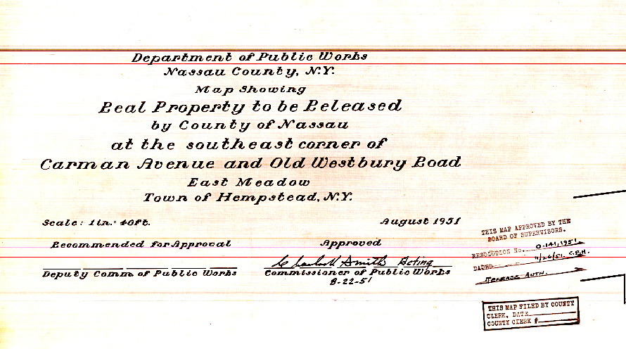
Nassau County gave up some of the area near Carman Avenue in 1951 to eventually allow for a firehouse to be built for East Meadow. This is the area near Gasser Avenue (Old Westbury Road).
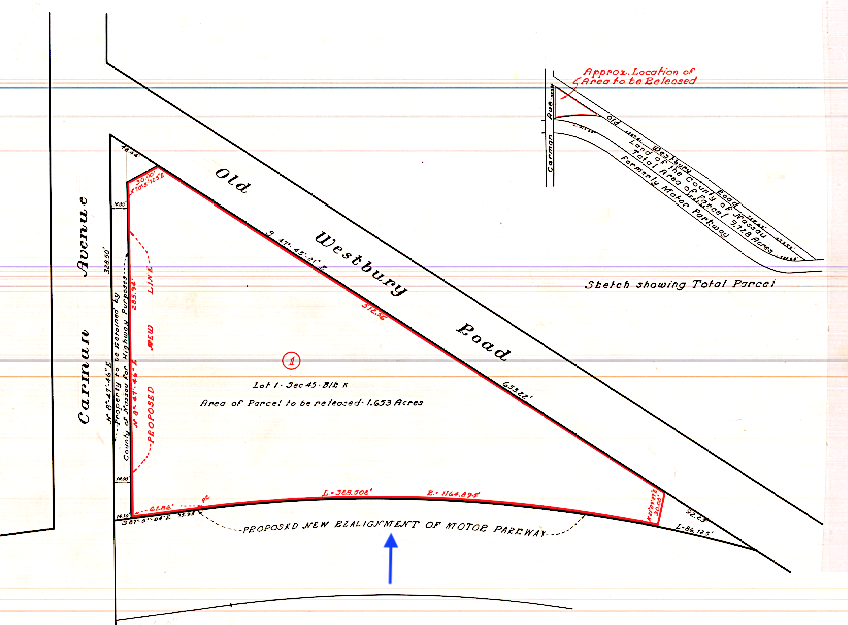
Plans also called for the realignment of the Motor Parkway.
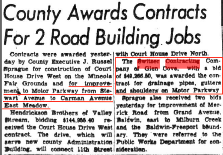
In July, 1952 the county awarded a contract to the Switzer Contracting Co. of Glen Cove to improve the Motor Parkway between Stewart Avenue and Carmen Avenue. Total amount awarded was $49,266.50. (Courtesy Al Velocci and the Nassau Daily Review-Star)
43d
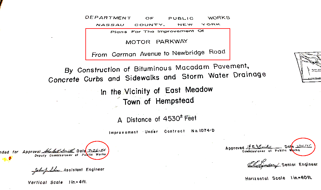
Additional improvements were made in 1955 between Carmen Avenue and Newbridge Road.
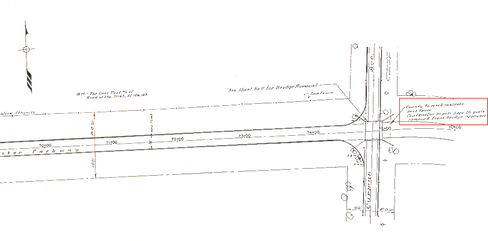
Note the plans call for the erection by the County of a "concrete post fence" and for the "contractor to pile here 20 concrete posts removed from the bridge approach". If I had been around then and living so close many of the posts would have found a different home.
Current Views
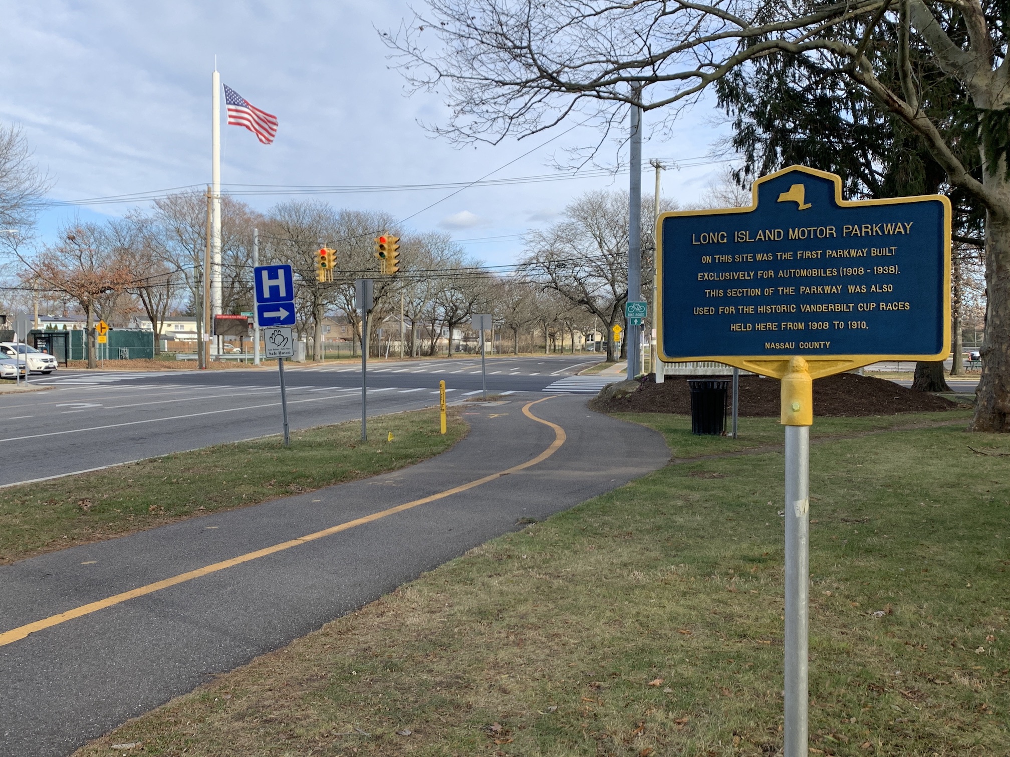
The current intersection, looking east, of Carman Avenue and Salisbury Park Drive where the Motor Parkway Bridge once stood. The flag pole is on the triangular property where the previously discussed East Meadow firehouse is. The Motor Parkway Trail ends (or begins) here and the marker is one of three placed along Salisbury Park Drive. The hospital sign is for the Nassau County University Medical Center.
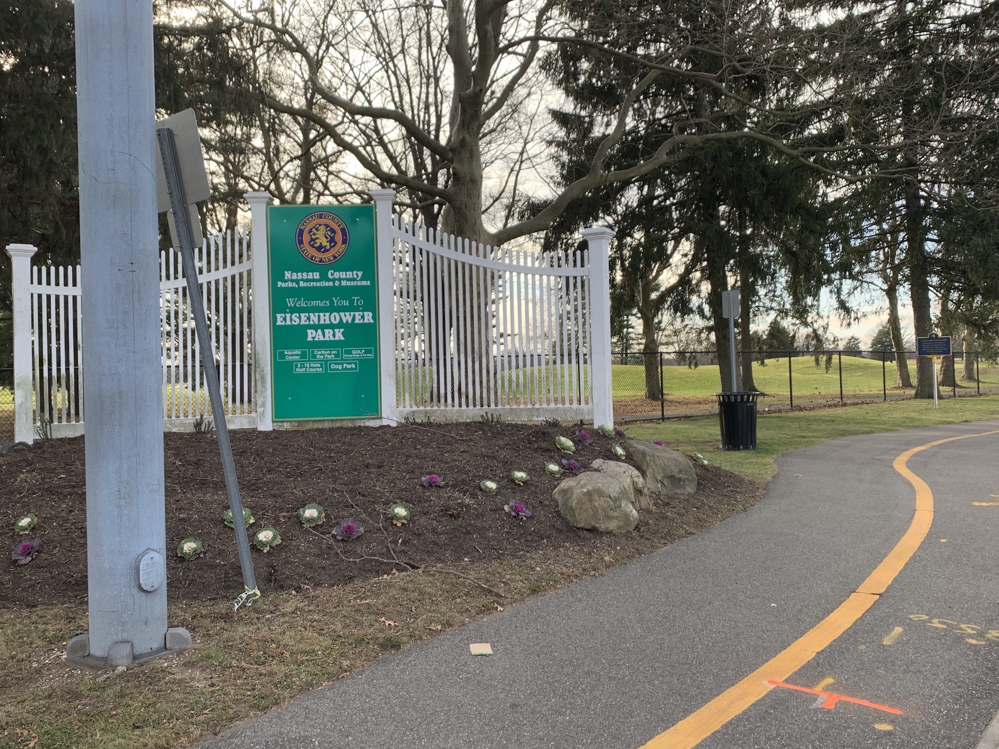
This view is along Salisbury Park Drive going west on the Motor Parkway Trail. As noted in an earlier post, Nassau County is currently extending the Trail completely around Eisenhower Park.


Comments
Art, with your easy manner and diplomacy, you would’ve had no problem acquiring some of those boundary posts : )
I’m thinking in general that a bridge footing below ground wouldn’t have to be removed unless it would be a obstruction to new below ground facilities like sewer, water, natural gas or electric.
The Carmen Ave. bridge is where the photographer stood on the bridge took the photo of the 1907/08 Buick on the Motor Parkway with view looking west of the vast Hempstead Plains beyond, taken in Sept. 1908, appears on the cover of the Arcadia Pub. The Long Island Motor Parkway, co written by Howard and Al Volocci.
I’m with Brian; the abutments are “structure” and would have been removed under the contract. The south side of the triangle does not appear to have been actually realigned so much as the triangle was simply removed from the parcel. I well remember “liberating” a post from the CR67 widening operation just west of Harned Road, ‘way back; whoo - was that ever heavy! I was still strong then but could only lift one end at a time. Sam, III
If you look by the firehouse fence there are remnants of the posts