Greg O’s Garage and Kleiner’s Korner look at Jericho Turnpike Then & Now
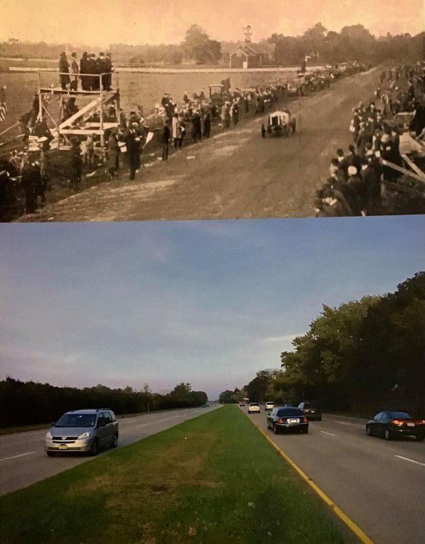
Today's post has Art's Kleiner's Korner and myself taking an in depth look into how much Jericho Turnpike and the surrounding area has changed at the 1904 & 1906 Start/Finish line.
Facebook has a wonderful group called 'Long Island History' where contributors post up incredible historic photos of family members or other historic photos from all around the island. I recently posted in the group the photo above that had been previously used in a Motor Parkway presentation of a Then & Now of Jericho at the starting line. A much older reader saw the 'now' photo and was adamant that it was not Jericho Turnpike and there was no place along Jericho that a 6 lane road with a grass center divider could have existed. I then surmised he must have moved away from Long Island before that section of Jericho widened and only has a memory of the stretch from the 1950's.
So when did this area change so drastically to make it completely unrecognizable from what it used to be? I employed Art's masterful researching skills and connections at the Nassau County Dept of Public Works to assist in solving the question.
Greg O.
THEN: 1904
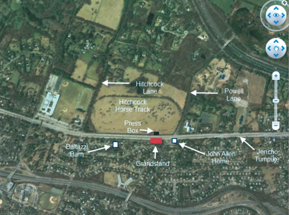
The grandstands along Jericho at the southern edge of the Hitchcock horse track under construction in the short 3 days given to build them before the 1904 race.
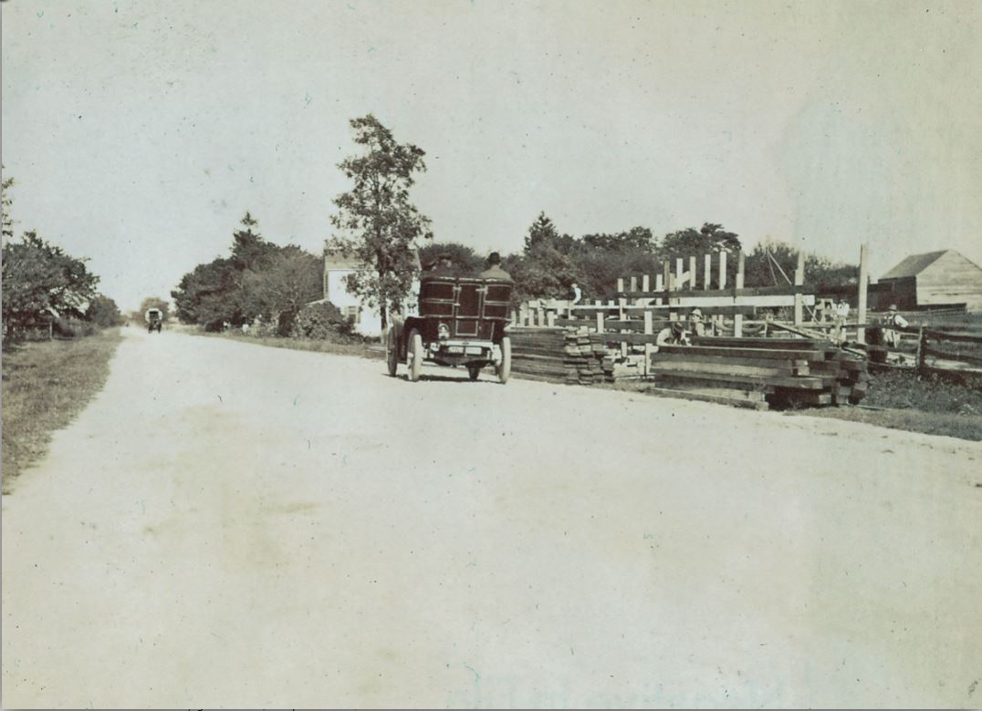
This view looking east towards the John Allen home at the intersection of Powell and Jericho.
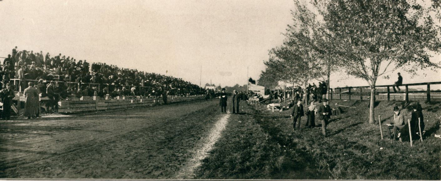
The completed grandstands in an excellent view of Jericho looking west.
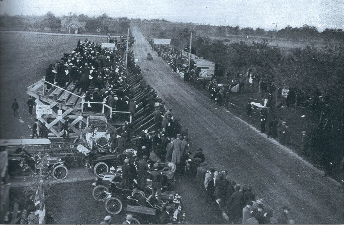
Another great view of Jericho looking west from the top of John Allen's home.
THEN: 1906
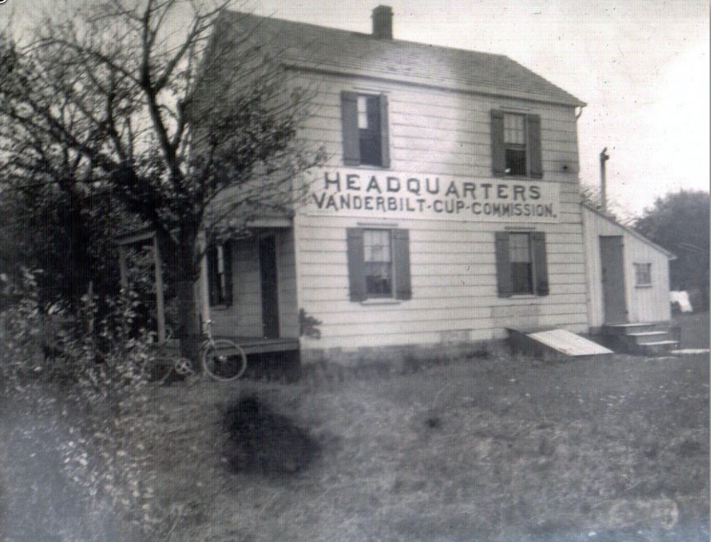
For the 1906 races, John Allen's home became the conveniently located HQ for the Vanderbilt Cup Commission, as well as great spot for spectators to grab a refreshment while watching the races.
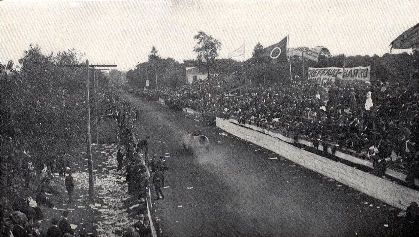
Jericho hadn't changed much in the two years gone by since the 1904 races.
Looking east.
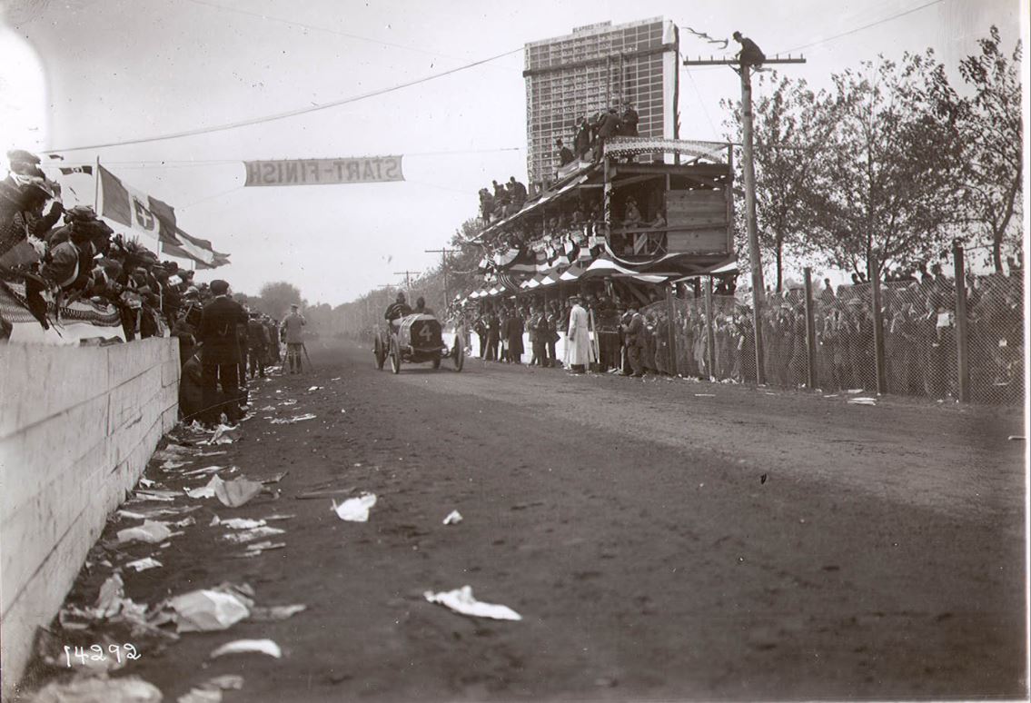
Looking west with Vincenzo Lancia's #4 FIAT passing the Start/Finish line.
Jericho Turnpike Widening
By the time of the 1950's, Long Island was booming! Gridlock traffic was becoming a major problem and even the arrival of the Long Island Expressway didn't help alleviate the issue. In fact, the LIE was making the problem worse by bringing in more traffic to the booming communities along the expressway.
In the very early 60's, it was proposed that a widening of Jericho Turnpike in various sections in Nassau and Suffolk would help with the new traffic problem, with the 2 notable locations being between the Northern State overpass and the new L.I.E. overpass in Old Westbury, and another section around the intersection of Route 110 and Jericho in Huntington.
The widening in Old Westbury would encompass a new 6 lane highway with a grassy center divider and an expansion of Hillside Ave. to then merge with Jericho just east of the Northern State overpass.
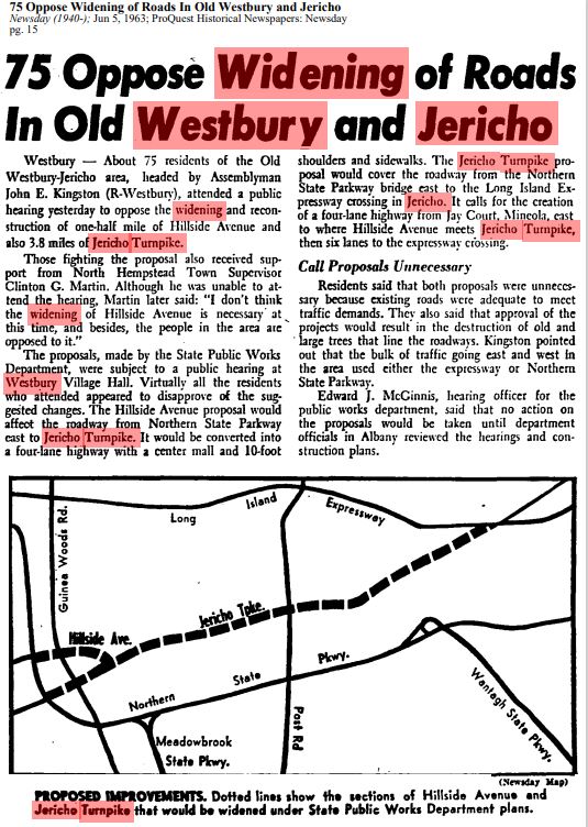
Newsday; June 5th, 1963
However, this plan was met with much opposition.
In the above Newsday article from 1963, it was suggested there was no problem in the area and most of the local residents were firmly against the project.
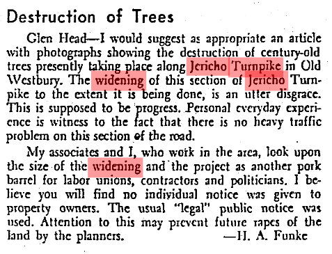
Some Newsday readers, like this June 15th, 1966 letter to Newsday provided by Art's Kleiner's Korner, even went so far to complain about the 'destruction of century-old trees [along Jericho]' and claim it to be 'another pork barrel for labor unions, contractors, and politicians'
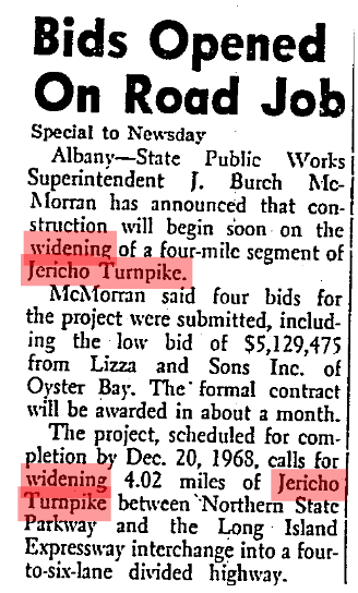
The project was eventually put through and bids opened for the job.
Lizza and Sons Inc. of Oyster Bay proposing a low bid of $5,129,475 and scheduled to be completed by Dec. 20. 1968.
Article supplied by Kleiner's Korner from Newsday, March 7th, 1966
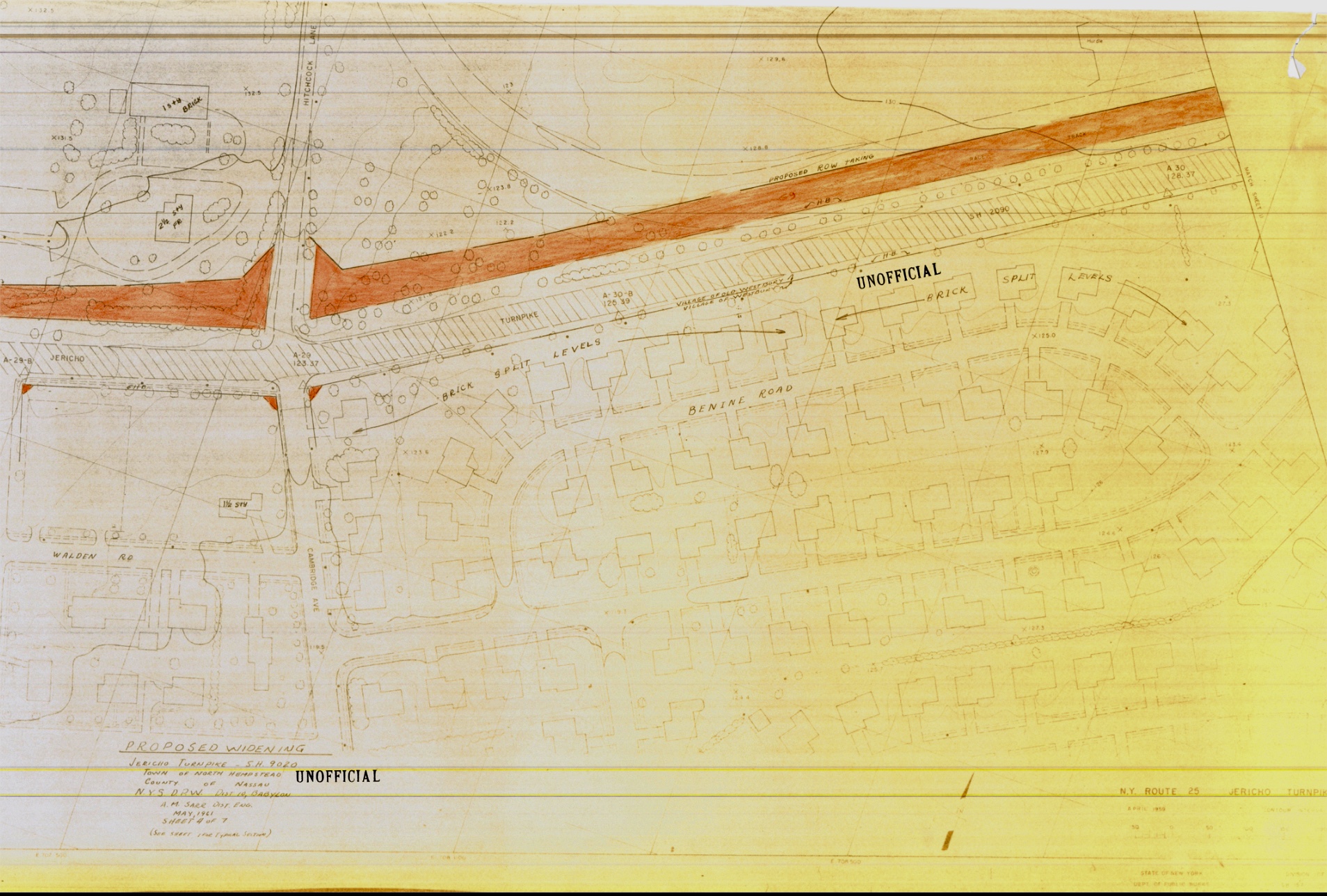
'Unofficial' plans proposed in May 1961 show the widening on the north side of Jericho with the westbound 3 lanes directly on top of Hitchcock's old horse track. This section being from Hitchcock Lane easterly to around the midpoint of the horse track just about where the grandstands were.
This and following 1961 plans supplied by Kleiner's Korner and his friends at the Nassau County Dept. of Public Works.
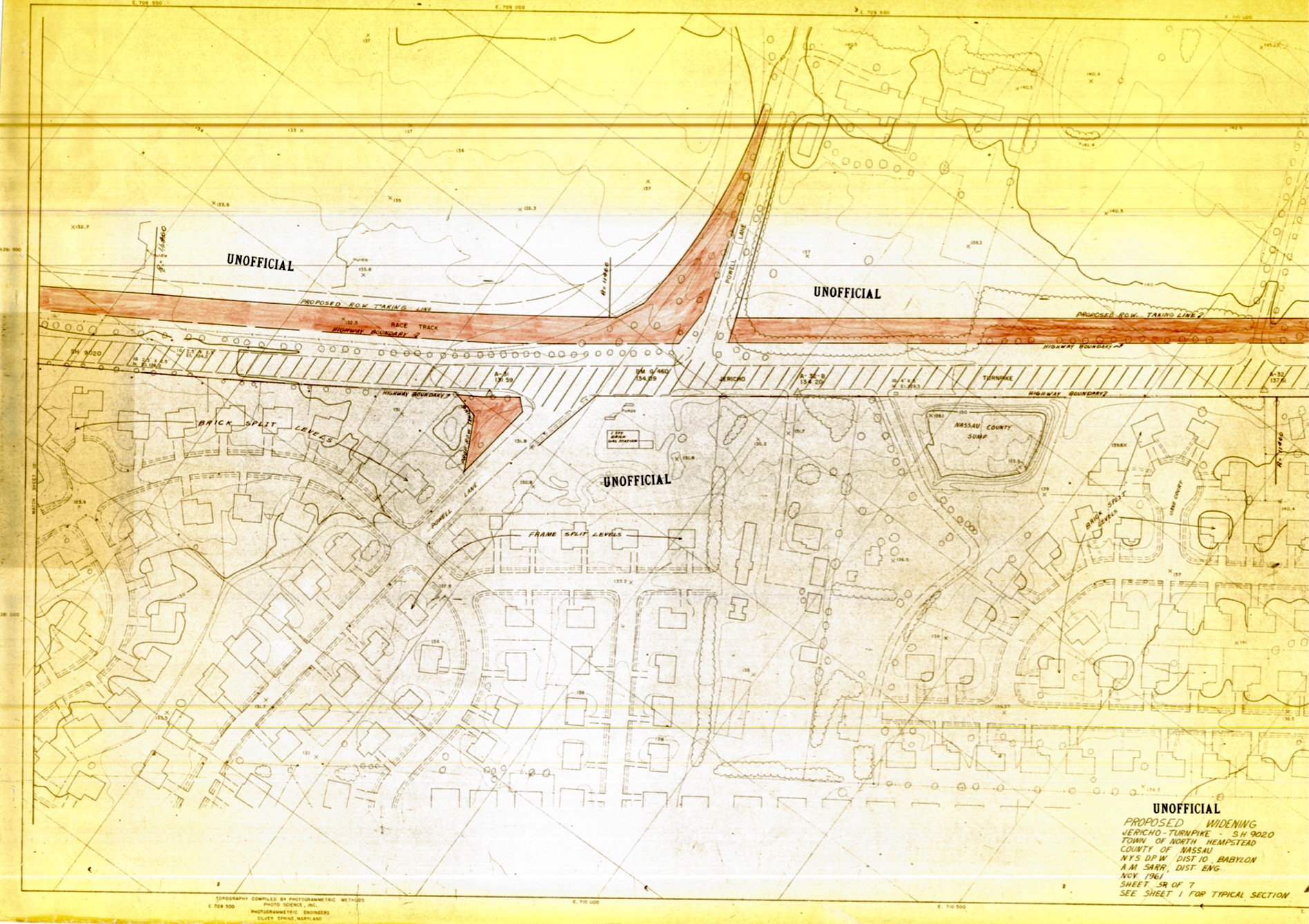
Continuing from the midpoint of the track to Powell lane.
Courtesy of the Nassau County Dept. of Public Works
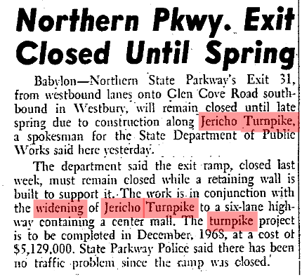
Informing the public that the Northern State Parkway exit #31 will be closed during the construction of retaining walls in the area and the project still on track to be completed by the December 1968 deadline.
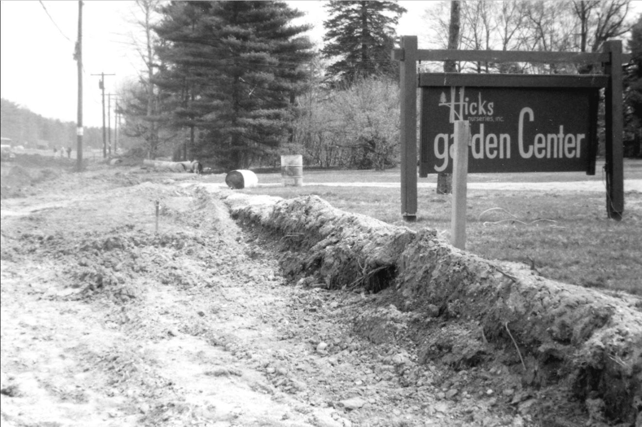
Surprisingly, there does not appear to be easily found ground level photos or aerials of the construction as Art, nor I, found any.
I did manage to come up with this 1966 photo of Hick's Nursery during the time of construction in Pinterest.
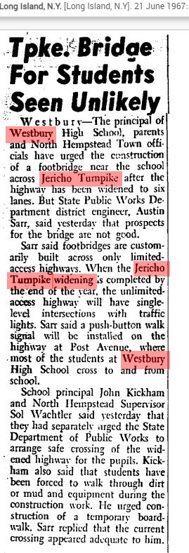
Concerned for the Westbury High School students who had to cross the new wider and more dangerous Jericho Turnpike, the parents and principal requested a pedestrian foot bridge to ensure students on the south side could safely cross.
June 21st, 1967
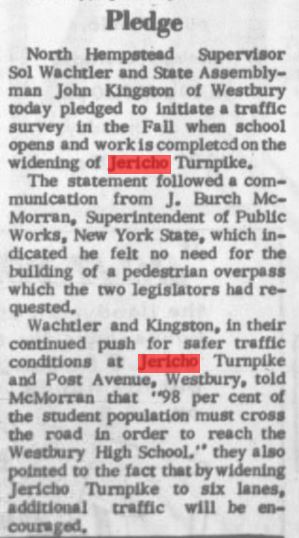
However, J. Burch McMorran, Superintendent of Public Works disagreed and did not feel a foot bridge was necessary.
Manhasset Mail Aug. 10th, 1967
Today and current views
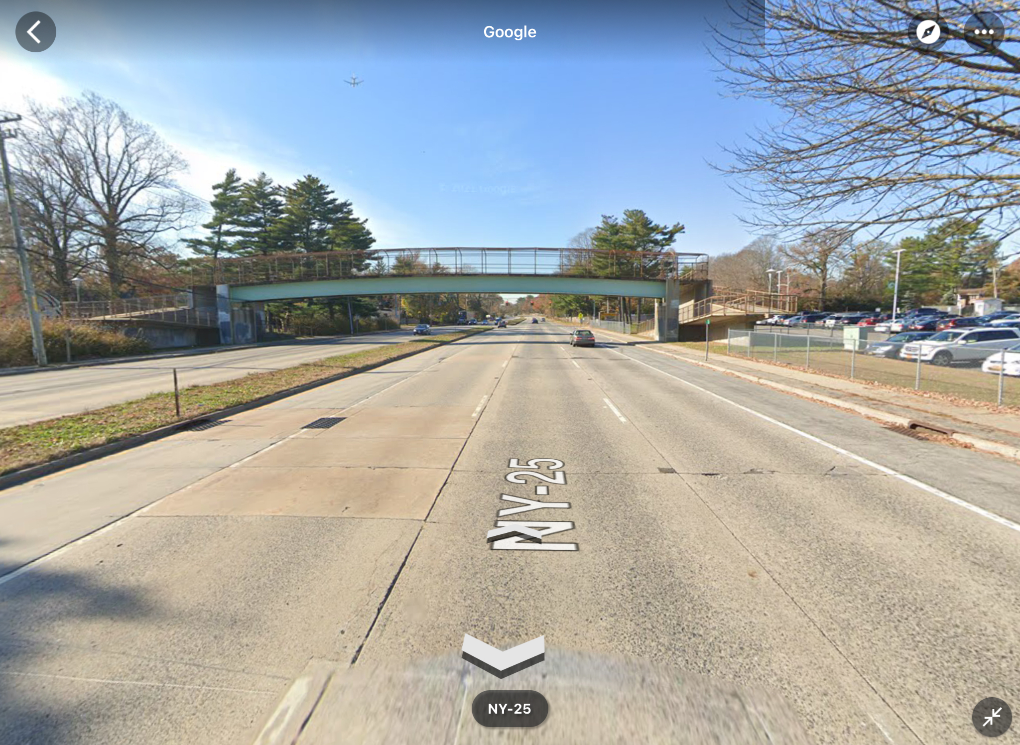
At some point, maybe long after the project was completed, the High School finally did get their bridge and the kids were probably thrilled to get to school...or not.
As seen from this current Google Street View image.
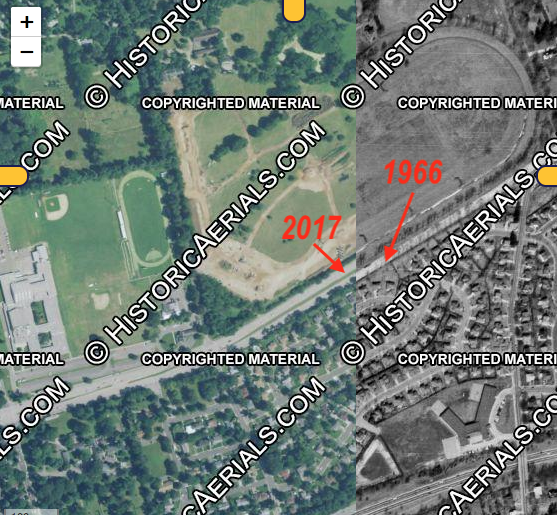
So that answers the question!
The area changed to be unrecognizable after the mid 1960's and the narrow, bucolic Jericho Turnpike known by people in the 1950's and earlier was long gone.
Historic Aerials screen shot courtesy of Kleiner's Korner
The Hitchcock property battle
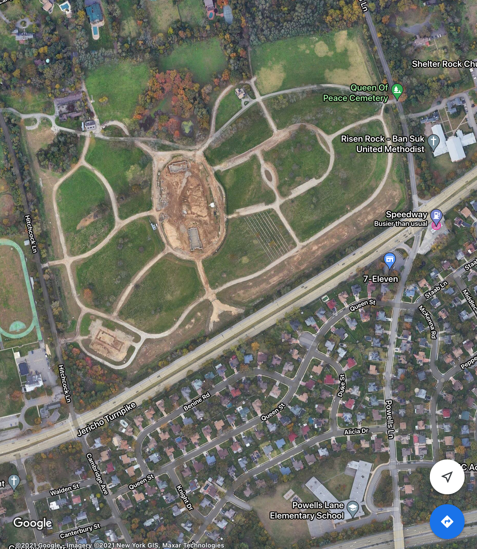
The Diocese of Rockville Centre purchased the old Hitchcock race track and grounds for $5.63 million at a public auction in 1996 and have since started converting the grounds into a cemetery after decades of legal battles with the Village of Westbury.
In a June 17th, 2018 Newsday article, it was stated that;
"The land had been owned by horse trainers who federal law enforcement officials described as connected to the Colombo crime family, according to court documents. During a multiyear FBI investigation that began in 1990, the horse farm’s owners attempted to sell the property for $14 million to an undercover FBI agent posing as a drug dealer, court documents show. In 1992, the owners were indicted on federal charges of money laundering and conspiracy, and the federal government seized the farm, according to court documents."
The article continued;
"In 2000, State Supreme Court Judge Thomas Phelan ruled in the diocese’s favor, stating the cemetery could be developed as a religious use. The village appealed and in 2002, the state Supreme Court’s appellate division’s second department affirmed the religious-use decision. As a religious use, the diocese is exempt from paying taxes on the property.
The diocese alleged that despite the court approvals, the village stalled issuing required permits. In 2009, the diocese sued the village in U.S. District Court, claiming officials had “abused virtually every device and mechanism available” to prevent the cemetery’s development, court documents read.
The litigation ended in 2016 with a settlement agreement paving the way for the cemetery. It also required the village’s insurance company to pay the diocese $7.5 million around April of [2017], said Village Administrator Brian Ridgway."
Historic Marker
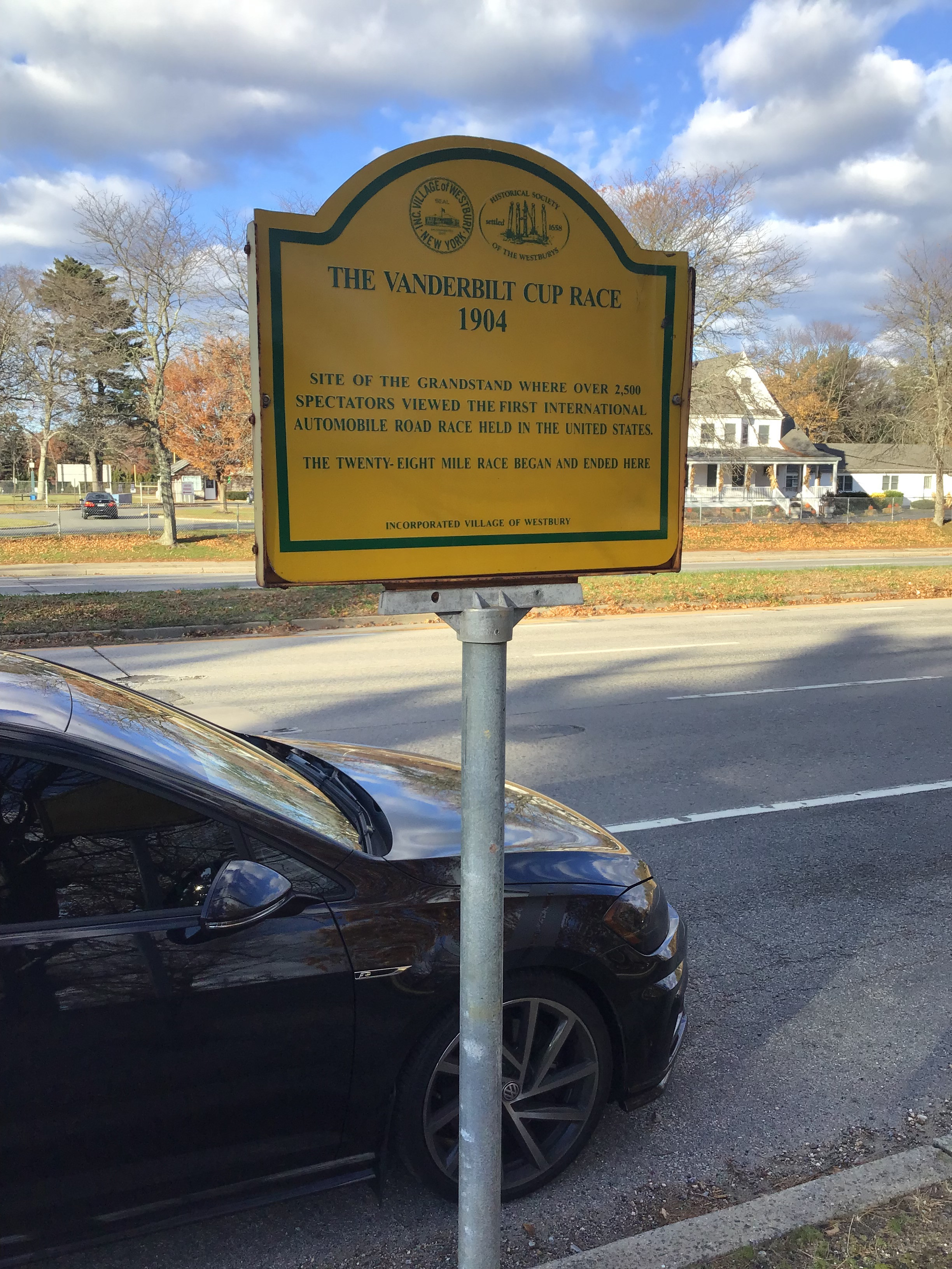
A marker along the south side of Jericho commemorating the 1904 grandstand location can be found closer to the High School.
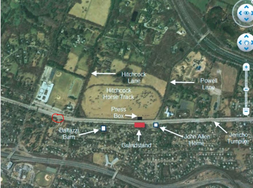
The marker is slightly off by some distance from the actual location. The crude red circle is where the marker is located in relation to the actual grandstand/press box locations.
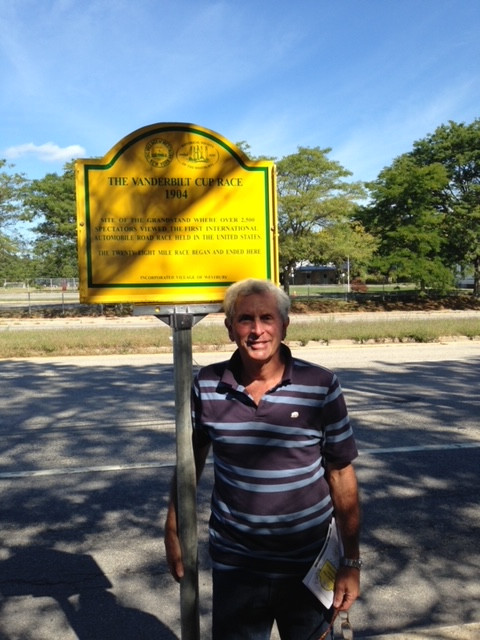
Our favorite intrepid Motor Parkway explorer Art K. at the unveiling ceremony of the marker in 2016.
Howard Kroplick describing the location to Ray Evernham on Americarna a few years ago.


Comments
Alot of research. Thanks
Great research guys, thanks! I began working in Hicksville in 1992, didn’t realize about the horse farm being connected to the mafia, wow.
Interesting coincidence today!
For the last year or so, construction has been underway on the new chapel within the cemetery grounds of the old Hitchcock property.
Cablevision’s News12 just tonight, reported that today was a milestone in the construction of the chapel with the installation of the chapel spires. The Queen of Peace cemetery is one only a very small number of cemeteries being built today. The chapel is scheduled to completed the middle of next year.
Interesting research. Somewhere, someone must have pictures of the reconstruction project. Thanks for all of your efforts.
When I was a farrier apprentice in the 60’s I got to go to Hitchcock’s farm a few times and it was quite an experience for a young man. It was the most beautiful horse farm I had ever seen up to that time. I got to go back in the early 90’s when the track was gone but the barns were still there for lay ups. Thanks for the memories.
JeRita - yes a beautiful place, now gone forever, except in your mind and in pictures.
Here are some of the ones I’ve taken before and during demolition. I have more pictures of the house in disrepair but better off remembering the mansion and track the way it once was.
Some more.
Two more.
And a postcard showing the mansion in better condition.
Thanks for the memories as Bob Hope would have sang
Is the marker commemorating the grandstand still up? If not, when and why did it come down? Thanks for a very interesting article.
Elliot. The marker is still there.
Mark—
Thank you. Just so I have it right: marker is on the south side of Jericho Turnpike
between Post Avenue and Cambridge Avenue? If I am incorrect, please let me know
the exact intersection. Thank you.
Eliot.
The sign is between Advent St. and Cambridge Ave. Closer to Advent.