Greg O’s Garage: A 1906 Nassau County Map
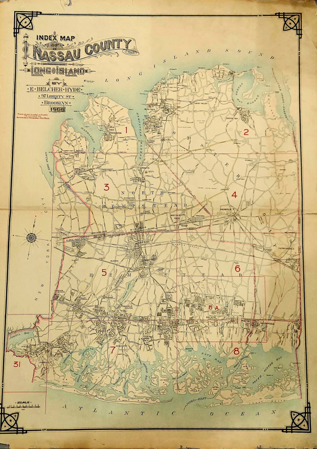
An early Nassau County map has an important, unique addition.
Greg O.

The area now designated Nassau County was originally the eastern 70% of Queens County, one of the original 12 counties formed in 1683, and was then contained within two towns: Hempstead and Oyster Bay. In 1784, the Town of North Hempstead, was formed through secession by the northern portions of the Town of Hempstead. Nassau County was formed in 1899 by the division of Queens County, after the western portion of Queens had become a borough of New York City in 1898, as the three easternmost towns seceded from the county. -Wikipedia
A new map of the newly formed county, then just 6 years old, was needed.
In 1906 E. Belcher Hyde created this map found in a collection of Atlases in the Kroplick collection..
Unique to this map was the inclusion of a Vanderbilt Race course.
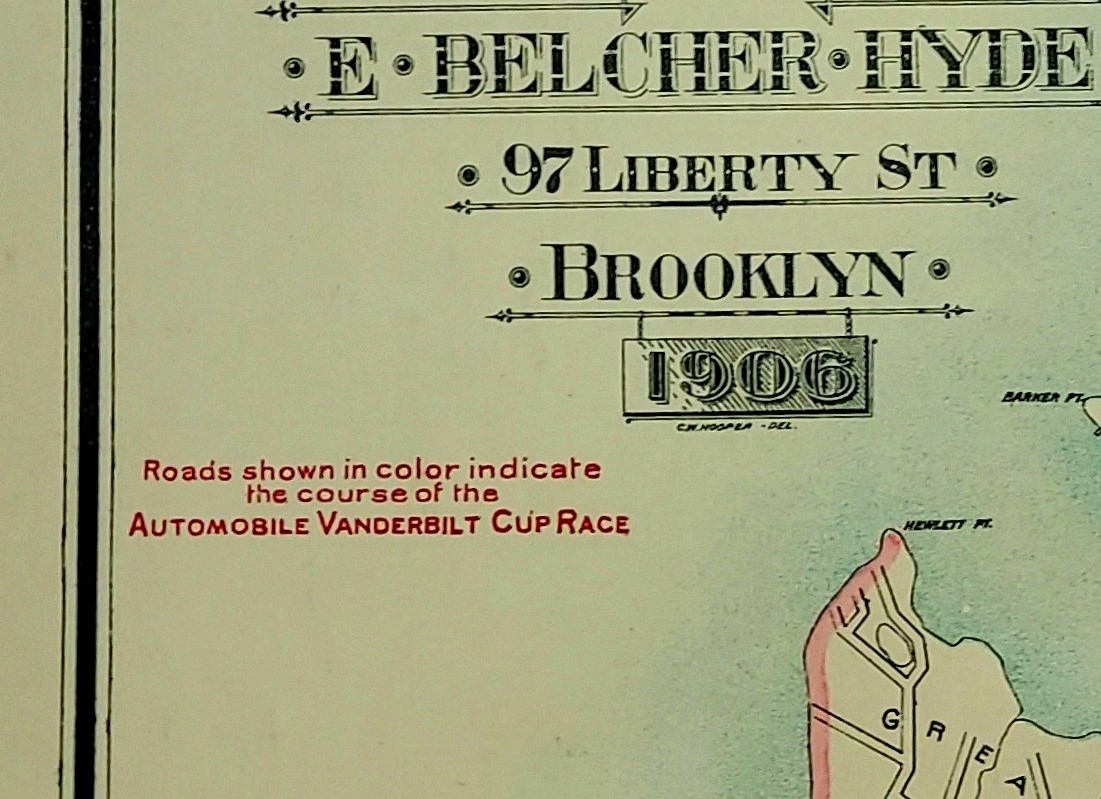
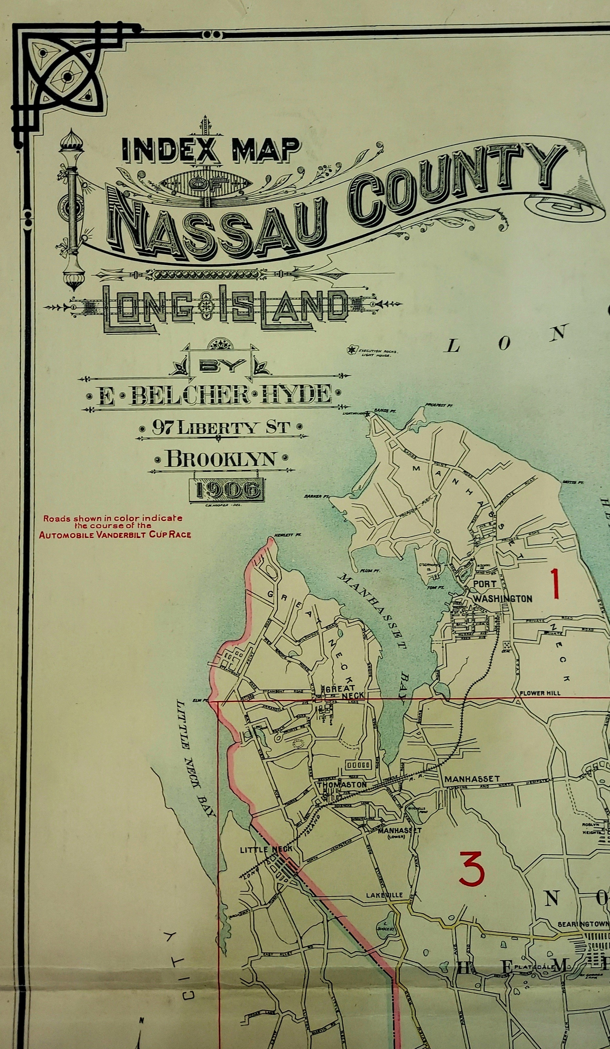
A closeup reveals the caption that the course was marked on the map by colored roads.
Seen here are the roads of the course colored in yellow.
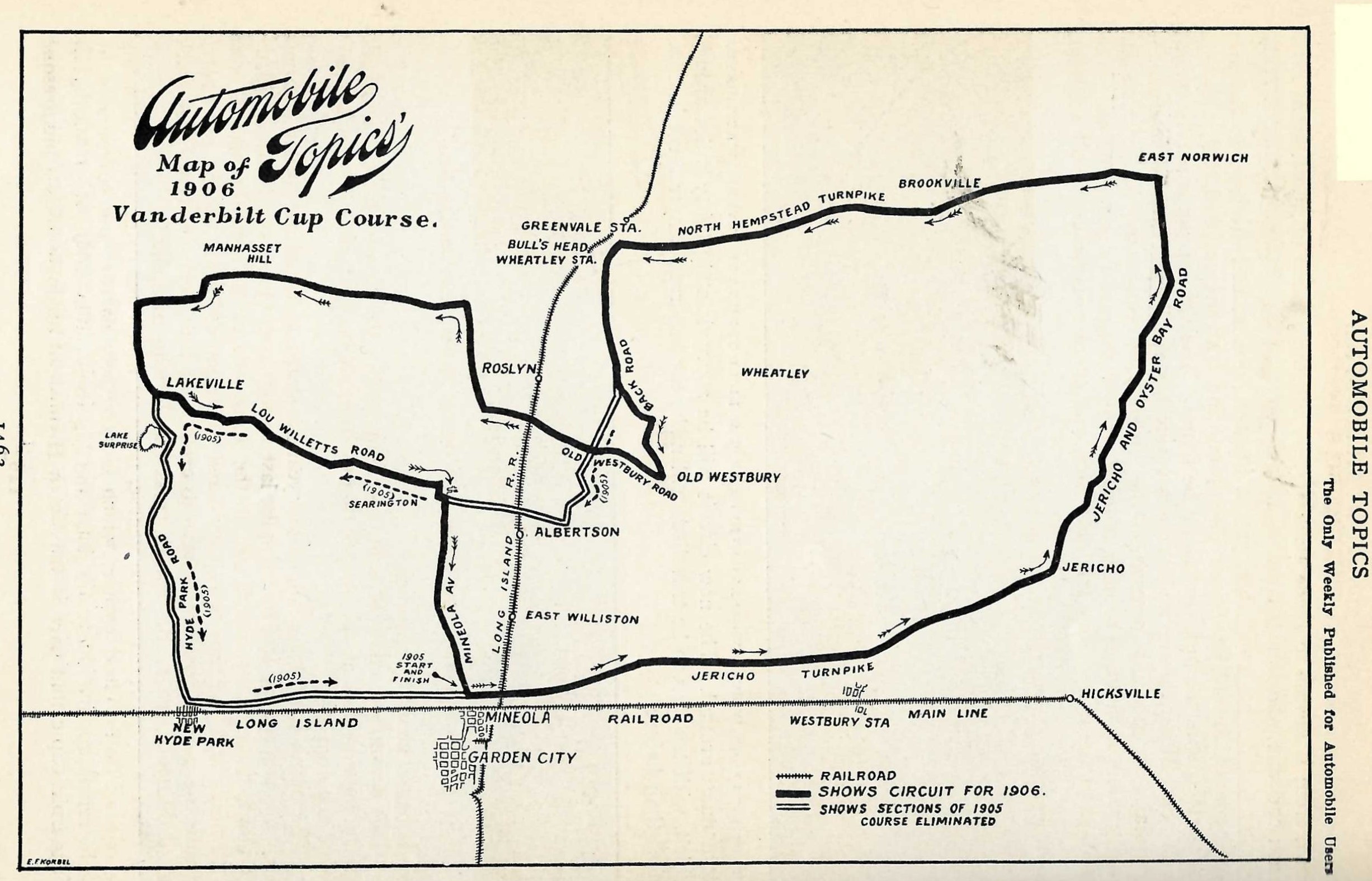
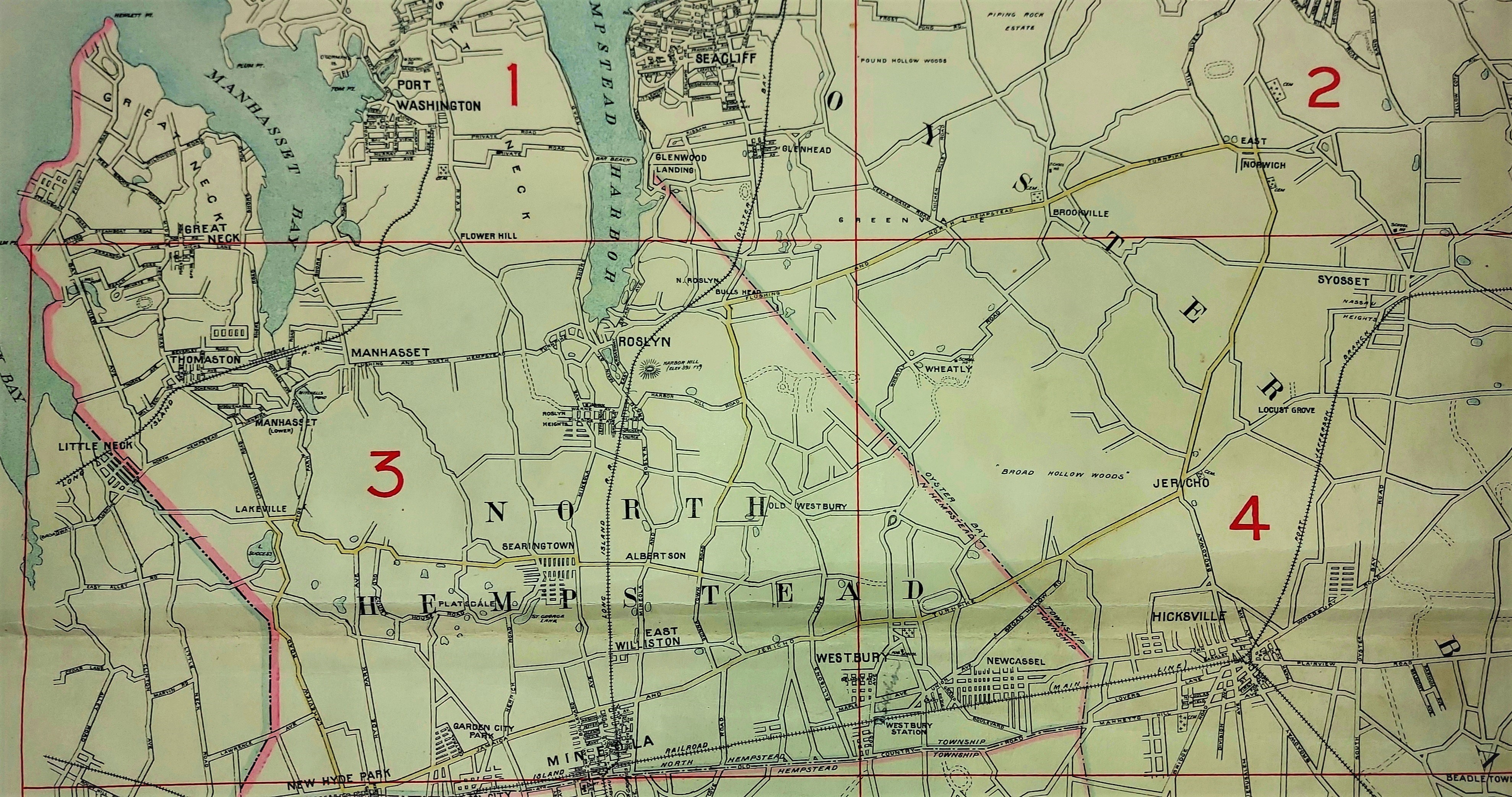
However, the course seen marked on this 1906 Belcher Hyde map are not the 1906 course, but the 1905 course.
With the exception of the 1909 and 1910 course, the courses changed every year from 1904 through 1909. The 1910 course being identical to the 1909 course.
The differences between the 1905 and 1906 courses are shown here in Automobile Topics from 1906. The new 1906 course now went further north to include Manhasset and the tricky Manhasset hill, but headed west on IU Willetts cutting out the portion leading to New Hyde Park.
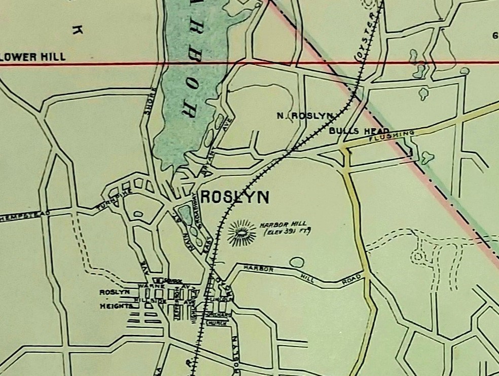
A closer look at the Roslyn area that shows the famously tough Bull's Head turn and hotel, as well as Harbor Hill where Clarence Mackay's Harbor Hill estate, (built from 1900 through 1902), was located.
Harbor Hill also shares the distinction of being the highest point in Nassau County, as indicated by the 391 ft. elevation notation on the map.
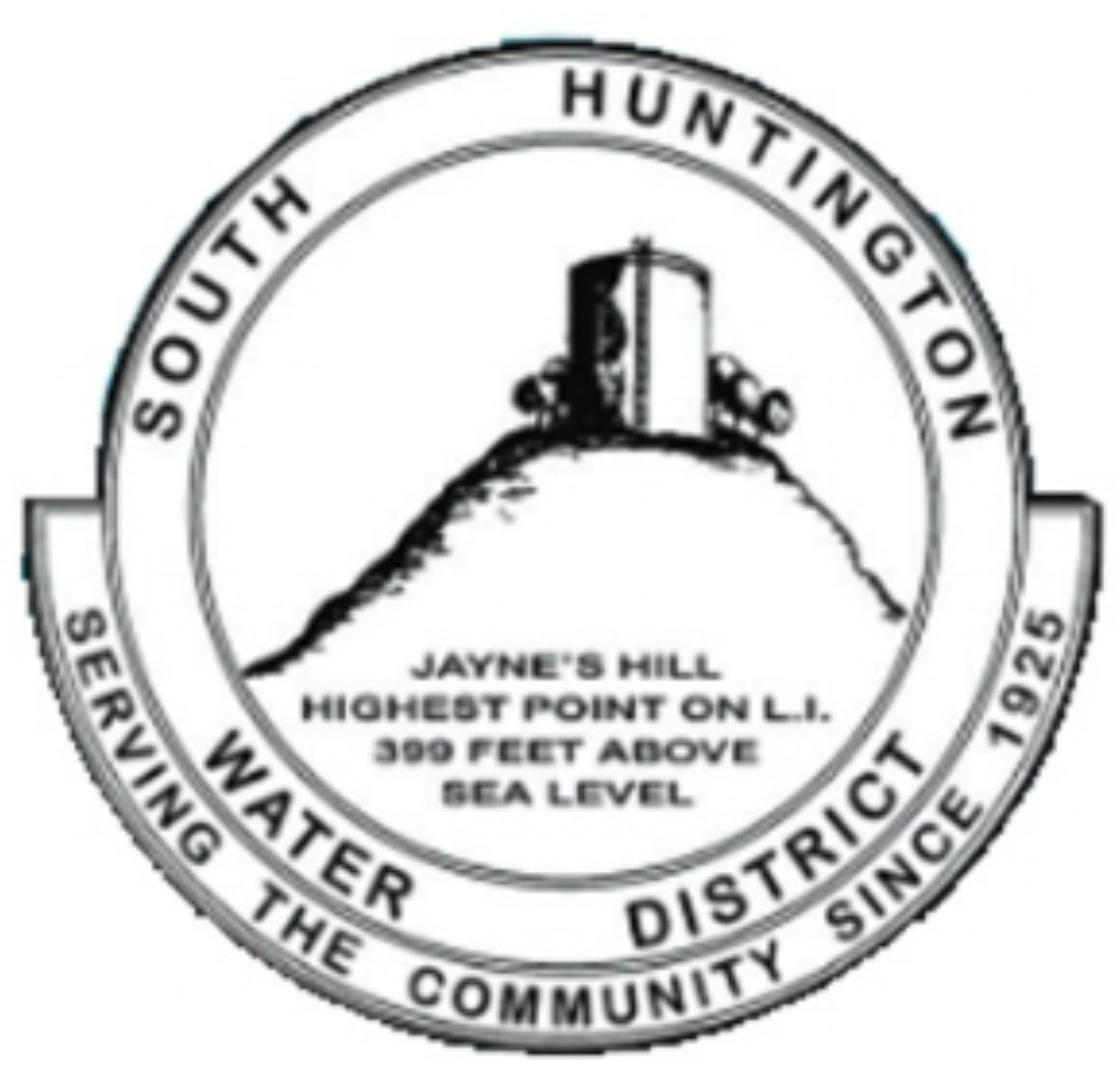
While still part of the Harbor Hill moraine that makes up the northern spine of Long Island, the highest point on Long Island at 400.9 ft. is Jayne's Hill, located in West Hills, Huntington.
A distinction Huntington is proud of, shown here being used as the logo for the South Huntington Water District since its founding.


Comments
Great stuff Greg. Love Clinton Ave, the precursor for Cross Island Pkwy/Commonwealth Blvd. Also the short-jagged Marvin Rd between Clinton Av and Alley Rd (Winchester Blvd). Long gone with the development of the CIP. Mostly everything else is the same today! Thanks for sharing this gem.
Wow! I love old maps.
Is there a way of purchasing this map? A wall size print would be great.
Love ya Howard K. et.al.
John Ulrich
Seen this map on display once? at the Oyster Bay Historical Society in Oyster Bay. Ball Hill, Farmingville, highest point in Suffolk Co. at 300+ft. Just to let you know.
Mark-
A lot of people (myself included for a while) do think Bald Hill is the highest, but Jayne’s Hill in S.Huntington is highest. Other high spots in Nassau AND Suffolk are Beacon Hill in Port Washington and the hill that Oheka Castle is built upon. Interesting tidbit about Oheka is that it was man-made. Otto Kahn wanted the highest point on Long Island, so he built the Cold Spring Harbor LIRR station to have train loads of dirt, rocks and material to build the ‘mountain’ that Oheka is built on.
Greg,
Forgot that Jayne’s Hill in S. Huntington is in Suffolk County.