Updated: Femenias Findings- Exploring the Rustic Bagatelle Section of the Long Island Motor Parkway

Frank Femenias and Brian McCarthy recently explored the "rustic" Bagatelle section of the Motor Parkway Wheatley Heights and Dix Hills (Half Hollow Hills) . This area is rarely visited due to heavy brush and an abundance of poison ivy.
Below is the research report from Frank and Brian. Great job!
Enjoy,
Howard Kroplick
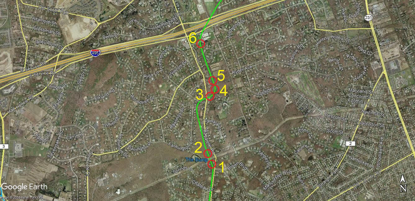
Frank Femenias: Brian McCarthy and I recently explored the Motor Parkway RoW in Wheatley Heights off Bagatelle Road. What a blast we had exploring the sites that have been sleeping silently for ages. This rustic-hilly area must have been very scenic for travellers, often overlooking the land below and above, like cruising on a narrow shelf along a mountain side. We found posts!
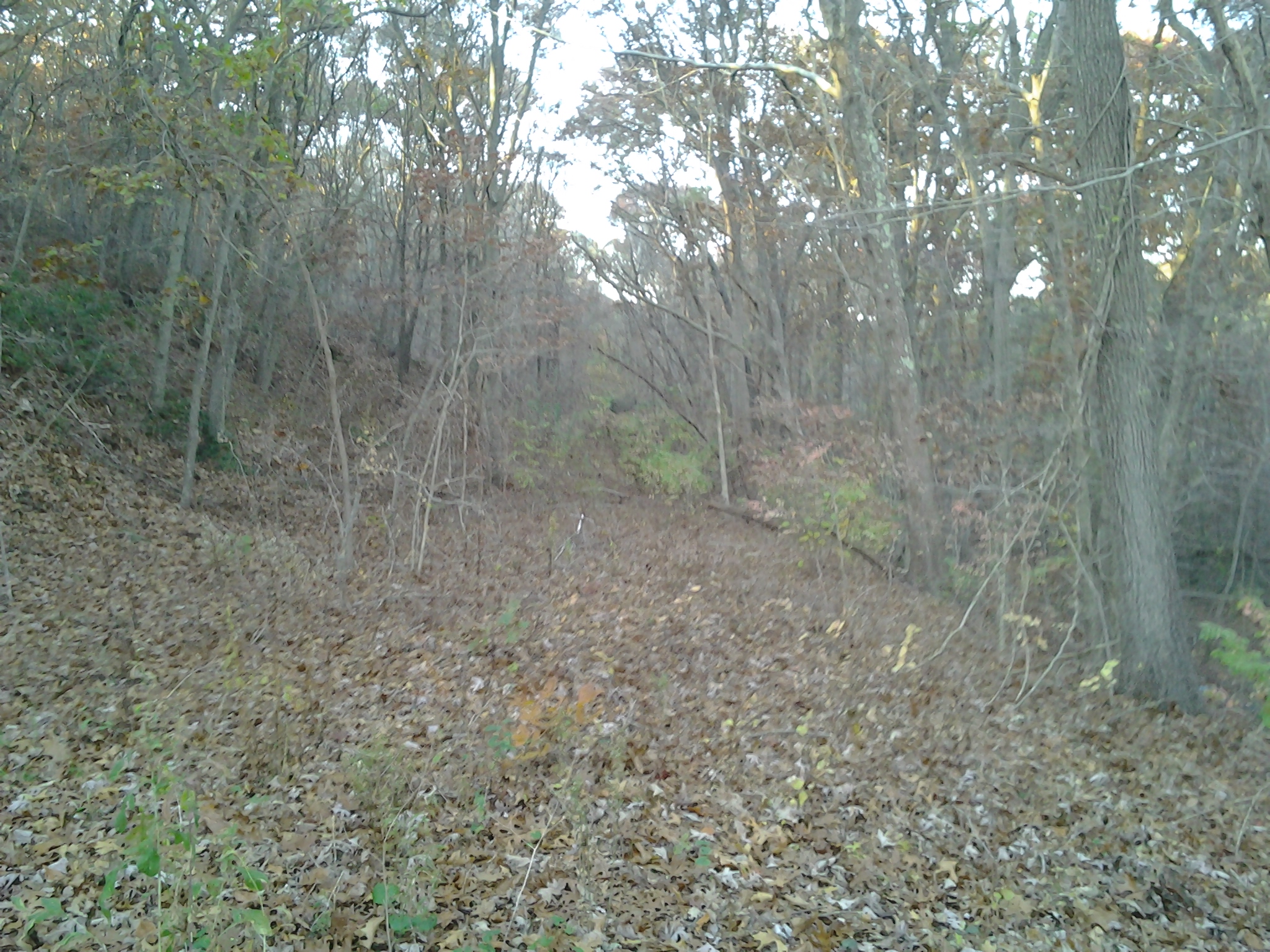
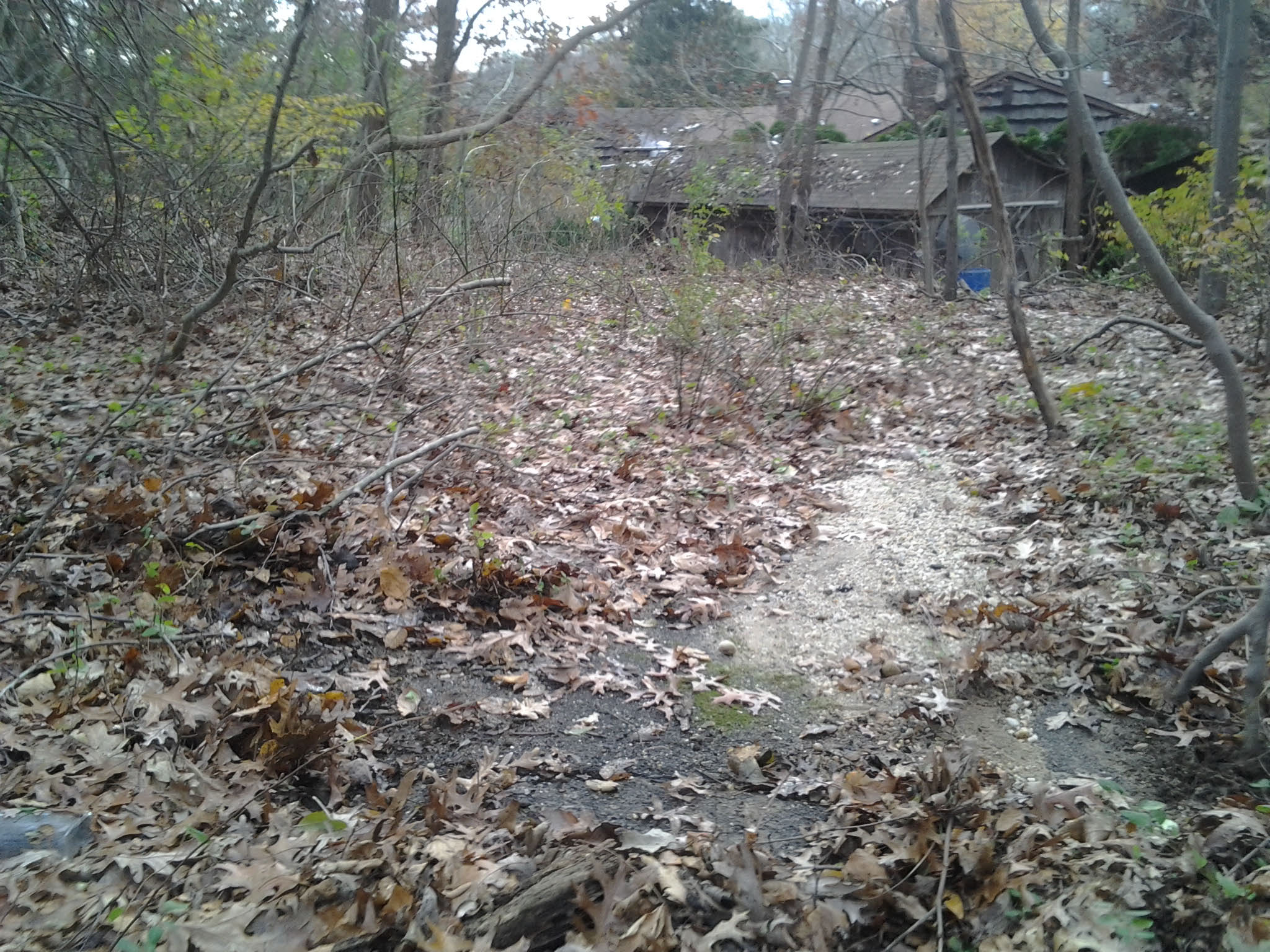
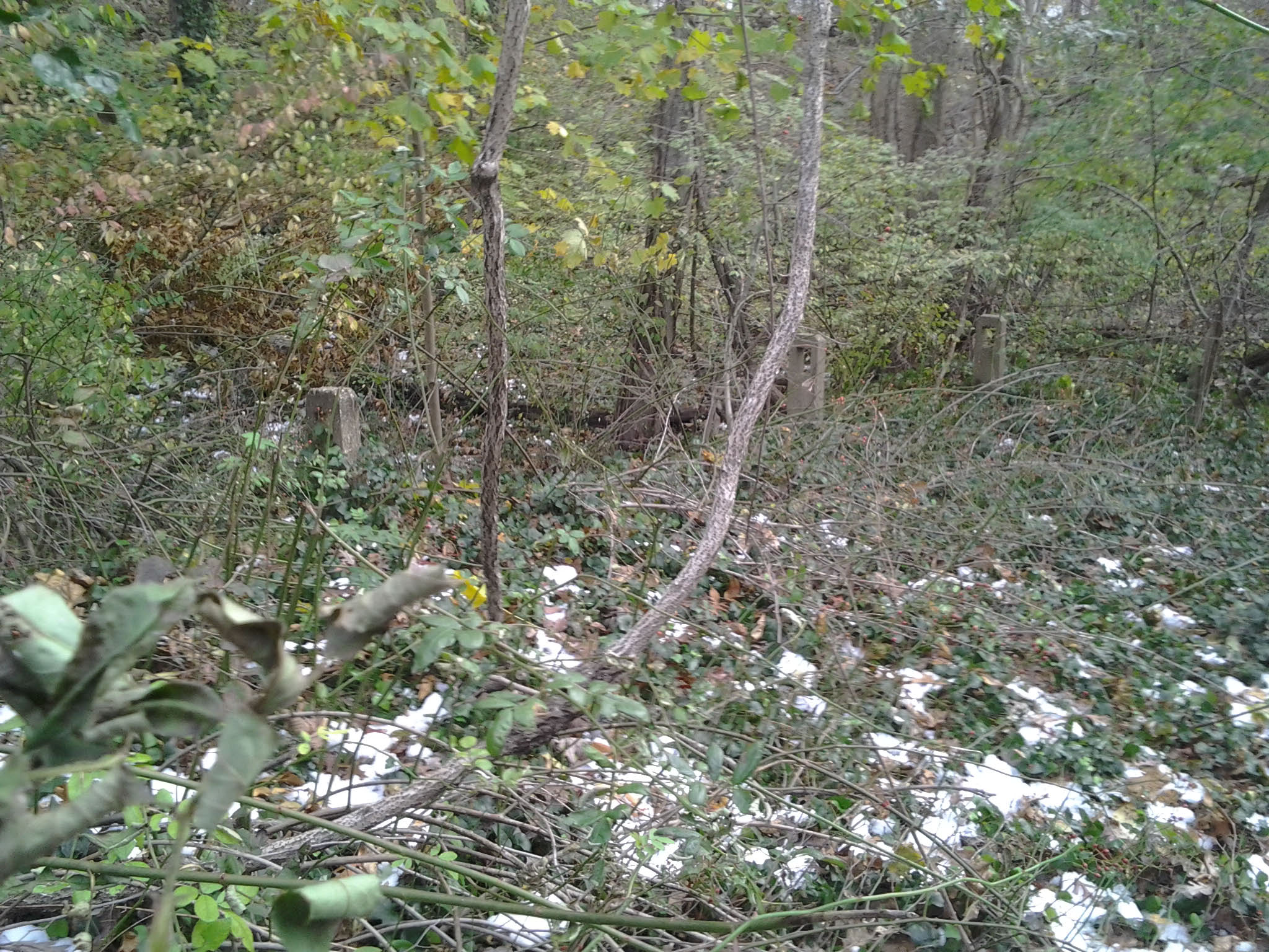
West of Bagatelle Road, Wheatley Heights
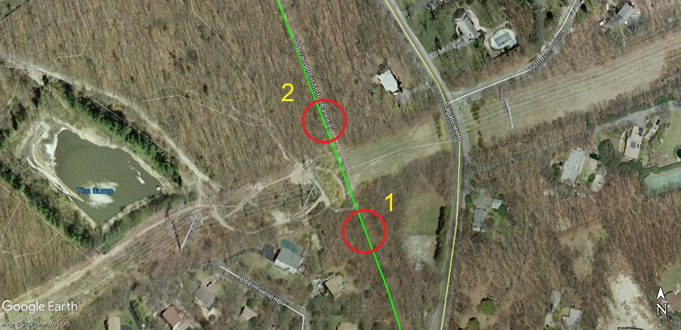
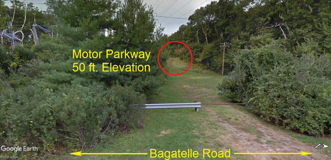
From Bagatelle Road looking west, the elevated section of the Motor Parkway can still be seen
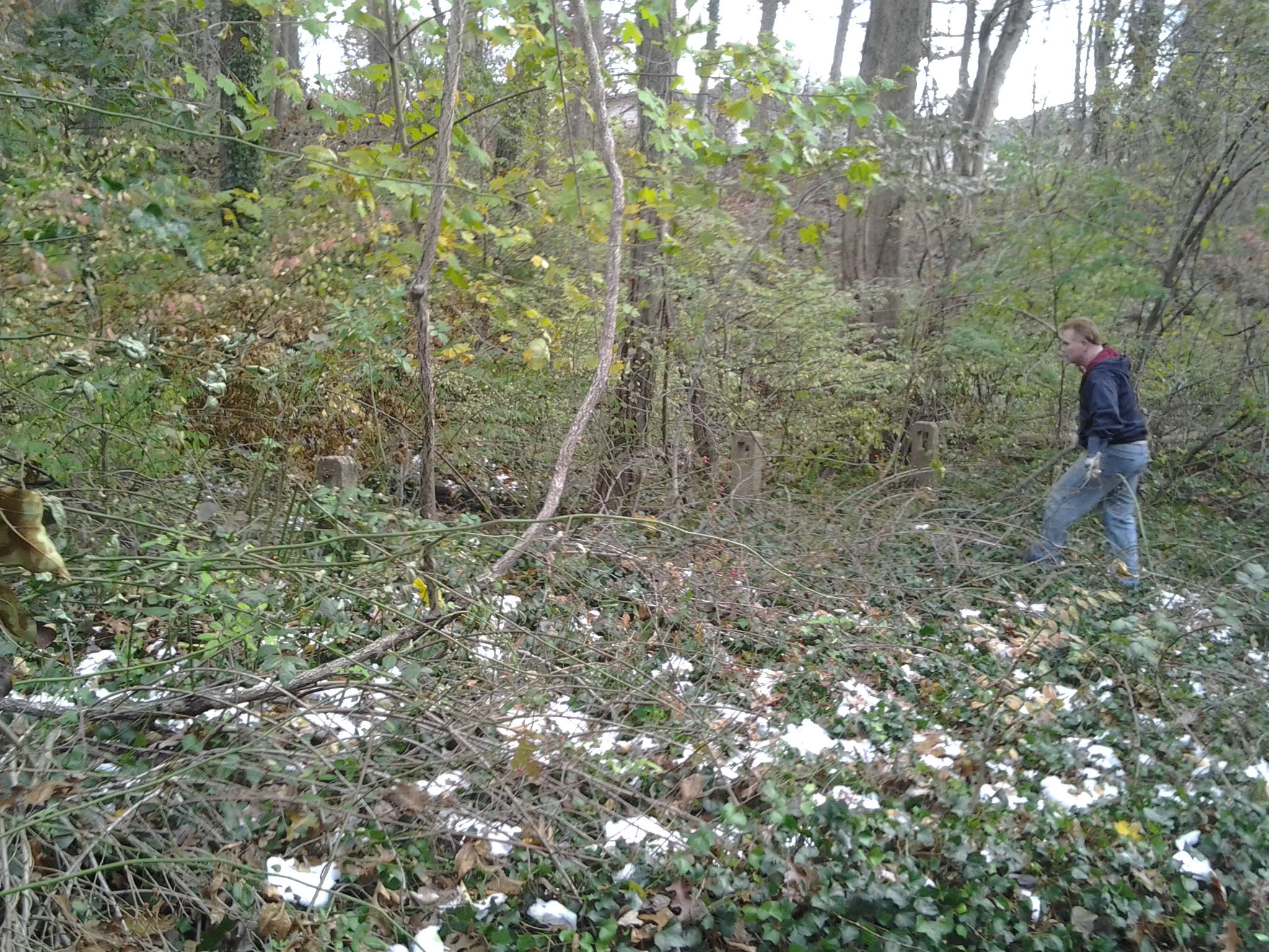
#1. On the Motor Parkway ROW shelf, looking south.
#2. On the Motor Parkway ROW shelf, looking north.
East of Bagatelle Road, Dix Hills
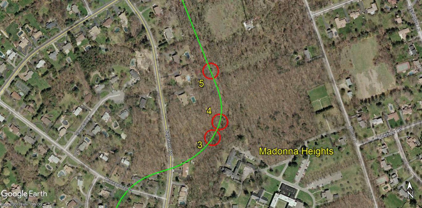
Madonna Heights School for Girls is just south of #3.
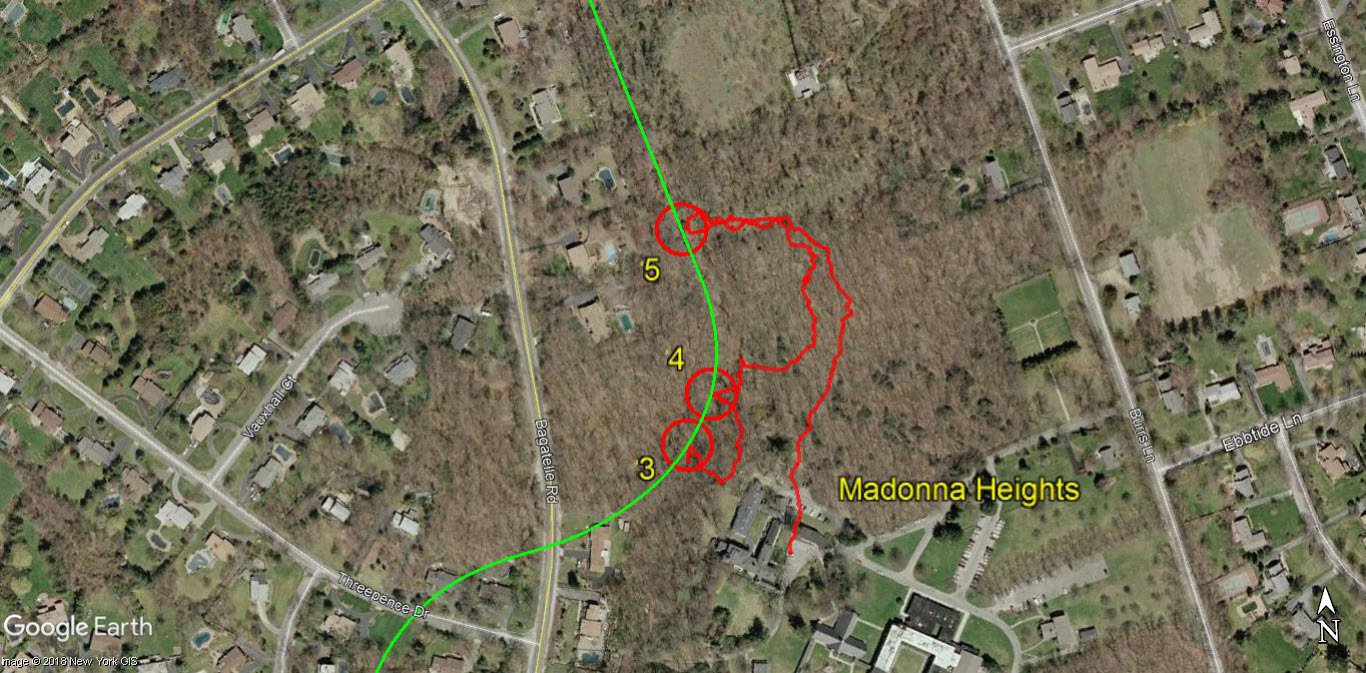
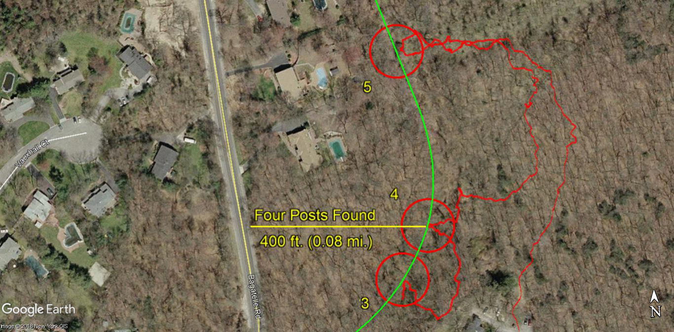
The GPS tracks of Frank's and Brian's exploration.
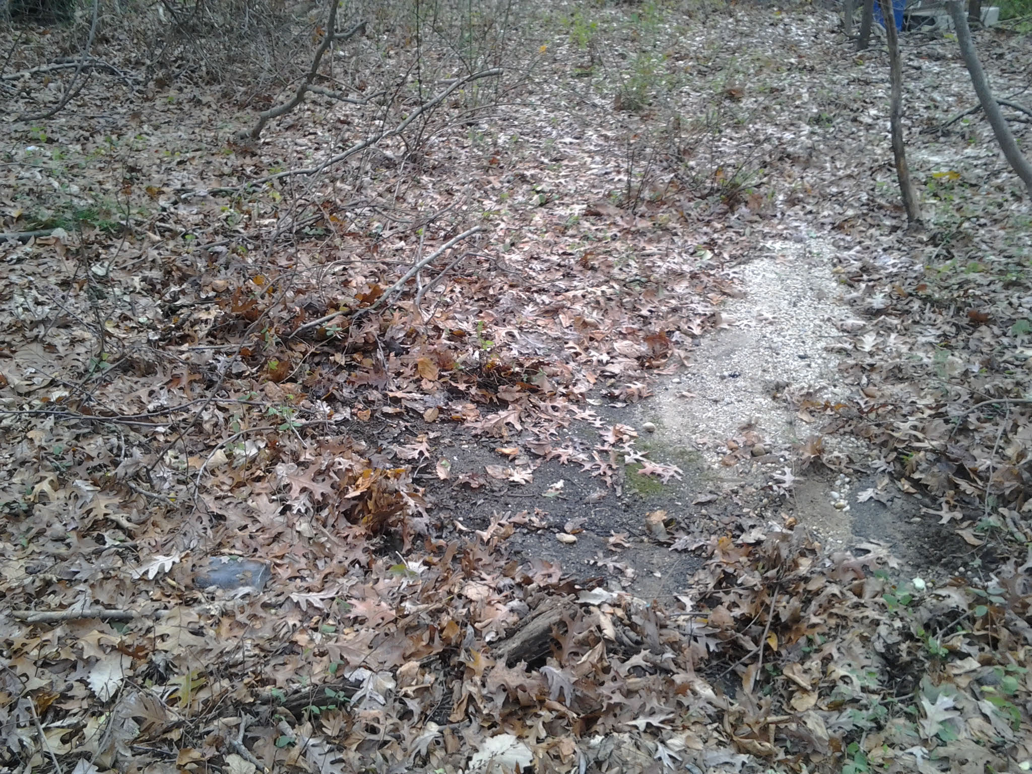
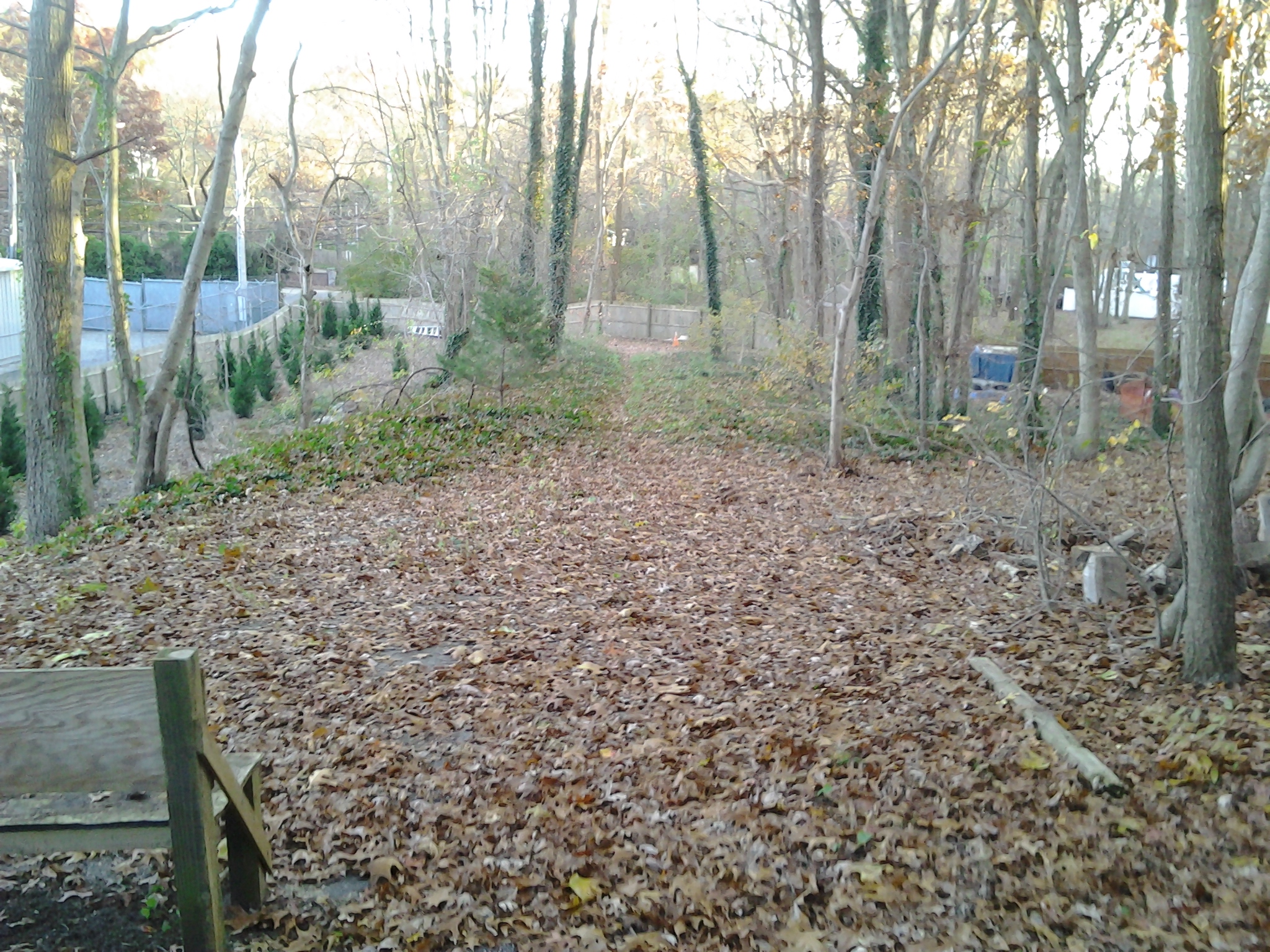
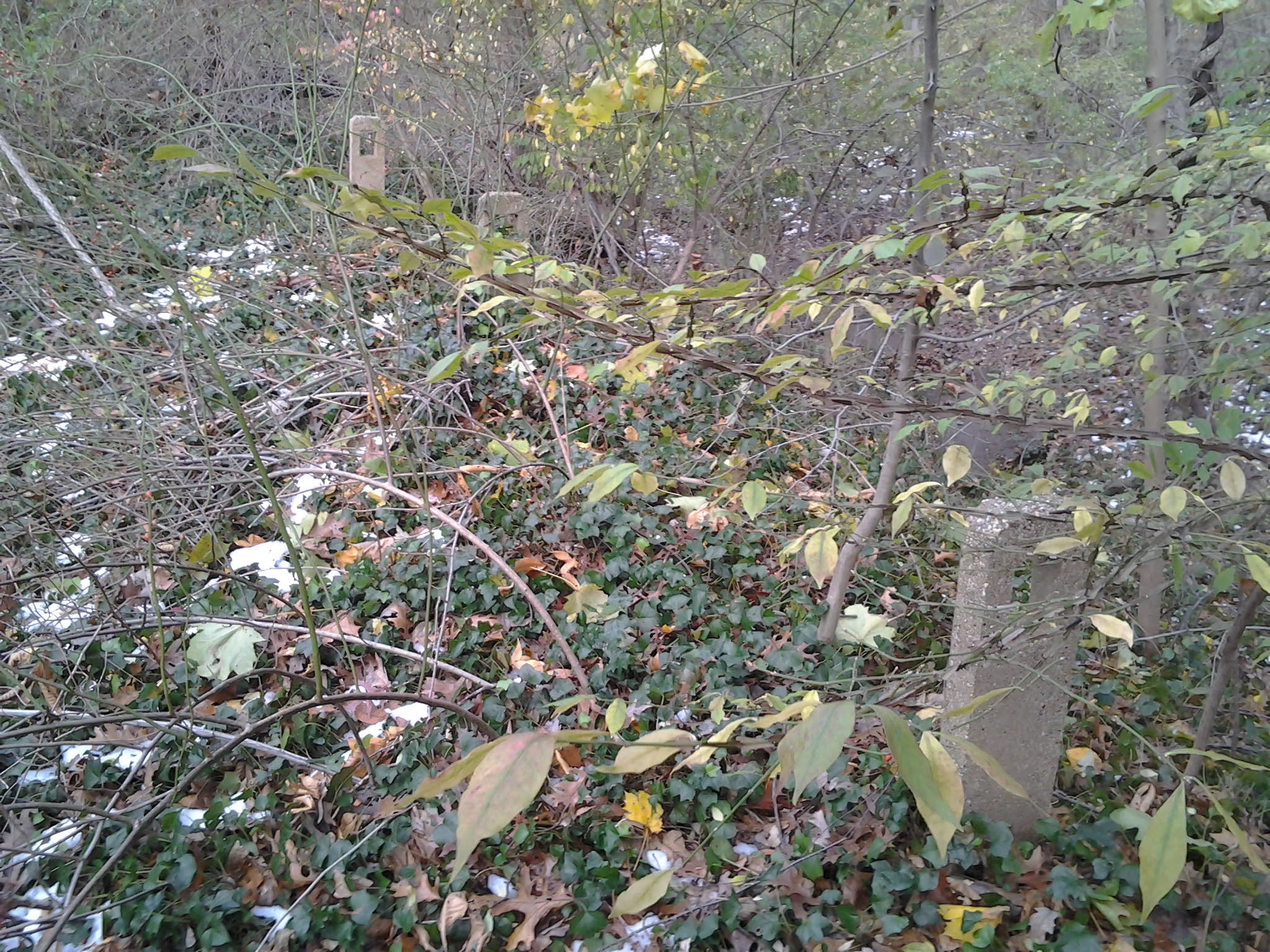
#3. Roadway found, facing southwest.
#3. More Motor Parkway, facing southwest.
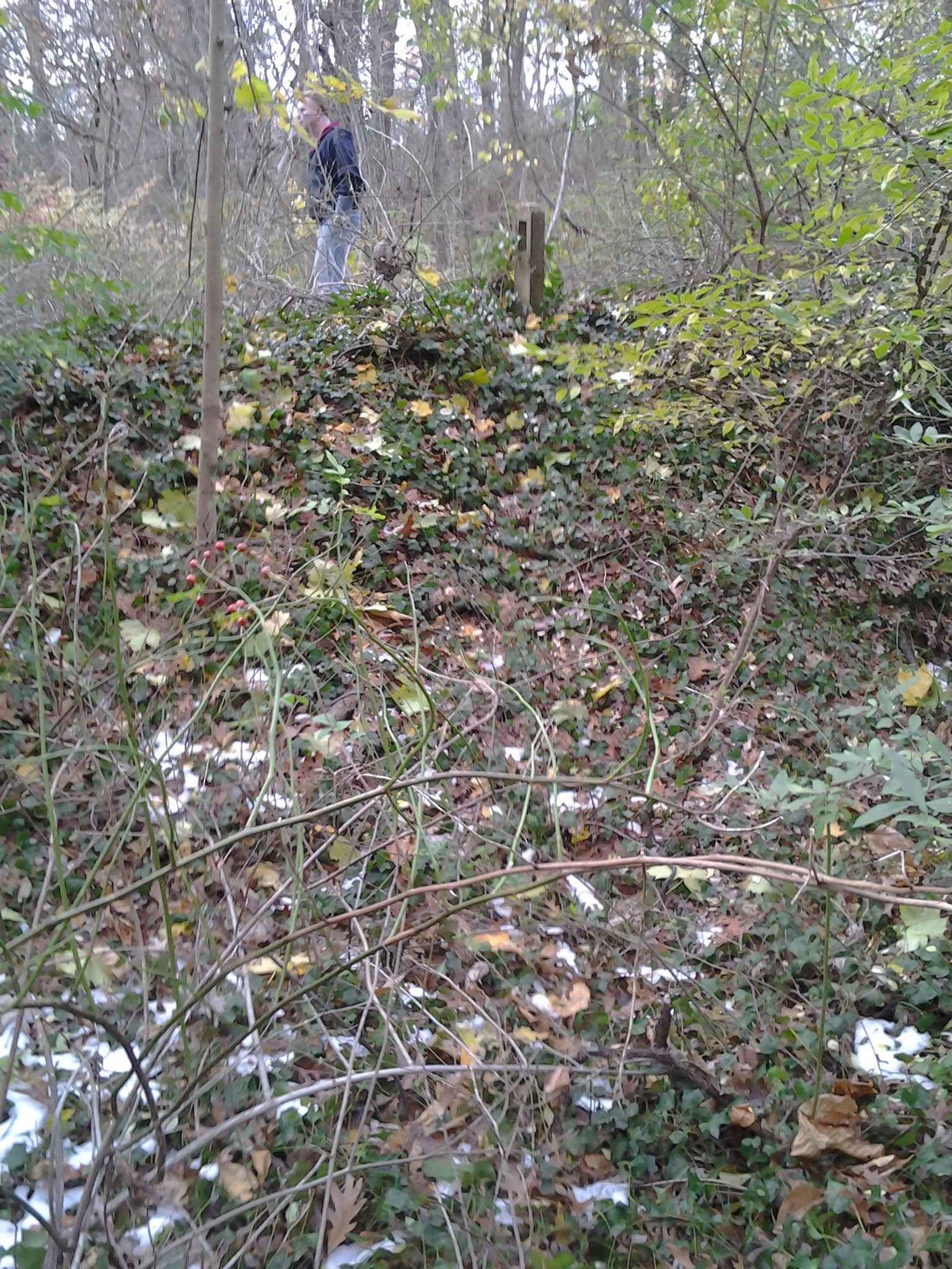
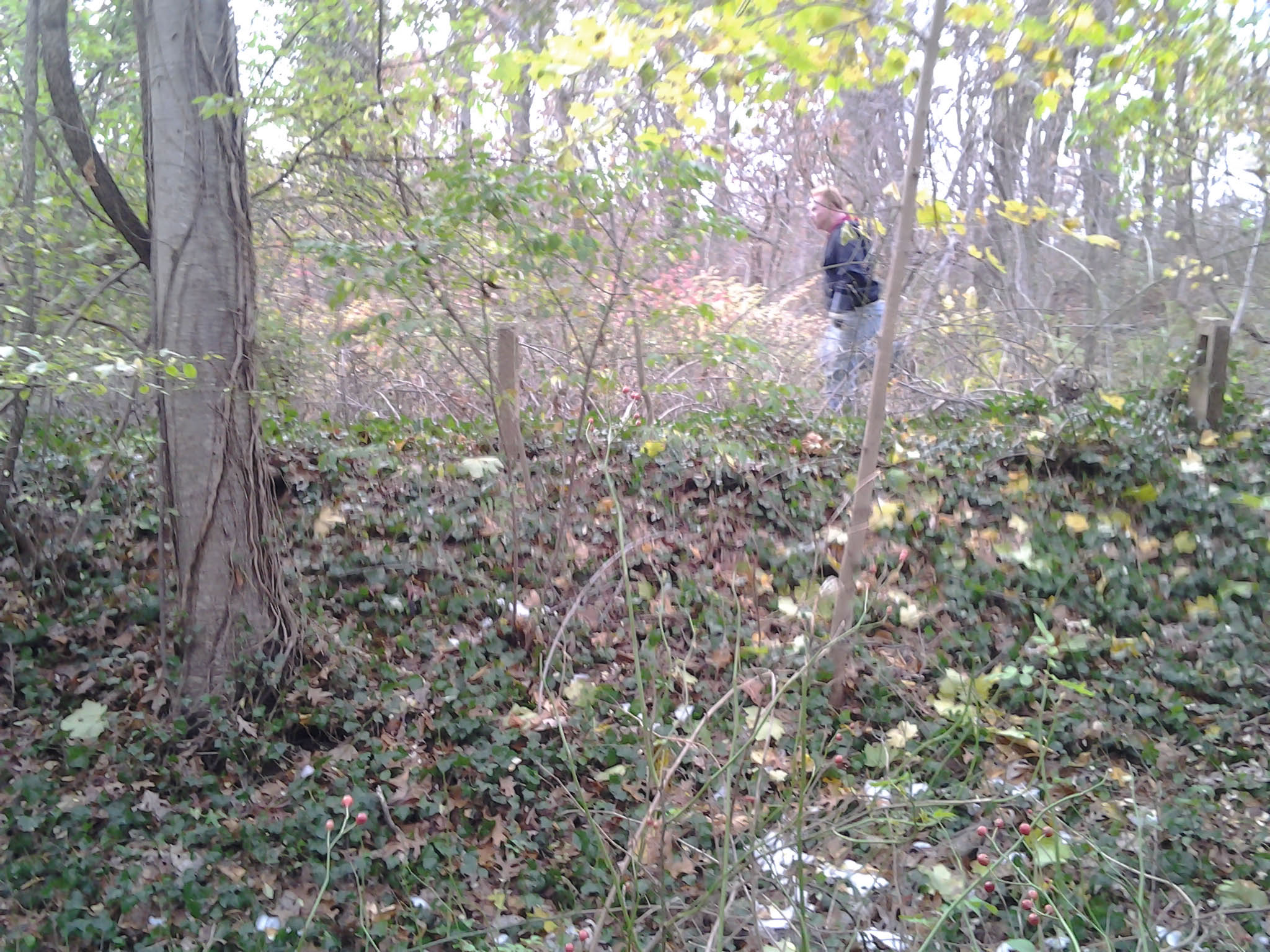
#4. Four posts found on the curve.
#4. Brian on elevated Motor Parkway curve walking south/southwest. Photo facing northwest.
#4. Brian on elevated Motor Parkway curve walking south/southwest. Photo facing northwest.
#4. Four posts on elevated Motor Parkway curve. Looking south/southwest.
#4. On elevated Motor Parkway curve with posts, facing south.
#4. Posts on elevated Motor Parkway curve, facing northeast.
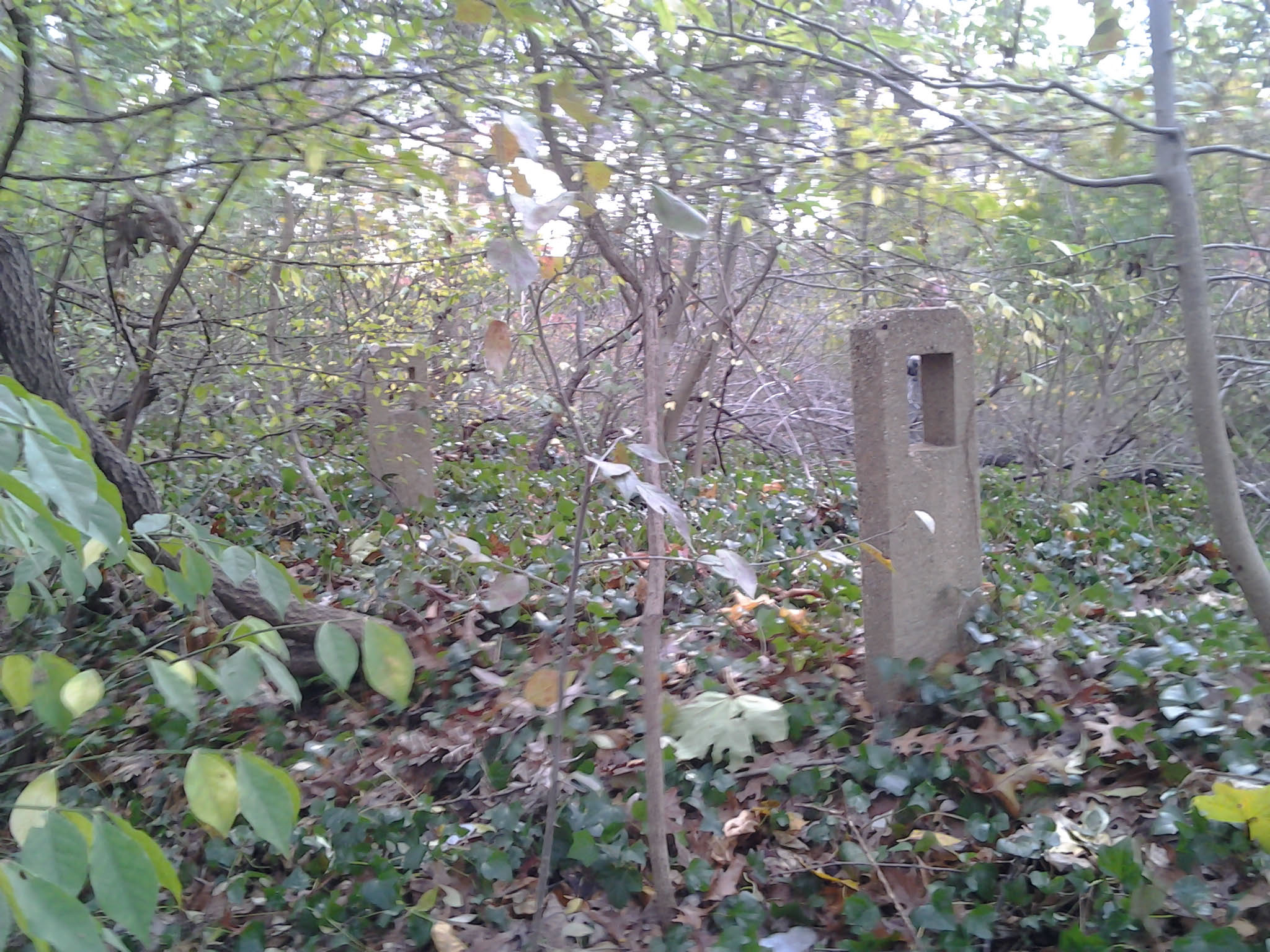
#4. Posts on elevated Motor Parkway curve, facing northeast.These posts held a wooden post to protect automobiles on the curve.
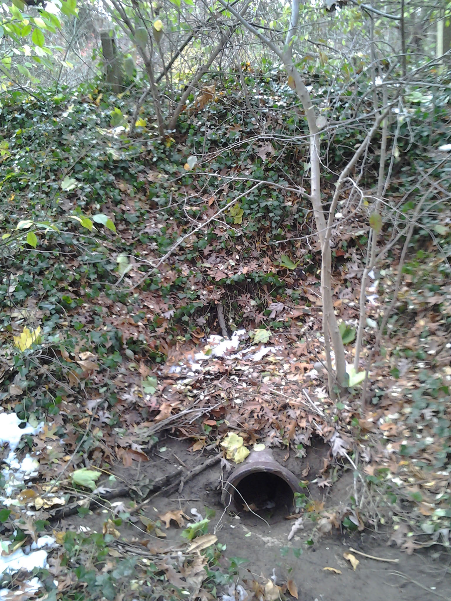
#4. Drainage system under elevated Motor Parkway curve, facing northwest.
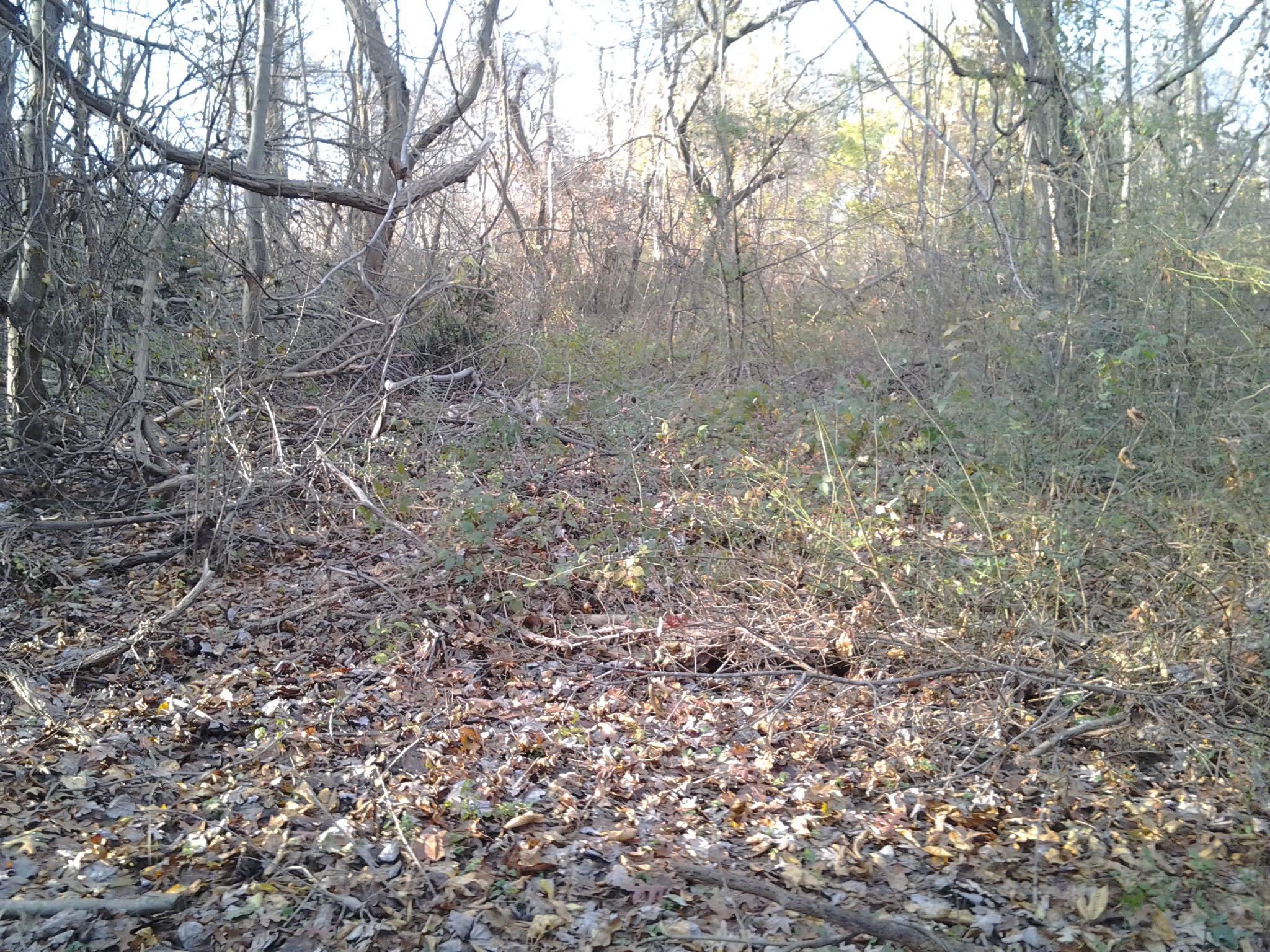
#5. Motor Parkway ROW facing North/northeast on the straight-away.
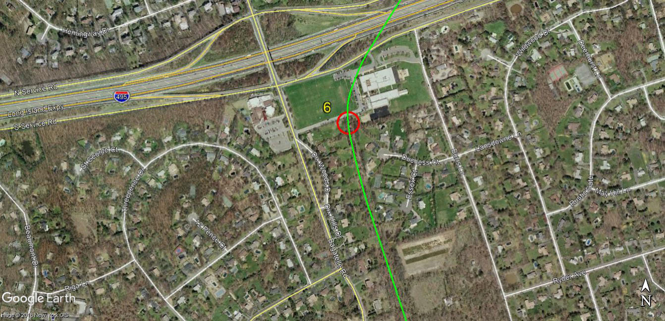
#6 Chestnut Hill School
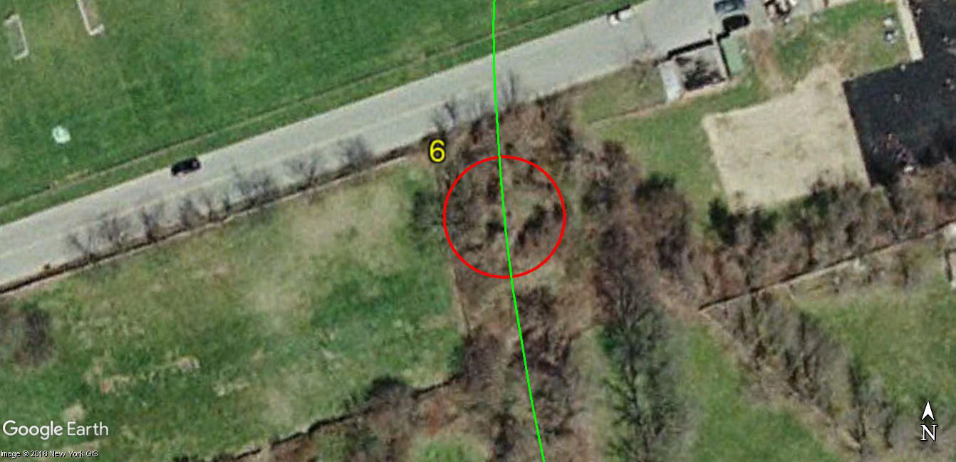
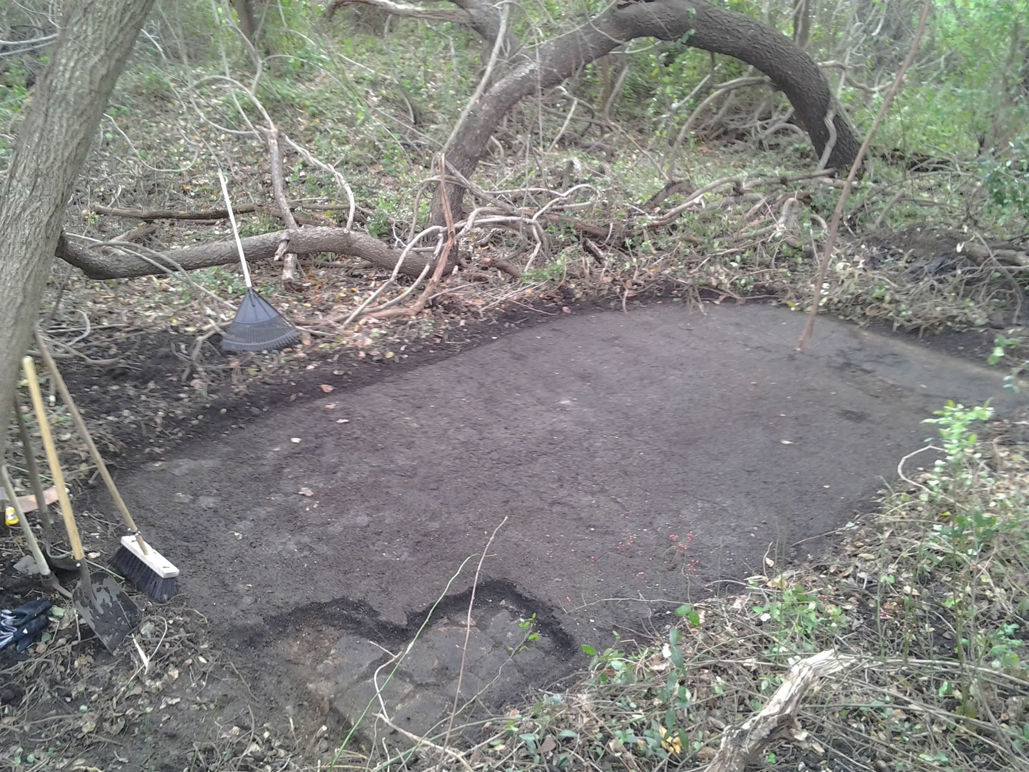
#6 19 feet wide Motor Parkway uncovered, no concrete extensions.
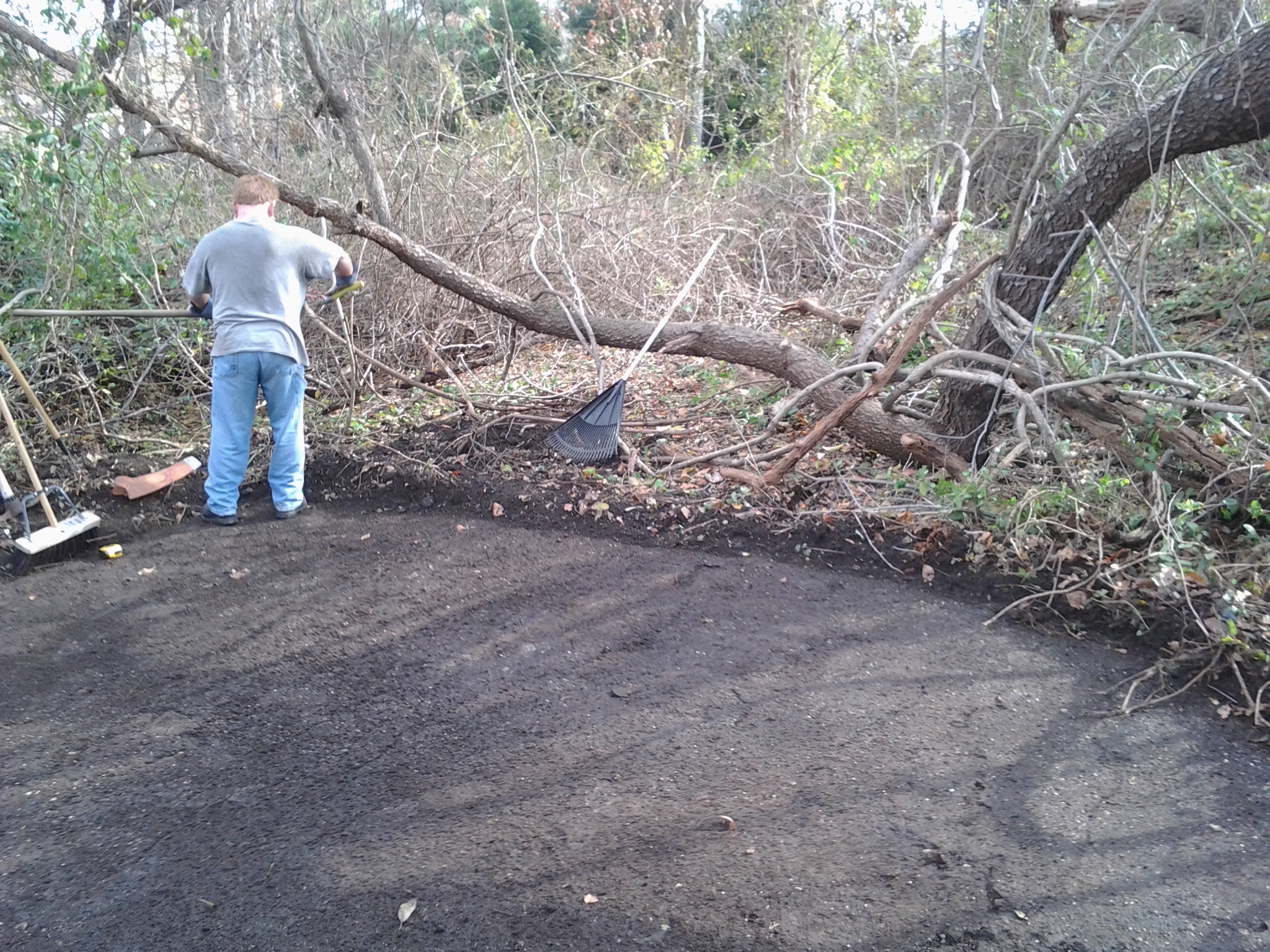
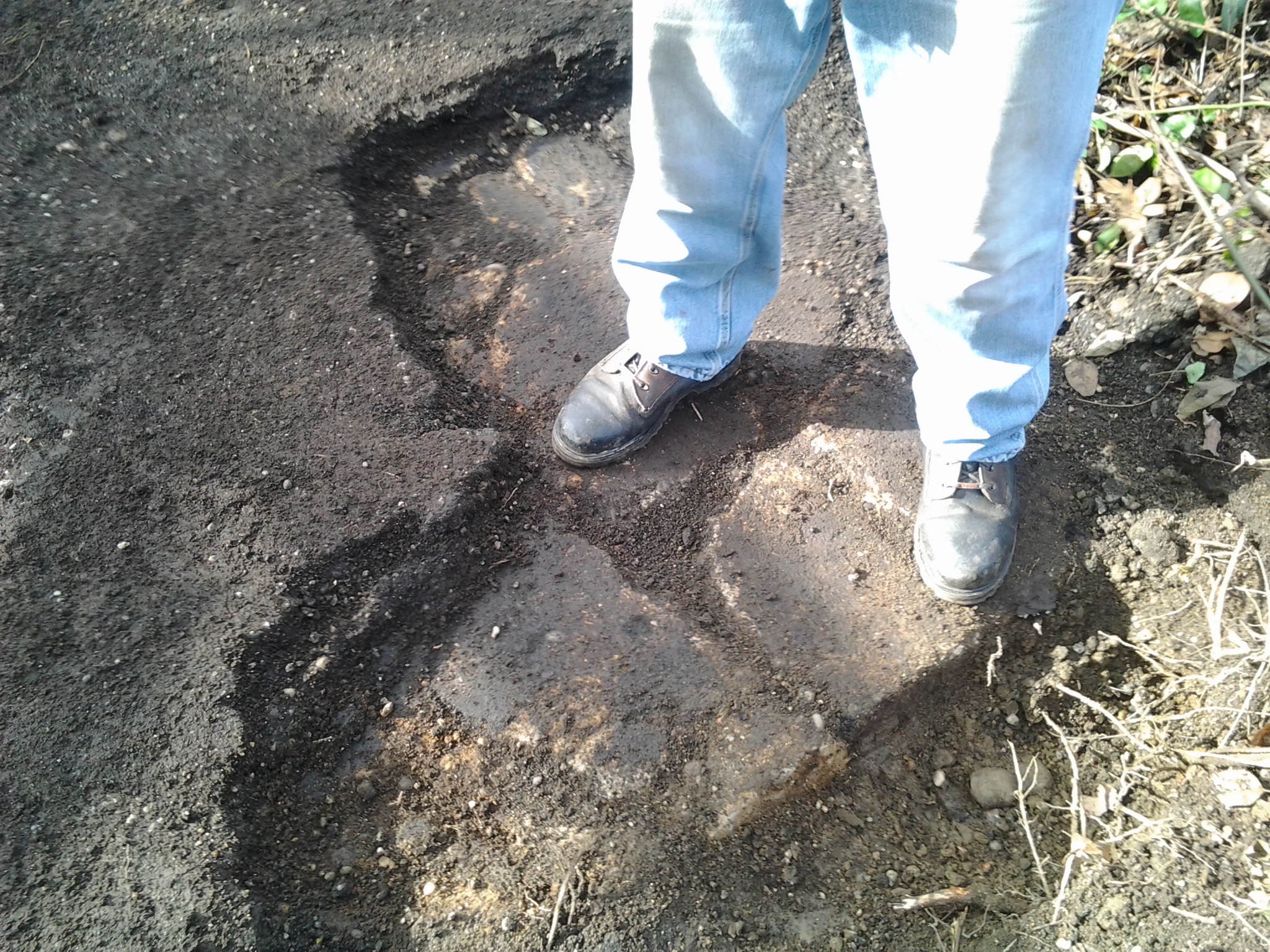
Original concrete.
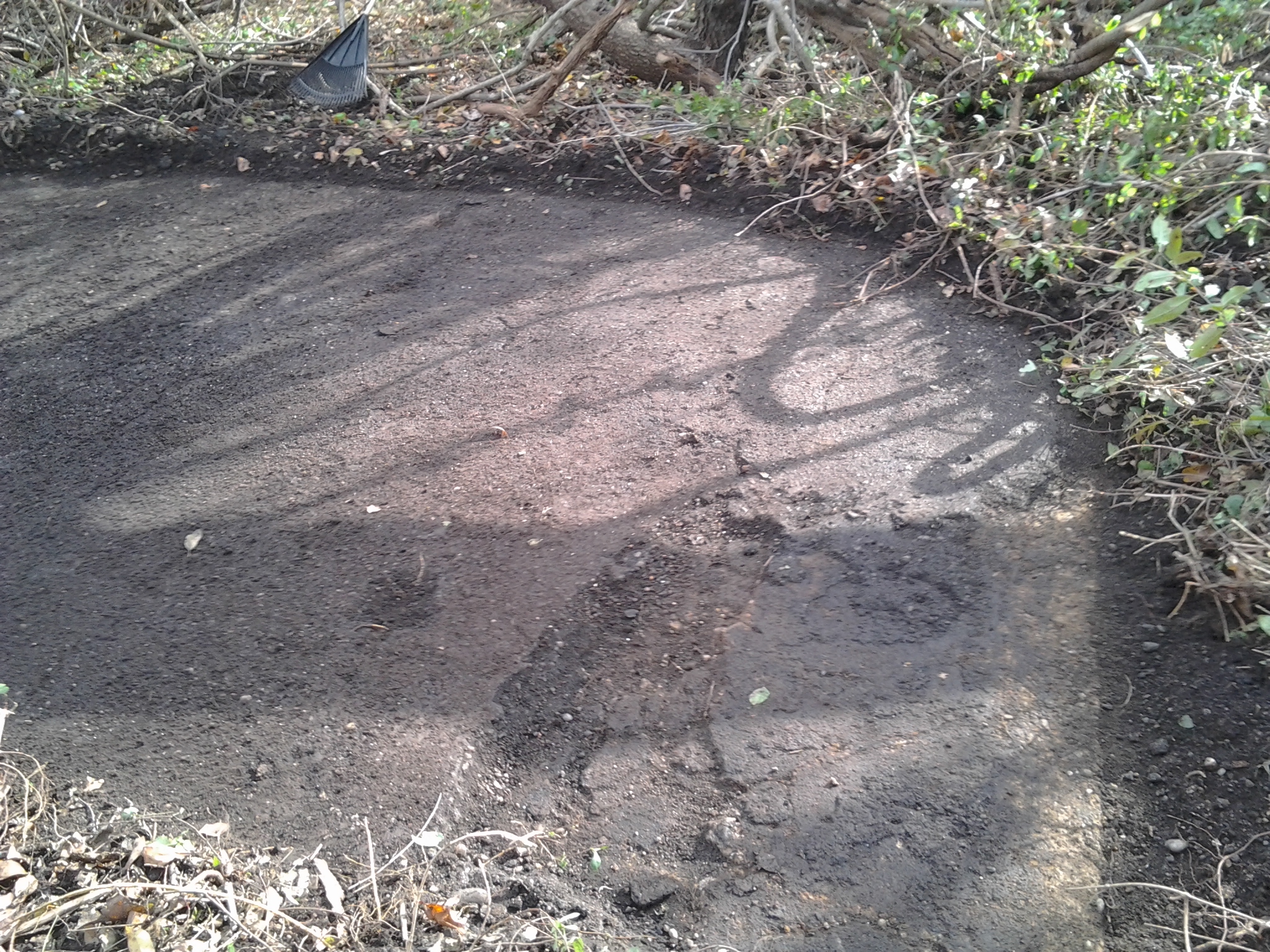
Note banking of curve, facing south.
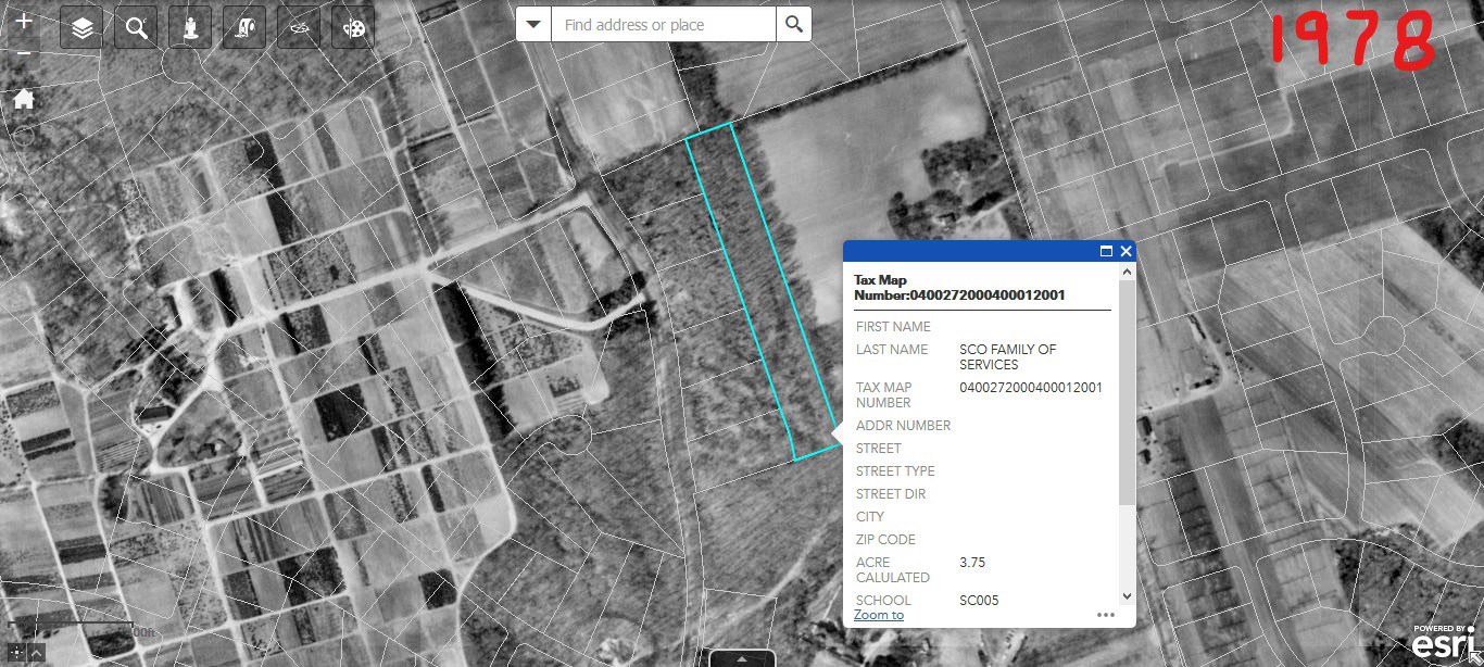
1978 Aerials. Courtesy of Brian McCarthy.
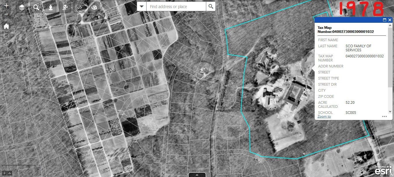
Brian McCarthy:These maps are from the Suffolk County GIS website. 1978 aerials with present day property lines. SCO ( Madonna Heights ) owns the LIMP ROW in both areas ( surprised they own the narrow strip west of the farm ). Thought it would be helpful to add these to this blog since Denis and Al were speaking of this.


Comments
I’ve explored all of this really nice segment. Sadly most of it is not public or LIPA owned here and subject to development. Some just south of the school already is owned by private homes although I was able to sneak through the yards back around 2000 or so. The town of Huntington tried to get a trail easement on the LI Motor Parkway segment owned by Madonna Heights but they totally rejected any attempts to restrict future development of the old roadbed. Which is sad since the banked downhill curve in there is awesome!
Great work guys! Brings back memories! You did some nice clean up work too! I love the spots you dug out. Excellent work.
Your spot #1 pic - looking over shelf - that is usually much more visible LIMP there - you can blame the fall leaves for hiding it but that is a cool spot.
In between your points #2 and #3—before you go over Bagatelle Rd - if you go down and dig at any point you will find the LIMP in tact, we dug randomly throughout and it was always right under us. Hidden history. Awesome. The entire road is under you the whole time.
Nice posts finds. We didn’t find those. Must have been too busy getting poison ivy!
In between points 5 and 6 did you find that location that was speculated about? Could have been a drain run off? There was a lot of LIMP debris in one location there and we had good back and forth about what it was.might be, I’m wondering if you saw it yourself now?
And you started too far north! Should have started down by the VFW and witnessed the bridge remnants and the pavement behind the VFW and then proceed through the farmland. Next time!
Thanks Denis, I didn’t know that Huntington was pushing for a trail in the past. This actually happening would be excellent. We didn’t really examine the ROW south of the school to rear of Holmes Farm, but will soon. Maybe there’s not much to see, but just to make sure
Frank, Brian - nice exploration. Been there (east and west of Bagatelle) and I know what you mean about the poison ivy, thorns, etc. I usually start my trip by crossing Bagatelle where the Parkway would have and venturing northward. Found the posts years ago but haven’t since so glad you did. Probably will venture out there again soon thanks to your post!
From my website:
https://www.freewebs.com/limparkway/bagatelleroadwest.htm
https://www.freewebs.com/limparkway/bagatelleroadeast.htm
Hi Dave. I’ve wanted to explore this toughest section of the LIMP ever You and Sammy have.And I kept in mind to locate the concrete structures you pointed out. I saw 3 structures total within a well worn drainage bed that continues south on the east side of the LIMP. This bed eventually turns west beneath the LIMP embankment ( thru a pipe ) where we witnessed the guard rail type posts. Frank may have taken a photo of the concrete structures, I’ll ask him. I’m not sure what their purpose is but it appears that they were formed there in a specific way. Could help for drainage but still scratching my head.
Hi Art. I remember reading about your trek thru here. And you witnessed the guard rail type posts back then along with concrete posts we didn’t see. That’s what’s good about all doing these explorings, more eyes the better.
Dave - Brian had mentioned the soil/grass covering the roadway by the school may have helped preserve the top layer over the years, but also made it brittle at the same time. Exposing the original concrete below was not that hard.
We also found the concrete item you mention. It seems to be part of a drainage system that ran under the curve where the posts are (#4). We took a snapshot of the connecting pipe as well. I’ll send Howard the drainage pics.
Art - If it helps, the coordinates for the posts were at N40*46’51.46, W73*22’5.00
Update 11/23/2018: Frank Femenias has added an image of the drainage system at Site #3.
Very nice pictures. Been through that spot a few times, since early 1970 it got worse every single year, hard to walk a long. Great job.
Since the early 70’s, that’s cool Joe. I guess it may have been possible to walk or bike the ROW with no interruptions from Colonial Springs Rd right up to the LIE at that time? The pavement is just a few inches below the soil thru out here.
Thanks for sharing the pics of the LIMP find. Every time I see any of these pics it just pulls at my heart strings. To have walked so much of the section of the parkway myself as a child near route 110. Glad to see some shots of the post too. I think awhile back when I submitted my family pics of early 1950s, there was a shot of one of the entry posts near the parkway. Our driveway was part of the access to the parkway from route 110. Like seeing a dear family member. Thanks again.
Been there -done that - http://sbiii.com/limpkwya.html#wintale - I never had a chance to dig but I always KNEW the paving was under there! YAY! You can always tell by the way vegetation grows over paving. Thanks. Sam, III
Great job Brian and Frank, brought back some very similar memories. I visited that section the first time about 25 years ago. It was a lot easier in some areas to to find the roadbed. Regarding ownership of the R.O.W., at the time I was told it was owned by Suffolk County. Even then some abutting property owners infringed 0n the R.O.W. for their own use. I’m inclined to thihk the County still owns it. Time to bring up the idea of a trailway again?
Denis, Went thru what I have on sales of the Parkway R.O.W. I could not find any reference to a sale to Madonna Heights, not by the Parkway at least. I’m guessing they objected to a trailway as it would change the character of a very bucolic setting.
Thank you Maureen, Sam III, and Al.
I agree, Sam III; having the “right” amount of snow on the ground is lot easier on the eyes and makes for great images. Very neat that you were giving tours of the parkway! I recognize many of your images.
Tours? Only to Howard and Al and Parks & Trails New York (formerly New York Parks & Conservation Association). AHA! You may be referring to a bad link at the bottom of my “A” page, “A Winter’s Tale”, “For a tour guide to the Parkway, see the host’s {my} LIMP Tour Page”. I’ll fix it ASAP. It will read::
http://sbiii.com/limptour.html {I left off “.html”} and that, you’ll see, is a “virtual” tour, all words, no pix (and ‘way out of date, probably). Sorry ‘bout that. Sam, III
Correction - that “tours” link is up TOP, not bottom, and on the LIMP Index page, not the “A” page! Regardless, it now reads http://sbiii.com/limptour.html and now works. Sam, III
Denis, Al and for anyone else that’s curious. According to the Tax/Property Maps within the Suffolk County GIS website, the entire LIMP ROW east of Bagatelle Rd,including the section heading north till it “ends” at the sump off of Essex Ct, is part of the SCO ( Madonna Heights ) property.
Great discoveries and info guys!