Kleiner’s Korner: The 1938 Regional Plan Association Update
As a follow-up to its 1929 plan detailed in an earlier post, the NY/NJ/CT Regional Plan Association (RPA) provided a status update in 1938 aptly named "From Plan to Reality". The update highlighted actions taken and recommendations still to be acted upon. The Motor Parkway was once again included in the update. Unless otherwise noted, all documentation is courtesy of The HathiTrust Digital Library.
Art Kleiner
"From Plan to Reality"

After its initial 1929 plan, the RPA provided two updates, each covering a period of 4 years (1929-1932 and 1933-1936). The latter 4 year period was documented in 5 booklets and distributed during 1937.
Completed Route Using the Motor Parkway
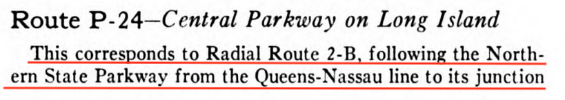
Use of The Motor Parkway was included in the original plan as P-24 and which centered around the Central Parkway (e.g., Grand Central Parkway?).
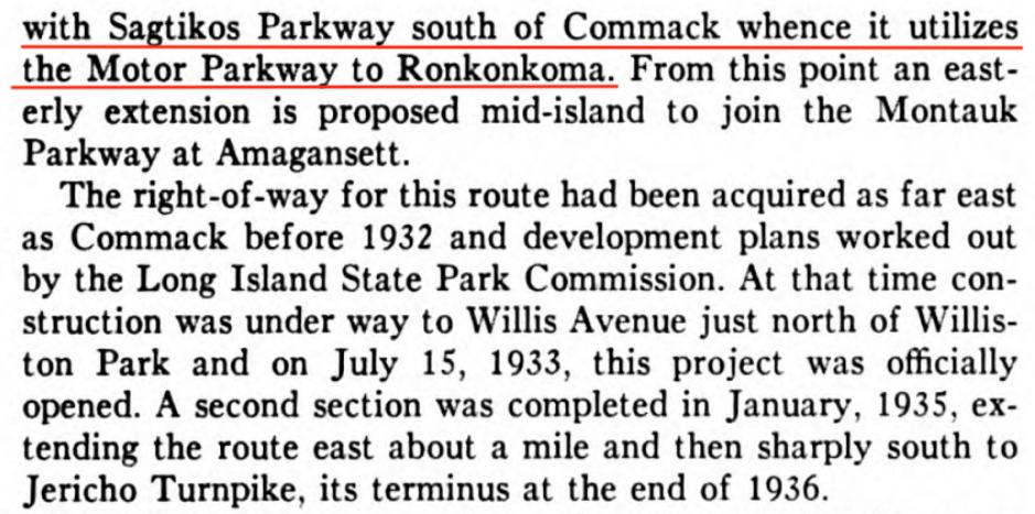
The Motor Parkway was said to have been the route's link between Commack and Ronkonkoma.
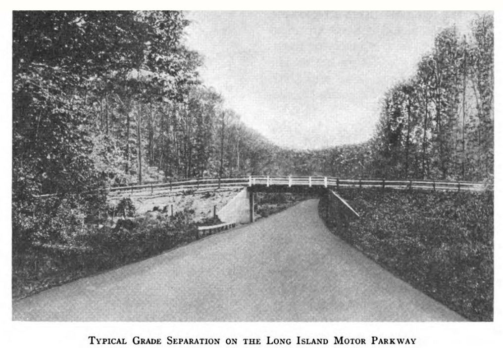
A typical scene of the Motor Parkway and a bridge was included in the update. Any guesses as to its location?
Actions Needing to Be Taken
The RPA, while acknowledging much progress had been made during the prior 8 years, still envisioned many projects needing to be done.
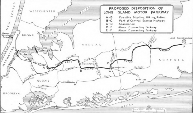
Overall Disposition of The Motor Parkway
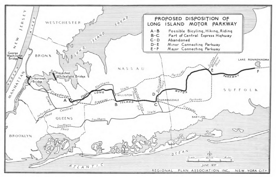
The RPA recommended several uses for The Motor Parkway including recreational (A-B), as part of the Central Express Highway (B-C) and as connecting highways (D-F). It appears there was no use thought of for Deadman's Curve (C-D)!
The Creedmoor Freeway
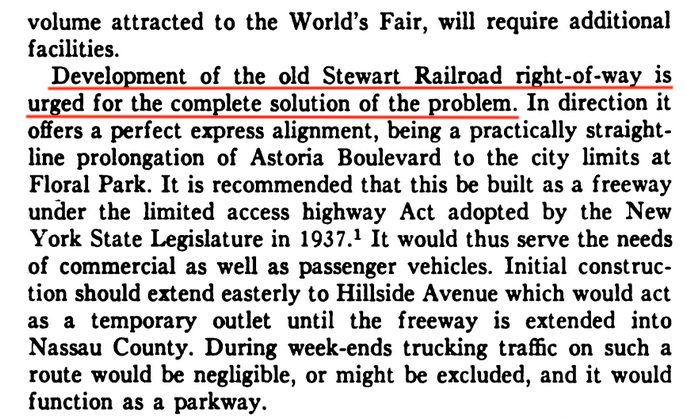
Additional traffic, partly due to the soon to be opened 1939 NY World's Fair, increased the urgency for the building of what was called the Creedmoor Freeway, which was to utilize the "old Stewart Railroad right-of-way".
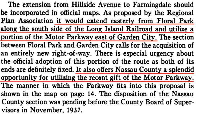
A portion of the Motor Parkway east of Garden City, noted as recently being gifted to Nassau County, was to be used. Comments by David S. in my earlier RPA post, highlighted the political tension between the RPA and Robert Moses prior to and around this time.
Westerly End of the Motor Parkway
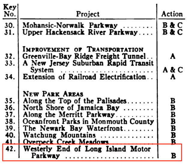
Also urgently needed was the development of the westerly end of the Motor Parkway (#42) for recreational purposes. A first step, noted here as with the code "B", was its acquisition by the City of New York. Code "A" refers to Construction and "C" Adoption and Mapping.
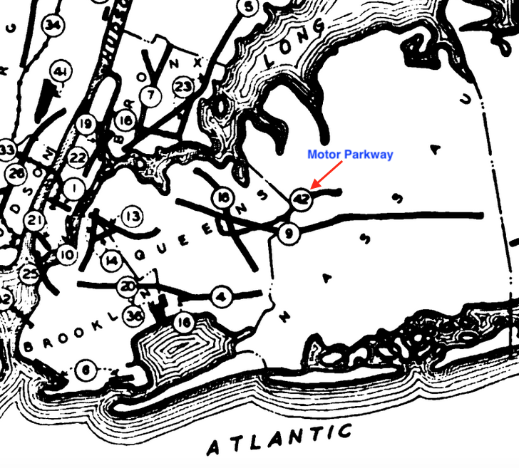
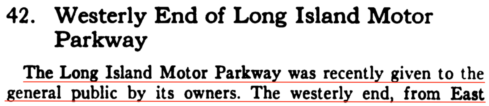
This section went from East Williston west to Horace Harding Blvd.
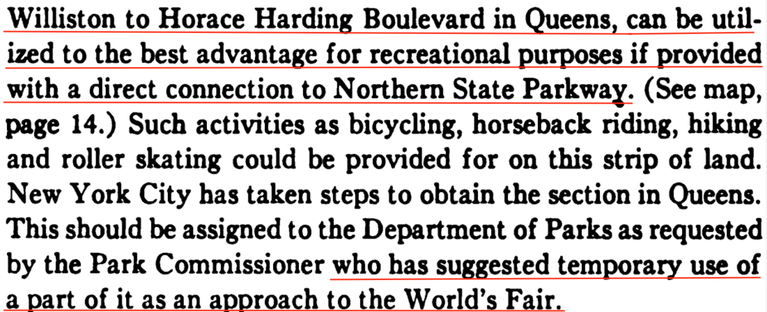
Aside from recreational purposes, it was also suggested to be a temporary approach to the World's Fair, as noted by Al Velocci in my prior RPA post.


Comments
Art, I believe the pictured bridge is the Smith farmway bridge just east of the Great Neck lodge.
Love the proposed bike path from the western terminus to the Garden City lodge! Where can I sign up?
Here’s the matching real photo postcard.
From Art Kleiner:
Thanks, Gary!
Bridge was about 300 yards east of the Great Neck toll.
The freight tunnel from Greenville (Jersey City) to Bay Ridge was proposed way back then? Needless to say, it was never built. They’re still talking about building it! Lack of the tunnel is part of the reason that it’s so expensive getting goods on and off Long Island.
From Art Kleiner - Thanks Al - as a previous LIRR commuter to Penn Station, sounds like the amount of time they’ve been talking about an east side terminal! Except in my case it was getting people on and off Long Island.