Kleiner’s Korner: Part V - Motor Parkway Maps and More
One thing about being at home is the time it affords to conduct on-line research into our favorite topic. Here are more examples of maps showing the Motor Parkway taken from touring guides and other publications. All images courtesy of the Crittenden Automotive Library.
Art Kleiner
Brooklyn Daily Eagle
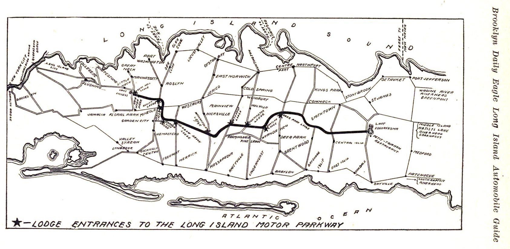
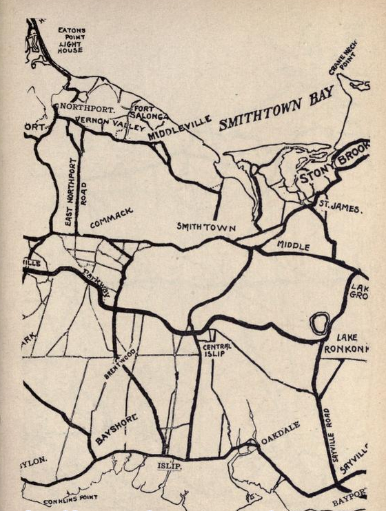
The Brooklyn Daily Eagle regularly published the "Long Island Automobile Guide" to promote the use of automobiles and touring. This map is from the 1911 edition and denotes the Motor Parkway lodges (including two lodges that were never built; Babylon Lodge and the Deer Park Lodge) and the Petit Trianon. A 1910 version of this map appears in Howard and Al's Motor Parkway book on page 18.
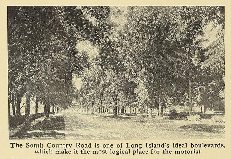
Note the grandstand and South Country Road!
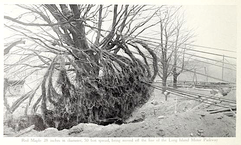
House and Garden, March 1911
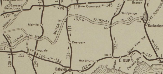
Scarborough Guide Book
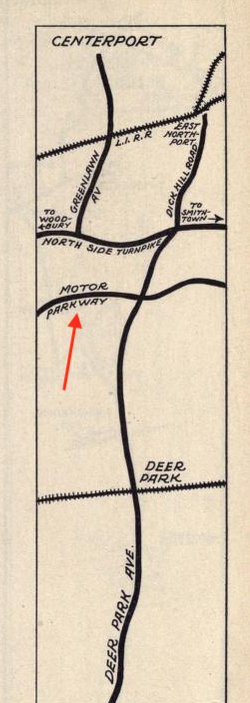
Notice the "gates" that are marked. Published by the New York State Automobile Association, circa 1916.

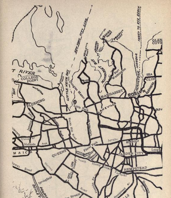
Vanderbilt Hotel (NYC)
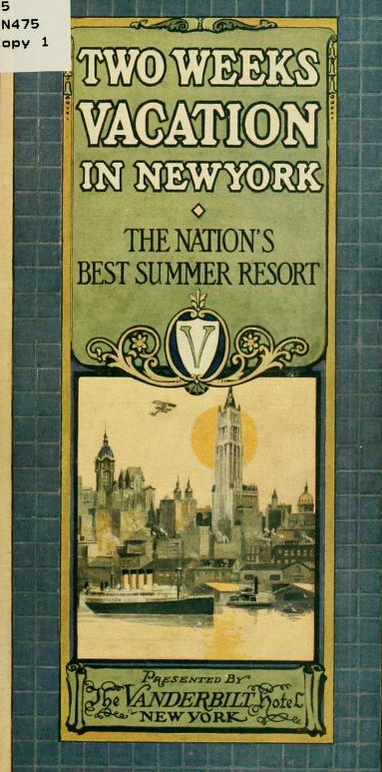
The Vanderbilt Hotel published a guide entitled "Two Weeks Vacation in New York" promoting inns and restaurants in the NY metropolitan area.
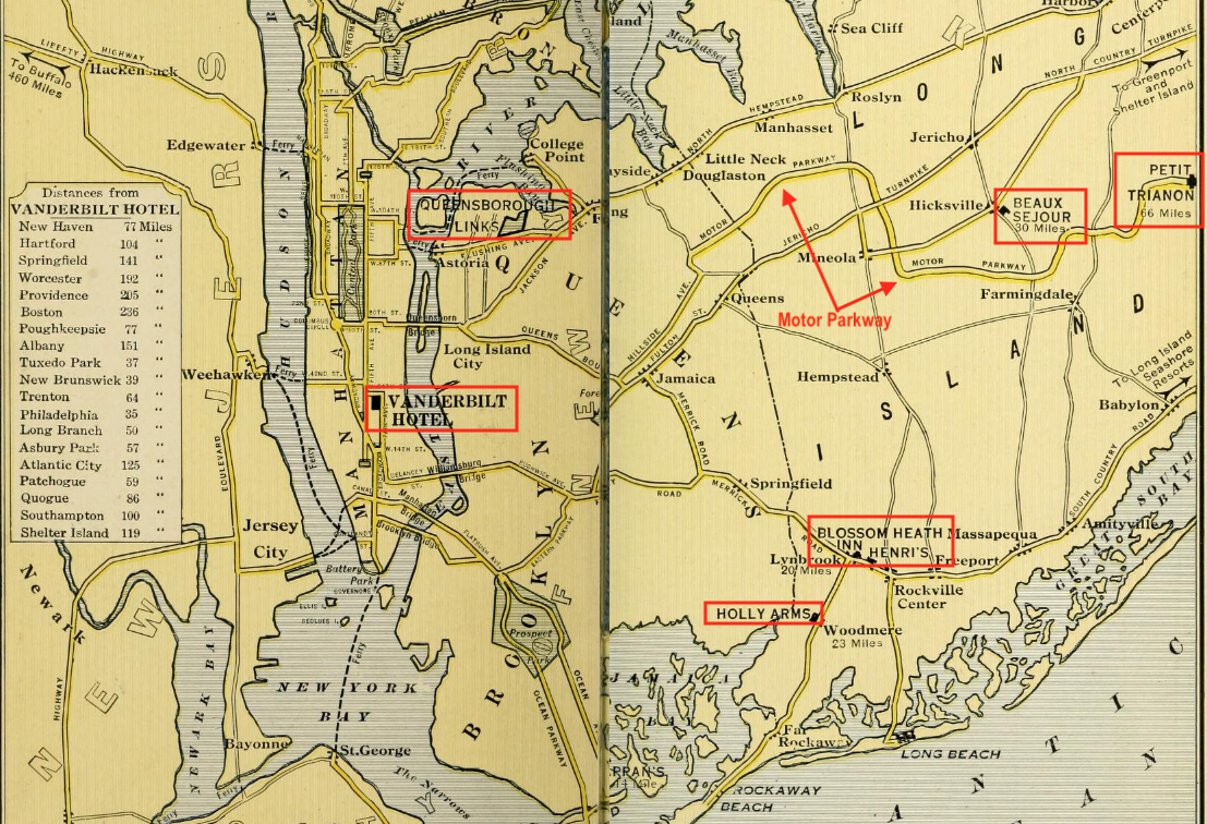
I've highlighted some of hotel's suggestions including the Beaux Sejour and the Petit Trianon and several others that I had never hear of. Feel free to research whichever sound of interest and which I've started to do in the next section. The map also points out the Queensborough Links.
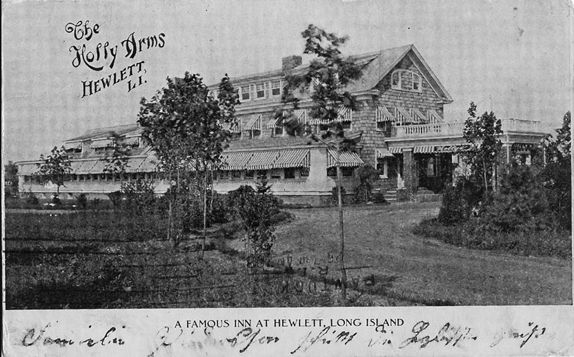
The Holly Arms Inn, Hewlett (Five Towns Local History)
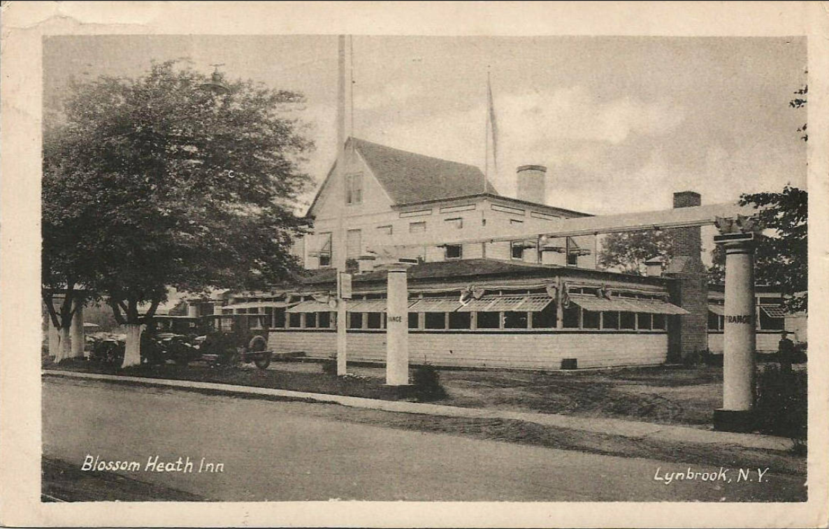
The Blossom Heath Inn, Lynbrook (New York Heritage Digital Collections)
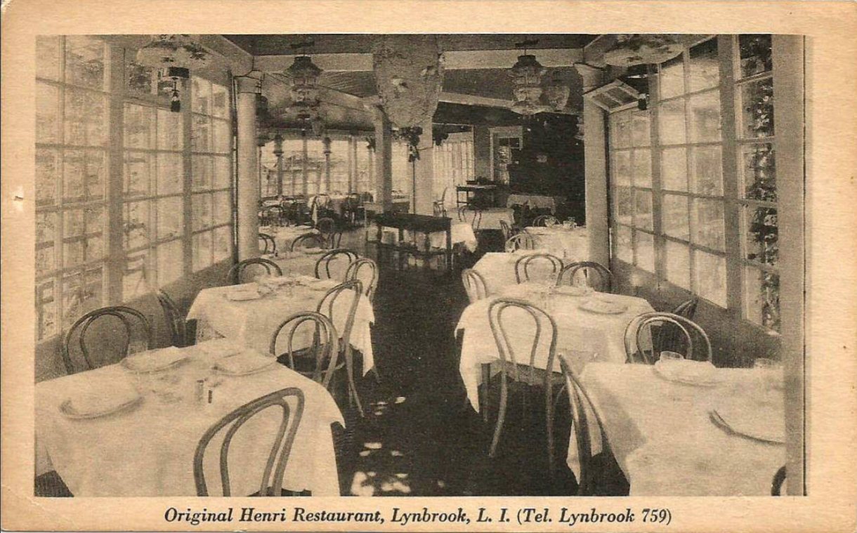
Henri Restaturant, Lynbrook (New York Heritage Digital Collections)
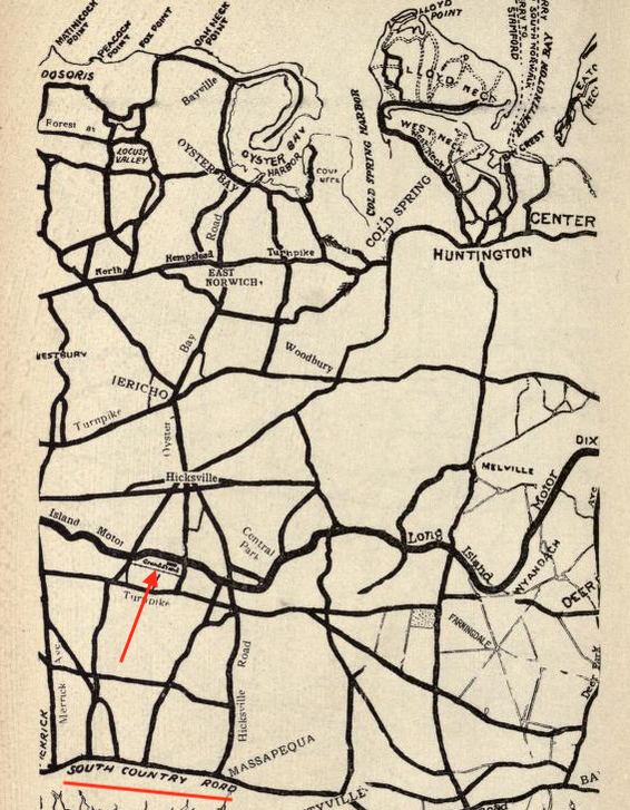
Bagatelle Nursery
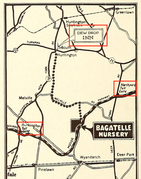
While not a touring guide, I couldn't resist putting this map in. It came from a pamphlet published in 1931 by the Bagatelle Nursery located in Dix Hills adjacent to the Motor Parkway. Note the Huntington and Northport? Toll Gates and the Dew Drop Inn.
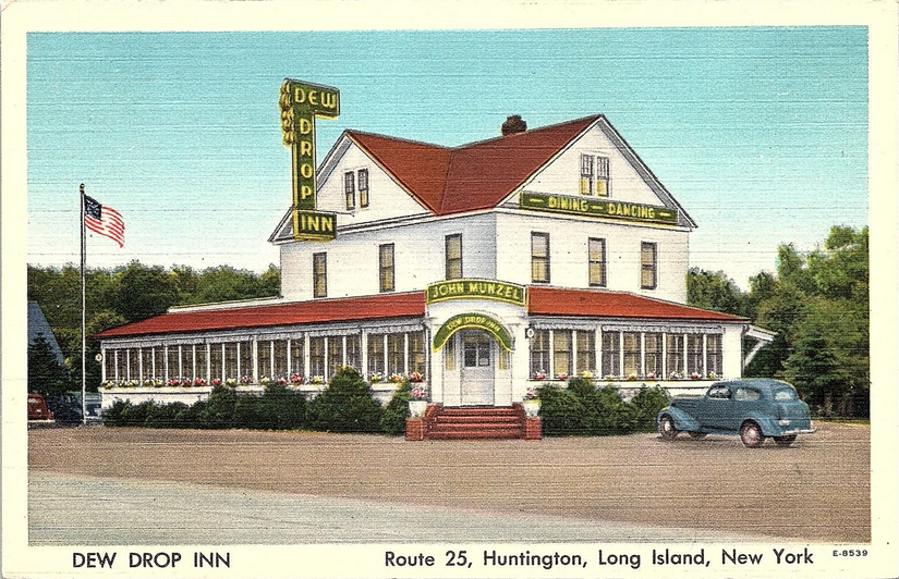
The Dew Drop Inn (hippostcard.com)
HIcks Nurseries
And speaking of nurseries, I couldn't help but include this photo from Hicks Nurseries of Westbury.


Comments
Great stuff Art! This will take time to sort through.
Art, Regarding the Bagatelle Nursery map. There is more to it than the Nursery being adjacent to the Parkway. In 1927 the Parkway sold two parcels of land totaling around 270 acres to Dr. H. B. Baruch, the owner of Bagatelle Nursery for which he paid $54,000. Some of the acquired acreage was separated by the Parkway. As a condition of the sale Dr. Baruch requested and received permission to build a bridge over the Parkway at his expense. So. besides highway bridges, Parkway bridges, farmway bridges, a farmway underpass, we can also include a nursery bridge.
Now to see where this nursery bridge spanned over the LIMP and possibly also over Conklin/Bagatelle Rd. Maybe somewhere between Colonial Springs Rd and the intersection of the LIMP & Conklin/Bagatelle Rd?
Amazing details Al. Would love to locate the nursery bridge. Inspecting all aerial resources currently available… My guess the same, Brian. That’s the most likely location of the bridge!
Brian, Frank, I took some liberties when I called it a nursery bridge. In a letter from A.J. Kienzle, the Parkway’s general manager, to Vanderbilt dated June 21, 1927, he refers to it as a farmway bridge.
Brian, Frank, The bridge would have been somewhere on the west side of Bagatelle Rd. north of the Babylon Town line, pretty much in the vicinity of where the Parkway crosses over Bagatelle.
The 2 maps below MAY show where Mr. Baruch had a bridge built over the LIMP for easier access to his Nursery. What I point out as a bridge is quite faint, but is near the intersection of the LIMP & Bagatelle Rd. I haven’t luck lately locating 1938 aerials within the Stony Brook Collection, recall those maps being pretty clear. The terrain is high in this area, must have been tricky constructing the bridge. Old ads describe the main entrance to the Nursery on Bagatelle Rd. Any chance this bridge was noted on a updated Motor Pkwy Atlas?
I was able to access much clearer 1930 aerials of the Bagatelle Nursery Farm and properties near the LIMP. I now don’t see any type of bridge on the below aerials marked as : 1930 - 1 & 1930 - 2. But just north of here, I notice a ‘narrow line/path possibly’ between the Holmes & Yaiser properties. Then possibly a narrow bridge over the LIMP & Path,then abruptly angles southwest to Bagatelle Rd towards the nursery. This is marked on the 1930 - A & 1930 - B aerials. This is gone or not visible on the 1947 aerial w/overlay. An article from 1927 with Christian Yaiser.
Last 3 images below.
Turns out Dr. H. B. Baruch, owner of Bagattele Nursery mentioned in the comments above was also an auto enthusiast. From “The Automobile” of August, 1901.