Cradle of Aviation Archives: An amazing 1936 aerial of the Motor Parkway, Roosevelt Field and Roosevelt Raceway
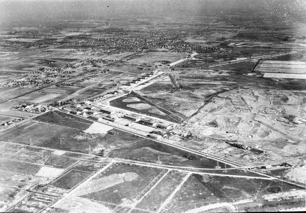
Through the joint efforts of the Cradle of Aviation and VanderbiltCupRaces.com, treasures of Long Island history continue to be uncovered including this 1936 aerial.
The view is looking northeast over the Long Island Motor Parkway and Clinton Road in Garden City.
Enjoy,
Howard Kroplick
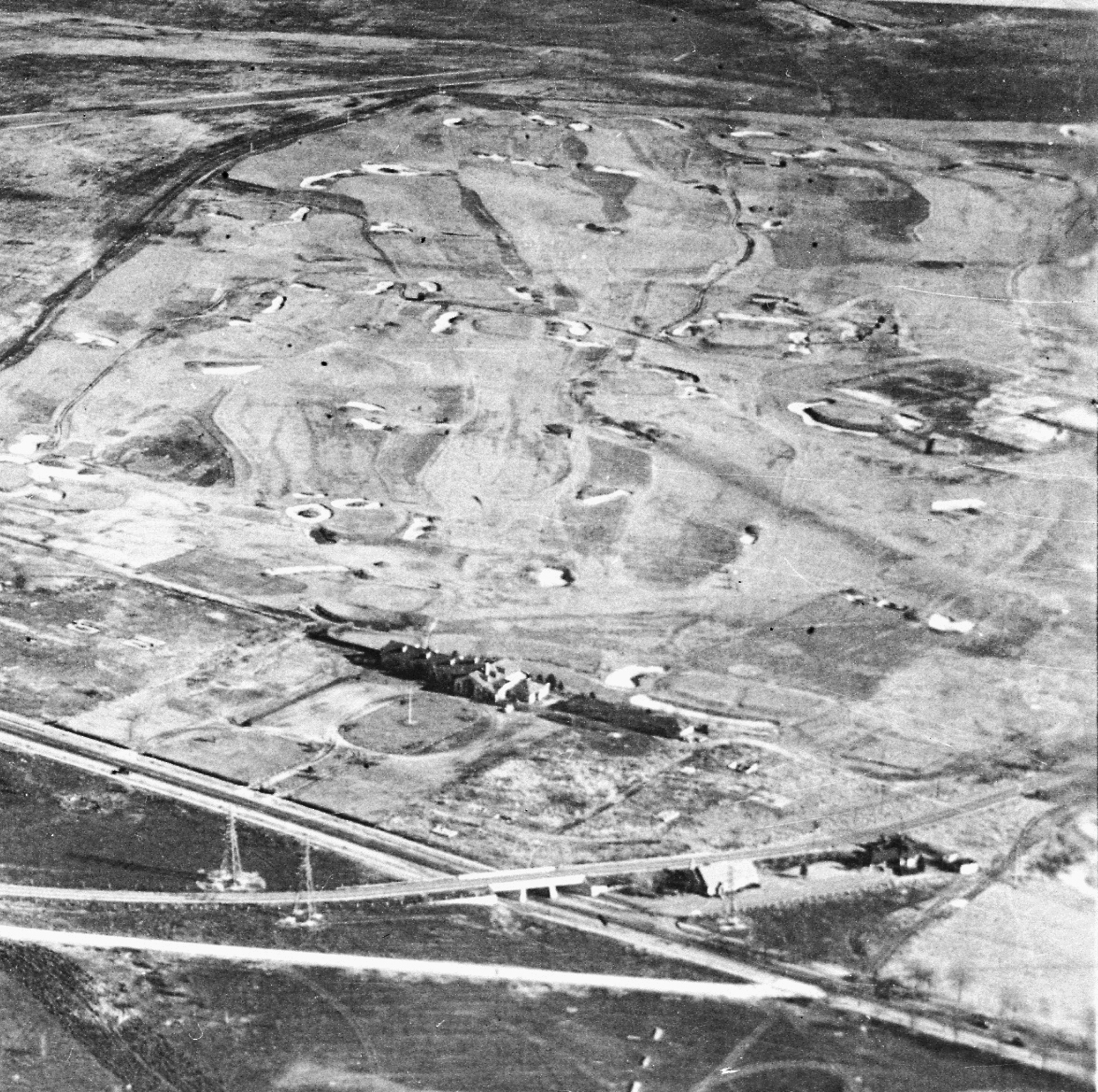
Close-Ups
A very historic section of the Motor Parkway: Clinton Road Motor Parkway Bridge, the General Manager's Office and the Garden City Lodge.
In the background was the links course of the Intercollegiate Golf Club, later Old Westbury Golf Club. Note: The great view of the clubhouse and the absence of any trees.
The unfinished "Mayan Ruins" Motor Parkway Bridge.
Anyone know what the semi-circle concrete area was used for?
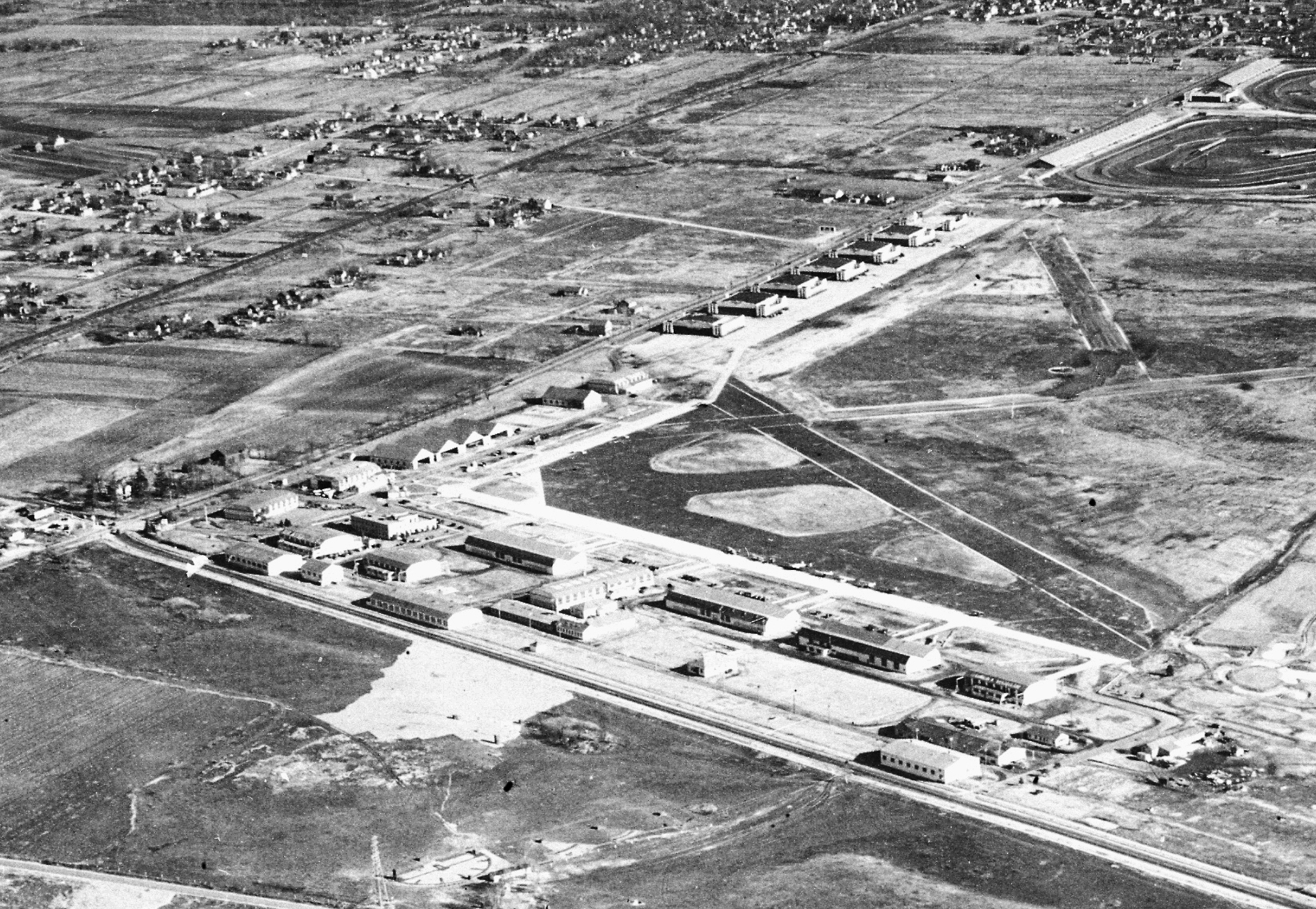
Roosevelt Field Airfield
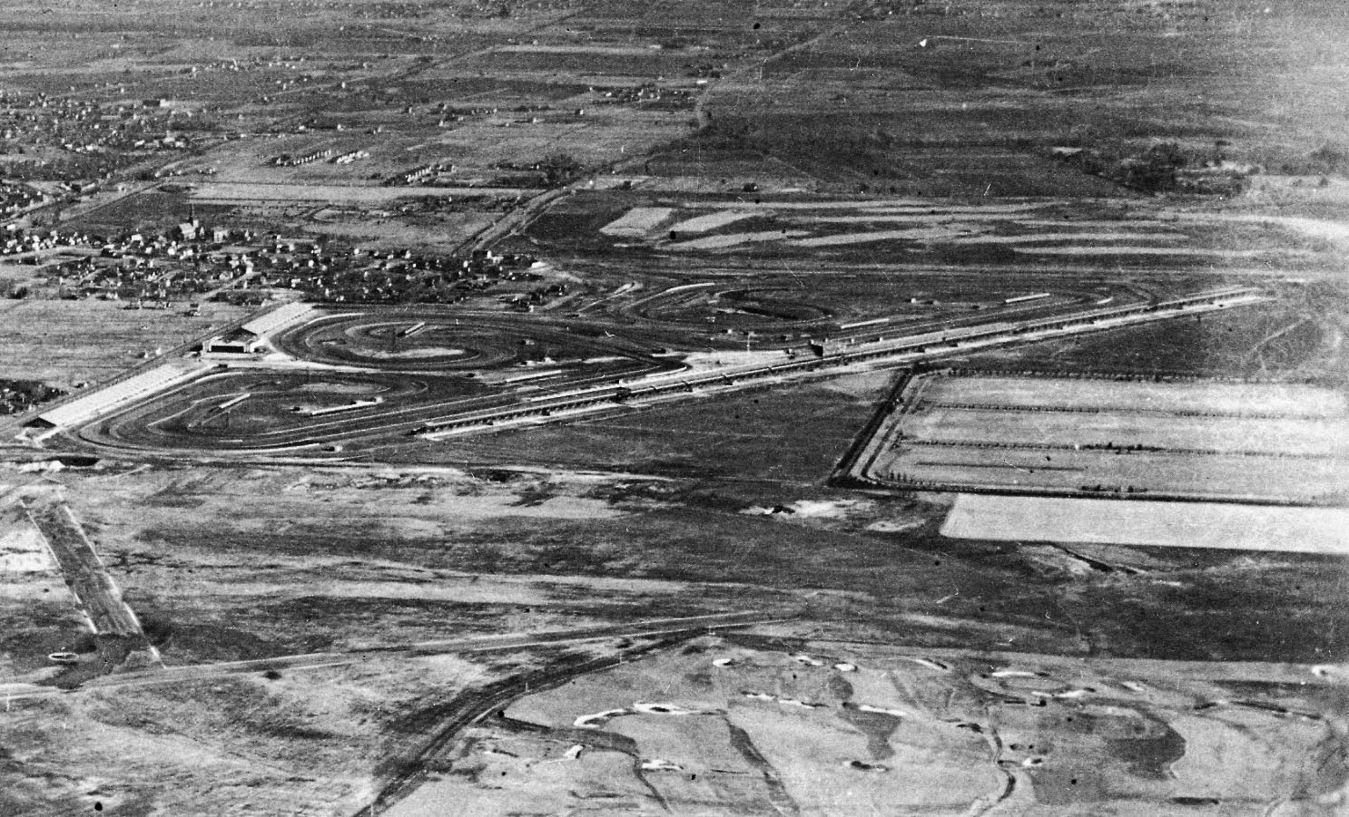
The 1936 course of Roosevelt Raceway and a Meadowbrook Polo Club Field.

According to Garden City village historian Bill Bellmer the road on the right corner was us used to reach the Camp Mills' hospital facilities.


Comments
I remember noticing the half circle on a less clear but similar birds eye view of this area. Definitely meant to be seen from above, maybe a landing for helicopters.
Below are aerials from this website. The semi circle isn’t there in 1933. Definitely existing in 1936. But not there in August 1938. Also a rectangular building at the right side of the semi circle. I remember this from the past mystery foto.
Thought this is interesting, too. Current street pattern overlay.
Brian, Doubt the semi-circle area used by helicopters, to close to the electric lines towers. Also, don’t think that is a building on the right side of the circle, to me looks more like grandstand seating. My guess ... the area had to do with the Field’s model plane club.
Your semi-circle looks like a Skeet Range. Notice that the left tower is higher than the right which is standard for skeet houses. A Trap range might be to the right of the skeet range. I am going to guess that it is a gun club.
Click here to Download this file
Robert, thanks for the identification.
See an illustration at https://en.wikipedia.org/wiki/Skeet_shooting for a diagram that better matches the photo. Building to immediate south is in proper position to be a storage area or clubhouse, which makes sense because shooters would be aiming to the north.
Mystery solved, Excellent!